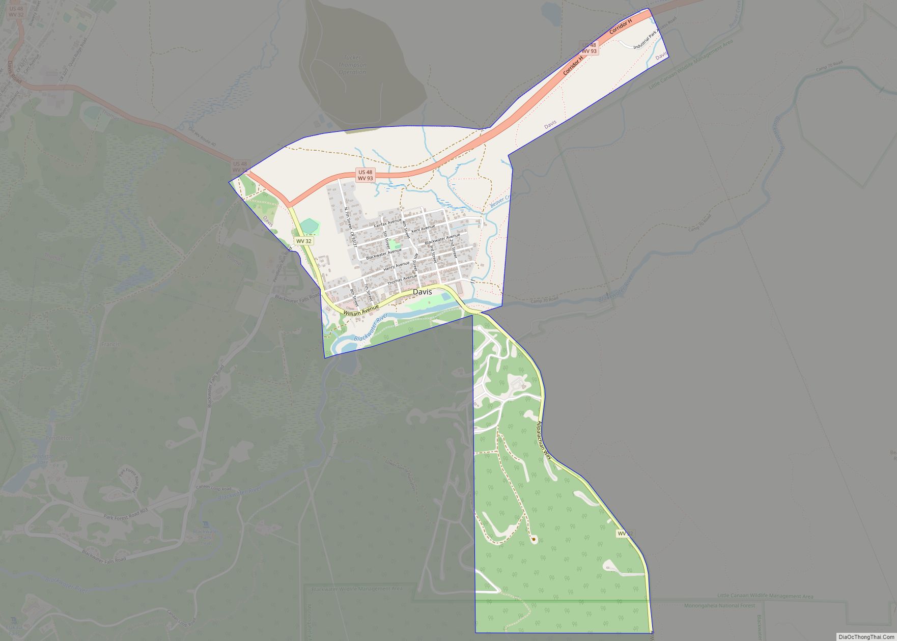
Thomas is a city and former coal town in Tucker County, West Virginia, United States. The population was 623 at the 2020 census.
| Name: | Thomas city |
|---|---|
| LSAD Code: | 25 |
| LSAD Description: | city (suffix) |
| State: | West Virginia |
| County: | Tucker County |
| Elevation: | 3,035 ft (925 m) |
| Total Area: | 4.51 sq mi (11.67 km²) |
| Land Area: | 4.46 sq mi (11.55 km²) |
| Water Area: | 0.05 sq mi (0.12 km²) |
| Total Population: | 623 |
| Population Density: | 123.32/sq mi (47.61/km²) |
| ZIP code: | 26292 |
| Area code: | 304 |
| FIPS code: | 5480020 |
| GNISfeature ID: | 1555802 |
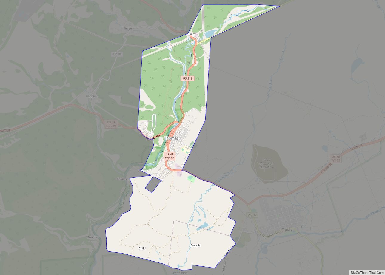
Online Interactive Map
Click on ![]() to view map in "full screen" mode.
to view map in "full screen" mode.
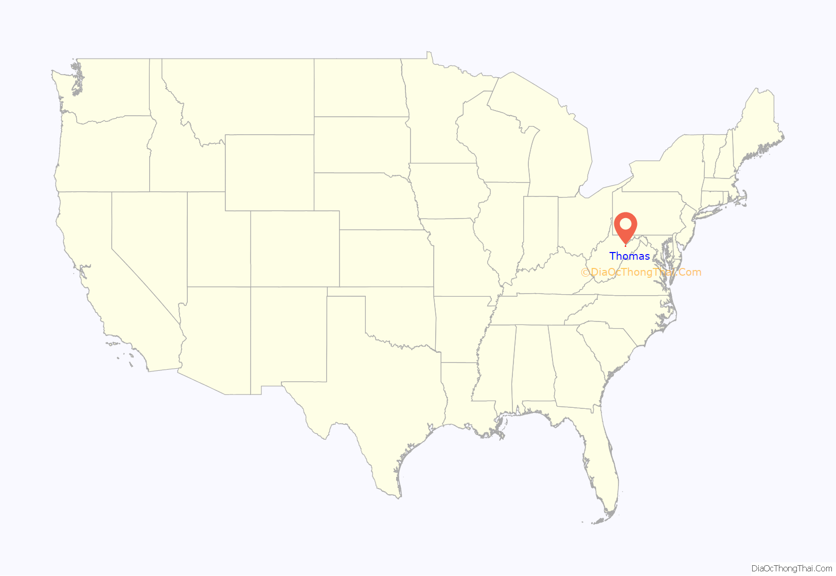
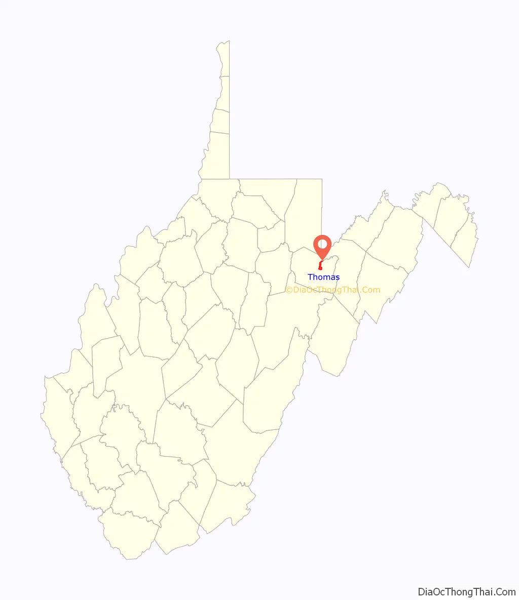
Thomas location map. Where is Thomas city?
History
Thomas was platted in 1884. Thomas was named for Thomas Beall Davis (1828-1911), brother of Senator Henry Gassaway Davis. The Davis brothers, in 1883, opened a mine near Thomas and had coal ready to ship when their railway arrived a year later. By 1892, Davis Coal and Coke was among the largest and best known coal companies in the world and employed 1,600 people. At the peak of its operations in 1915, there were nine producing mines within a mile of the company’s office in Thomas.
Immigrants flocked to the area as miners, railroad laborers, or merchants. The company employed a man named Wladyslaw Dackiewicz as an interpreter. He could speak, read, and write eight languages and his services were much in demand with the influx of immigrants.
In 1901, in less than two hours, nearly half of Thomas (83 buildings) was destroyed by a fire. The city was quickly rebuilt with fine hotels and a new opera house. The Cottrill Opera House had a saloon on the first floor which was by far the most elegant of the eight bars located on Front Street. In 1909, Front Street (also known as First Street, Main Street, and East Avenue) was laid with brick to become the first paved street in the county.
Thomas claimed to have the grandest railway station between Cumberland, Maryland, and Elkins, West Virginia. Built of brick in 1901, it was destroyed by a tornado in 1944.
In 1921, coke production ceased and mining operations slowed.
The Cottrill Opera House, Davis Coal and Coke Company Administrative Building, Fairfax Stone, and Thomas Commercial Historic District are listed on the National Register of Historic Places.
Western Maryland Railroad Depot
Thomas in 1906
Davis Coal and Coke Co Mining Operation
Buxton and Landstreet Company Store
Cottrill Opera House
Thomas City Hall in 2006
Thomas Road Map
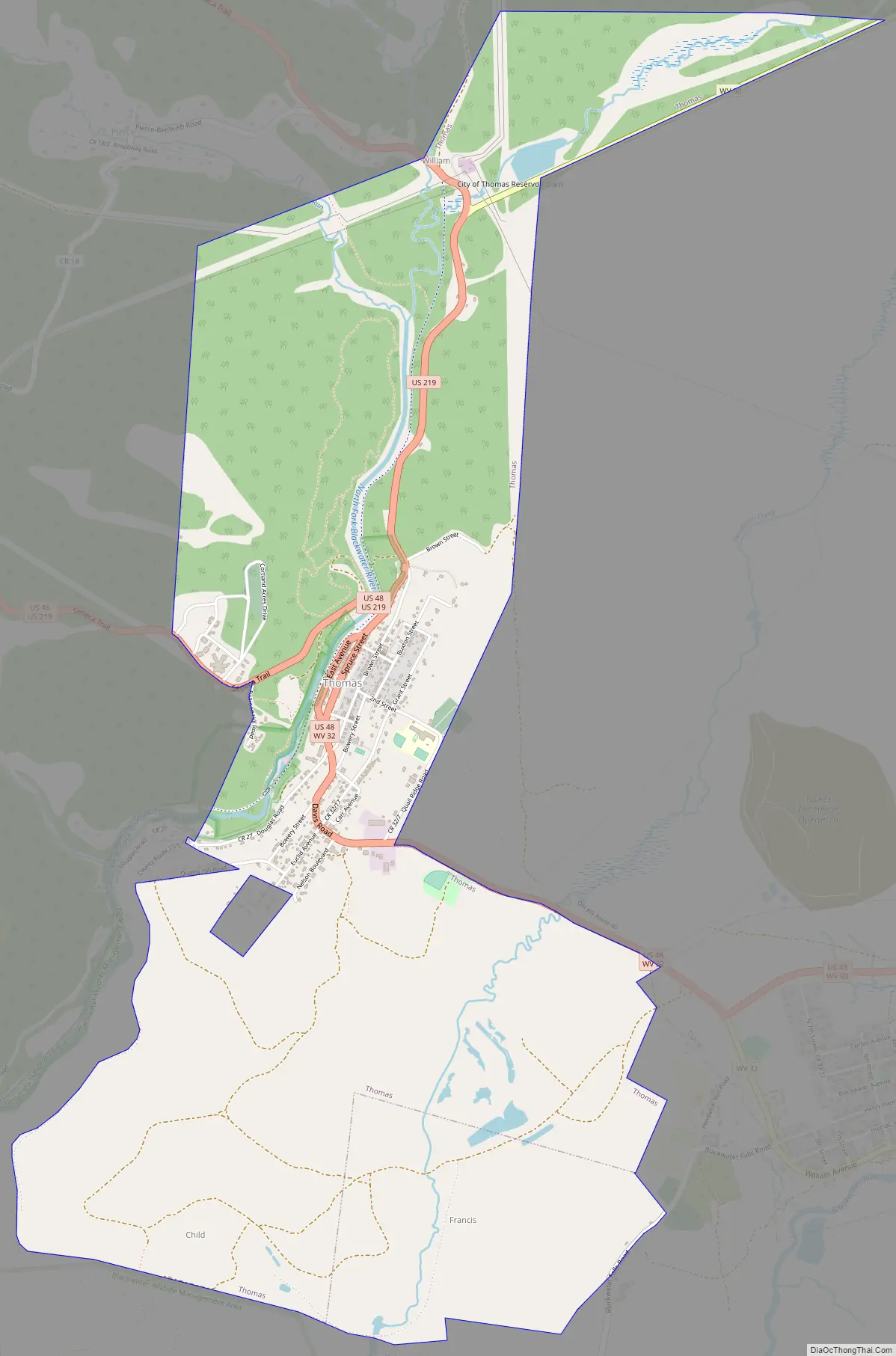
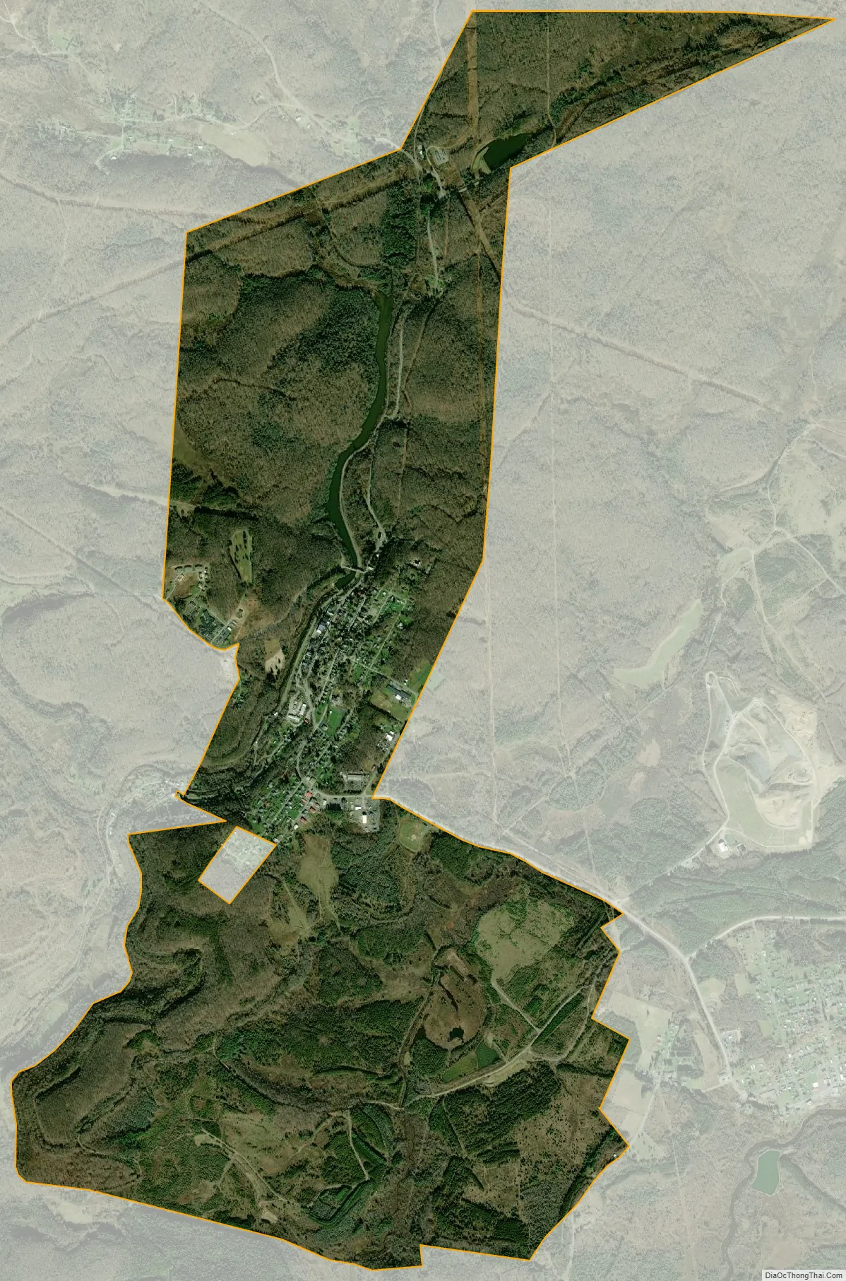
Thomas city Satellite Map
Geography
Thomas is located along the North Fork of the Blackwater River.
According to the United States Census Bureau, the city has a total area of 4.51 square miles (11.68 km), of which 4.46 square miles (11.55 km) is land and 0.05 square miles (0.13 km) is water.
Climate
The climate in this area has mild differences between highs and lows, and there is adequate rainfall year-round. Thomas has a humid contintal climate (Koppen: Dfb).
See also
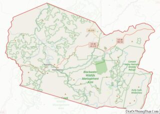
Map of West Virginia State and its subdivision:- Barbour
- Berkeley
- Boone
- Braxton
- Brooke
- Cabell
- Calhoun
- Clay
- Doddridge
- Fayette
- Gilmer
- Grant
- Greenbrier
- Hampshire
- Hancock
- Hardy
- Harrison
- Jackson
- Jefferson
- Kanawha
- Lewis
- Lincoln
- Logan
- Marion
- Marshall
- Mason
- McDowell
- Mercer
- Mineral
- Mingo
- Monongalia
- Monroe
- Morgan
- Nicholas
- Ohio
- Pendleton
- Pleasants
- Pocahontas
- Preston
- Putnam
- Raleigh
- Randolph
- Ritchie
- Roane
- Summers
- Taylor
- Tucker
- Tyler
- Upshur
- Wayne
- Webster
- Wetzel
- Wirt
- Wood
- Wyoming
- Alabama
- Alaska
- Arizona
- Arkansas
- California
- Colorado
- Connecticut
- Delaware
- District of Columbia
- Florida
- Georgia
- Hawaii
- Idaho
- Illinois
- Indiana
- Iowa
- Kansas
- Kentucky
- Louisiana
- Maine
- Maryland
- Massachusetts
- Michigan
- Minnesota
- Mississippi
- Missouri
- Montana
- Nebraska
- Nevada
- New Hampshire
- New Jersey
- New Mexico
- New York
- North Carolina
- North Dakota
- Ohio
- Oklahoma
- Oregon
- Pennsylvania
- Rhode Island
- South Carolina
- South Dakota
- Tennessee
- Texas
- Utah
- Vermont
- Virginia
- Washington
- West Virginia
- Wisconsin
- Wyoming