Castleberry is a town in Conecuh County, Alabama, United States. At the 2020 census, the population was 486. Castleberry is known as the “Strawberry Capital of Alabama” and is home to the annual Castleberry Strawberry Festival. Castleberry is also known for its “speed trap” with the confiscation of property happening on a regular basis. The town has five police officers. A lawsuit against former Police Chief Tracy Hawsey and the town of Castleberry is pending. According to one source, “Lawsuits allege that Brookside police officers made up charges to soak vehicle owners for thousands of dollars in fines.”
| Name: | Castleberry town |
|---|---|
| LSAD Code: | 43 |
| LSAD Description: | town (suffix) |
| State: | Alabama |
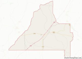
| County: | Conecuh County |
| Elevation: | 180 ft (55 m) |
| Total Area: | 1.73 sq mi (4.48 km²) |
| Land Area: | 1.71 sq mi (4.43 km²) |
| Water Area: | 0.02 sq mi (0.05 km²) |
| Total Population: | 486 |
| Population Density: | 284.04/sq mi (109.65/km²) |
| ZIP code: | 36432 |
| Area code: | 251 |
| FIPS code: | 0112496 |
| GNISfeature ID: | 0115688 |
Online Interactive Map
Click on ![]() to view map in "full screen" mode.
to view map in "full screen" mode.
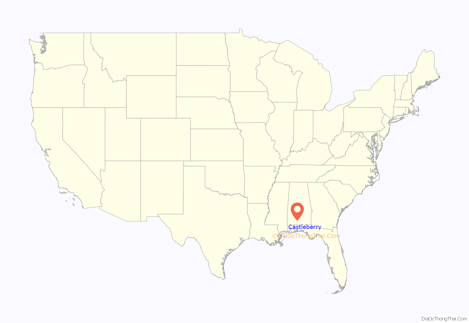
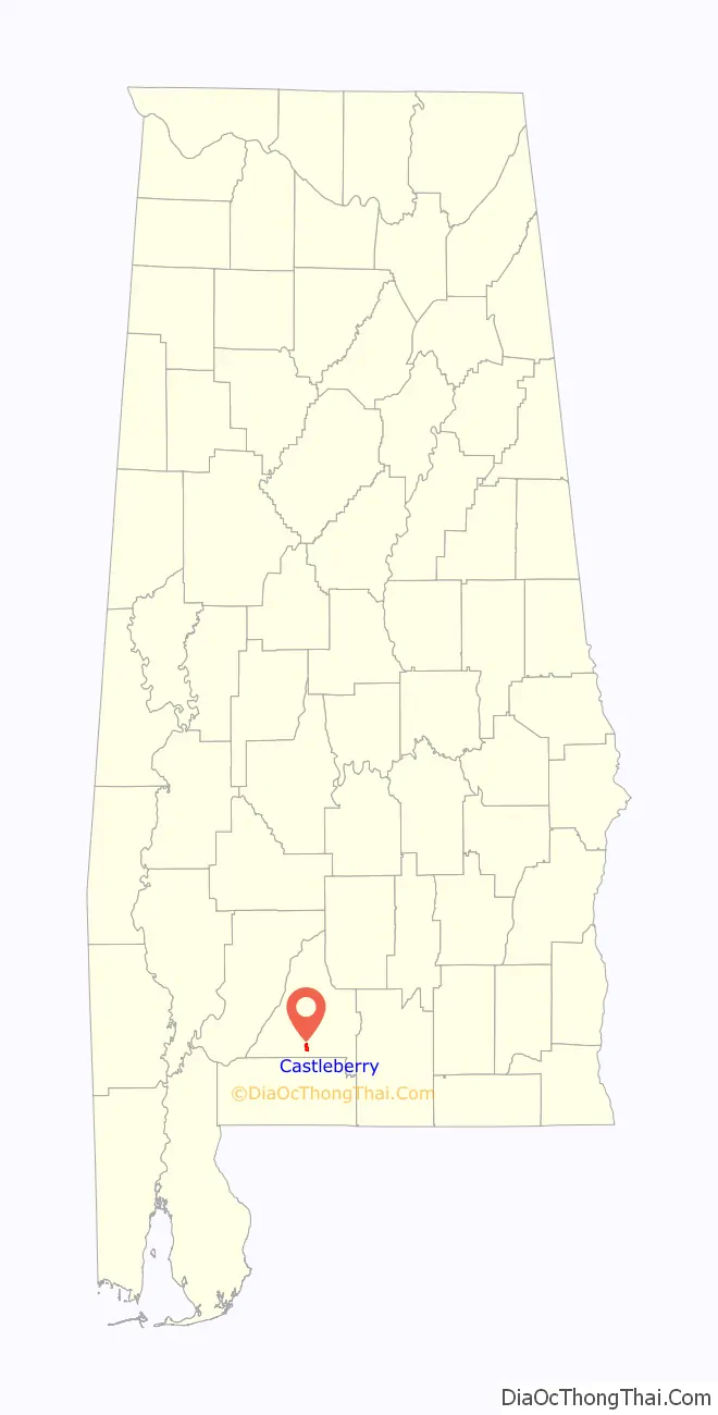
Castleberry location map. Where is Castleberry town?
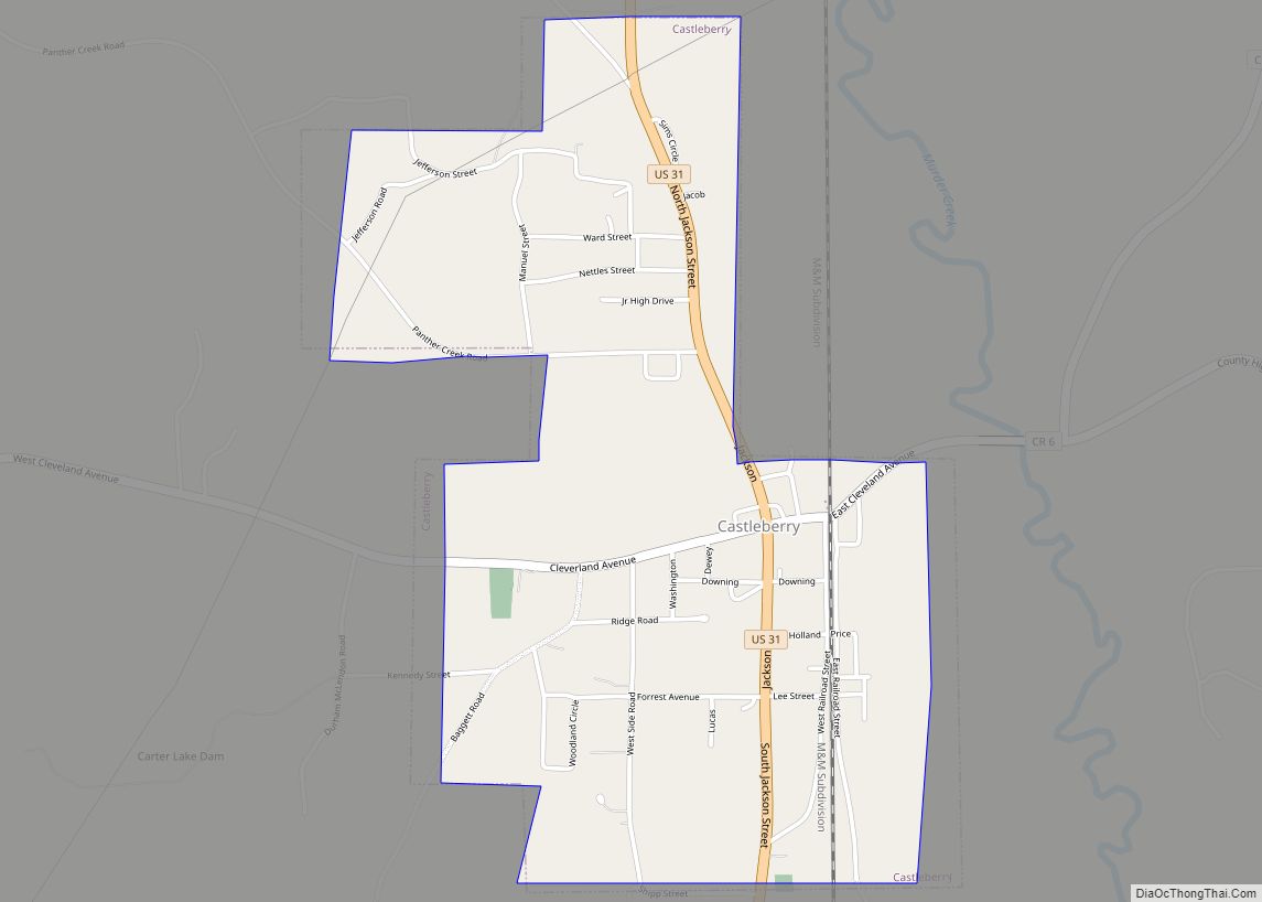
Castleberry Road Map
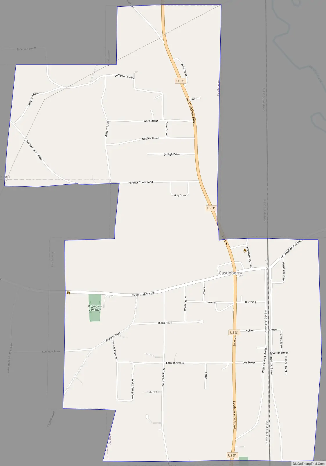
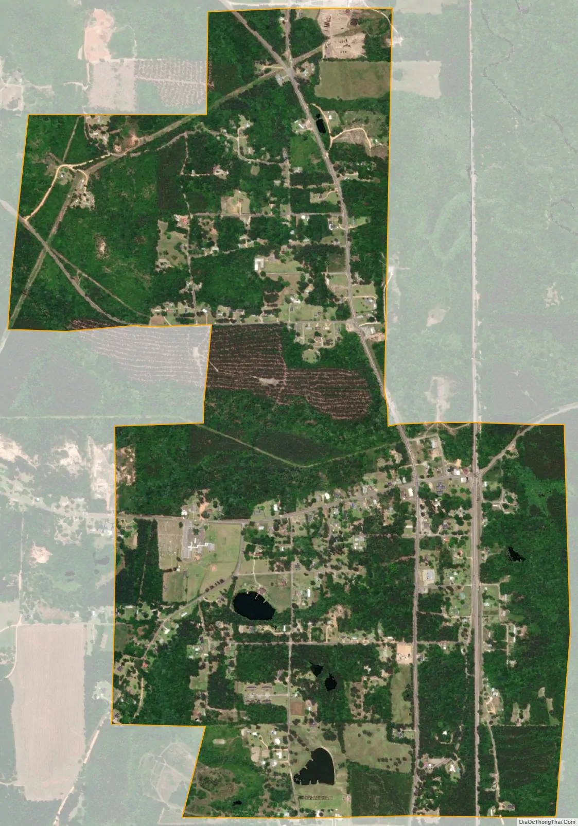
Castleberry city Satellite Map
Geography
Castleberry is located in southern Conecuh County at 31°17′52″N 87°1′30″W / 31.29778°N 87.02500°W / 31.29778; -87.02500 (31.297899, −87.025027).
According to the U.S. Census Bureau, the town has a total area of 1.7 square miles (4.5 km), of which 0.02 square miles (0.05 km), or 1.09%, is water.
See also
Map of Alabama State and its subdivision:- Autauga
- Baldwin
- Barbour
- Bibb
- Blount
- Bullock
- Butler
- Calhoun
- Chambers
- Cherokee
- Chilton
- Choctaw
- Clarke
- Clay
- Cleburne
- Coffee
- Colbert
- Conecuh
- Coosa
- Covington
- Crenshaw
- Cullman
- Dale
- Dallas
- De Kalb
- Elmore
- Escambia
- Etowah
- Fayette
- Franklin
- Geneva
- Greene
- Hale
- Henry
- Houston
- Jackson
- Jefferson
- Lamar
- Lauderdale
- Lawrence
- Lee
- Limestone
- Lowndes
- Macon
- Madison
- Marengo
- Marion
- Marshall
- Mobile
- Monroe
- Montgomery
- Morgan
- Perry
- Pickens
- Pike
- Randolph
- Russell
- Saint Clair
- Shelby
- Sumter
- Talladega
- Tallapoosa
- Tuscaloosa
- Walker
- Washington
- Wilcox
- Winston
- Alabama
- Alaska
- Arizona
- Arkansas
- California
- Colorado
- Connecticut
- Delaware
- District of Columbia
- Florida
- Georgia
- Hawaii
- Idaho
- Illinois
- Indiana
- Iowa
- Kansas
- Kentucky
- Louisiana
- Maine
- Maryland
- Massachusetts
- Michigan
- Minnesota
- Mississippi
- Missouri
- Montana
- Nebraska
- Nevada
- New Hampshire
- New Jersey
- New Mexico
- New York
- North Carolina
- North Dakota
- Ohio
- Oklahoma
- Oregon
- Pennsylvania
- Rhode Island
- South Carolina
- South Dakota
- Tennessee
- Texas
- Utah
- Vermont
- Virginia
- Washington
- West Virginia
- Wisconsin
- Wyoming