Franklin is a rural town in Macon County, Alabama, United States. As of the 2020 census, the population was 590.
| Name: | Franklin town |
|---|---|
| LSAD Code: | 43 |
| LSAD Description: | town (suffix) |
| State: | Alabama |
| County: | Macon County |
| Elevation: | 220 ft (70 m) |
| Total Area: | 15.11 sq mi (39.14 km²) |
| Land Area: | 15.07 sq mi (39.04 km²) |
| Water Area: | 0.04 sq mi (0.10 km²) |
| Total Population: | 590 |
| Population Density: | 39.1/sq mi (15.11/km²) |
| FIPS code: | 0128024 |
| GNISfeature ID: | 0156379 |
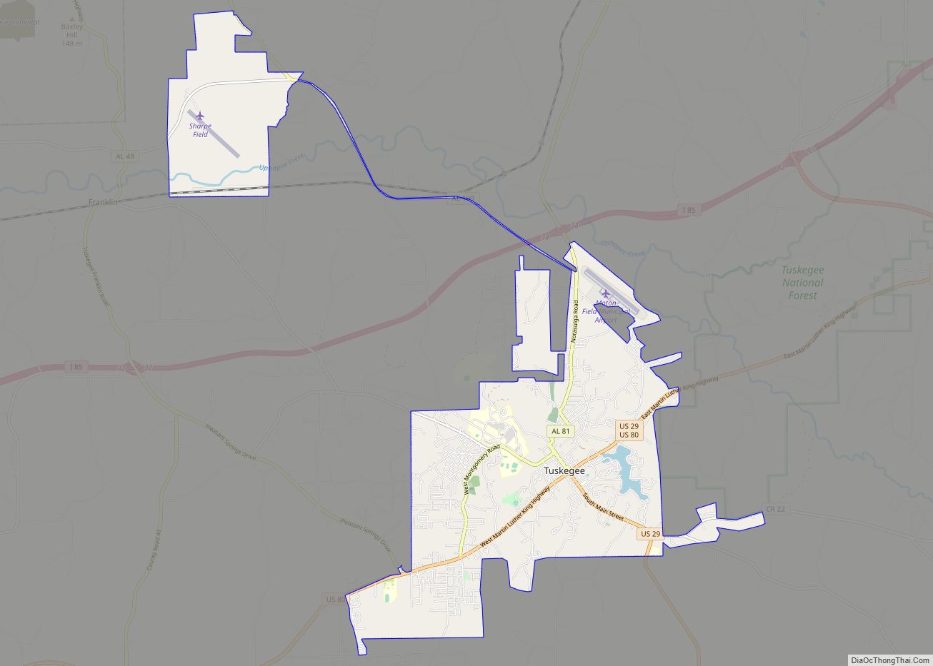
Online Interactive Map
Click on ![]() to view map in "full screen" mode.
to view map in "full screen" mode.
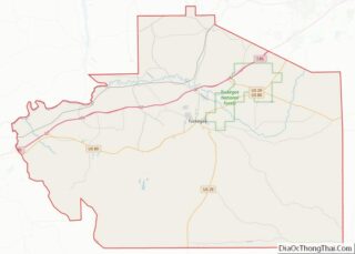
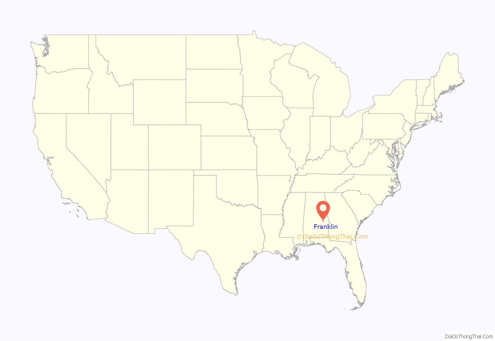
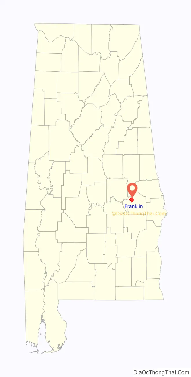
Franklin location map. Where is Franklin town?
History
The Muscogee (Creek) people had long been cultivating lands in this area, producing crops of maize, squash and beans (the Three Sisters), and tobacco, used primarily for ritual purposes. Osceola (1804-1838), who became well known as a leader of the Seminole people in Florida, was born to a Creek woman at Red Creek, 10 miles from the Tallapoosa River. He was of mixed race but identified as Creek; the people have a matrilineal kinship system.
Franklin has been home to many churches for more than 200 years. In the late 18th and early 19th centuries, a Methodist Missionary Church operated here for the Creek. It had two cemeteries, one for whites and one for the Creek. James McQueen, a Scots trader who lived here and married a Creek woman, was great-grandfather of Osceola. McQueen is buried in the Indian cemetery.
After the Creek were forced to cede their lands, European Americans developed the area for cotton cultivation. They depended on the labor of enslaved African Americans, many of whom were initially transported to this region from the Upper South in the domestic slave trade. Cotton continued as the chief commodity crop after the Civil War.
Residents established Franklin School by the 1890s, teaching grades 1–11 of white students. By the mid-1930s, the upper grades had been moved to another facility, and it held grades 1–6. Northern and southern classrooms were adjoined by a common auditorium. The school’s original water source was a spring near the buildings. A well was later dug in the front yard of the school, with a hand pump to get water. Heat was provided by a wood-burning potbelly stove. Each student brought a stick of wood every morning to burn in the stove.
The school closed in 1942, and its 75–80 students transferred to Tuskegee schools. After the school closed, the northern classroom was moved to its current location and converted to a community center. The rest of the school was torn down.
In the mid-20th century, musician Hank Williams Sr. often performed at dances at the community center. Upon Franklin’s incorporation in 1977, the town began using the community center building as the town hall. A mile north of Town Hall lay the remnants of what is rumored to be the first school in Macon County.
Harris Barrett School was built in 1903 with handmade bricks made by students of the Tuskegee Normal School (now Tuskegee University), under the direction of Booker T. Washington. In the segregated system of public facilities, the Barrett School was reserved for African-American students, who were mostly descendants of freedmen in this rural area. Both the Barrett School and the Tuskegee Institute played a major role in education in the Franklin community. They operated an experimental farm on the west side of Baldwin Farm Road. Booker T. Washington and George Washington Carver were both active in farming in Franklin, and assisted farmers both black and white. Harris Barrett School was restored and is operated as a historic museum; it is located at the corner of Co. Rd. 27 and 36.
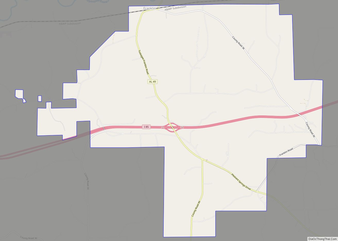
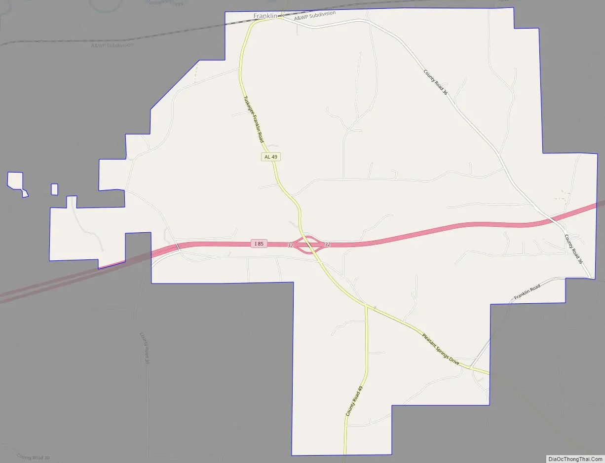
Franklin Road Map
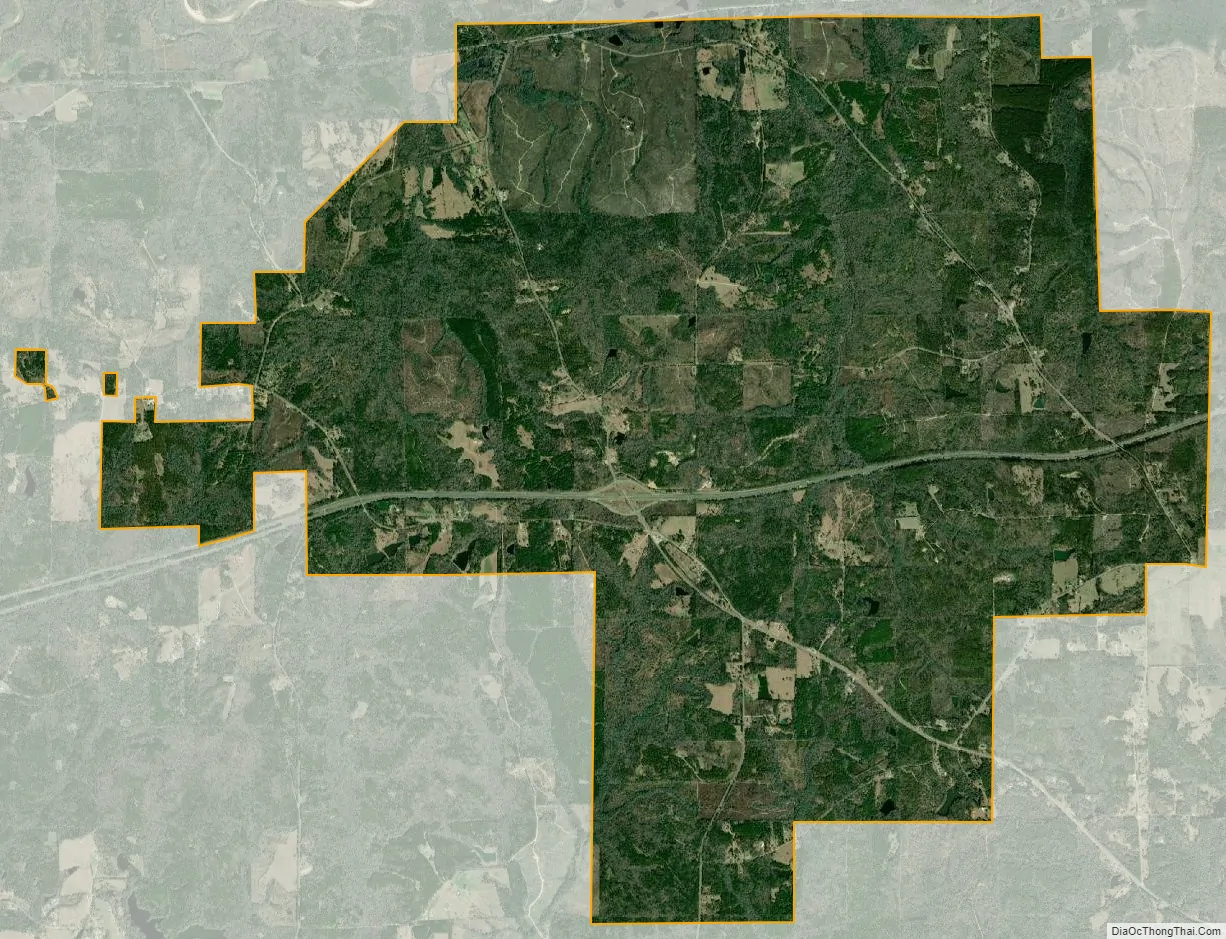
Franklin city Satellite Map
Geography
Franklin is located at 32°27′19″N 85°48′10″W / 32.45528°N 85.80278°W / 32.45528; -85.80278 (32.455388, -85.802884).
According to the U.S. Census Bureau, the town has a total area of 3.34 square miles (8.7 km), all land.
See also
Map of Alabama State and its subdivision:- Autauga
- Baldwin
- Barbour
- Bibb
- Blount
- Bullock
- Butler
- Calhoun
- Chambers
- Cherokee
- Chilton
- Choctaw
- Clarke
- Clay
- Cleburne
- Coffee
- Colbert
- Conecuh
- Coosa
- Covington
- Crenshaw
- Cullman
- Dale
- Dallas
- De Kalb
- Elmore
- Escambia
- Etowah
- Fayette
- Franklin
- Geneva
- Greene
- Hale
- Henry
- Houston
- Jackson
- Jefferson
- Lamar
- Lauderdale
- Lawrence
- Lee
- Limestone
- Lowndes
- Macon
- Madison
- Marengo
- Marion
- Marshall
- Mobile
- Monroe
- Montgomery
- Morgan
- Perry
- Pickens
- Pike
- Randolph
- Russell
- Saint Clair
- Shelby
- Sumter
- Talladega
- Tallapoosa
- Tuscaloosa
- Walker
- Washington
- Wilcox
- Winston
- Alabama
- Alaska
- Arizona
- Arkansas
- California
- Colorado
- Connecticut
- Delaware
- District of Columbia
- Florida
- Georgia
- Hawaii
- Idaho
- Illinois
- Indiana
- Iowa
- Kansas
- Kentucky
- Louisiana
- Maine
- Maryland
- Massachusetts
- Michigan
- Minnesota
- Mississippi
- Missouri
- Montana
- Nebraska
- Nevada
- New Hampshire
- New Jersey
- New Mexico
- New York
- North Carolina
- North Dakota
- Ohio
- Oklahoma
- Oregon
- Pennsylvania
- Rhode Island
- South Carolina
- South Dakota
- Tennessee
- Texas
- Utah
- Vermont
- Virginia
- Washington
- West Virginia
- Wisconsin
- Wyoming