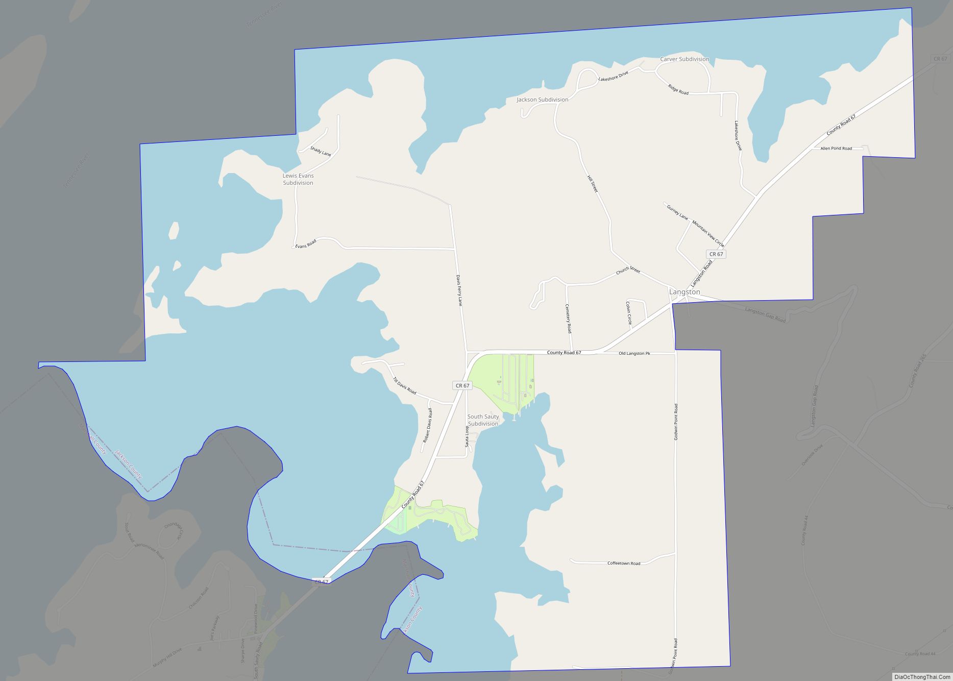
Langston is a town in Jackson County, Alabama, United States, and is included in the Chattanooga-Cleveland-Dalton, TN-GA-AL Combined Statistical Area. As of the 2010 census, the population of the town was 270, up from 254. Langston initially incorporated in 1899. At some point after 1920, it disincorporated and did not reincorporate again until 1980 (after the census was taken that year, since it did not appear on it). Its peak population was in 1920, when it had a population of 500.
| Name: | Langston town |
|---|---|
| LSAD Code: | 43 |
| LSAD Description: | town (suffix) |
| State: | Alabama |
| County: | Jackson County |
| Elevation: | 630 ft (192 m) |
| Total Area: | 8.24 sq mi (21.35 km²) |
| Land Area: | 4.92 sq mi (12.76 km²) |
| Water Area: | 3.32 sq mi (8.60 km²) |
| Total Population: | 265 |
| Population Density: | 53.81/sq mi (20.77/km²) |
| ZIP code: | 35755 |
| Area code: | 256 |
| FIPS code: | 0141368 |
| GNISfeature ID: | 0151989 |
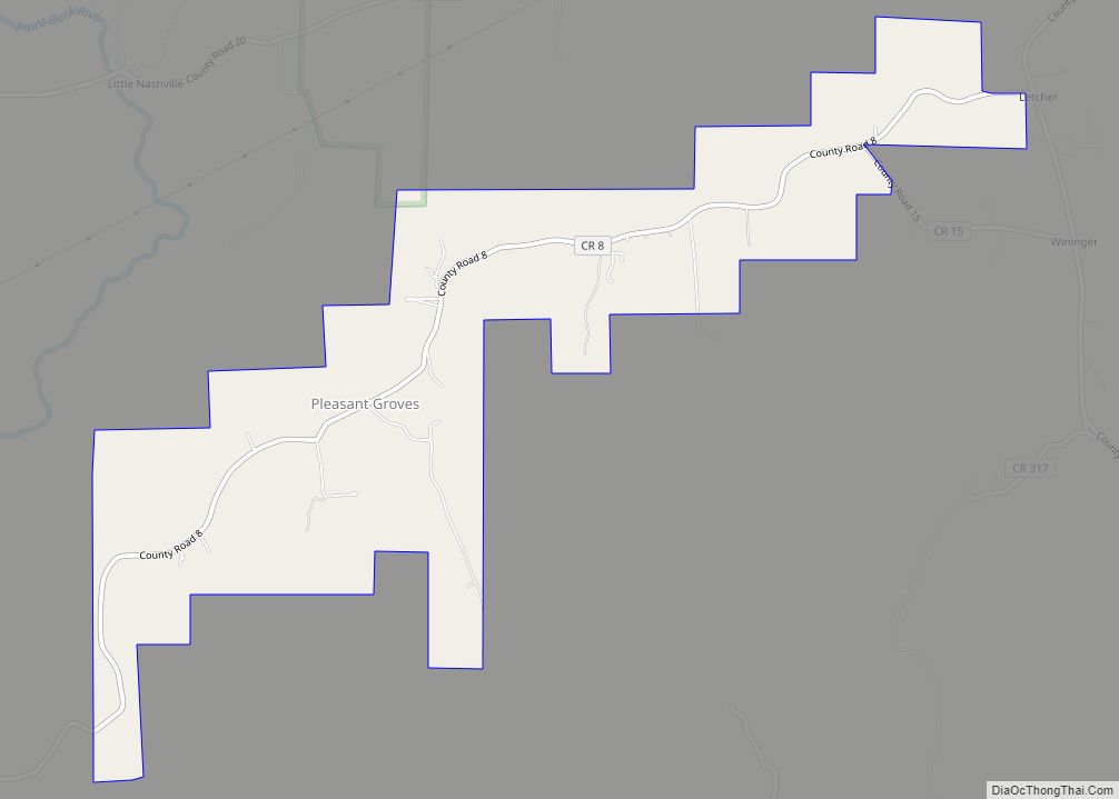
Online Interactive Map
Click on ![]() to view map in "full screen" mode.
to view map in "full screen" mode.
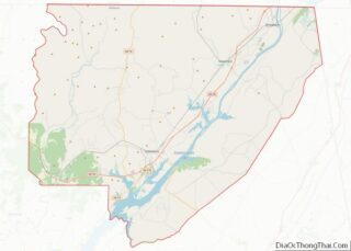
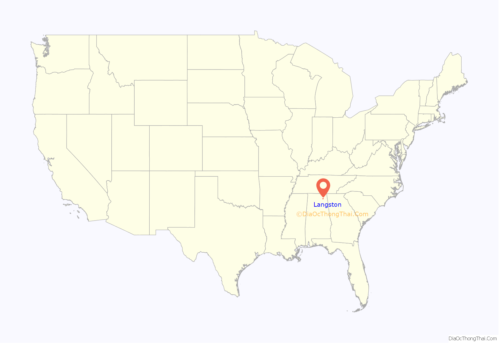
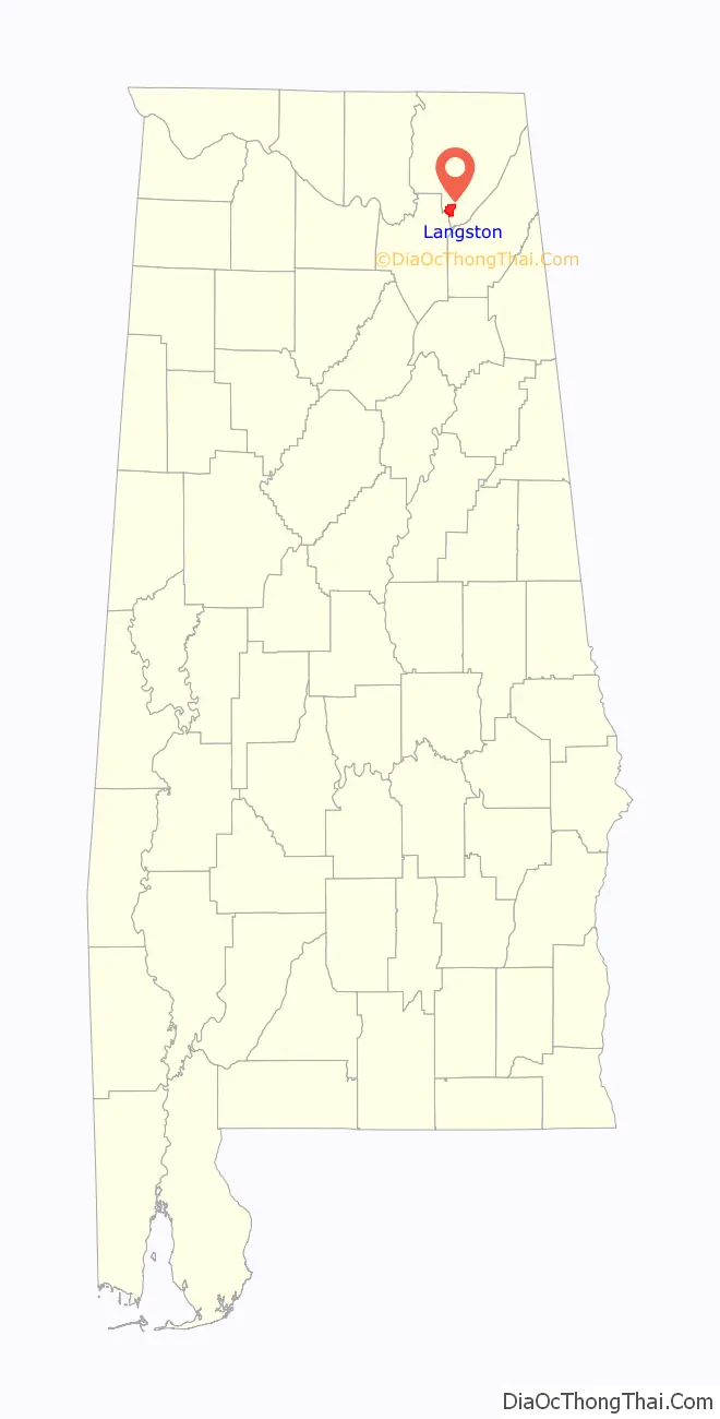
Langston location map. Where is Langston town?
History
Langston was settled in the 1810s, and was initially known as “Coffeetown” after the Coffee brothers, who were among the early settlers. A post office was established in 1845 with Langston Coffee as the first postmaster. In 1869, most of Coffeetown’s residents moved to Texas, and the following year, James Morgan sold lots for the creation of a new town. The new town was named “Langston” after Langston Coffee.
Langston initially thrived as a river port along the Tennessee River, eventually growing to include nine stores and a blacksmith shop. With the rise of railroad traffic in the late 19th century and automobile traffic in the early 20th century, however, the town began to decline. The construction of Guntersville Dam by the Tennessee Valley Authority in the late 1930s flooded a significant portion of the town, further reducing its population.
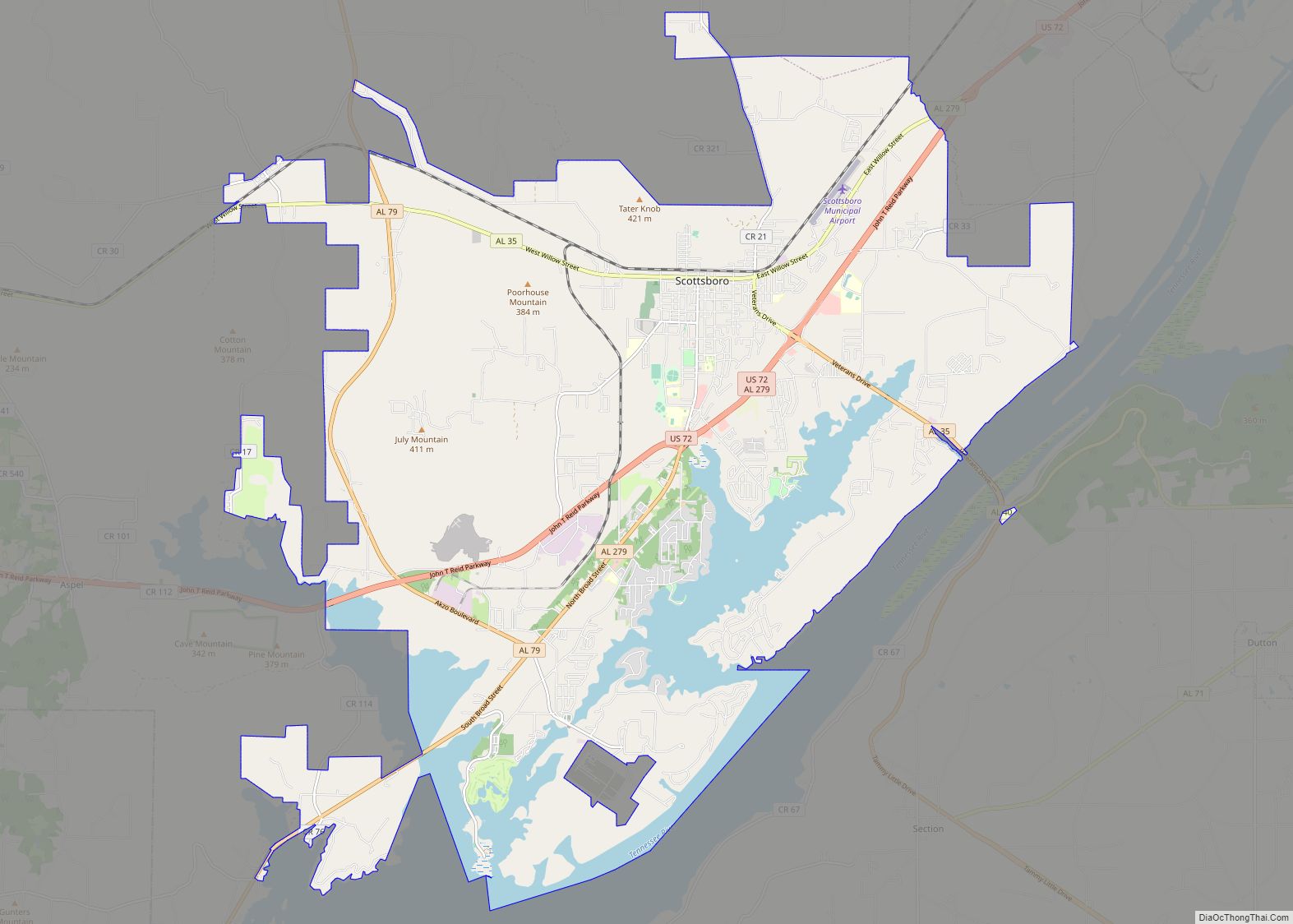
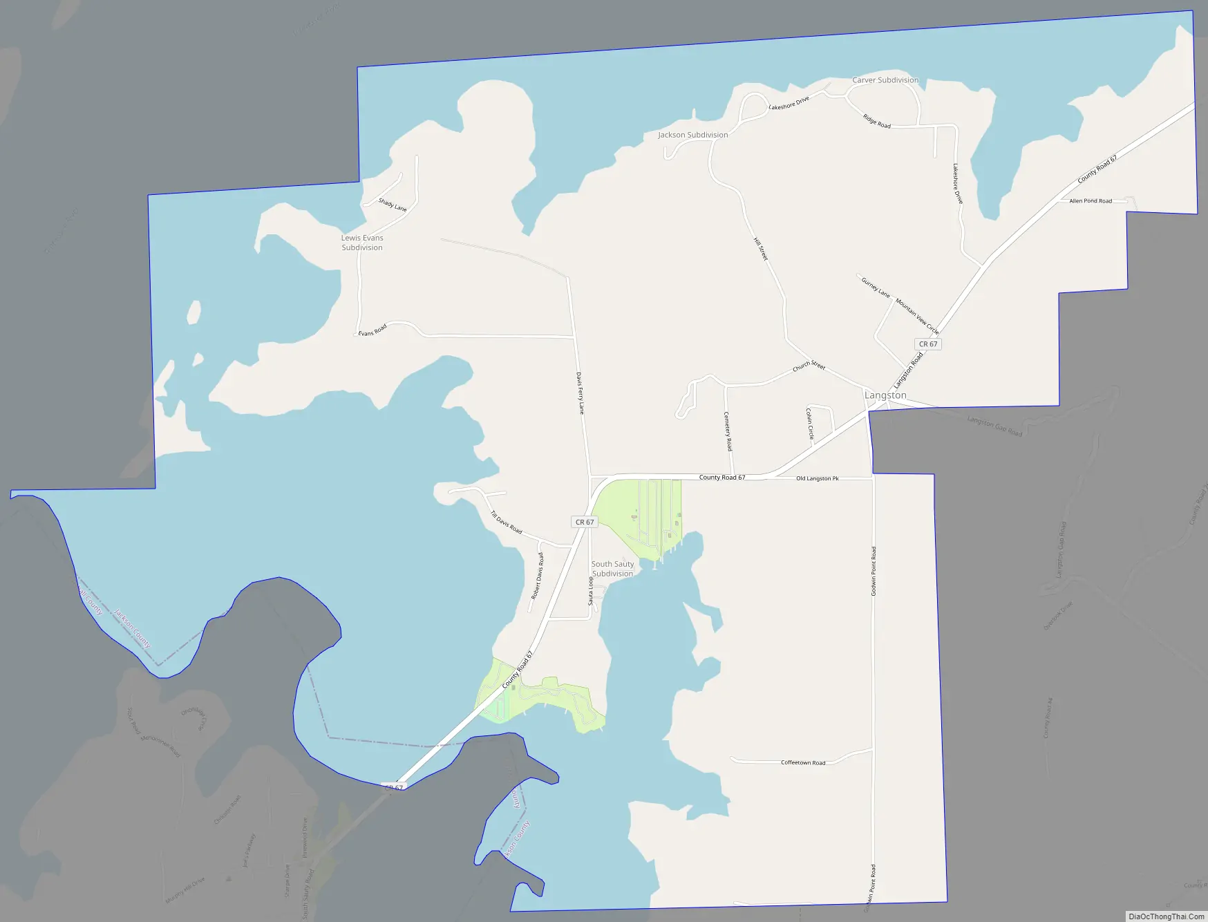
Langston Road Map
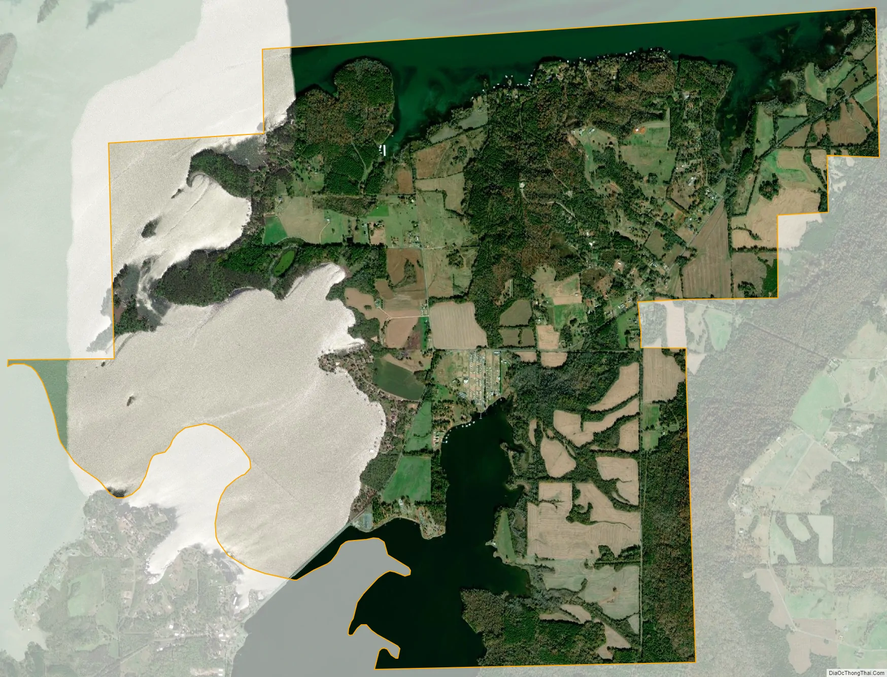
Langston city Satellite Map
Geography
Langston is located at 34°32′05″N 86°04′56″W / 34.534817°N 86.082169°W / 34.534817; -86.082169. The town is situated on the eastern shore of the Tennessee River, at river mile 377. This section of the river is part of Guntersville Lake, which is formed by Guntersville Dam nearly 30 miles (48 km) downstream. Sand Mountain rises immediately to the east of Langston. Scottsboro lies across the river to the north, and Section lies atop Sand Mountain to the northeast. County Road 67 connects Langston with State Route 35 to the northeast.
According to the U.S. Census Bureau, the town has a total area of 8.3 square miles (21 km), of which 5.0 square miles (13 km) is land and 3.2 square miles (8.3 km) (39.06%) is water.
See also
Map of Alabama State and its subdivision:- Autauga
- Baldwin
- Barbour
- Bibb
- Blount
- Bullock
- Butler
- Calhoun
- Chambers
- Cherokee
- Chilton
- Choctaw
- Clarke
- Clay
- Cleburne
- Coffee
- Colbert
- Conecuh
- Coosa
- Covington
- Crenshaw
- Cullman
- Dale
- Dallas
- De Kalb
- Elmore
- Escambia
- Etowah
- Fayette
- Franklin
- Geneva
- Greene
- Hale
- Henry
- Houston
- Jackson
- Jefferson
- Lamar
- Lauderdale
- Lawrence
- Lee
- Limestone
- Lowndes
- Macon
- Madison
- Marengo
- Marion
- Marshall
- Mobile
- Monroe
- Montgomery
- Morgan
- Perry
- Pickens
- Pike
- Randolph
- Russell
- Saint Clair
- Shelby
- Sumter
- Talladega
- Tallapoosa
- Tuscaloosa
- Walker
- Washington
- Wilcox
- Winston
- Alabama
- Alaska
- Arizona
- Arkansas
- California
- Colorado
- Connecticut
- Delaware
- District of Columbia
- Florida
- Georgia
- Hawaii
- Idaho
- Illinois
- Indiana
- Iowa
- Kansas
- Kentucky
- Louisiana
- Maine
- Maryland
- Massachusetts
- Michigan
- Minnesota
- Mississippi
- Missouri
- Montana
- Nebraska
- Nevada
- New Hampshire
- New Jersey
- New Mexico
- New York
- North Carolina
- North Dakota
- Ohio
- Oklahoma
- Oregon
- Pennsylvania
- Rhode Island
- South Carolina
- South Dakota
- Tennessee
- Texas
- Utah
- Vermont
- Virginia
- Washington
- West Virginia
- Wisconsin
- Wyoming