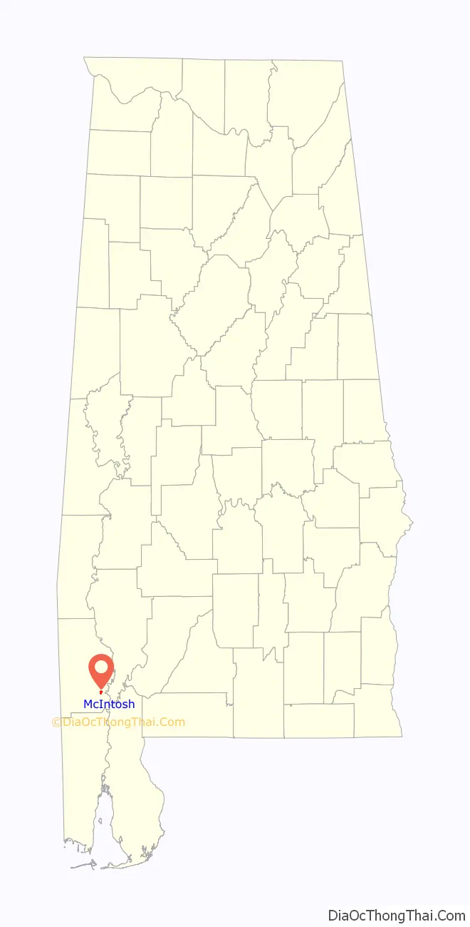
McIntosh is a town located in Washington County, Alabama, United States along U.S. Route 43. It is 12+1⁄2 miles (20.1 km) south of Wagarville and 44 miles (71 km) north of Mobile. It was named for William McIntosh, a prominent Creek chief of the nineteenth century. The town was incorporated on April 7, 1970. The population as of the 2020 U.S. Census was 206, down from 238 in 2010.
McIntosh is one of the most Native American towns in Alabama, With over half of the Towns inhabitants reporting to be of Native descent in the 2020 census
The town and county have a high proportion of residents who are members of the MOWA Band of Choctaw Indians, a state-recognized tribe of people of the Muskogean-speaking language family. It has one site, Andrews Chapel, listed on the National Register of Historic Places.
McIntosh is near the site of Aaron Burr’s arrest in 1807 while the area was part of the Mississippi Territory. He was captured by U.S. Army Lt. Edmund P. Gaines in the town of Wakefield, a few miles to the north, and then confined to Fort Stoddert. A historic marker has been placed to document this event.
| Name: | McIntosh town |
|---|---|
| LSAD Code: | 43 |
| LSAD Description: | town (suffix) |
| State: | Alabama |
| County: | Washington County |
| Elevation: | 49 ft (15 m) |
| Total Area: | 1.00 sq mi (2.58 km²) |
| Land Area: | 1.00 sq mi (2.58 km²) |
| Water Area: | 0.00 sq mi (0.00 km²) |
| Total Population: | 206 |
| Population Density: | 206.83/sq mi (79.85/km²) |
| ZIP code: | 36553 |
| Area code: | 251 |
| FIPS code: | 0145472 |
| GNISfeature ID: | 0152280 |
| Website: | mcintoshal.com |
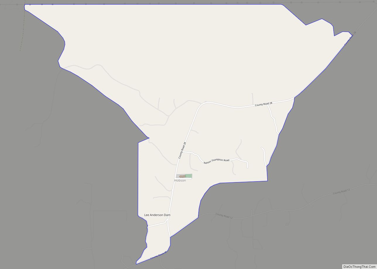
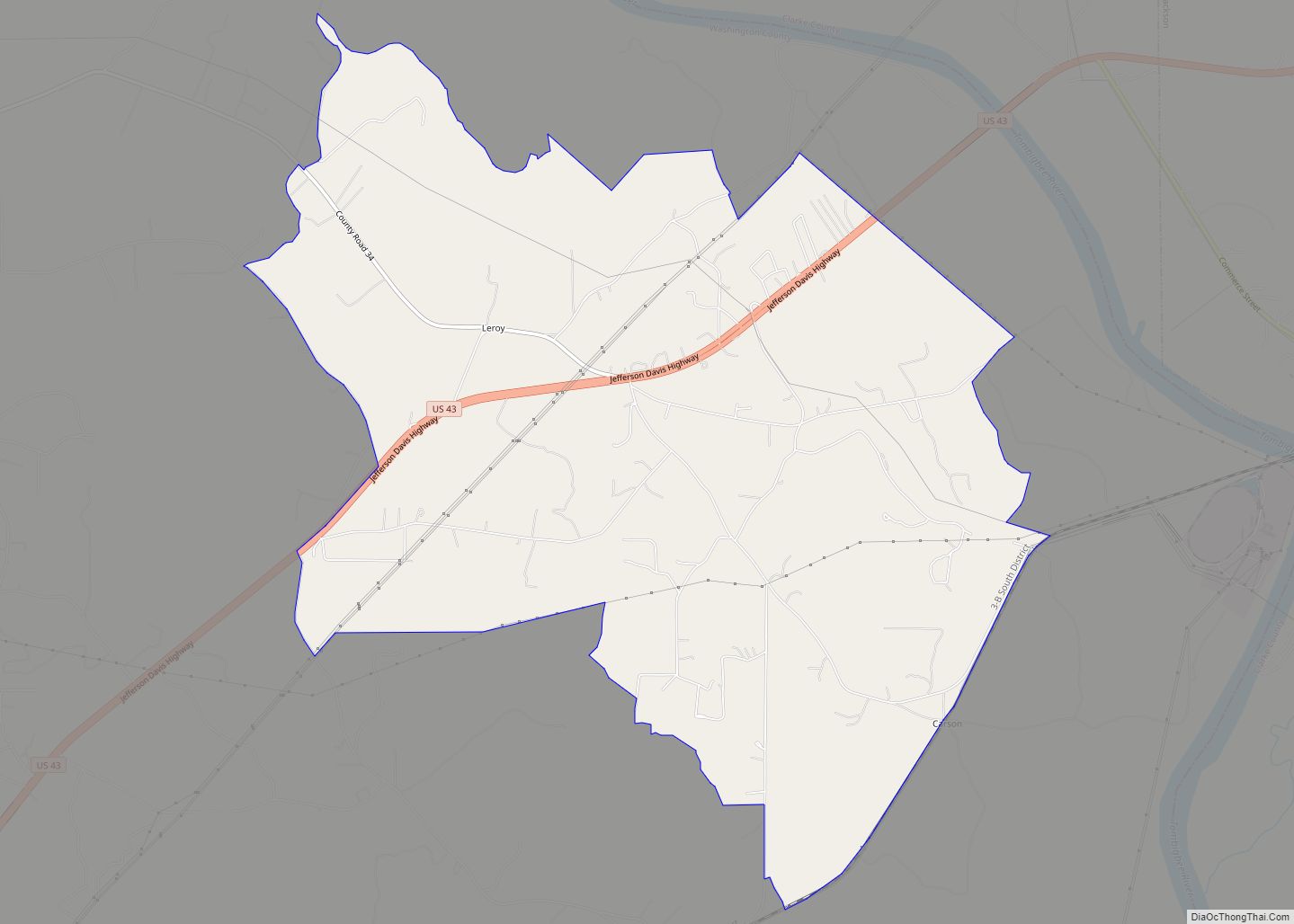
Online Interactive Map
Click on ![]() to view map in "full screen" mode.
to view map in "full screen" mode.
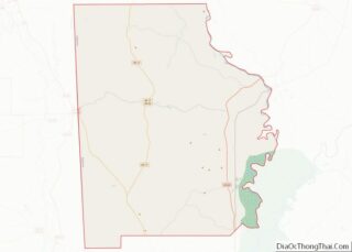
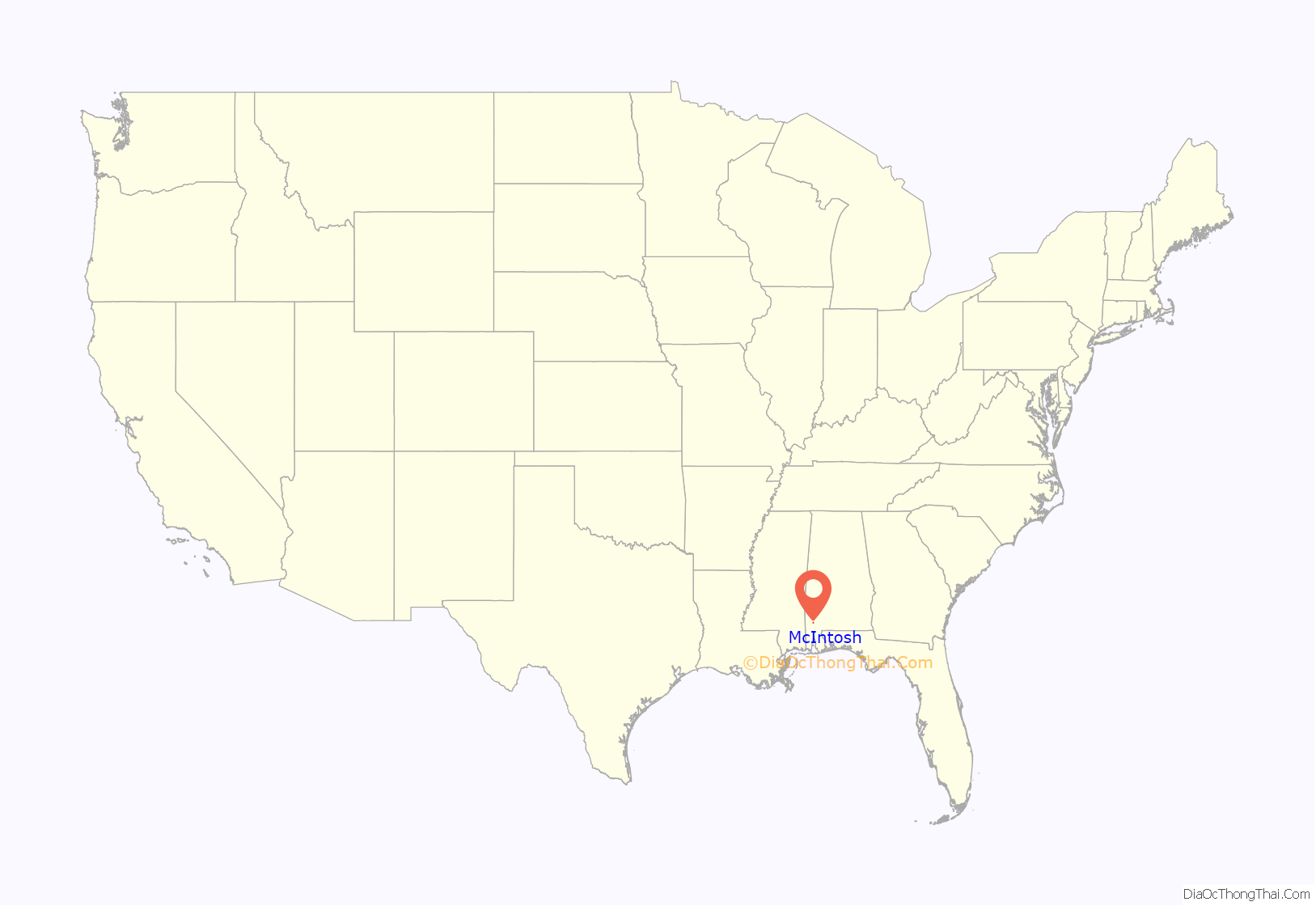
McIntosh location map. Where is McIntosh town?
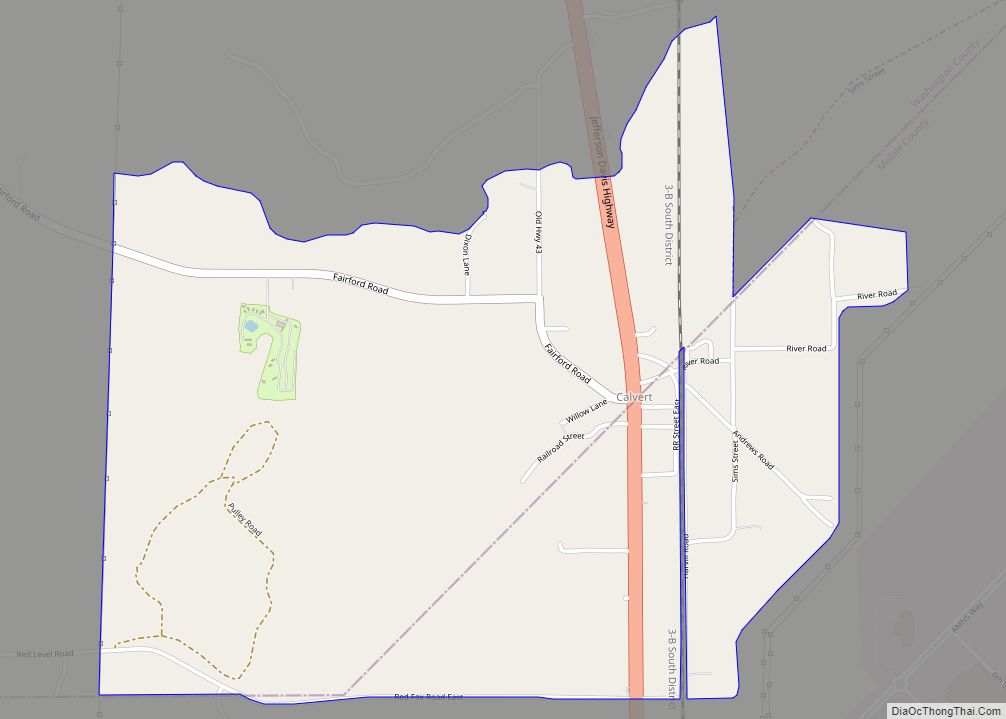
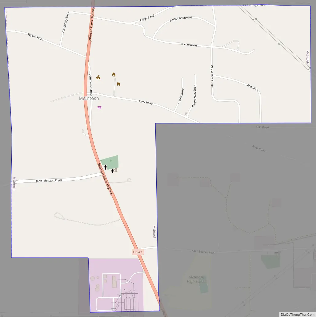
McIntosh Road Map
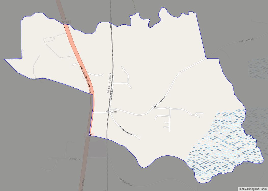
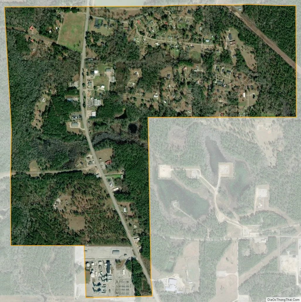
McIntosh city Satellite Map
Geography
McIntosh is located at 31°15’58” North, 88°1’53” West (31.265979, -88.031473). According to the U.S. Census Bureau, the town has a total area of 1.0 square mile (2.6 km), all land.
See also
Map of Alabama State and its subdivision:- Autauga
- Baldwin
- Barbour
- Bibb
- Blount
- Bullock
- Butler
- Calhoun
- Chambers
- Cherokee
- Chilton
- Choctaw
- Clarke
- Clay
- Cleburne
- Coffee
- Colbert
- Conecuh
- Coosa
- Covington
- Crenshaw
- Cullman
- Dale
- Dallas
- De Kalb
- Elmore
- Escambia
- Etowah
- Fayette
- Franklin
- Geneva
- Greene
- Hale
- Henry
- Houston
- Jackson
- Jefferson
- Lamar
- Lauderdale
- Lawrence
- Lee
- Limestone
- Lowndes
- Macon
- Madison
- Marengo
- Marion
- Marshall
- Mobile
- Monroe
- Montgomery
- Morgan
- Perry
- Pickens
- Pike
- Randolph
- Russell
- Saint Clair
- Shelby
- Sumter
- Talladega
- Tallapoosa
- Tuscaloosa
- Walker
- Washington
- Wilcox
- Winston
- Alabama
- Alaska
- Arizona
- Arkansas
- California
- Colorado
- Connecticut
- Delaware
- District of Columbia
- Florida
- Georgia
- Hawaii
- Idaho
- Illinois
- Indiana
- Iowa
- Kansas
- Kentucky
- Louisiana
- Maine
- Maryland
- Massachusetts
- Michigan
- Minnesota
- Mississippi
- Missouri
- Montana
- Nebraska
- Nevada
- New Hampshire
- New Jersey
- New Mexico
- New York
- North Carolina
- North Dakota
- Ohio
- Oklahoma
- Oregon
- Pennsylvania
- Rhode Island
- South Carolina
- South Dakota
- Tennessee
- Texas
- Utah
- Vermont
- Virginia
- Washington
- West Virginia
- Wisconsin
- Wyoming