Orrville is a town in Dallas County, Alabama, United States. At the 2020 census, the population was 150. According to the 1910 U.S. census, Orrville incorporated in 1908, though it was listed as an incorporated community prior to that.
| Name: | Orrville town |
|---|---|
| LSAD Code: | 43 |
| LSAD Description: | town (suffix) |
| State: | Alabama |
| County: | Dallas County |
| Elevation: | 190 ft (58 m) |
| Total Area: | 1.04 sq mi (2.68 km²) |
| Land Area: | 1.04 sq mi (2.68 km²) |
| Water Area: | 0.00 sq mi (0.00 km²) |
| Total Population: | 150 |
| Population Density: | 144.65/sq mi (55.87/km²) |
| ZIP code: | 36767 |
| Area code: | 334 |
| FIPS code: | 0157240 |
| GNISfeature ID: | 0152821 |
| Website: | www.townoforrville.com |
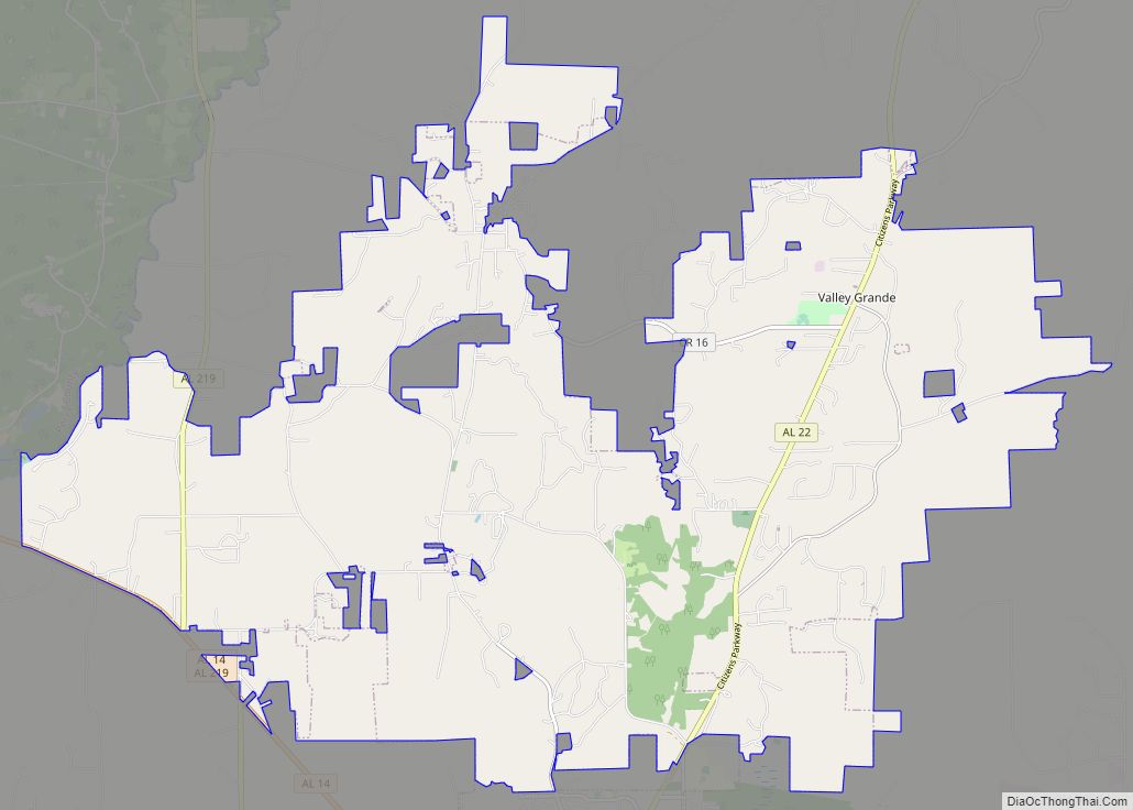
Online Interactive Map
Click on ![]() to view map in "full screen" mode.
to view map in "full screen" mode.
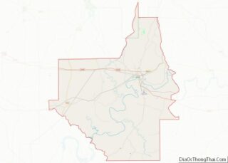
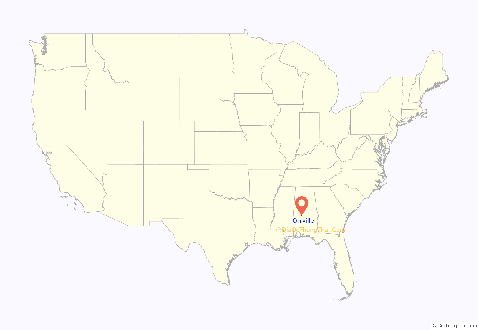
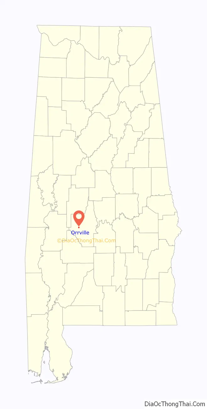
Orrville location map. Where is Orrville town?
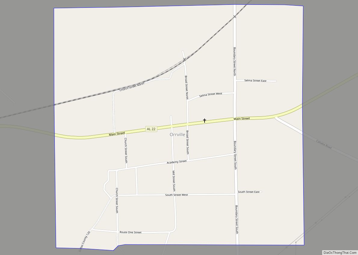
Orrville Road Map
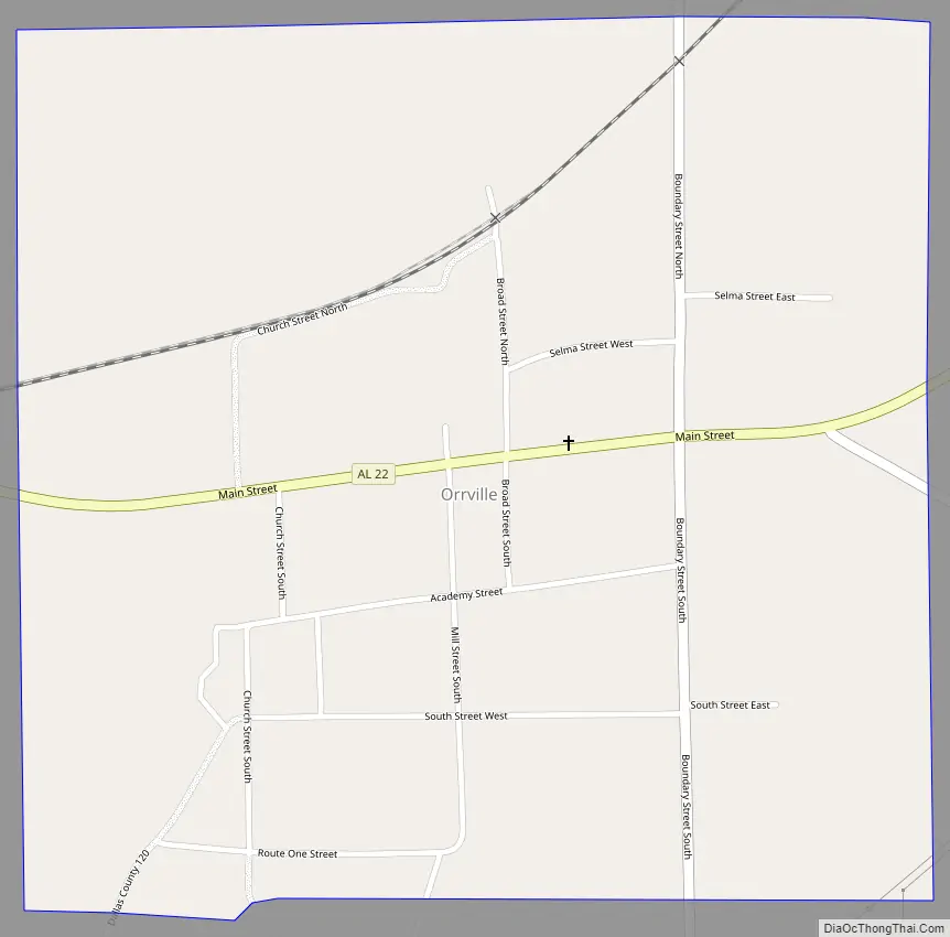
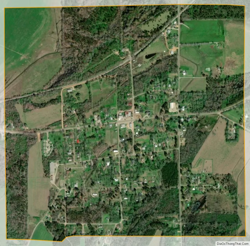
Orrville city Satellite Map
Geography
Orrville is located in western Dallas County at 32°18′20″N 87°14′43″W / 32.30556°N 87.24528°W / 32.30556; -87.24528 (32.305584, -87.245378). Alabama State Route 22 passes through the town, leading northeast 15 miles (24 km) to Selma, the county seat, and west 8 miles (13 km) to Safford.
According to the U.S. Census Bureau, Orrville has a total area of 1.0 square mile (2.7 km), all land.
See also
Map of Alabama State and its subdivision:- Autauga
- Baldwin
- Barbour
- Bibb
- Blount
- Bullock
- Butler
- Calhoun
- Chambers
- Cherokee
- Chilton
- Choctaw
- Clarke
- Clay
- Cleburne
- Coffee
- Colbert
- Conecuh
- Coosa
- Covington
- Crenshaw
- Cullman
- Dale
- Dallas
- De Kalb
- Elmore
- Escambia
- Etowah
- Fayette
- Franklin
- Geneva
- Greene
- Hale
- Henry
- Houston
- Jackson
- Jefferson
- Lamar
- Lauderdale
- Lawrence
- Lee
- Limestone
- Lowndes
- Macon
- Madison
- Marengo
- Marion
- Marshall
- Mobile
- Monroe
- Montgomery
- Morgan
- Perry
- Pickens
- Pike
- Randolph
- Russell
- Saint Clair
- Shelby
- Sumter
- Talladega
- Tallapoosa
- Tuscaloosa
- Walker
- Washington
- Wilcox
- Winston
- Alabama
- Alaska
- Arizona
- Arkansas
- California
- Colorado
- Connecticut
- Delaware
- District of Columbia
- Florida
- Georgia
- Hawaii
- Idaho
- Illinois
- Indiana
- Iowa
- Kansas
- Kentucky
- Louisiana
- Maine
- Maryland
- Massachusetts
- Michigan
- Minnesota
- Mississippi
- Missouri
- Montana
- Nebraska
- Nevada
- New Hampshire
- New Jersey
- New Mexico
- New York
- North Carolina
- North Dakota
- Ohio
- Oklahoma
- Oregon
- Pennsylvania
- Rhode Island
- South Carolina
- South Dakota
- Tennessee
- Texas
- Utah
- Vermont
- Virginia
- Washington
- West Virginia
- Wisconsin
- Wyoming