Selmont-West Selmont is a census-designated place (CDP) in Dallas County, Alabama, United States. At the 2020 census, the population was 2,158.
| Name: | Selmont-West Selmont CDP |
|---|---|
| LSAD Code: | 57 |
| LSAD Description: | CDP (suffix) |
| State: | Alabama |
| County: | Dallas County |
| Elevation: | 117 ft (36 m) |
| Total Area: | 3.32 sq mi (8.59 km²) |
| Land Area: | 3.28 sq mi (8.49 km²) |
| Water Area: | 0.04 sq mi (0.10 km²) |
| Total Population: | 2,158 |
| Population Density: | 658.33/sq mi (254.15/km²) |
| FIPS code: | 0169180 |
| GNISfeature ID: | 2402837 |
Online Interactive Map
Click on ![]() to view map in "full screen" mode.
to view map in "full screen" mode.
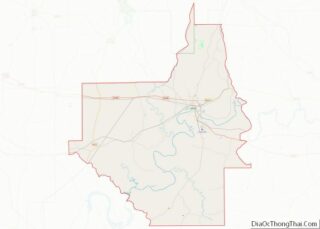
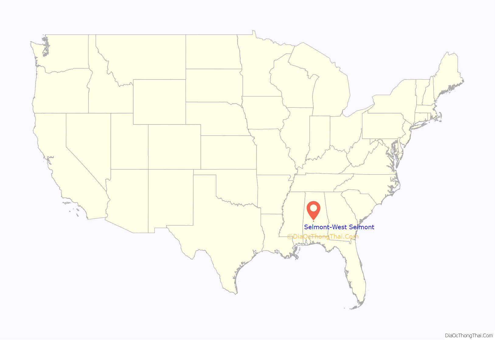
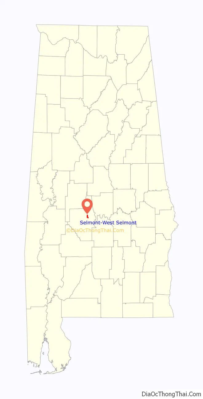
Selmont-West Selmont location map. Where is Selmont-West Selmont CDP?
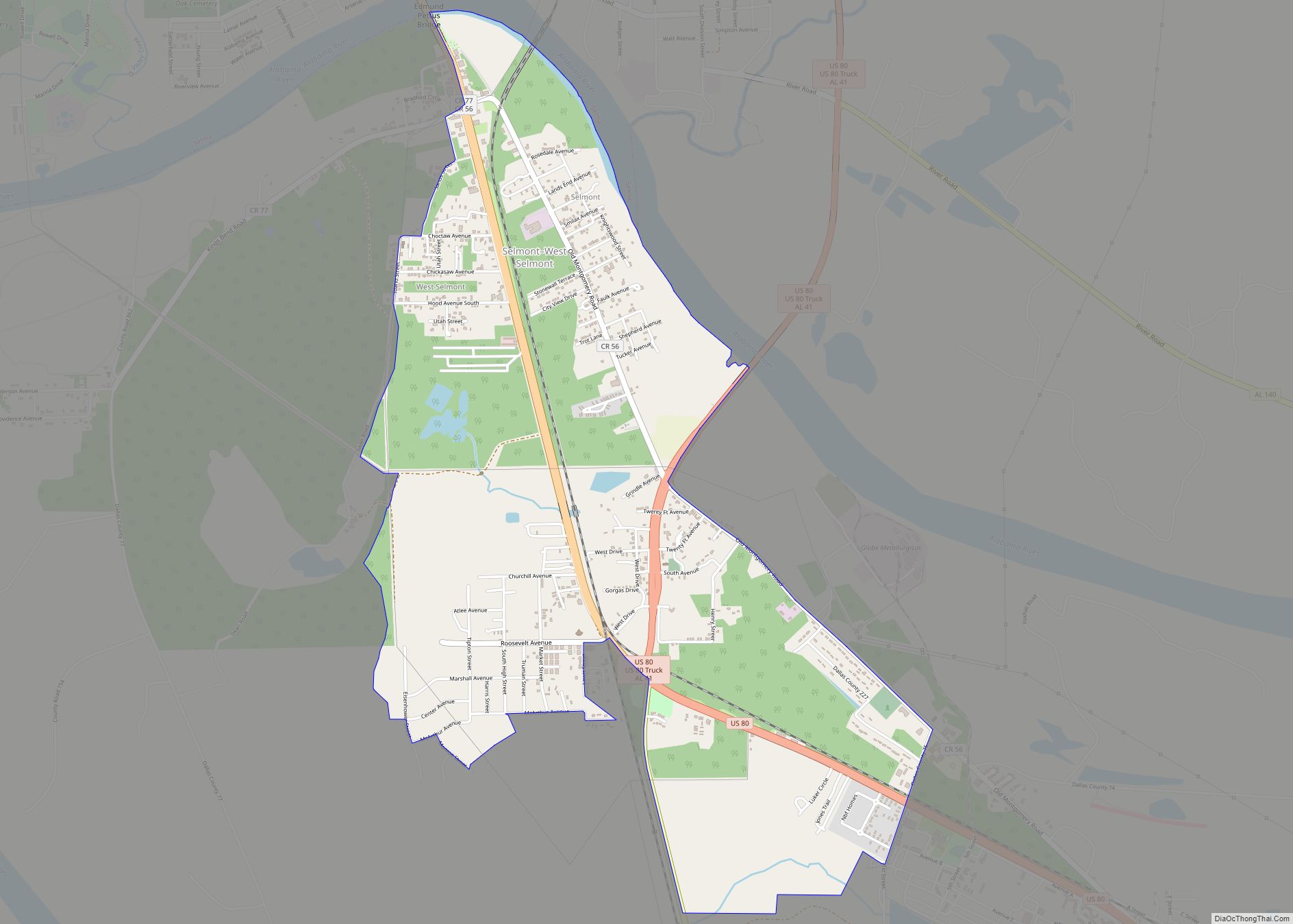
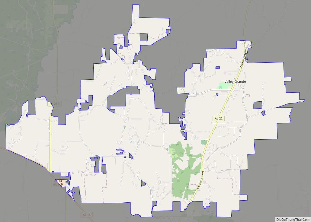
Selmont-West Selmont Road Map
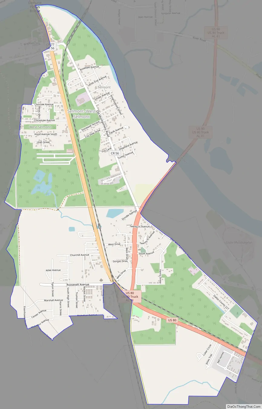
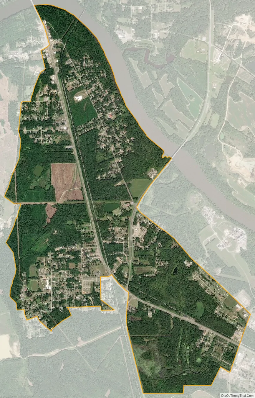
Selmont-West Selmont city Satellite Map
Geography
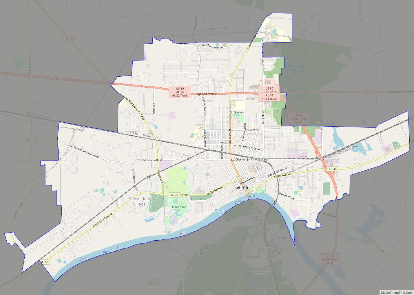
Selmont-West Selmont is located in eastern Dallas County at 32°22′43″N 87°0′24″W / 32.37861°N 87.00667°W / 32.37861; -87.00667 (32.378494, -87.006659). It is on the south side of the Alabama River, which separates it from the city of the Selma, the county seat, to the north. The Edmund Pettus Bridge carries U.S. Route 80 across the river into Selma at the north end of the CDP.
According to the U.S. Census Bureau, the CDP has a total area of 3.3 square miles (8.6 km), of which 3.3 square miles (8.5 km) is land and 0.04 square miles (0.1 km), or 1.17%, is water.
See also
Map of Alabama State and its subdivision:- Autauga
- Baldwin
- Barbour
- Bibb
- Blount
- Bullock
- Butler
- Calhoun
- Chambers
- Cherokee
- Chilton
- Choctaw
- Clarke
- Clay
- Cleburne
- Coffee
- Colbert
- Conecuh
- Coosa
- Covington
- Crenshaw
- Cullman
- Dale
- Dallas
- De Kalb
- Elmore
- Escambia
- Etowah
- Fayette
- Franklin
- Geneva
- Greene
- Hale
- Henry
- Houston
- Jackson
- Jefferson
- Lamar
- Lauderdale
- Lawrence
- Lee
- Limestone
- Lowndes
- Macon
- Madison
- Marengo
- Marion
- Marshall
- Mobile
- Monroe
- Montgomery
- Morgan
- Perry
- Pickens
- Pike
- Randolph
- Russell
- Saint Clair
- Shelby
- Sumter
- Talladega
- Tallapoosa
- Tuscaloosa
- Walker
- Washington
- Wilcox
- Winston
- Alabama
- Alaska
- Arizona
- Arkansas
- California
- Colorado
- Connecticut
- Delaware
- District of Columbia
- Florida
- Georgia
- Hawaii
- Idaho
- Illinois
- Indiana
- Iowa
- Kansas
- Kentucky
- Louisiana
- Maine
- Maryland
- Massachusetts
- Michigan
- Minnesota
- Mississippi
- Missouri
- Montana
- Nebraska
- Nevada
- New Hampshire
- New Jersey
- New Mexico
- New York
- North Carolina
- North Dakota
- Ohio
- Oklahoma
- Oregon
- Pennsylvania
- Rhode Island
- South Carolina
- South Dakota
- Tennessee
- Texas
- Utah
- Vermont
- Virginia
- Washington
- West Virginia
- Wisconsin
- Wyoming