Skyline is a town in Jackson County, Alabama, United States. The town incorporated in 1985. As of the 2010 census, the population of the town was 851, up from 843 in 2000.
| Name: | Skyline town |
|---|---|
| LSAD Code: | 43 |
| LSAD Description: | town (suffix) |
| State: | Alabama |
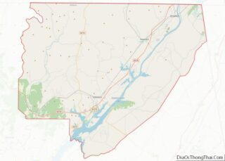
| County: | Jackson County |
| Elevation: | 1,591 ft (485 m) |
| Total Area: | 3.99 sq mi (10.34 km²) |
| Land Area: | 3.98 sq mi (10.31 km²) |
| Water Area: | 0.01 sq mi (0.03 km²) |
| Total Population: | 834 |
| Population Density: | 209.50/sq mi (80.88/km²) |
| Area code: | 256 |
| FIPS code: | 0170896 |
| GNISfeature ID: | 0139288 |
Online Interactive Map
Click on ![]() to view map in "full screen" mode.
to view map in "full screen" mode.
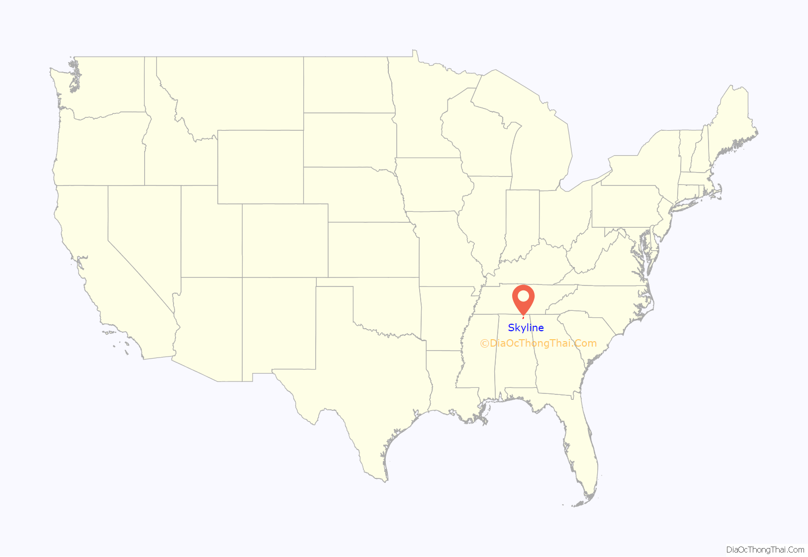
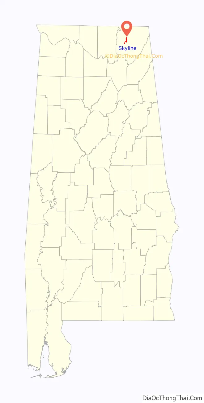
Skyline location map. Where is Skyline town?
History
Skyline began in 1934 as a cooperative farming experiment known as “Cumberland Farms” under President Franklin Roosevelt’s Federal Emergency Relief Administration. This was one of 43 such projects attempted nationally in depressed areas. It was soon renamed “Skyline Farms” to avoid confusion with another project in neighboring Tennessee. The experiment lasted for a decade before being sold off to private buyers in 1944.
The current town of Skyline is located about a mile north of the original farming colony.
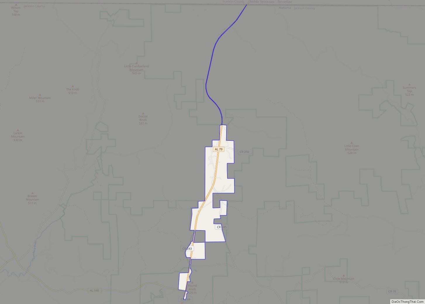
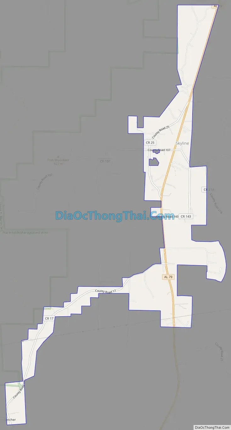
Skyline Road Map
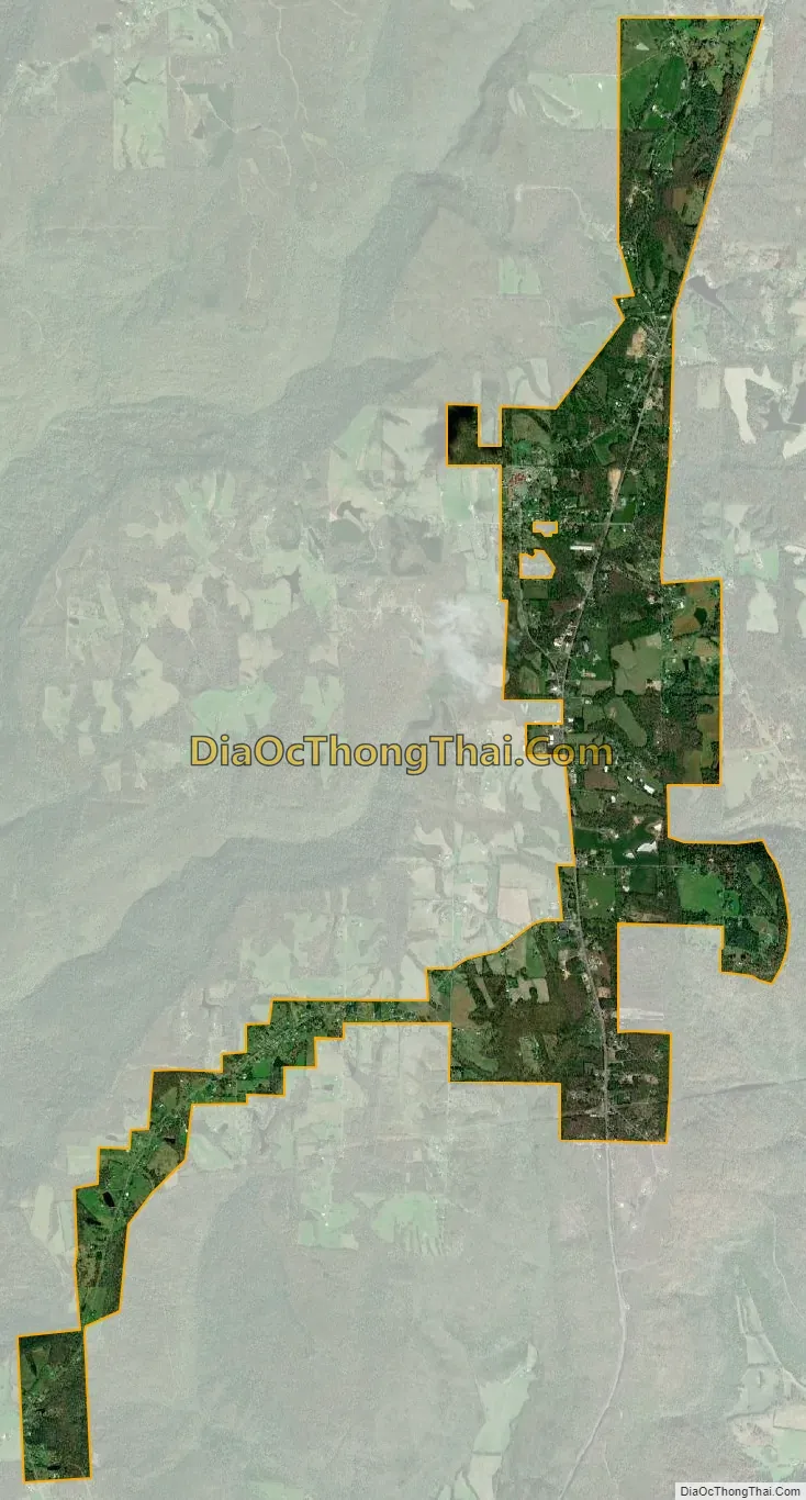
Skyline city Satellite Map
Geography
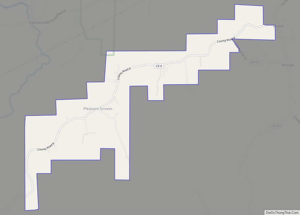
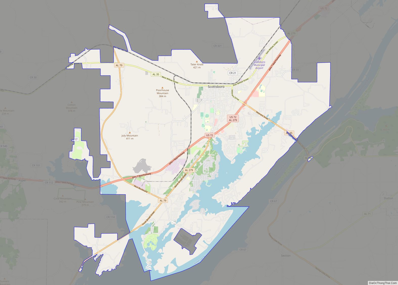
Skyline is located at 34°48′11″N 86°7′25″W / 34.80306°N 86.12361°W / 34.80306; -86.12361 (34.802946, -86.123494). The town is situated atop the Cumberland Plateau in western Jackson County. The plateau towns of Hytop and Pleasant Groves lie to the north and southwest, respectively. State Route 79 traverses Skyline, connecting the town with Scottsboro in the valley to the south and Tennessee to the north. State Route 146 intersects SR 79 just north of Skyline, and connects the area with the Paint Rock Valley to the west.
According to the U.S. Census Bureau, the town has a total area of 3.9 square miles (10 km), all land.
See also
Map of Alabama State and its subdivision:- Autauga
- Baldwin
- Barbour
- Bibb
- Blount
- Bullock
- Butler
- Calhoun
- Chambers
- Cherokee
- Chilton
- Choctaw
- Clarke
- Clay
- Cleburne
- Coffee
- Colbert
- Conecuh
- Coosa
- Covington
- Crenshaw
- Cullman
- Dale
- Dallas
- De Kalb
- Elmore
- Escambia
- Etowah
- Fayette
- Franklin
- Geneva
- Greene
- Hale
- Henry
- Houston
- Jackson
- Jefferson
- Lamar
- Lauderdale
- Lawrence
- Lee
- Limestone
- Lowndes
- Macon
- Madison
- Marengo
- Marion
- Marshall
- Mobile
- Monroe
- Montgomery
- Morgan
- Perry
- Pickens
- Pike
- Randolph
- Russell
- Saint Clair
- Shelby
- Sumter
- Talladega
- Tallapoosa
- Tuscaloosa
- Walker
- Washington
- Wilcox
- Winston
- Alabama
- Alaska
- Arizona
- Arkansas
- California
- Colorado
- Connecticut
- Delaware
- District of Columbia
- Florida
- Georgia
- Hawaii
- Idaho
- Illinois
- Indiana
- Iowa
- Kansas
- Kentucky
- Louisiana
- Maine
- Maryland
- Massachusetts
- Michigan
- Minnesota
- Mississippi
- Missouri
- Montana
- Nebraska
- Nevada
- New Hampshire
- New Jersey
- New Mexico
- New York
- North Carolina
- North Dakota
- Ohio
- Oklahoma
- Oregon
- Pennsylvania
- Rhode Island
- South Carolina
- South Dakota
- Tennessee
- Texas
- Utah
- Vermont
- Virginia
- Washington
- West Virginia
- Wisconsin
- Wyoming