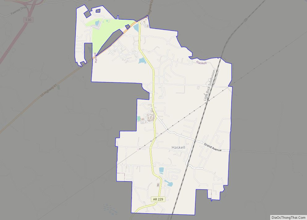
Bauxite is a city in Saline County, Arkansas, United States. Located within Central Arkansas, the city is named for bauxite, the source ore for aluminum, which was found in abundant quantities in the area and became a source of aluminium refining. The city’s population boomed during expanded aluminium production during World War II and shrank rapidly with output of the ore. Bauxite was incorporated as a town in 1973. The population was 487 at the 2010 census.
| Name: | Bauxite town |
|---|---|
| LSAD Code: | 43 |
| LSAD Description: | town (suffix) |
| State: | Arkansas |
| County: | Saline County |
| Elevation: | 344 ft (105 m) |
| Total Area: | 3.13 sq mi (8.10 km²) |
| Land Area: | 3.04 sq mi (7.89 km²) |
| Water Area: | 0.08 sq mi (0.22 km²) |
| Total Population: | 629 |
| Population Density: | 206.57/sq mi (79.77/km²) |
| ZIP code: | 72011 |
| Area code: | 501 |
| FIPS code: | 0504090 |
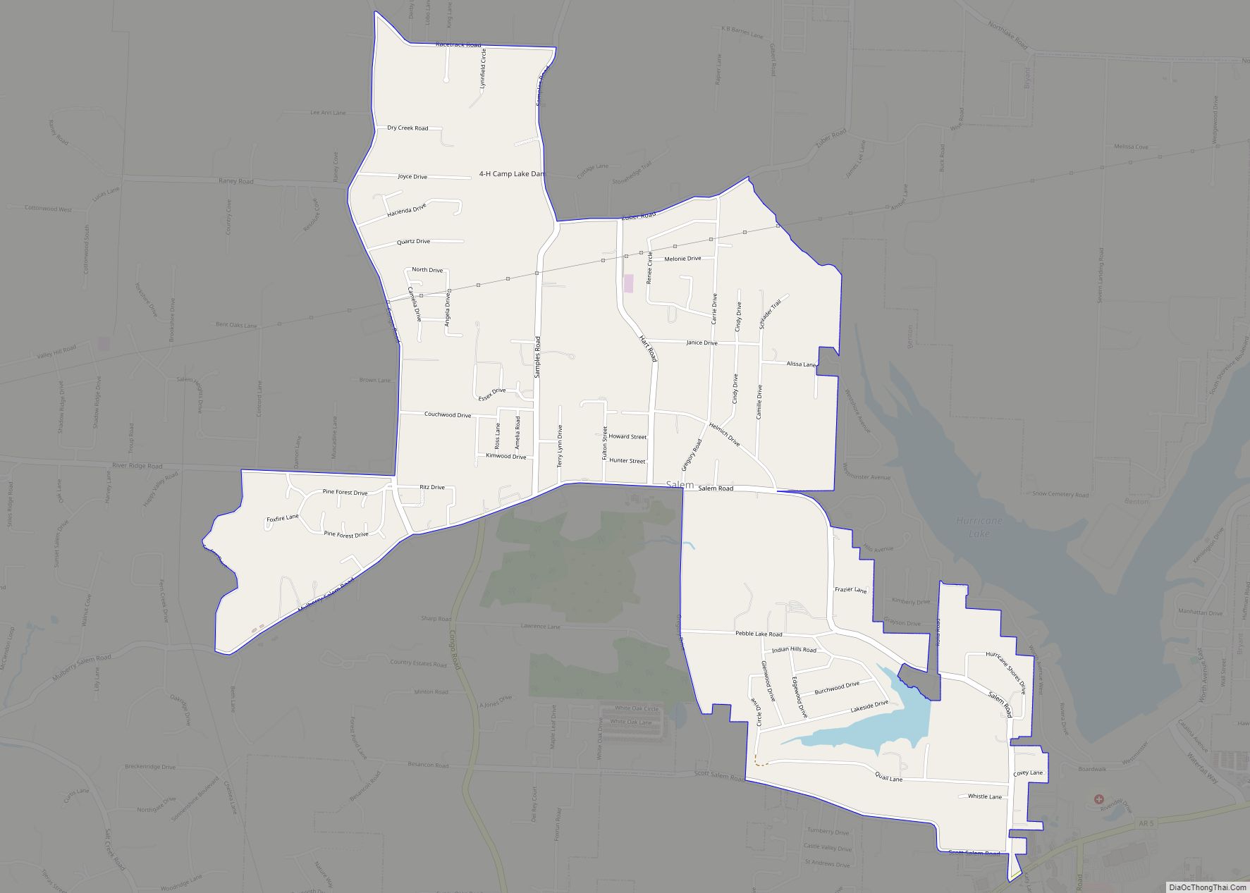
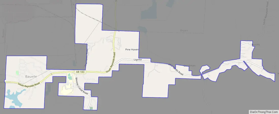
Online Interactive Map
Click on ![]() to view map in "full screen" mode.
to view map in "full screen" mode.
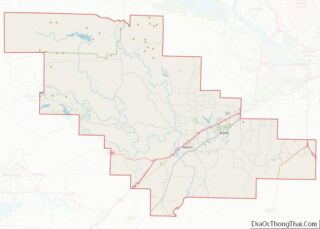
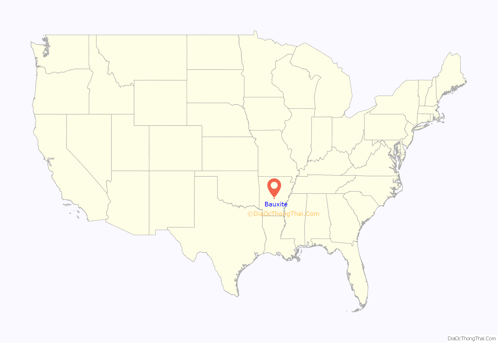
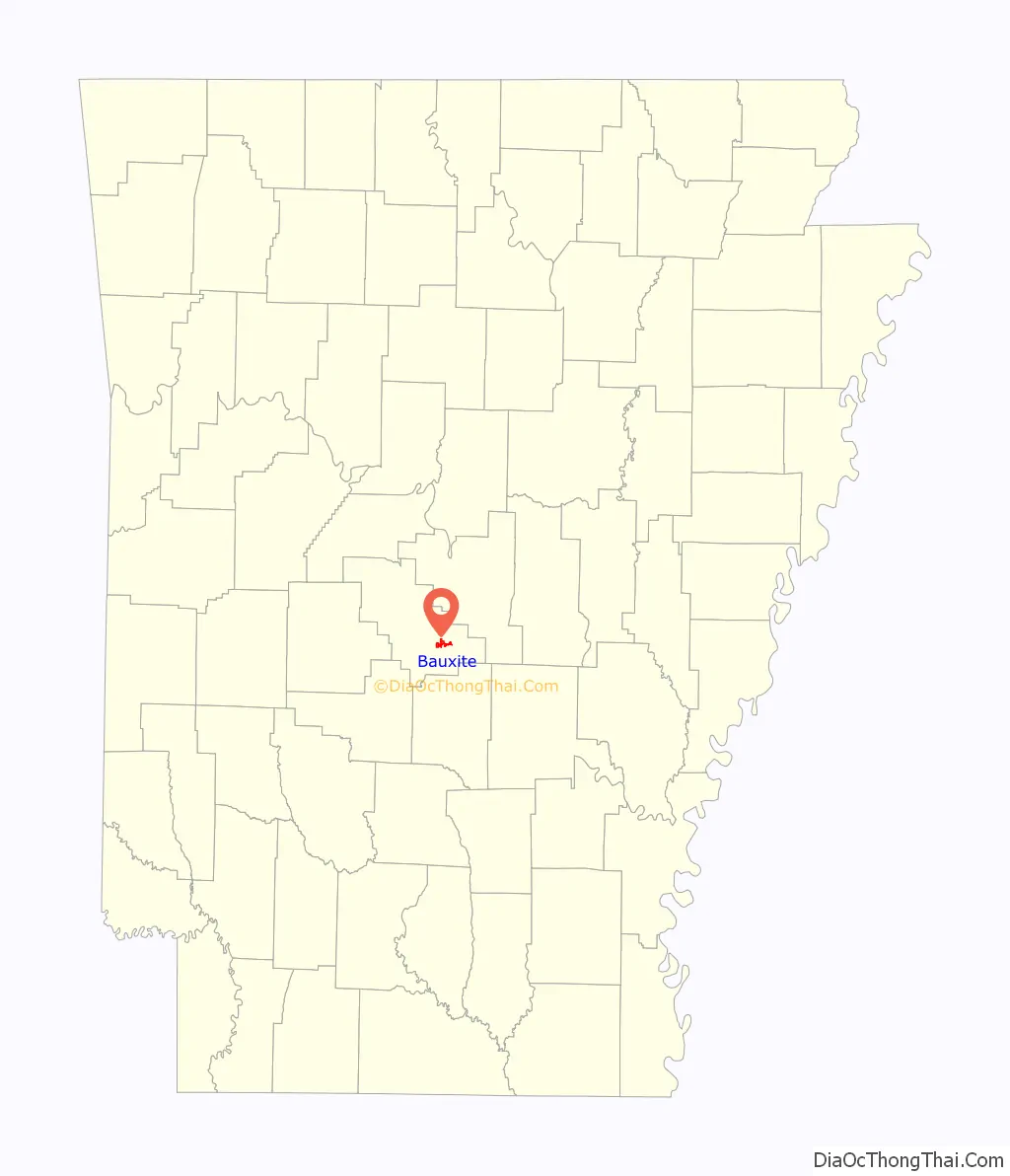
Bauxite location map. Where is Bauxite town?
History
The ore for which the city is named was discovered in the area in the early 1890s and mined by the General Bauxite Company until 1905, when the Pittsburgh Reduction Company, a northeastern aluminium refining company, purchased vast tracts of land in Saline County after learning of the high-quality ore that was being shipped from the area. The company bought out the local producers of the ore, including the General Bauxite Company. Pittsburgh Reduction would go on to incorporate as the Aluminum Company of America, or ALCOA.
Production of the ore rose rapidly, growing from 200,000 short tons (180,000 t) in 1914 during World War I, to 560,000 short tons (510,000 t) by war’s end in 1918. With decreased demand and an expanded source base in South America, Arkansas production levels fluctuated with demand, dropping as low as 60,000 short tons (54,000 t) per annum in the mid-1930s.
World War I provided the greatest surge in growth for Bauxite, with multiple camps developing in and around the present-day city, often segregated by race or ethnicity, with such camp names as Italy Camp, Mexico Camp, Africa Camp, etc. Throughout the Great Depression, ALCOA provided a standard of living for its employees that was generally un-matched during that period of economic turbulence.
When World War II broke out, Bauxite was again called into martial action, with production rapidly increasing with the need for refined aluminium to produce airplanes and other material. Donald M. Nelson, the Chairman of the WPA, requested that ALCOA president, Arthur V. Davis implement a three-shift, 24-hour production schedule. Davis brought in miners from across the country to keep the mines running continuously. This rapid rise in output led to a 1943 annual production of 6,000,000 short tons (5,400,000 t) of ore.
Production began to slow as the war drew to a close, but the city’s population and infrastructure had swelled to include multiple new communities and a larger school district. ALCOA and Reynolds Metal Company continued to refine bauxite in the area, with Reynolds finally ceasing operations in 1981.
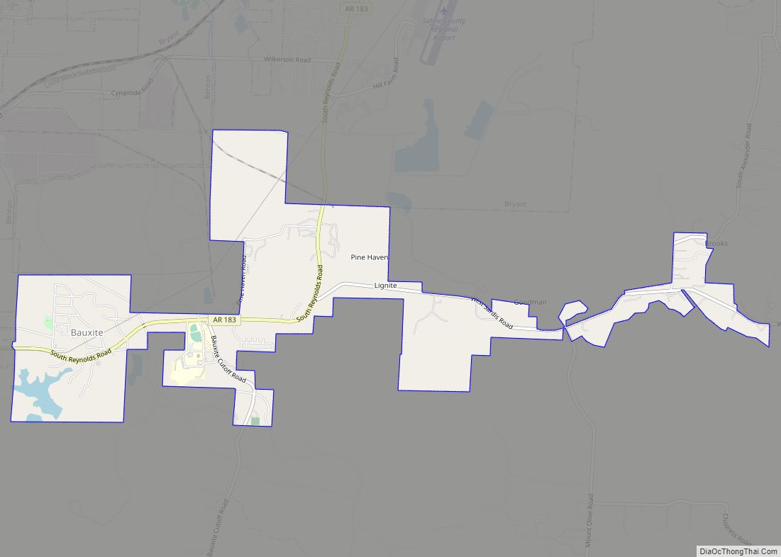
Bauxite Road Map
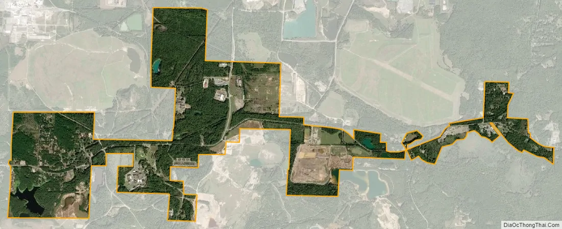
Bauxite city Satellite Map
Geography
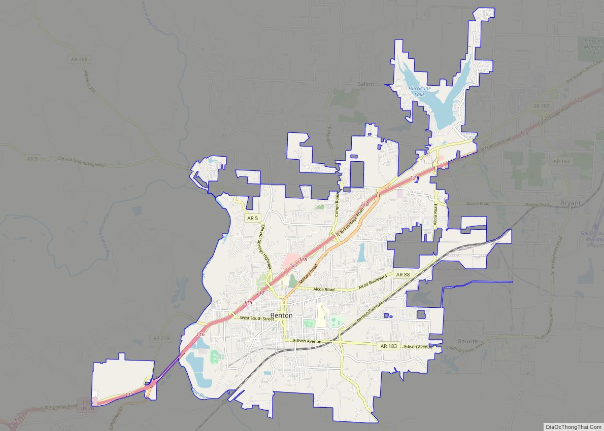
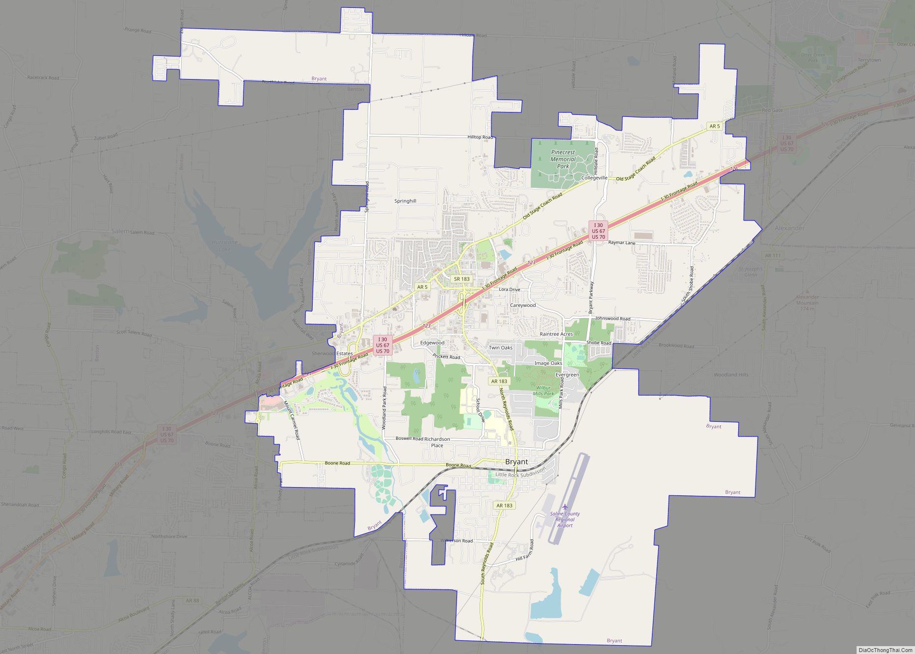
Bauxite is located in Saline County in south central Arkansas. Situated along Arkansas Highway 183 which also runs through Benton and Bryant, Bauxite is bordered on that path by Benton to the west and Bryant to the north. The city is 14 miles southwest of Little Rock. According to the United States Census Bureau, the town has a total area of 2.5 square miles (6.5 km), of which 2.4 square miles (6.2 km) is land and 0.1 square miles (0.26 km) (2.45%) is water.
See also
Map of Arkansas State and its subdivision:- Arkansas
- Ashley
- Baxter
- Benton
- Boone
- Bradley
- Calhoun
- Carroll
- Chicot
- Clark
- Clay
- Cleburne
- Cleveland
- Columbia
- Conway
- Craighead
- Crawford
- Crittenden
- Cross
- Dallas
- Desha
- Drew
- Faulkner
- Franklin
- Fulton
- Garland
- Grant
- Greene
- Hempstead
- Hot Spring
- Howard
- Independence
- Izard
- Jackson
- Jefferson
- Johnson
- Lafayette
- Lawrence
- Lee
- Lincoln
- Little River
- Logan
- Lonoke
- Madison
- Marion
- Miller
- Mississippi
- Monroe
- Montgomery
- Nevada
- Newton
- Ouachita
- Perry
- Phillips
- Pike
- Poinsett
- Polk
- Pope
- Prairie
- Pulaski
- Randolph
- Saint Francis
- Saline
- Scott
- Searcy
- Sebastian
- Sevier
- Sharp
- Stone
- Union
- Van Buren
- Washington
- White
- Woodruff
- Yell
- Alabama
- Alaska
- Arizona
- Arkansas
- California
- Colorado
- Connecticut
- Delaware
- District of Columbia
- Florida
- Georgia
- Hawaii
- Idaho
- Illinois
- Indiana
- Iowa
- Kansas
- Kentucky
- Louisiana
- Maine
- Maryland
- Massachusetts
- Michigan
- Minnesota
- Mississippi
- Missouri
- Montana
- Nebraska
- Nevada
- New Hampshire
- New Jersey
- New Mexico
- New York
- North Carolina
- North Dakota
- Ohio
- Oklahoma
- Oregon
- Pennsylvania
- Rhode Island
- South Carolina
- South Dakota
- Tennessee
- Texas
- Utah
- Vermont
- Virginia
- Washington
- West Virginia
- Wisconsin
- Wyoming