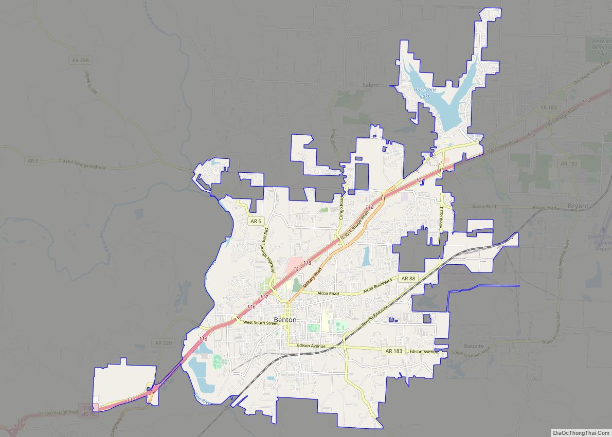
Benton is a city in and the county seat of Saline County, Arkansas, United States and a suburb of Little Rock. It was established in 1837. At the 2010 census, the city had a population of 30,681. In 2019 the population was estimated at 36,820. It is part of the Little Rock–North Little Rock–Conway Metropolitan Statistical Area. The city of Benton, first settled in 1833 and named after Missouri Senator Thomas Hart Benton, was formally chartered in 1836 when Arkansas became a state.
| Name: | Benton city |
|---|---|
| LSAD Code: | 25 |
| LSAD Description: | city (suffix) |
| State: | Arkansas |
| County: | Saline County |
| Elevation: | 407 ft (124 m) |
| Total Area: | 23.42 sq mi (60.65 km²) |
| Land Area: | 22.88 sq mi (59.27 km²) |
| Water Area: | 0.54 sq mi (1.39 km²) |
| Total Population: | 35,014 |
| Population Density: | 1,530.06/sq mi (590.77/km²) |
| ZIP code: | 72015, 72018-19, 72158 |
| Area code: | 501 |
| FIPS code: | 0505290 |
| GNISfeature ID: | 0046394 |
| Website: | www.bentonar.org |
Online Interactive Map
Click on ![]() to view map in "full screen" mode.
to view map in "full screen" mode.
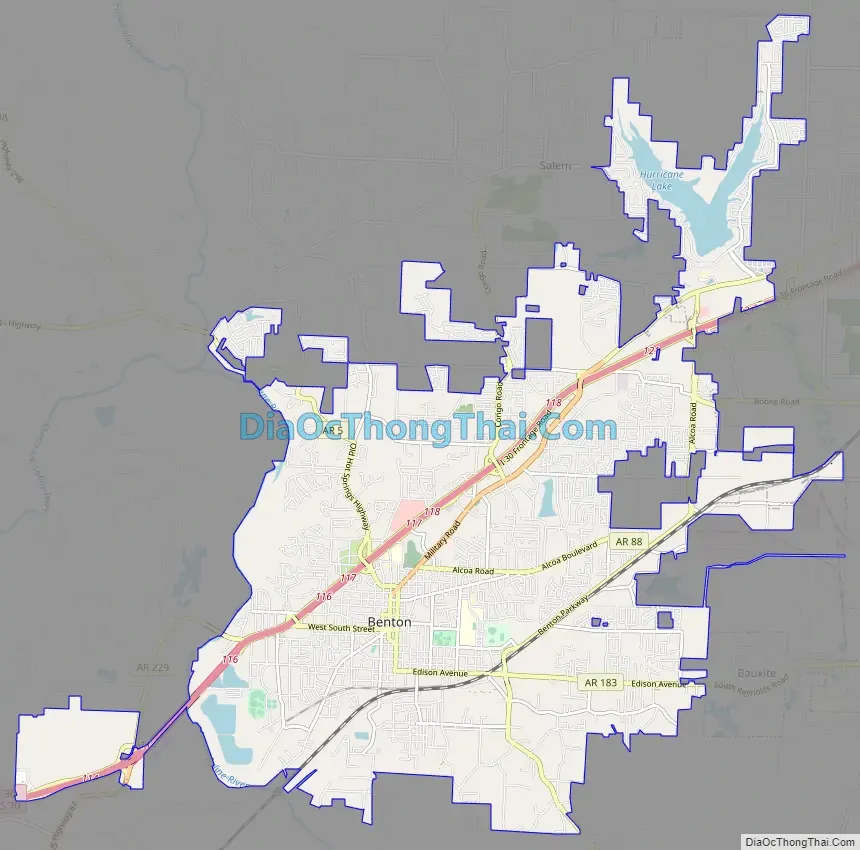
Benton location map. Where is Benton city?


Benton Road Map
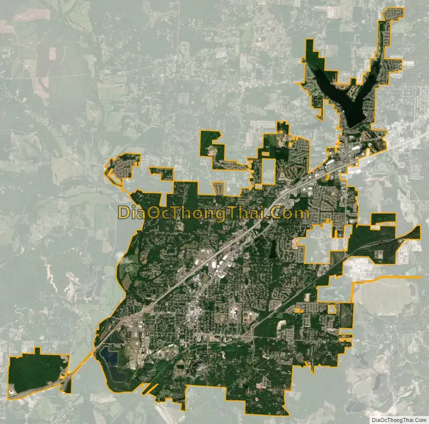
Benton city Satellite Map
Geography
According to the United States Census Bureau, the city has a total area of 18.4 square miles (48 km), of which 17.9 square miles (46 km) is land and 0.5 square miles (1.3 km) (2.71%) is water.
Climate
The climate in this area is characterized by hot, humid summers and generally mild to cool winters. According to the Köppen Climate Classification system, Benton has a humid subtropical climate, abbreviated “Cfa” on climate maps.
See also
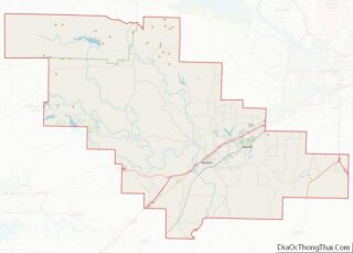
Map of Arkansas State and its subdivision:- Arkansas
- Ashley
- Baxter
- Benton
- Boone
- Bradley
- Calhoun
- Carroll
- Chicot
- Clark
- Clay
- Cleburne
- Cleveland
- Columbia
- Conway
- Craighead
- Crawford
- Crittenden
- Cross
- Dallas
- Desha
- Drew
- Faulkner
- Franklin
- Fulton
- Garland
- Grant
- Greene
- Hempstead
- Hot Spring
- Howard
- Independence
- Izard
- Jackson
- Jefferson
- Johnson
- Lafayette
- Lawrence
- Lee
- Lincoln
- Little River
- Logan
- Lonoke
- Madison
- Marion
- Miller
- Mississippi
- Monroe
- Montgomery
- Nevada
- Newton
- Ouachita
- Perry
- Phillips
- Pike
- Poinsett
- Polk
- Pope
- Prairie
- Pulaski
- Randolph
- Saint Francis
- Saline
- Scott
- Searcy
- Sebastian
- Sevier
- Sharp
- Stone
- Union
- Van Buren
- Washington
- White
- Woodruff
- Yell
- Alabama
- Alaska
- Arizona
- Arkansas
- California
- Colorado
- Connecticut
- Delaware
- District of Columbia
- Florida
- Georgia
- Hawaii
- Idaho
- Illinois
- Indiana
- Iowa
- Kansas
- Kentucky
- Louisiana
- Maine
- Maryland
- Massachusetts
- Michigan
- Minnesota
- Mississippi
- Missouri
- Montana
- Nebraska
- Nevada
- New Hampshire
- New Jersey
- New Mexico
- New York
- North Carolina
- North Dakota
- Ohio
- Oklahoma
- Oregon
- Pennsylvania
- Rhode Island
- South Carolina
- South Dakota
- Tennessee
- Texas
- Utah
- Vermont
- Virginia
- Washington
- West Virginia
- Wisconsin
- Wyoming