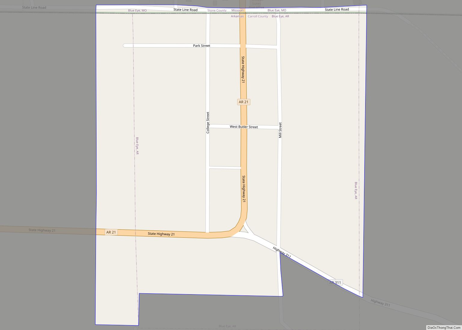
Blue Eye is an incorporated town in Carroll County, Arkansas, United States. The population was 46 at the 2020 census. The population estimate is 52 as of 2021. Blue Eye, Arkansas, is adjacent to Blue Eye, Missouri.
| Name: | Blue Eye town |
|---|---|
| LSAD Code: | 43 |
| LSAD Description: | town (suffix) |
| State: | Arkansas |
| County: | Carroll County |
| Elevation: | 1,289 ft (393 m) |
| Total Area: | 0.07 sq mi (0.19 km²) |
| Land Area: | 0.07 sq mi (0.19 km²) |
| Water Area: | 0.00 sq mi (0.00 km²) |
| Total Population: | 46 |
| Population Density: | 613.33/sq mi (236.90/km²) |
| Area code: | 870 |
| FIPS code: | 0507150 |
| GNISfeature ID: | 0076381 |
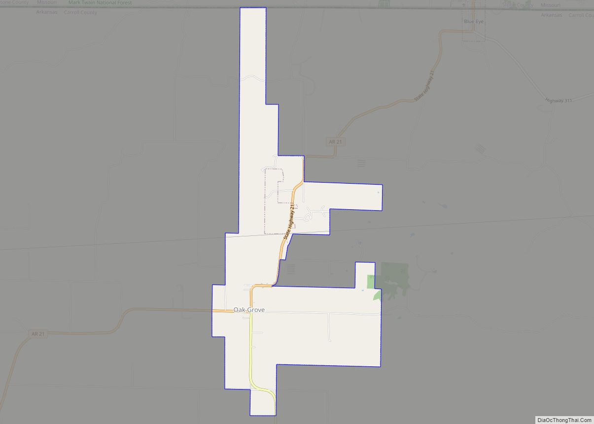
Online Interactive Map
Click on ![]() to view map in "full screen" mode.
to view map in "full screen" mode.
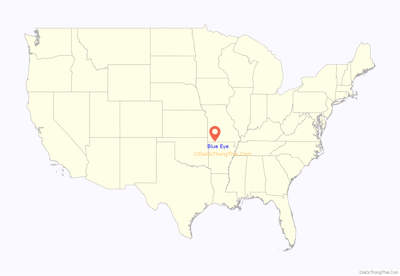
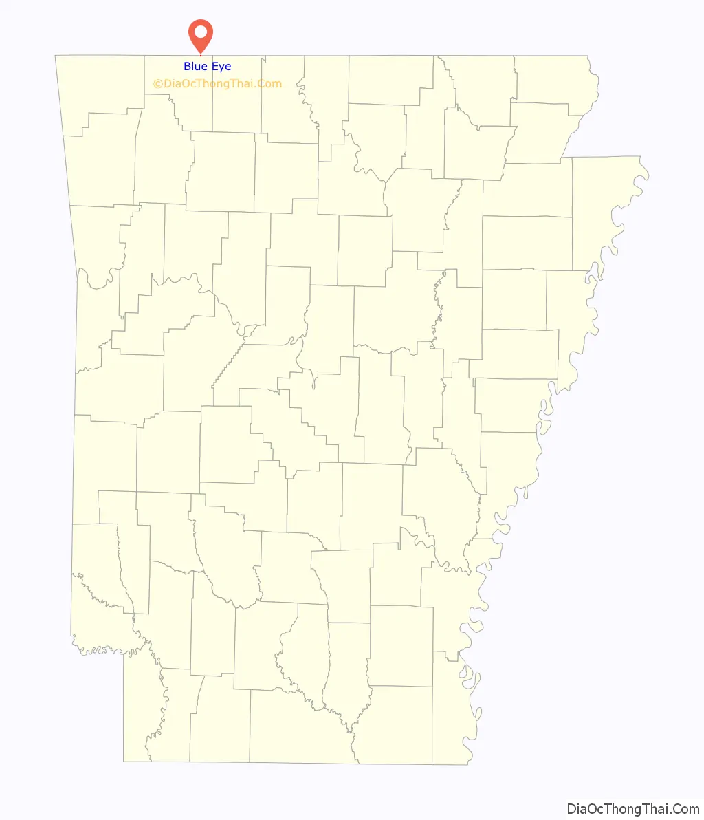
Blue Eye location map. Where is Blue Eye town?
Blue Eye Road Map

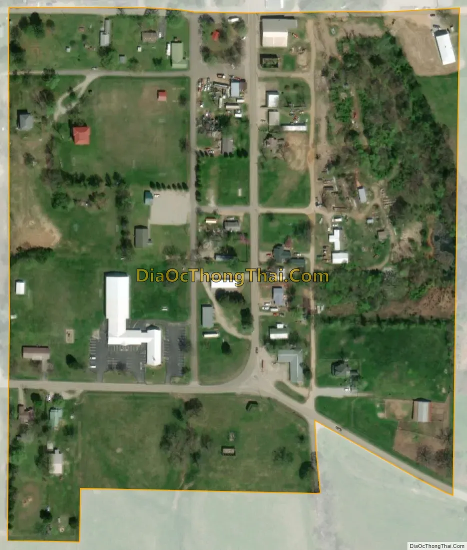
Blue Eye city Satellite Map
Geography
Blue Eye is the northernmost settlement in the state of Arkansas. The town is contiguous with Blue Eye, Missouri on the north side of the border. Arkansas Highway 21 ends at the border and continues north as Missouri Route 13. The community lies south of Table Rock Lake.
According to the United States Census Bureau, the town has a total area of 0.07 square miles (0.18 km), all land.
List of highways
- Arkansas Highway 21
- Arkansas Highway 311
See also
Map of Arkansas State and its subdivision:- Arkansas
- Ashley
- Baxter
- Benton
- Boone
- Bradley
- Calhoun
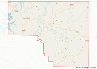
- Carroll
- Chicot
- Clark
- Clay
- Cleburne
- Cleveland
- Columbia
- Conway
- Craighead
- Crawford
- Crittenden
- Cross
- Dallas
- Desha
- Drew
- Faulkner
- Franklin
- Fulton
- Garland
- Grant
- Greene
- Hempstead
- Hot Spring
- Howard
- Independence
- Izard
- Jackson
- Jefferson
- Johnson
- Lafayette
- Lawrence
- Lee
- Lincoln
- Little River
- Logan
- Lonoke
- Madison
- Marion
- Miller
- Mississippi
- Monroe
- Montgomery
- Nevada
- Newton
- Ouachita
- Perry
- Phillips
- Pike
- Poinsett
- Polk
- Pope
- Prairie
- Pulaski
- Randolph
- Saint Francis
- Saline
- Scott
- Searcy
- Sebastian
- Sevier
- Sharp
- Stone
- Union
- Van Buren
- Washington
- White
- Woodruff
- Yell
- Alabama
- Alaska
- Arizona
- Arkansas
- California
- Colorado
- Connecticut
- Delaware
- District of Columbia
- Florida
- Georgia
- Hawaii
- Idaho
- Illinois
- Indiana
- Iowa
- Kansas
- Kentucky
- Louisiana
- Maine
- Maryland
- Massachusetts
- Michigan
- Minnesota
- Mississippi
- Missouri
- Montana
- Nebraska
- Nevada
- New Hampshire
- New Jersey
- New Mexico
- New York
- North Carolina
- North Dakota
- Ohio
- Oklahoma
- Oregon
- Pennsylvania
- Rhode Island
- South Carolina
- South Dakota
- Tennessee
- Texas
- Utah
- Vermont
- Virginia
- Washington
- West Virginia
- Wisconsin
- Wyoming