Cotter is a city in Baxter County, Arkansas, United States. The population was 886 at the 2020 census.
| Name: | Cotter city |
|---|---|
| LSAD Code: | 25 |
| LSAD Description: | city (suffix) |
| State: | Arkansas |
| County: | Baxter County |
| Incorporated: | November 23, 1905 |
| Elevation: | 640 ft (200 m) |
| Total Area: | 2.45 sq mi (6.34 km²) |
| Land Area: | 2.45 sq mi (6.34 km²) |
| Water Area: | 0.00 sq mi (0.00 km²) |
| Total Population: | 886 |
| Population Density: | 362.08/sq mi (139.78/km²) |
| ZIP code: | 72626 |
| Area code: | 870 |
| FIPS code: | 0515490 |
| GNISfeature ID: | 2404136 |
| Website: | www.cotterweb.com |
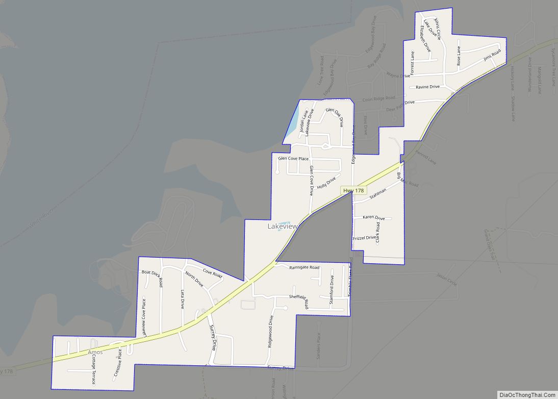
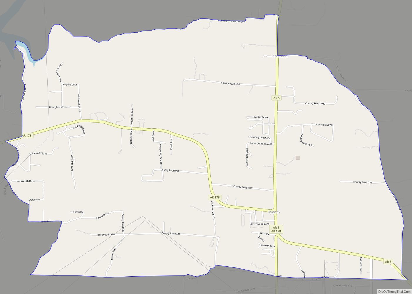
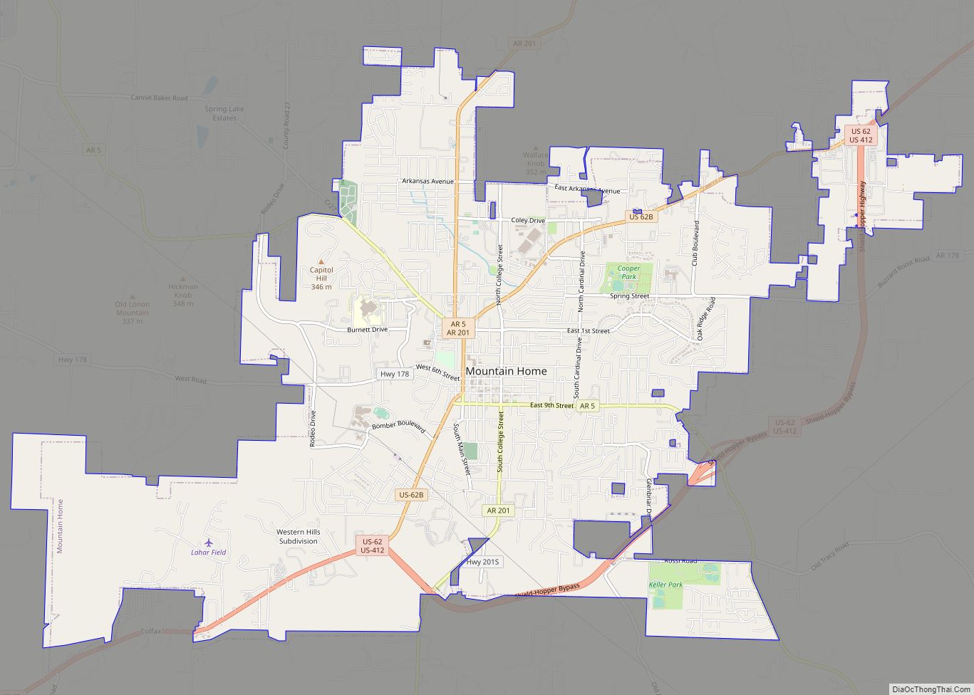
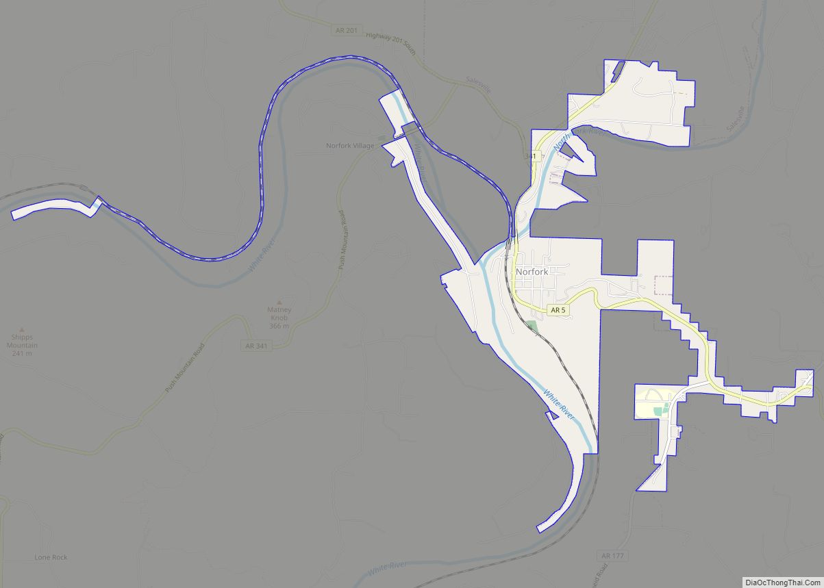
Online Interactive Map
Click on ![]() to view map in "full screen" mode.
to view map in "full screen" mode.
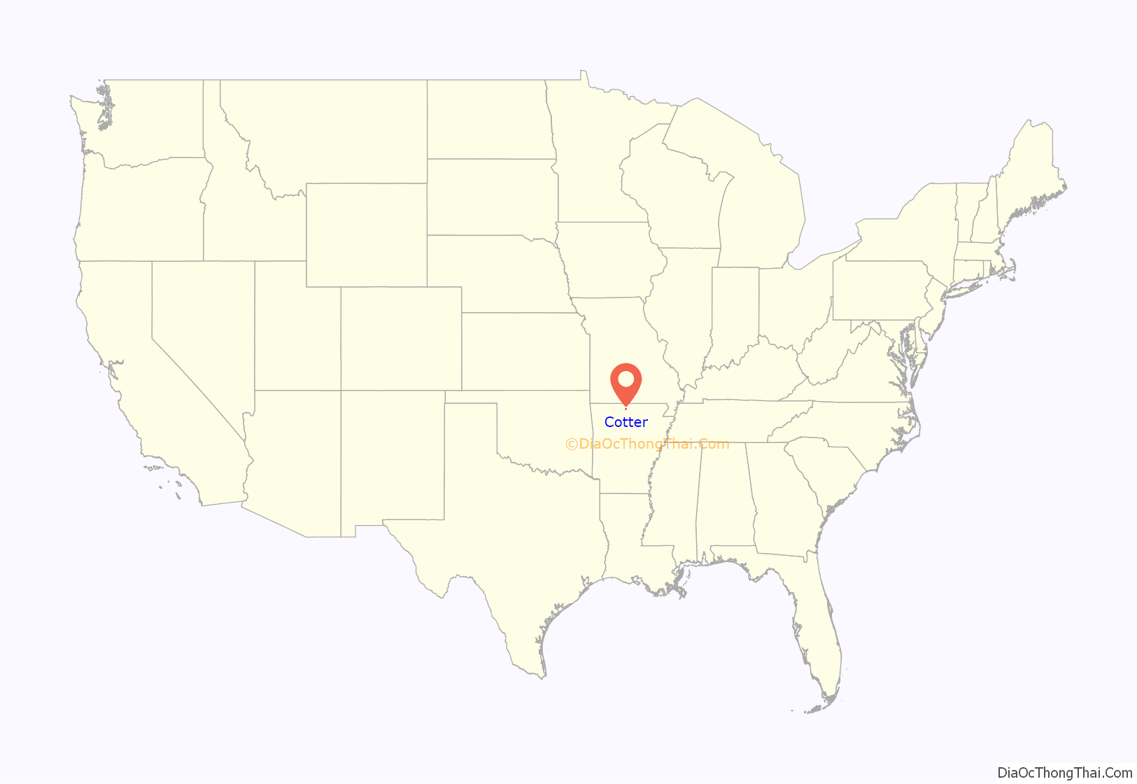
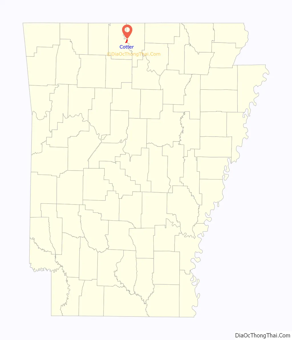
Cotter location map. Where is Cotter city?
History
Native American Bluff Dwellers were the original inhabitants of the area now known as Cotter. When Native Americans were moved westward on the Trail of Tears, approximately 1000 Cherokees crossed just a short distance upriver from the current location of Downtown Cotter.
Exploration and settlement
In 1819, Henry Schoolcraft was exploring the Ozarks and spent a night in the Cotter area. He said of the area,
Future president, Herbert Hoover, spent the summer of 1892 helping Geologist John C. Branner survey the northern Ozarks. By the early 1900s, there were many mining companies active in both Baxter and Marion Counties. Cotter quickly became a central point where minerals could be shipped via steamboat to much larger cities in central Arkansas or southern Missouri.
Originally, the river bend was known as either Lake’s Ferry or Lake’s Landing. At this spot, the White River turns sharply, making a convenient border for a town. The spring that rises up from the caves beneath Cotter, also added to the appeal to early settlers. Lake’s Ferry was known as one of the most beautiful spots on the river and was appreciated by locals and tourists.
White River Line
Seeking to capitalize on the growing trade in the area, the Missouri-Pacific Railroad announced plans to open the White River Line which would run through the area and would connect with the main line in Lake’s Landing. By 1902, the Cotter post office had opened. Two years later, the first school in Cotter opened. In 1905, the Missouri Pacific Railroad bought the area and sold over one thousand lots, mostly to railroad employees. The city was incorporated in 1905 as Cotter, Arkansas. By that time, the population was over 600. The town was named after William Cotter, an official for the Missouri Pacific Railway System. The materials required to build the town and railroad had to be brought in by steamboats down the White River. Once the railroad was completed, the use of steamboats on the rivers of Arkansas decreased and eventually ceased altogether. In 1906, the first passenger train arrived, and the tourist era began.
Expulsion of African Americans
The construction of the railroad brought many laborers, including African Americans, to the area. However, once the work was completed the sentiment among white residents turned against them. The anti-Black attitude was encouraged by a visit from Arkansas Governor Jeff Davis, who gave a racist speech in Cotter in 1904, and by the local newspaper, the Cotter Courier. In April 1906 the Courier ran an editorial titled “Too Many Negroes”, which said that local residents had a “feeling…that the negroes should move on.” In and around August 1906, all of Cotter’s African Americans were run out of town, except for one family of three, the Masons. In the 1950s advertisements for Cotter boasted that it was “100 per cent white”, and the 1960 census recorded no African American residents.
Cotter Bridge
The mercurial White River caused many motorists problems, as the nearest crossing was over 100 miles (160 km) to the north in Branson, Missouri. An inconvenient ferry system made the need for a bridge apparent. Locals wanted a bridge, but they strongly opposed a toll bridge. Arkansas did not have a central highway body at the time, and was instead a patchwork of “road districts”, which made the bridge-building efforts even more difficult. Without a toll, funding wasn’t available until Arkansas Highway 12 was redesignated U.S. Route 62 in 1930. The Cotter Bridge was constructed through the area using a unique rainbow arch design.
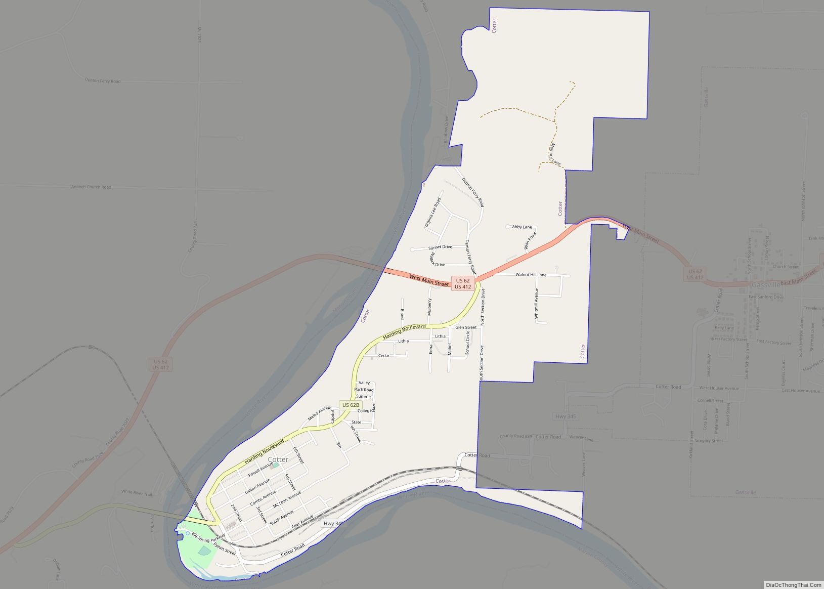
Cotter Road Map
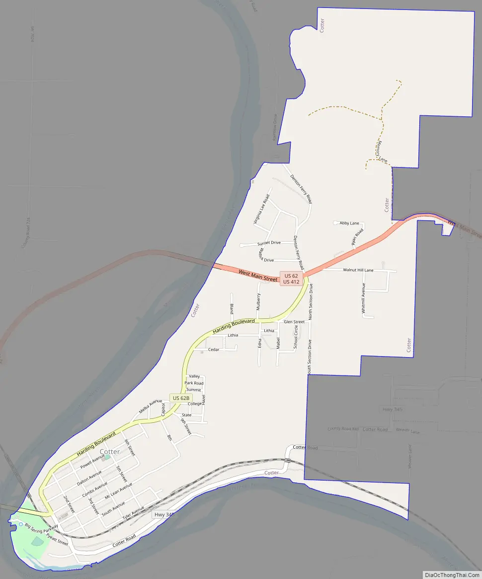
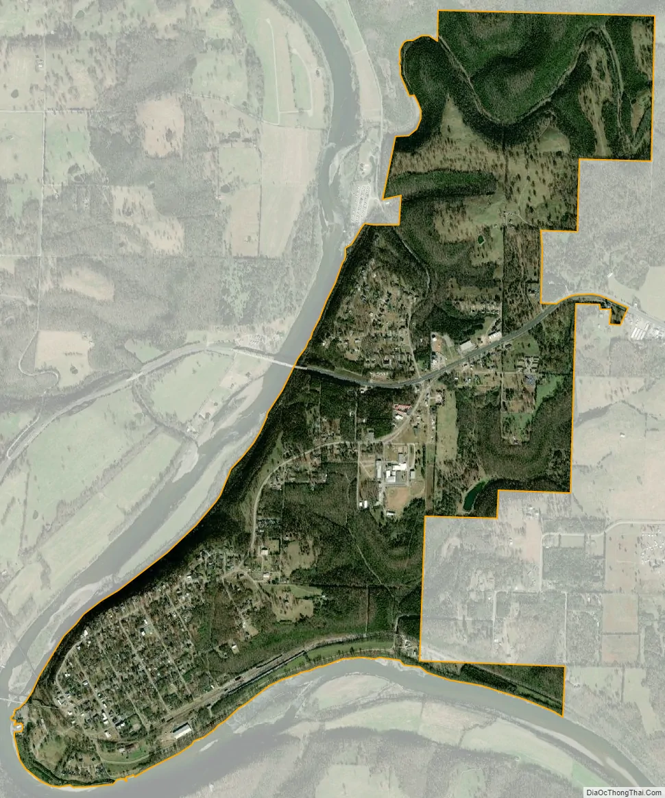
Cotter city Satellite Map
Geography
According to the United States Census Bureau, the city has a total area of 2.5 square miles (6.5 km), all land.
See also
Map of Arkansas State and its subdivision:- Arkansas
- Ashley
- Baxter
- Benton
- Boone
- Bradley
- Calhoun
- Carroll
- Chicot
- Clark
- Clay
- Cleburne
- Cleveland
- Columbia
- Conway
- Craighead
- Crawford
- Crittenden
- Cross
- Dallas
- Desha
- Drew
- Faulkner
- Franklin
- Fulton
- Garland
- Grant
- Greene
- Hempstead
- Hot Spring
- Howard
- Independence
- Izard
- Jackson
- Jefferson
- Johnson
- Lafayette
- Lawrence
- Lee
- Lincoln
- Little River
- Logan
- Lonoke
- Madison
- Marion
- Miller
- Mississippi
- Monroe
- Montgomery
- Nevada
- Newton
- Ouachita
- Perry
- Phillips
- Pike
- Poinsett
- Polk
- Pope
- Prairie
- Pulaski
- Randolph
- Saint Francis
- Saline
- Scott
- Searcy
- Sebastian
- Sevier
- Sharp
- Stone
- Union
- Van Buren
- Washington
- White
- Woodruff
- Yell
- Alabama
- Alaska
- Arizona
- Arkansas
- California
- Colorado
- Connecticut
- Delaware
- District of Columbia
- Florida
- Georgia
- Hawaii
- Idaho
- Illinois
- Indiana
- Iowa
- Kansas
- Kentucky
- Louisiana
- Maine
- Maryland
- Massachusetts
- Michigan
- Minnesota
- Mississippi
- Missouri
- Montana
- Nebraska
- Nevada
- New Hampshire
- New Jersey
- New Mexico
- New York
- North Carolina
- North Dakota
- Ohio
- Oklahoma
- Oregon
- Pennsylvania
- Rhode Island
- South Carolina
- South Dakota
- Tennessee
- Texas
- Utah
- Vermont
- Virginia
- Washington
- West Virginia
- Wisconsin
- Wyoming