Dierks is a city in Howard County, Arkansas, United States. The population was 916 as of the 2020 census, down from 1,133 in 2010.
| Name: | Dierks city |
|---|---|
| LSAD Code: | 25 |
| LSAD Description: | city (suffix) |
| State: | Arkansas |
| County: | Howard County |
| Elevation: | 443 ft (135 m) |
| Total Area: | 1.92 sq mi (4.97 km²) |
| Land Area: | 1.92 sq mi (4.97 km²) |
| Water Area: | 0.00 sq mi (0.00 km²) |
| Total Population: | 916 |
| Population Density: | 477.33/sq mi (184.28/km²) |
| ZIP code: | 71833 |
| Area code: | 870 |
| FIPS code: | 0518970 |
| GNISfeature ID: | 2404228 |
Online Interactive Map
Click on ![]() to view map in "full screen" mode.
to view map in "full screen" mode.
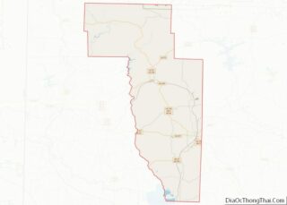
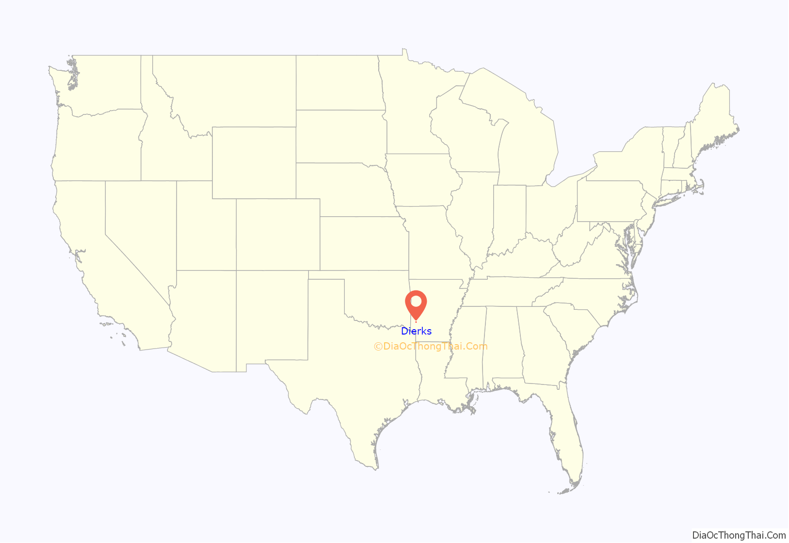
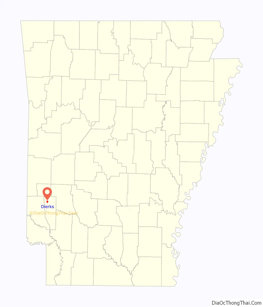
Dierks location map. Where is Dierks city?
History
Dierks was formerly known as “Hardscrabble.” It was changed to “Dierks” after Hans Dierks, the oldest of four brothers who owned the Dierks Lumber and Coal Company. In 2007, Dierks celebrated the 100th anniversary of its founding.
2009 tornado
Severe thunderstorms that moved through southwest Arkansas on April 9, 2009, produced an EF3 tornado that destroyed the city’s water treatment plant. A training technician from the Arkansas Rural Water Association helped the utility operators establish a temporary connection to the neighboring Nashville Rural Water System until the National Guard could deliver a pair of portable water purification systems. The Boy Scouts of America helped distribute water to families.
2019 Flood
Flash flooding in July 2019 provided Dierks with 17 inches of rain in less than 24 hours causing extensive flooding and damage to many local residents’ houses, businesses, and personal property. No injuries or deaths were reported.
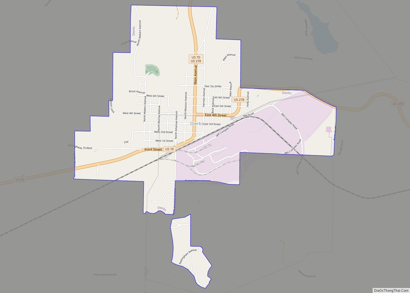
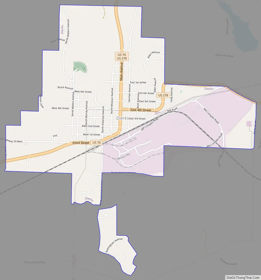
Dierks Road Map
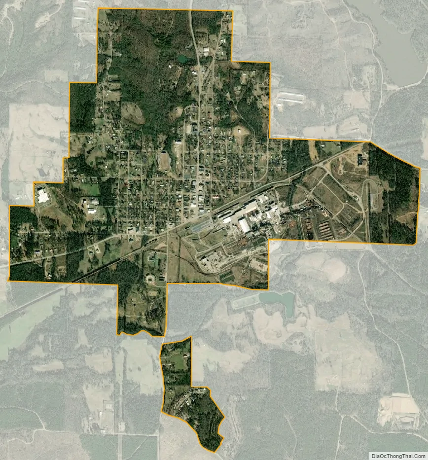
Dierks city Satellite Map
Geography
Dierks is located in north-central Howard County at 34°7′11″N 94°1′3″W / 34.11972°N 94.01750°W / 34.11972; -94.01750 (34.119793, -94.017452), along the southern edge of the Ouachita Mountains. It sits in the valley of Holly Creek, a southwest-flowing tributary of the Saline River. U.S. Route 70 passes through the city on Front Street and Main Avenue, leading northeast 36 miles (58 km) to Glenwood and southwest 21 miles (34 km) to De Queen. U.S. Route 278 also passes through Dierks, leading north out of town along Main Avenue with US 70 before turning northwest towards Wickes, 32 miles (51 km) from Dierks. US 278 runs east out of Dierks on 4th Street and Massey Avenue, eventually traveling 19 miles (31 km) southeast to Nashville.
According to the United States Census Bureau, the city has a total area of 1.9 square miles (4.9 km), all land.
Dierks Lake is a reservoir on the Saline River seven miles northwest of the city limits. It is a popular fishing spot and offers three areas to camp include Jefferson Ridge, Blue Ridge, and Horseshoe Bend.
See also
Map of Arkansas State and its subdivision:- Arkansas
- Ashley
- Baxter
- Benton
- Boone
- Bradley
- Calhoun
- Carroll
- Chicot
- Clark
- Clay
- Cleburne
- Cleveland
- Columbia
- Conway
- Craighead
- Crawford
- Crittenden
- Cross
- Dallas
- Desha
- Drew
- Faulkner
- Franklin
- Fulton
- Garland
- Grant
- Greene
- Hempstead
- Hot Spring
- Howard
- Independence
- Izard
- Jackson
- Jefferson
- Johnson
- Lafayette
- Lawrence
- Lee
- Lincoln
- Little River
- Logan
- Lonoke
- Madison
- Marion
- Miller
- Mississippi
- Monroe
- Montgomery
- Nevada
- Newton
- Ouachita
- Perry
- Phillips
- Pike
- Poinsett
- Polk
- Pope
- Prairie
- Pulaski
- Randolph
- Saint Francis
- Saline
- Scott
- Searcy
- Sebastian
- Sevier
- Sharp
- Stone
- Union
- Van Buren
- Washington
- White
- Woodruff
- Yell
- Alabama
- Alaska
- Arizona
- Arkansas
- California
- Colorado
- Connecticut
- Delaware
- District of Columbia
- Florida
- Georgia
- Hawaii
- Idaho
- Illinois
- Indiana
- Iowa
- Kansas
- Kentucky
- Louisiana
- Maine
- Maryland
- Massachusetts
- Michigan
- Minnesota
- Mississippi
- Missouri
- Montana
- Nebraska
- Nevada
- New Hampshire
- New Jersey
- New Mexico
- New York
- North Carolina
- North Dakota
- Ohio
- Oklahoma
- Oregon
- Pennsylvania
- Rhode Island
- South Carolina
- South Dakota
- Tennessee
- Texas
- Utah
- Vermont
- Virginia
- Washington
- West Virginia
- Wisconsin
- Wyoming