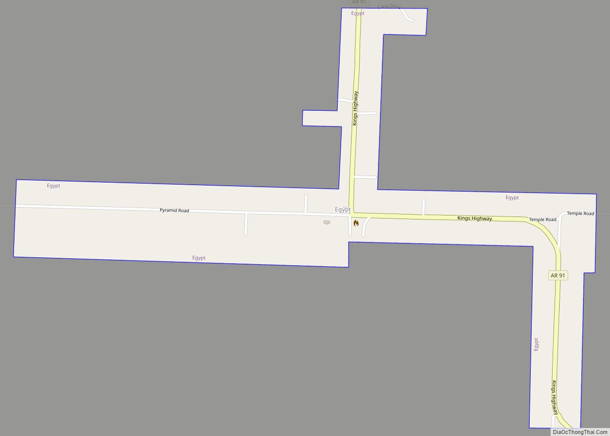
Egypt is a town in Craighead County, Arkansas, United States. The population was 112 at the 2010 census. It is included in the Jonesboro, Arkansas Metropolitan Statistical Area.
| Name: | Egypt town |
|---|---|
| LSAD Code: | 43 |
| LSAD Description: | town (suffix) |
| State: | Arkansas |
| County: | Craighead County |
| Elevation: | 249 ft (76 m) |
| Total Area: | 0.34 sq mi (0.87 km²) |
| Land Area: | 0.34 sq mi (0.87 km²) |
| Water Area: | 0.00 sq mi (0.00 km²) |
| Total Population: | 113 |
| Population Density: | 336.31/sq mi (129.71/km²) |
| ZIP code: | 72427 |
| Area code: | 870 |
| FIPS code: | 0520920 |
| GNISfeature ID: | 0057707 |
Online Interactive Map
Click on ![]() to view map in "full screen" mode.
to view map in "full screen" mode.
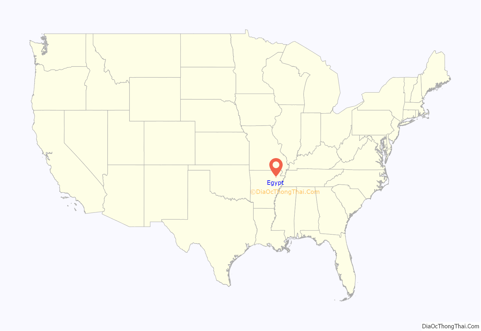
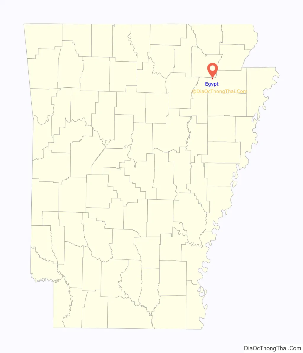
Egypt location map. Where is Egypt town?
History
Egypt, Arkansas is a small town located in Craighead County near the Cache River. It was named after ancient Egypt due to the abundance of corn grown in the area and was once a prosperous farming and timber town. The town was established in 1898 by New York businessmen attracted to the area’s abundant timber. The narrow gauge railway by the Sedgwick Tie and Timber Company connected the town to the major line of the Kansas City, Fort Scott and Memphis Railroad, which stimulated its growth. The town was home to several stores, a gin, a school, and churches in the 1930s and 1950s, but never experienced major growth due to its location far from the main railway line and major highways. In 1942 an oil pipeline pumping station was built near Bald Knob, Ar. to move oil northeast along the Big Inch oil pipeline. The town’s decline started after the cutting of timber and the consolidation of schools. It was incorporated as a town in 1984 and had a population of 113 in the 2020 census.
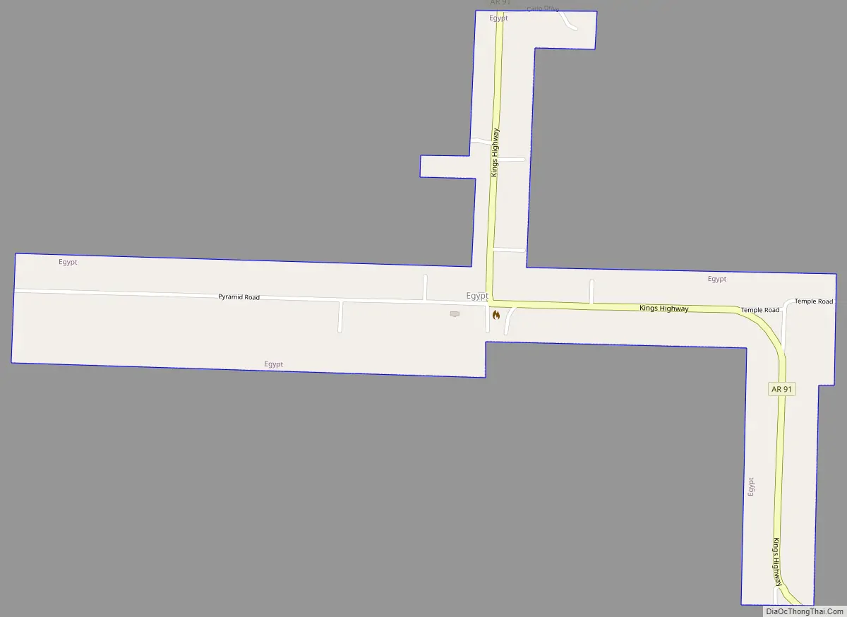
Egypt Road Map
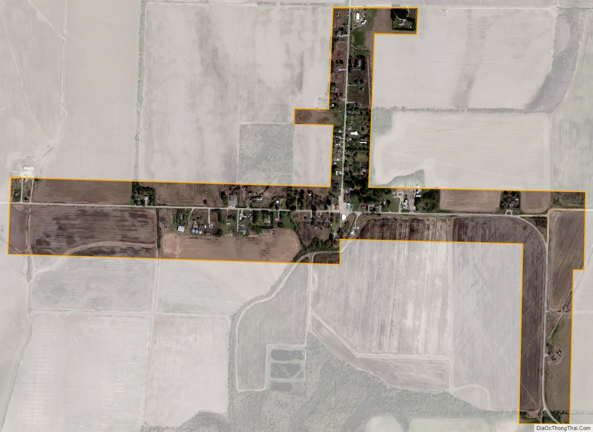
Egypt city Satellite Map
Geography
Egypt is located in western Craighead County at 35°52′3″N 90°56′43″W / 35.86750°N 90.94528°W / 35.86750; -90.94528 (35.867472, -90.945372). and was named after Victoria Eyshept. Eyshept was a Welsh noblewoman who was one of the first settlers: due to her thick accent, Americans assumed she was saying “Egypt“, and the name stuck.
According to the United States Census Bureau, the town has a total area of 0.35 square miles (0.9 km), all land.
Only one highway runs through the small community, Arkansas Highway 91, which intersects Craighead County Road 192 at the center of town.
See also
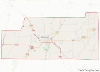
Map of Arkansas State and its subdivision:- Arkansas
- Ashley
- Baxter
- Benton
- Boone
- Bradley
- Calhoun
- Carroll
- Chicot
- Clark
- Clay
- Cleburne
- Cleveland
- Columbia
- Conway
- Craighead
- Crawford
- Crittenden
- Cross
- Dallas
- Desha
- Drew
- Faulkner
- Franklin
- Fulton
- Garland
- Grant
- Greene
- Hempstead
- Hot Spring
- Howard
- Independence
- Izard
- Jackson
- Jefferson
- Johnson
- Lafayette
- Lawrence
- Lee
- Lincoln
- Little River
- Logan
- Lonoke
- Madison
- Marion
- Miller
- Mississippi
- Monroe
- Montgomery
- Nevada
- Newton
- Ouachita
- Perry
- Phillips
- Pike
- Poinsett
- Polk
- Pope
- Prairie
- Pulaski
- Randolph
- Saint Francis
- Saline
- Scott
- Searcy
- Sebastian
- Sevier
- Sharp
- Stone
- Union
- Van Buren
- Washington
- White
- Woodruff
- Yell
- Alabama
- Alaska
- Arizona
- Arkansas
- California
- Colorado
- Connecticut
- Delaware
- District of Columbia
- Florida
- Georgia
- Hawaii
- Idaho
- Illinois
- Indiana
- Iowa
- Kansas
- Kentucky
- Louisiana
- Maine
- Maryland
- Massachusetts
- Michigan
- Minnesota
- Mississippi
- Missouri
- Montana
- Nebraska
- Nevada
- New Hampshire
- New Jersey
- New Mexico
- New York
- North Carolina
- North Dakota
- Ohio
- Oklahoma
- Oregon
- Pennsylvania
- Rhode Island
- South Carolina
- South Dakota
- Tennessee
- Texas
- Utah
- Vermont
- Virginia
- Washington
- West Virginia
- Wisconsin
- Wyoming