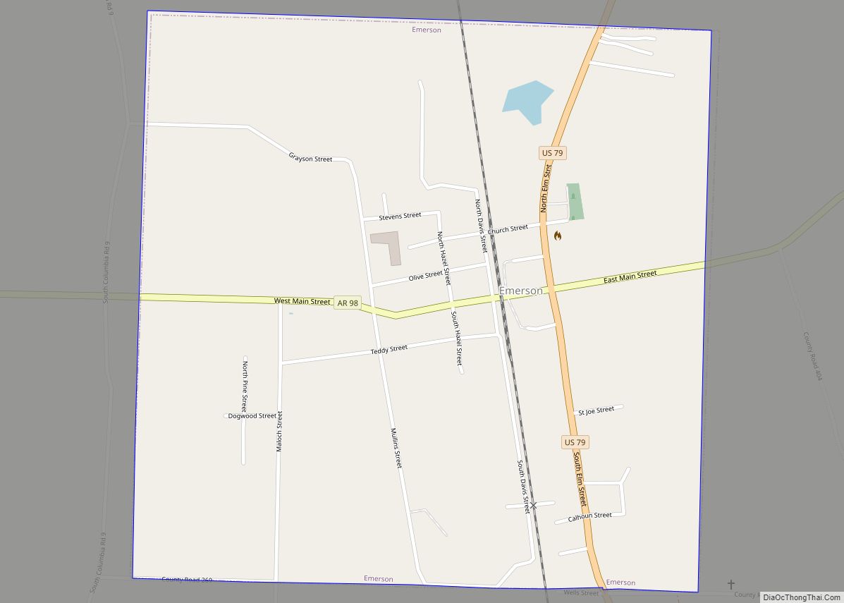
Emerson is a town in Columbia County, Arkansas, United States. The population was 368 at the 2010 census.
| Name: | Emerson town |
|---|---|
| LSAD Code: | 43 |
| LSAD Description: | town (suffix) |
| State: | Arkansas |
| County: | Columbia County |
| Elevation: | 322 ft (98 m) |
| Total Area: | 0.99 sq mi (2.57 km²) |
| Land Area: | 0.99 sq mi (2.57 km²) |
| Water Area: | 0.00 sq mi (0.00 km²) |
| Total Population: | 293 |
| Population Density: | 295.66/sq mi (114.17/km²) |
| ZIP code: | 71740 |
| Area code: | 870 |
| FIPS code: | 0521580 |
| GNISfeature ID: | 0048887 |
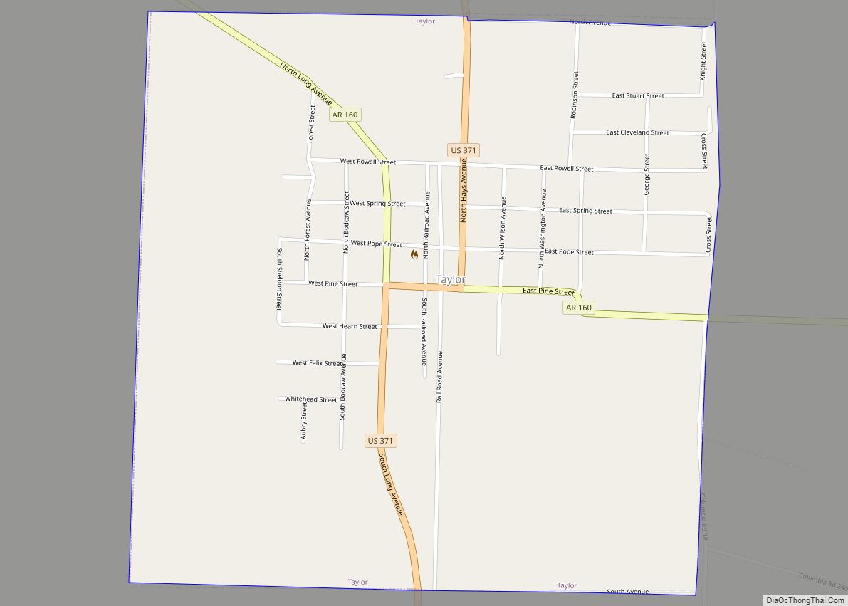
Online Interactive Map
Click on ![]() to view map in "full screen" mode.
to view map in "full screen" mode.
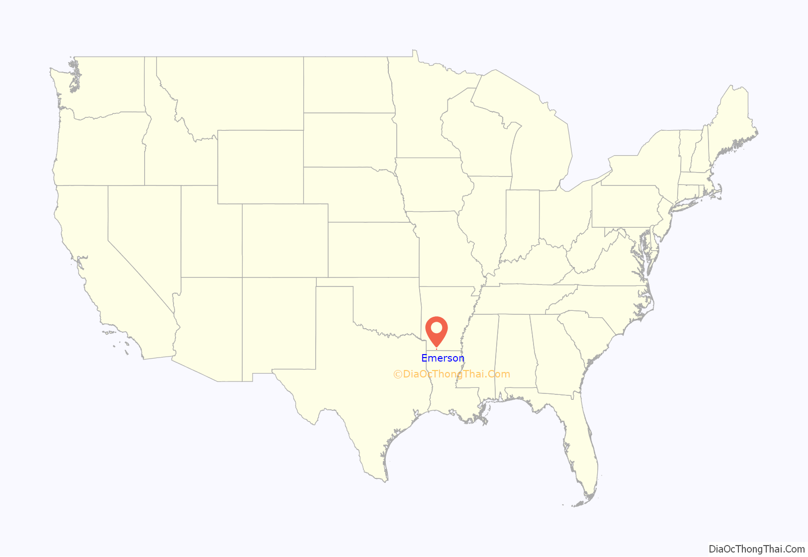
Emerson location map. Where is Emerson town?
History
Eponym
Emerson derives its name from Reuben Logan Emerson, an early settler of Columbia County, who was a teacher, merchant, banker, owner of the newspaper The Columbia Banner, and state representative. In 1905, he founded the town which today bears his name. Emerson celebrated its 100th birthday February 8, 2005.
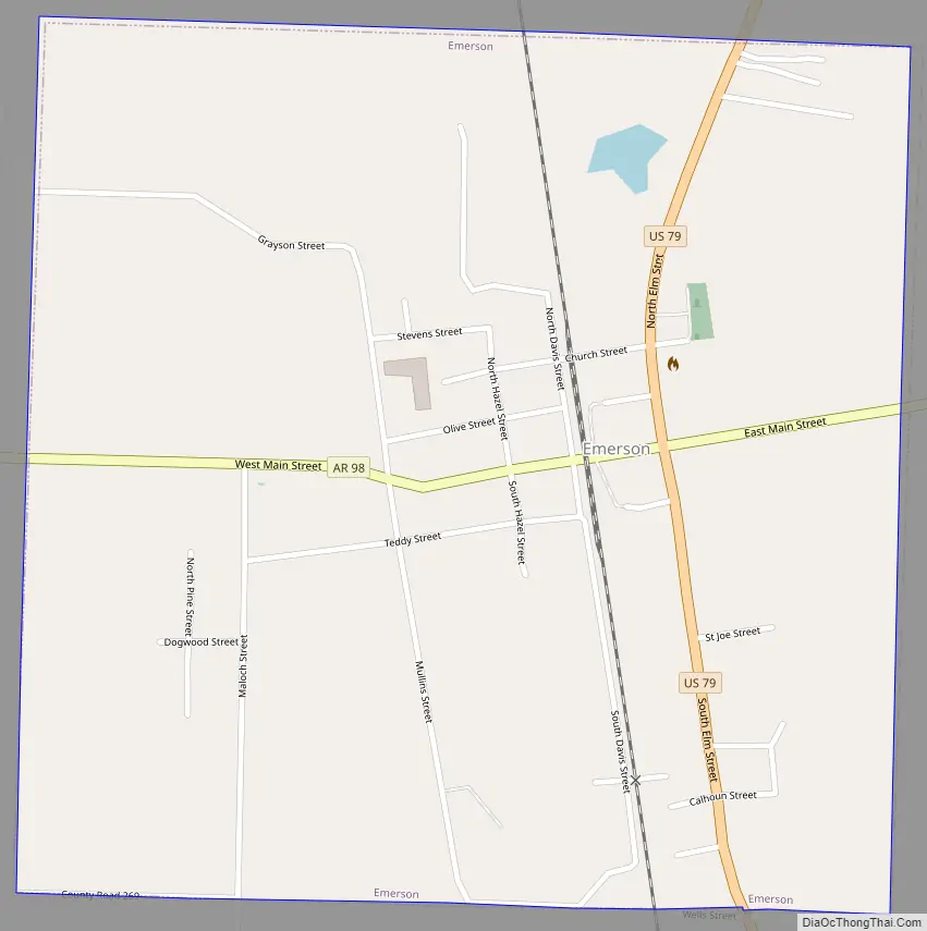
Emerson Road Map
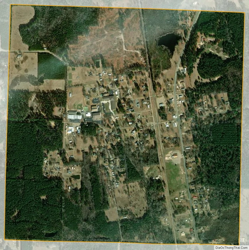
Emerson city Satellite Map
Geography
Emerson is located in southern Columbia County at 33°5′49″N 93°11′40″W / 33.09694°N 93.19444°W / 33.09694; -93.19444 (33.096914, -93.194312). The town is located along U.S. Route 79, 12 miles (19 km) south of Magnolia, the county seat, and 9 miles (14 km) north of Haynesville, Louisiana.
Emerson is also 68 miles (109 km) from Shreveport, Louisiana, and 205 miles (330 km) from Dallas, Texas.
According to the United States Census Bureau, Emerson has a total area of 1.0 square mile (2.6 km), all land.
See also
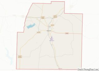
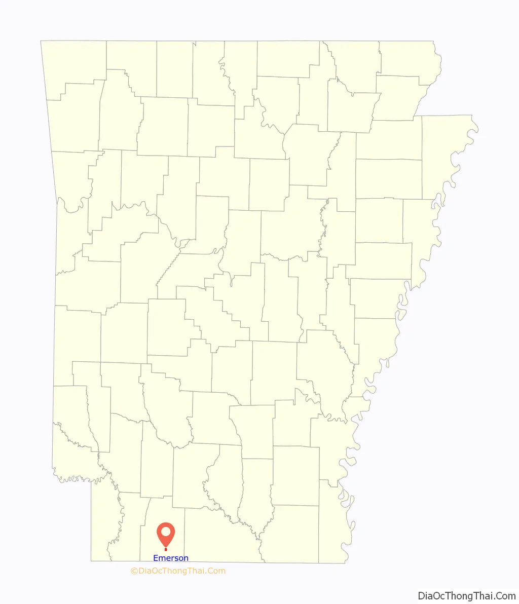
Map of Arkansas State and its subdivision:- Arkansas
- Ashley
- Baxter
- Benton
- Boone
- Bradley
- Calhoun
- Carroll
- Chicot
- Clark
- Clay
- Cleburne
- Cleveland
- Columbia
- Conway
- Craighead
- Crawford
- Crittenden
- Cross
- Dallas
- Desha
- Drew
- Faulkner
- Franklin
- Fulton
- Garland
- Grant
- Greene
- Hempstead
- Hot Spring
- Howard
- Independence
- Izard
- Jackson
- Jefferson
- Johnson
- Lafayette
- Lawrence
- Lee
- Lincoln
- Little River
- Logan
- Lonoke
- Madison
- Marion
- Miller
- Mississippi
- Monroe
- Montgomery
- Nevada
- Newton
- Ouachita
- Perry
- Phillips
- Pike
- Poinsett
- Polk
- Pope
- Prairie
- Pulaski
- Randolph
- Saint Francis
- Saline
- Scott
- Searcy
- Sebastian
- Sevier
- Sharp
- Stone
- Union
- Van Buren
- Washington
- White
- Woodruff
- Yell
- Alabama
- Alaska
- Arizona
- Arkansas
- California
- Colorado
- Connecticut
- Delaware
- District of Columbia
- Florida
- Georgia
- Hawaii
- Idaho
- Illinois
- Indiana
- Iowa
- Kansas
- Kentucky
- Louisiana
- Maine
- Maryland
- Massachusetts
- Michigan
- Minnesota
- Mississippi
- Missouri
- Montana
- Nebraska
- Nevada
- New Hampshire
- New Jersey
- New Mexico
- New York
- North Carolina
- North Dakota
- Ohio
- Oklahoma
- Oregon
- Pennsylvania
- Rhode Island
- South Carolina
- South Dakota
- Tennessee
- Texas
- Utah
- Vermont
- Virginia
- Washington
- West Virginia
- Wisconsin
- Wyoming