Fargo is a town in Monroe County, Arkansas, United States. As of the 2020 United States census it had a population of 57, down from 98 in 2010.
| Name: | Fargo town |
|---|---|
| LSAD Code: | 43 |
| LSAD Description: | town (suffix) |
| State: | Arkansas |
| County: | Monroe County |
| Elevation: | 200 ft (60 m) |
| Total Area: | 0.47 sq mi (1.23 km²) |
| Land Area: | 0.46 sq mi (1.18 km²) |
| Water Area: | 0.02 sq mi (0.04 km²) |
| Total Population: | 57 |
| Population Density: | 124.73/sq mi (48.13/km²) |
| ZIP code: | 72021 |
| Area code: | 870 |
| FIPS code: | 0523140 |
| GNISfeature ID: | 0057744 |
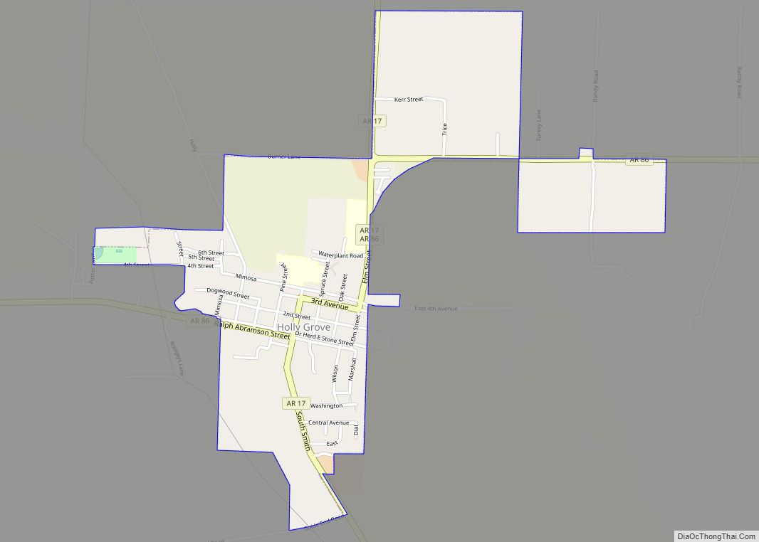
Online Interactive Map
Click on ![]() to view map in "full screen" mode.
to view map in "full screen" mode.
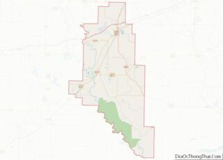
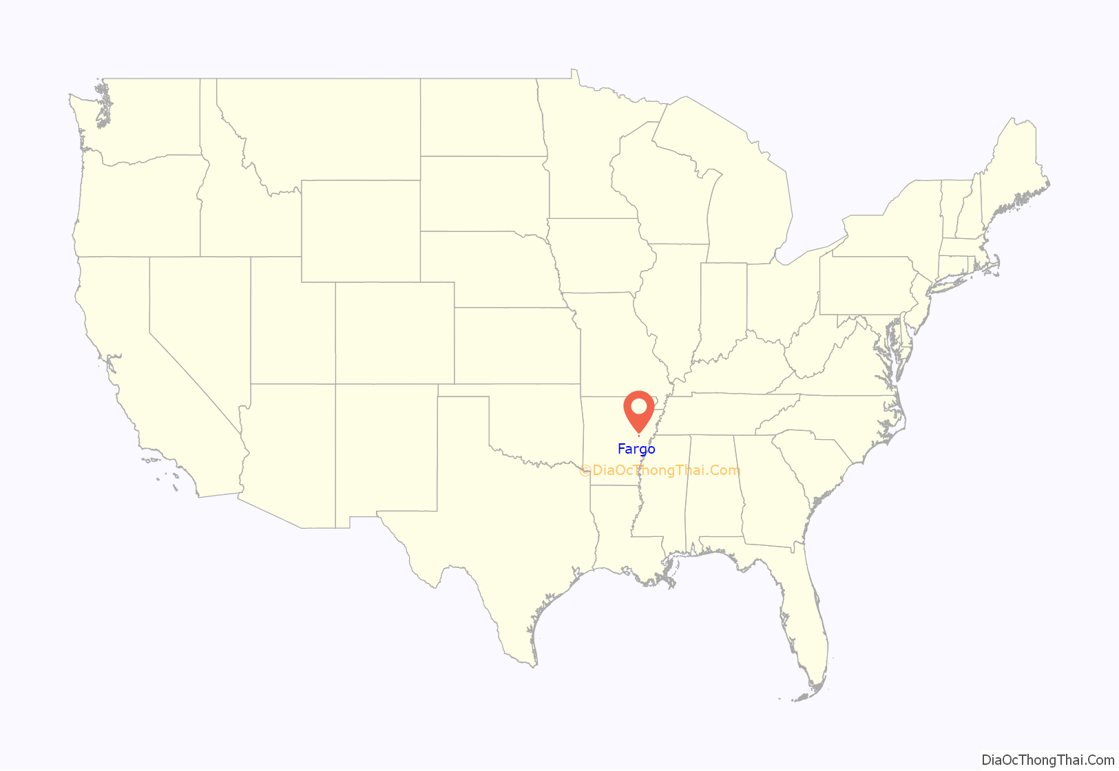
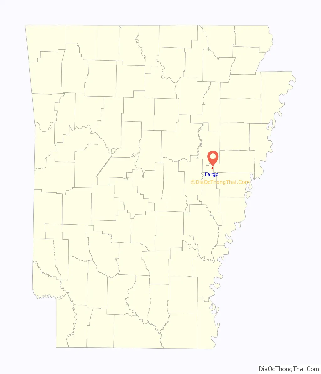
Fargo location map. Where is Fargo town?
History
The town was founded in 1911 by formerly enslaved man Leroy Washington Mahon. Taking a 40-acre (16 ha) plot of his farm, having it surveyed and marked off into streets and lots, he made plans for a little town. A conductor on the Cotton Belt Railroad suggested the name “Fargo”. Black home owners bought lots and built homes. The first established church in Fargo was called First Baptist and Bethel Presbyterian.
Actress and comedian Sasheer Zamata is the great-granddaughter of Mahon. This was discovered on the TV show Finding Your Roots with Henry Louis Gates Jr. which aired on January 7, 2020.
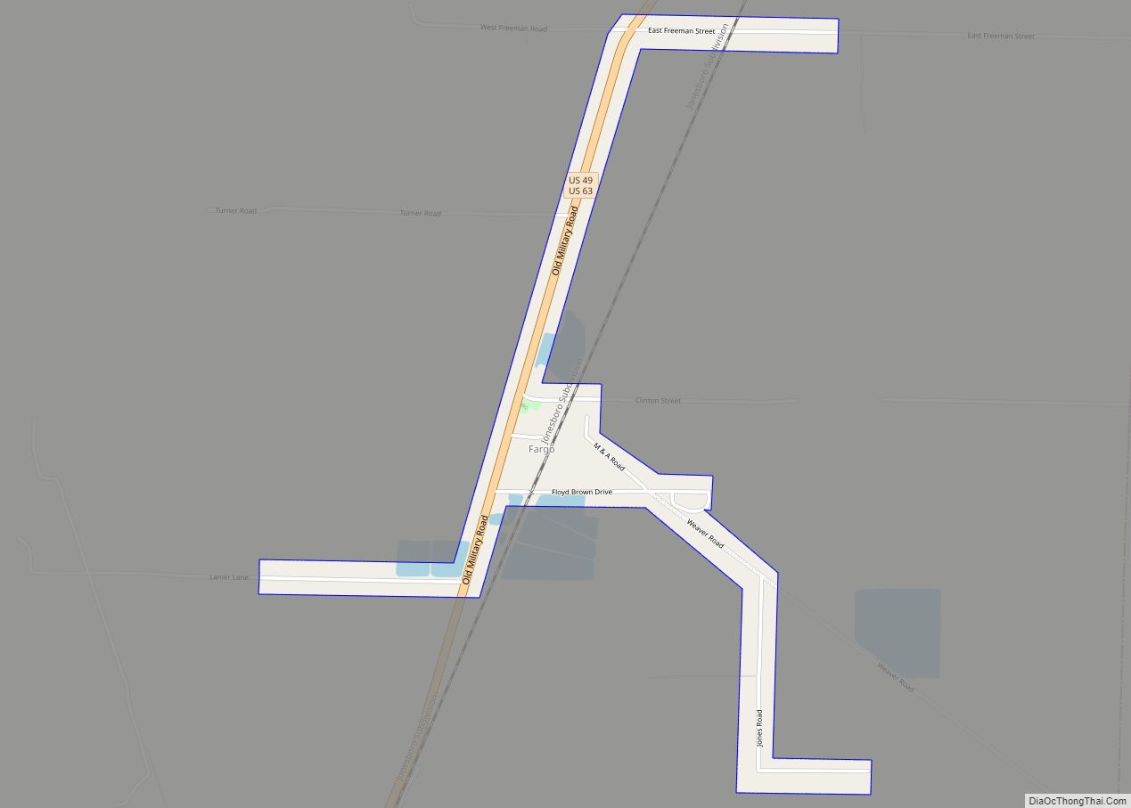
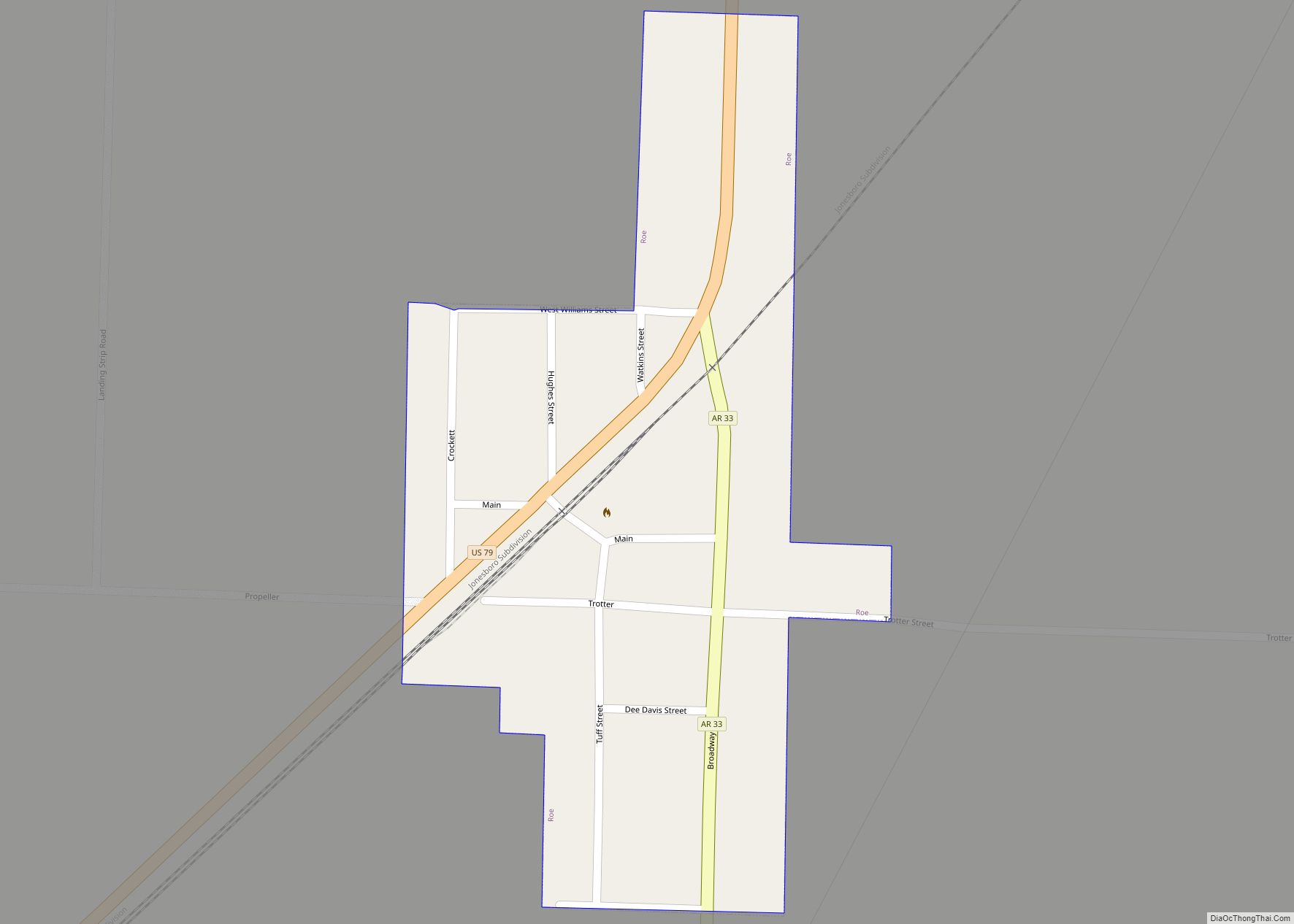
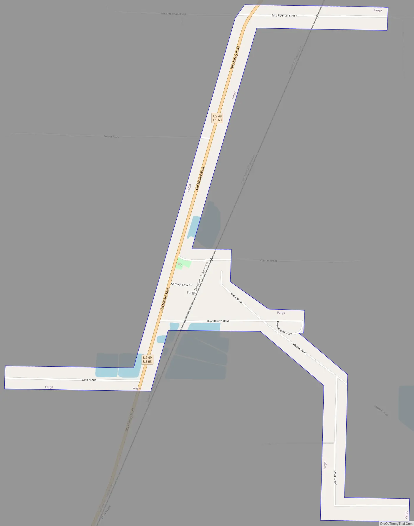
Fargo Road Map
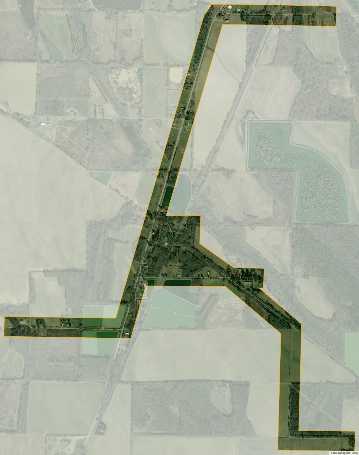
Fargo city Satellite Map
Geography
Fargo is located in northern Monroe County at 34°57′19″N 91°10′38″W / 34.95528°N 91.17722°W / 34.95528; -91.17722 (34.955140, -91.177179). It sits along U.S. Route 49, which leads south 4 miles (6 km) to Brinkley and north 8 miles (13 km) to Hunter. Interstate 40 passes 3 miles (5 km) south of Fargo, with access from Exit 216 (US 49).
According to the United States Census Bureau, the town has a total area of 0.47 square miles (1.22 km), of which 0.02 square miles (0.05 km), or 3.59%, are water.
See also
Map of Arkansas State and its subdivision:- Arkansas
- Ashley
- Baxter
- Benton
- Boone
- Bradley
- Calhoun
- Carroll
- Chicot
- Clark
- Clay
- Cleburne
- Cleveland
- Columbia
- Conway
- Craighead
- Crawford
- Crittenden
- Cross
- Dallas
- Desha
- Drew
- Faulkner
- Franklin
- Fulton
- Garland
- Grant
- Greene
- Hempstead
- Hot Spring
- Howard
- Independence
- Izard
- Jackson
- Jefferson
- Johnson
- Lafayette
- Lawrence
- Lee
- Lincoln
- Little River
- Logan
- Lonoke
- Madison
- Marion
- Miller
- Mississippi
- Monroe
- Montgomery
- Nevada
- Newton
- Ouachita
- Perry
- Phillips
- Pike
- Poinsett
- Polk
- Pope
- Prairie
- Pulaski
- Randolph
- Saint Francis
- Saline
- Scott
- Searcy
- Sebastian
- Sevier
- Sharp
- Stone
- Union
- Van Buren
- Washington
- White
- Woodruff
- Yell
- Alabama
- Alaska
- Arizona
- Arkansas
- California
- Colorado
- Connecticut
- Delaware
- District of Columbia
- Florida
- Georgia
- Hawaii
- Idaho
- Illinois
- Indiana
- Iowa
- Kansas
- Kentucky
- Louisiana
- Maine
- Maryland
- Massachusetts
- Michigan
- Minnesota
- Mississippi
- Missouri
- Montana
- Nebraska
- Nevada
- New Hampshire
- New Jersey
- New Mexico
- New York
- North Carolina
- North Dakota
- Ohio
- Oklahoma
- Oregon
- Pennsylvania
- Rhode Island
- South Carolina
- South Dakota
- Tennessee
- Texas
- Utah
- Vermont
- Virginia
- Washington
- West Virginia
- Wisconsin
- Wyoming