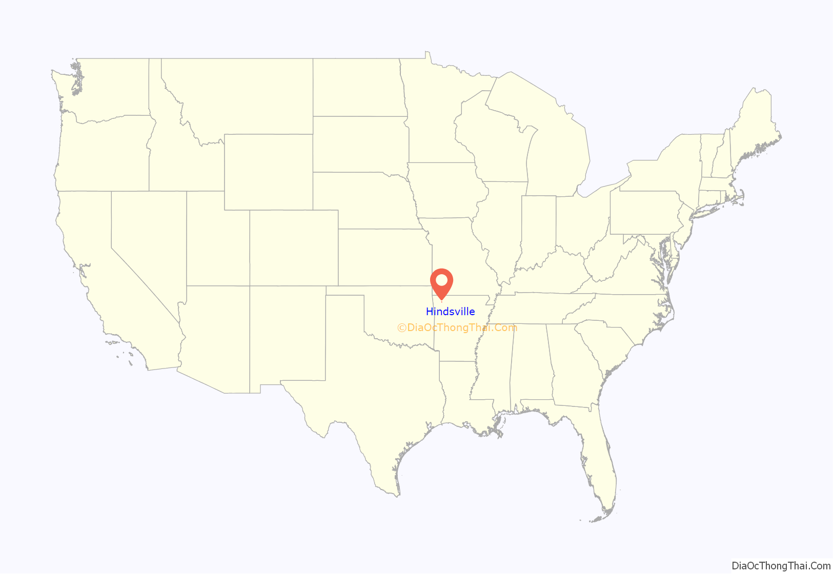
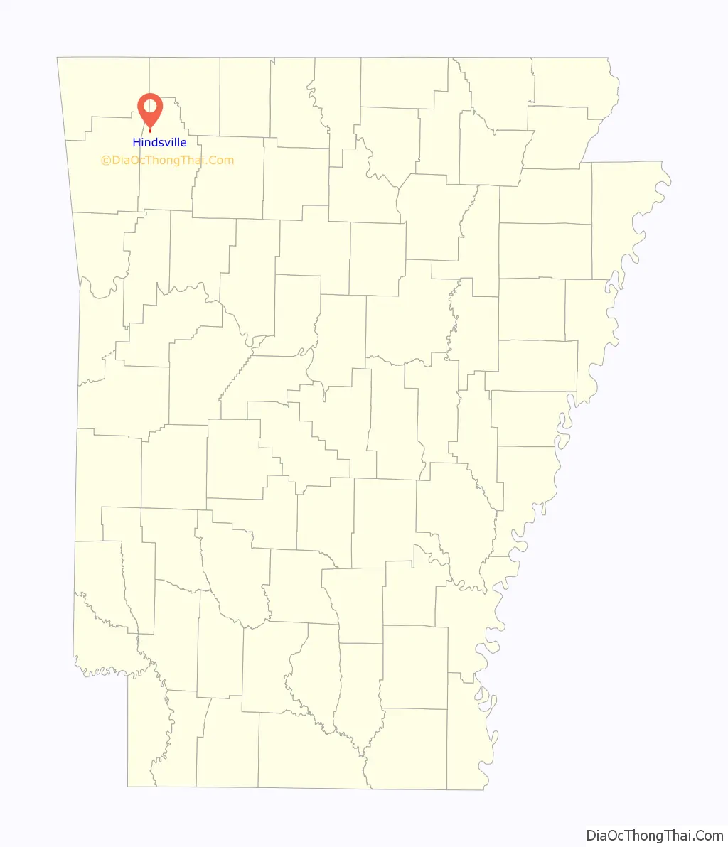
Hindsville is a town in Madison County, Arkansas, United States. The population was 90 at the 2020 census. It is part of the Northwest Arkansas region.
The community was named after John Hinds, a first settler.
| Name: | Hindsville town |
|---|---|
| LSAD Code: | 43 |
| LSAD Description: | town (suffix) |
| State: | Arkansas |
| County: | Madison County |
| Elevation: | 1,375 ft (419 m) |
| Total Area: | 0.37 sq mi (0.97 km²) |
| Land Area: | 0.37 sq mi (0.96 km²) |
| Water Area: | 0.00 sq mi (0.00 km²) |
| Total Population: | 90 |
| Population Density: | 241.94/sq mi (93.51/km²) |
| ZIP code: | 72738 |
| Area code: | 479 |
| FIPS code: | 0532470 |
| GNISfeature ID: | 2405843 |
Online Interactive Map
Click on ![]() to view map in "full screen" mode.
to view map in "full screen" mode.
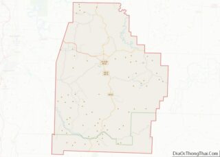
Hindsville location map. Where is Hindsville town?
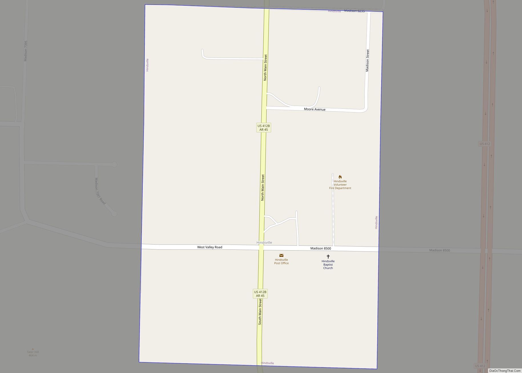
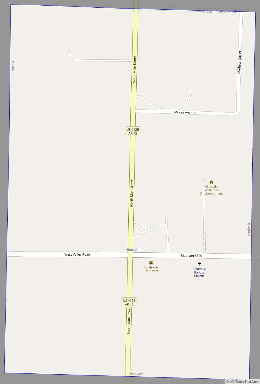
Hindsville Road Map
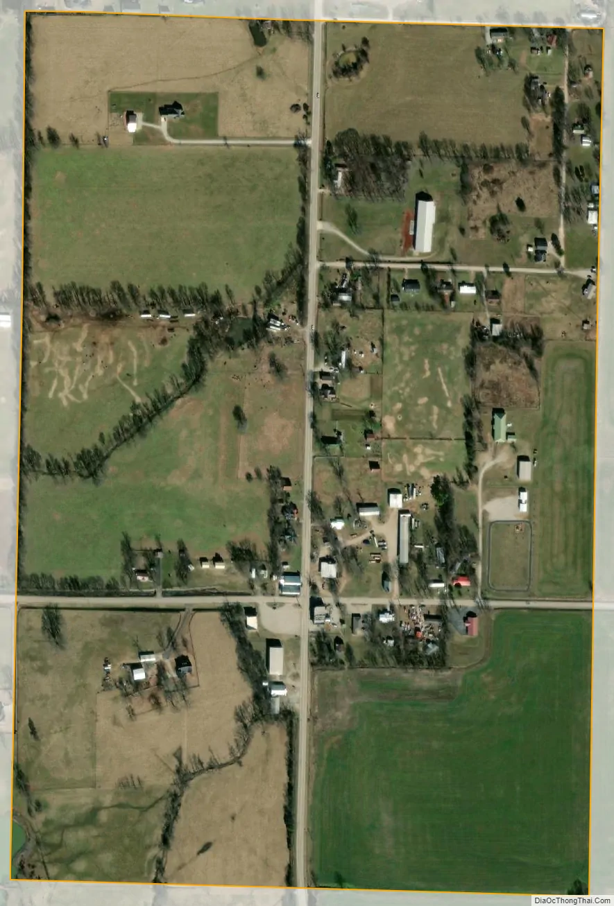
Hindsville city Satellite Map
Geography
In 2007, U.S. Highway 412 was widened to four lanes and now bypasses the town completely. Via US 412 it is 19 miles (31 km) west to Springdale and 9 miles (14 km) southeast to Huntsville, the Madison county seat.
According to the United States Census Bureau, Hindsville has a total area of 0.37 square miles (0.96 km), of which 0.002 square miles (0.0052 km), or 0.53%, are water. The town is drained by Whitener Branch, a west-flowing tributary of the White River.
Hindsville Lake, 3 miles (5 km) west of the town, is one of the oldest reservoirs in Arkansas. While Lake Conway was the first in the state to be commissioned by the Arkansas Game and Fish Commission, Lake Hindsville was the first to be built, with its construction completed in March 1950 before bids on Lake Conway had even been submitted. In 2007 it was drained, so that the dam could be repaired.
See also
Map of Arkansas State and its subdivision:- Arkansas
- Ashley
- Baxter
- Benton
- Boone
- Bradley
- Calhoun
- Carroll
- Chicot
- Clark
- Clay
- Cleburne
- Cleveland
- Columbia
- Conway
- Craighead
- Crawford
- Crittenden
- Cross
- Dallas
- Desha
- Drew
- Faulkner
- Franklin
- Fulton
- Garland
- Grant
- Greene
- Hempstead
- Hot Spring
- Howard
- Independence
- Izard
- Jackson
- Jefferson
- Johnson
- Lafayette
- Lawrence
- Lee
- Lincoln
- Little River
- Logan
- Lonoke
- Madison
- Marion
- Miller
- Mississippi
- Monroe
- Montgomery
- Nevada
- Newton
- Ouachita
- Perry
- Phillips
- Pike
- Poinsett
- Polk
- Pope
- Prairie
- Pulaski
- Randolph
- Saint Francis
- Saline
- Scott
- Searcy
- Sebastian
- Sevier
- Sharp
- Stone
- Union
- Van Buren
- Washington
- White
- Woodruff
- Yell
- Alabama
- Alaska
- Arizona
- Arkansas
- California
- Colorado
- Connecticut
- Delaware
- District of Columbia
- Florida
- Georgia
- Hawaii
- Idaho
- Illinois
- Indiana
- Iowa
- Kansas
- Kentucky
- Louisiana
- Maine
- Maryland
- Massachusetts
- Michigan
- Minnesota
- Mississippi
- Missouri
- Montana
- Nebraska
- Nevada
- New Hampshire
- New Jersey
- New Mexico
- New York
- North Carolina
- North Dakota
- Ohio
- Oklahoma
- Oregon
- Pennsylvania
- Rhode Island
- South Carolina
- South Dakota
- Tennessee
- Texas
- Utah
- Vermont
- Virginia
- Washington
- West Virginia
- Wisconsin
- Wyoming