Omaha is a town in Boone County, Arkansas, United States. As of the 2020 census the population stood at 128. It is a rural community located approximately 10 miles from Branson, Missouri and 15 miles from Harrison. The town is part of the Harrison Micropolitan Statistical Area.
| Name: | Omaha town |
|---|---|
| LSAD Code: | 43 |
| LSAD Description: | town (suffix) |
| State: | Arkansas |
| County: | Boone County |
| Elevation: | 1,345 ft (410 m) |
| Total Area: | 0.39 sq mi (1.01 km²) |
| Land Area: | 0.39 sq mi (1.01 km²) |
| Water Area: | 0.00 sq mi (0.00 km²) |
| Total Population: | 128 |
| Population Density: | 328.21/sq mi (126.72/km²) |
| ZIP code: | 72662 |
| Area code: | 870 |
| FIPS code: | 0552160 |
| GNISfeature ID: | 0058309 |
| Website: | omahaarkansas.com |
Online Interactive Map
Click on ![]() to view map in "full screen" mode.
to view map in "full screen" mode.
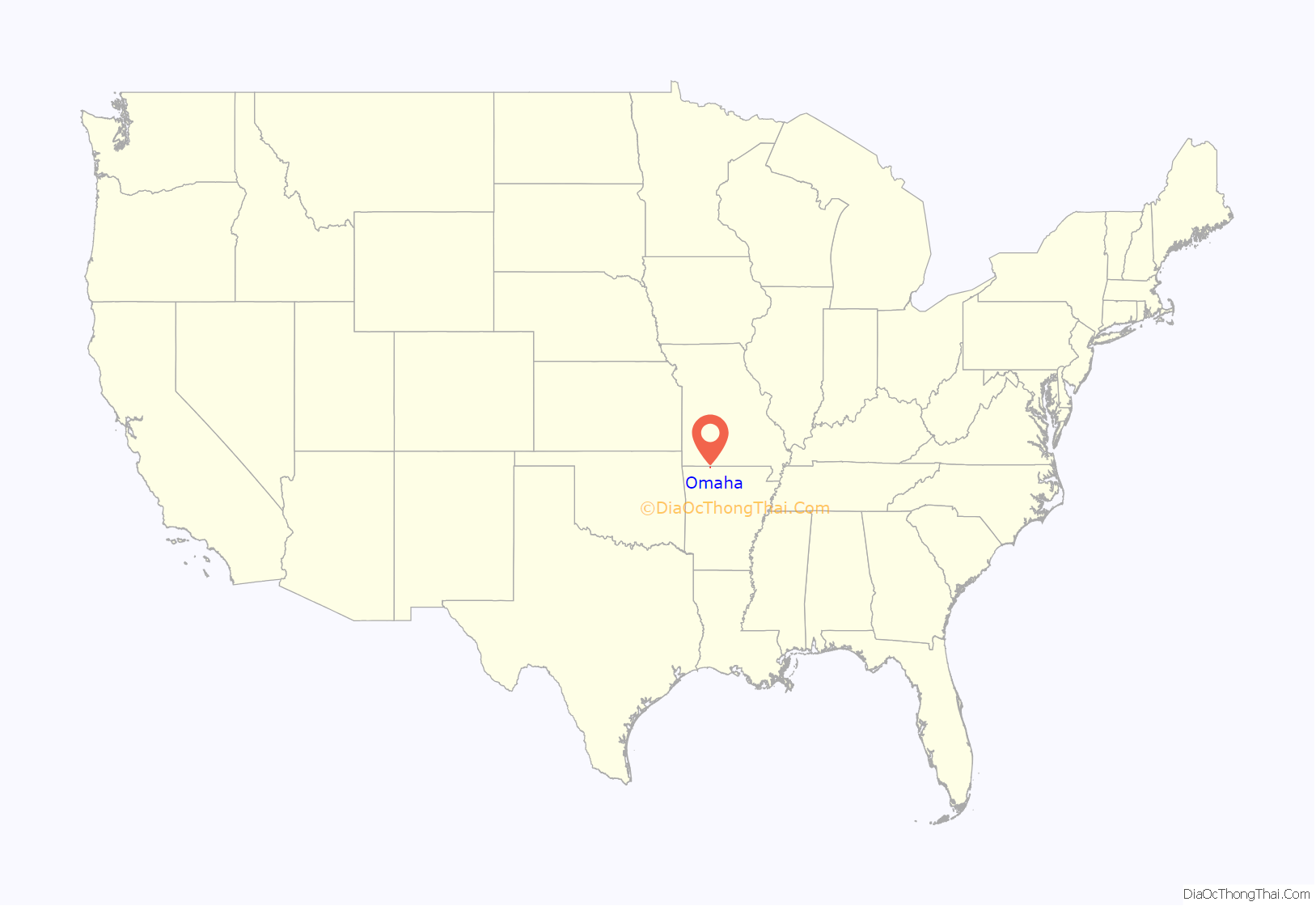
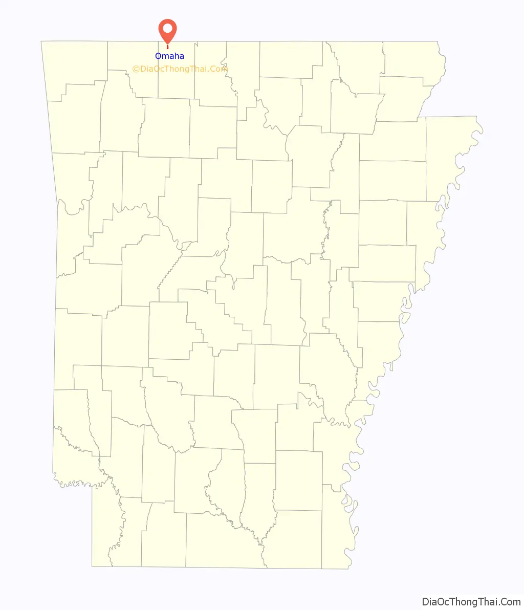
Omaha location map. Where is Omaha town?
History
Omaha’s first post office was set up on August 7, 1873. A census taken at the time showed there was a population of around 35 people.
By the year 1884, businesses included four steam saw mills, and four flour mills. In the year 1892, additional businesses included a saw and grist mill, general store, and a blacksmith shop.
An undated advertisement for Omaha indicated the town was along the Missouri Pacific Railroad and “State Highway 65”. It further indicated the school had 450 students. The advertisement described churches of every main denomination, that the town had electric and telephone service, a bank, canning factory, feed stores, a machine shop, mill, a modern garage, lumber yards and various types of stores. The ad claimed the town was started in 1878 after J.H. Middleton of Missouri came and began a general store.
In the 1930s, the town attempted to qualify as a border city due to its proximity to the Arkansas/Missouri state line. Missouri’s gas taxes are lower than Arkansas’, thus Omaha tried to take advantage of the lower tax. That incorporation was found to be invalid by the state supreme court in 1941.
Old US 65 went through Omaha, causing travelers from further south in Arkansas (such as Harrison) to go through Omaha on the way to Missouri, and likewise for travelers heading further south from Missouri. Businesses along the route were able to thrive. Although the new U.S. Route 65, opened in late 1999, was judged to be safer and reduced travel time, it completely bypassed Omaha. Businesses deriving revenue from the tourist trade felt the impact on the first day of the new road opening. Ultimately they were devastated. Some businesses planned to relocate to Branson at the time. Many noted that people will never even know Omaha exists. It was noted that old US 65 became so quiet that dogs could safely lie in the street.
Former University of Arkansas football All-American Brandon Burlsworth is buried at Gass Cemetery in Omaha.
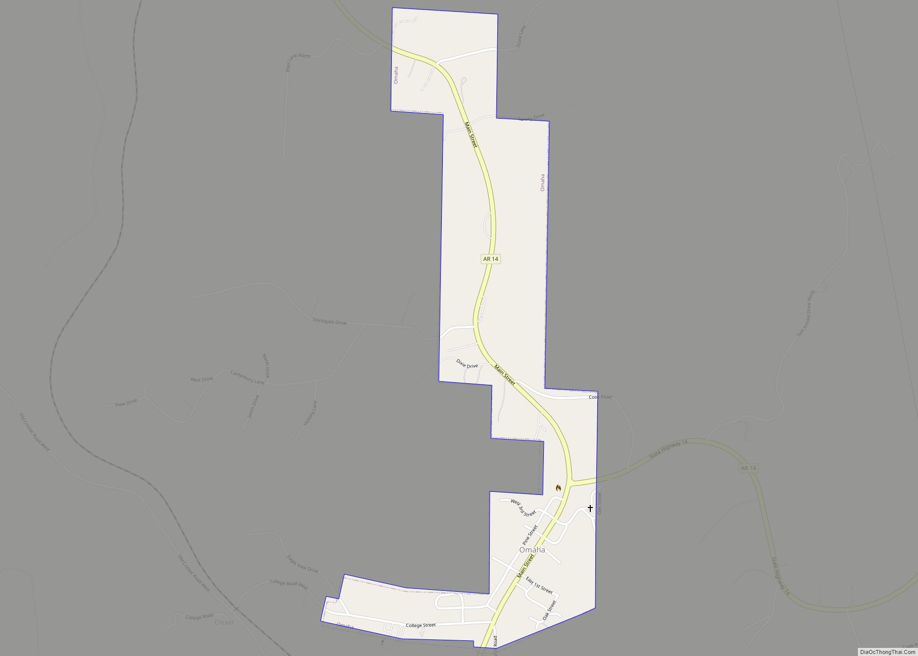
Omaha Road Map
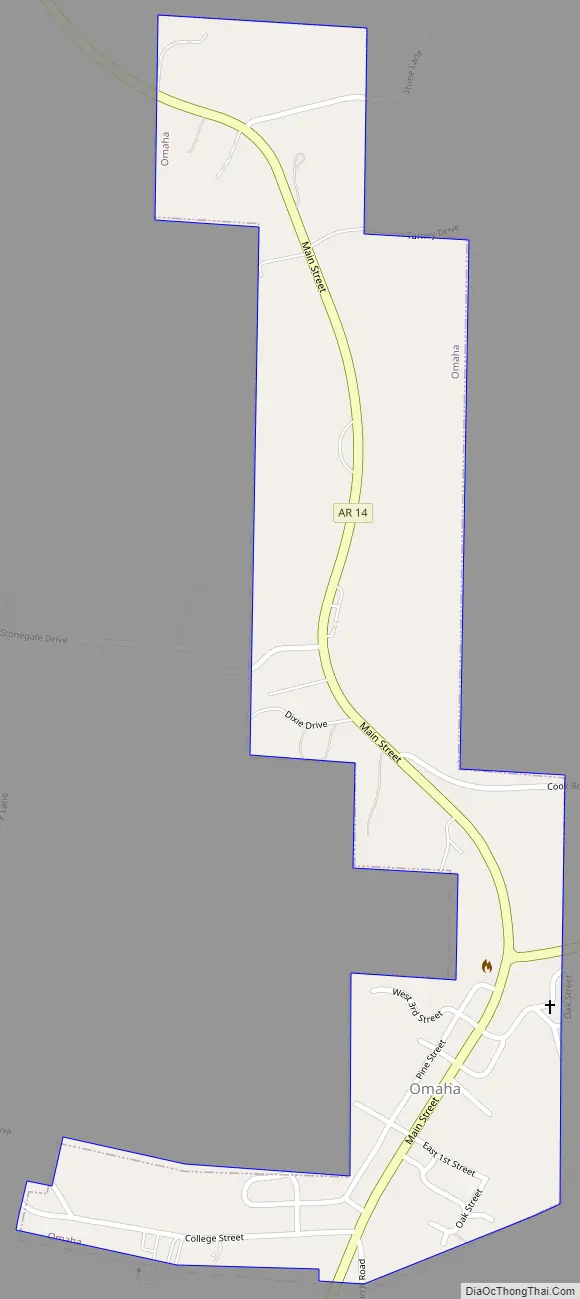
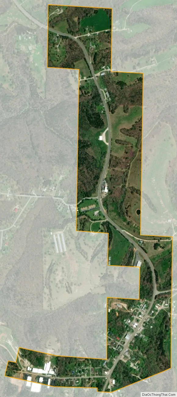
Omaha city Satellite Map
Geography
Omaha is located at 36°27′09″N 93°11′25″W / 36.452417°N 93.190196°W / 36.452417; -93.190196.
According to the United States Census Bureau, the town has a total area of 0.4 square miles (1.0 km), all land.
Only Highway
- Arkansas Highway 14
See also
Map of Arkansas State and its subdivision:- Arkansas
- Ashley
- Baxter
- Benton
- Boone
- Bradley
- Calhoun
- Carroll
- Chicot
- Clark
- Clay
- Cleburne
- Cleveland
- Columbia
- Conway
- Craighead
- Crawford
- Crittenden
- Cross
- Dallas
- Desha
- Drew
- Faulkner
- Franklin
- Fulton
- Garland
- Grant
- Greene
- Hempstead
- Hot Spring
- Howard
- Independence
- Izard
- Jackson
- Jefferson
- Johnson
- Lafayette
- Lawrence
- Lee
- Lincoln
- Little River
- Logan
- Lonoke
- Madison
- Marion
- Miller
- Mississippi
- Monroe
- Montgomery
- Nevada
- Newton
- Ouachita
- Perry
- Phillips
- Pike
- Poinsett
- Polk
- Pope
- Prairie
- Pulaski
- Randolph
- Saint Francis
- Saline
- Scott
- Searcy
- Sebastian
- Sevier
- Sharp
- Stone
- Union
- Van Buren
- Washington
- White
- Woodruff
- Yell
- Alabama
- Alaska
- Arizona
- Arkansas
- California
- Colorado
- Connecticut
- Delaware
- District of Columbia
- Florida
- Georgia
- Hawaii
- Idaho
- Illinois
- Indiana
- Iowa
- Kansas
- Kentucky
- Louisiana
- Maine
- Maryland
- Massachusetts
- Michigan
- Minnesota
- Mississippi
- Missouri
- Montana
- Nebraska
- Nevada
- New Hampshire
- New Jersey
- New Mexico
- New York
- North Carolina
- North Dakota
- Ohio
- Oklahoma
- Oregon
- Pennsylvania
- Rhode Island
- South Carolina
- South Dakota
- Tennessee
- Texas
- Utah
- Vermont
- Virginia
- Washington
- West Virginia
- Wisconsin
- Wyoming