Pollard is a city in Clay County, Arkansas, United States. The population was 222 at the 2010 census.
| Name: | Pollard city |
|---|---|
| LSAD Code: | 25 |
| LSAD Description: | city (suffix) |
| State: | Arkansas |
| County: | Clay County |
| Elevation: | 338 ft (103 m) |
| Total Area: | 0.30 sq mi (0.77 km²) |
| Land Area: | 0.30 sq mi (0.77 km²) |
| Water Area: | 0.00 sq mi (0.00 km²) |
| Total Population: | 193 |
| Population Density: | 649.83/sq mi (251.18/km²) |
| ZIP code: | 72456 |
| Area code: | 870 |
| FIPS code: | 0556600 |
| GNISfeature ID: | 2404546 |
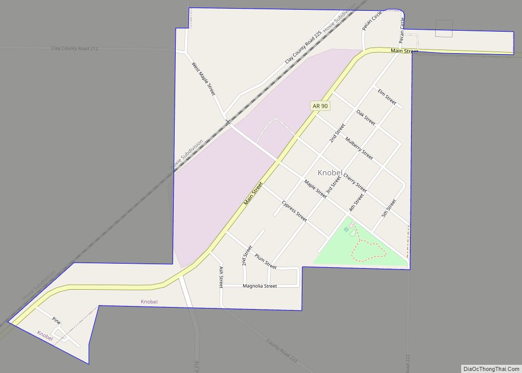
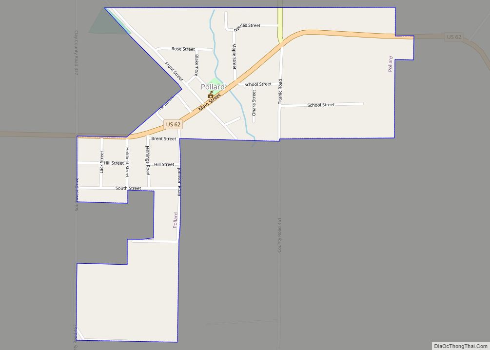
Online Interactive Map
Click on ![]() to view map in "full screen" mode.
to view map in "full screen" mode.
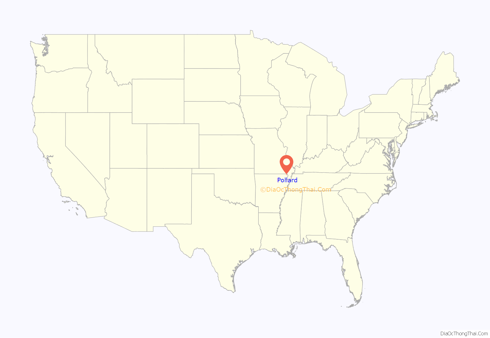
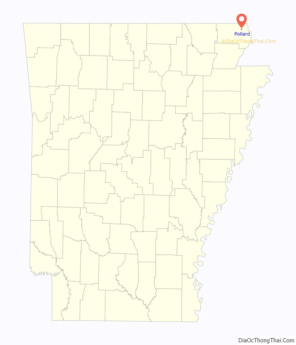
Pollard location map. Where is Pollard city?
History
Pollard is named for a family of early settlers who operated a general store that became home to the town’s post office in 1876. The post office briefly moved to the nearby Tucker plantation and became known as “Advance,” but was eventually restored to Pollard. A railroad line was constructed through Pollard in 1914 to serve area timber operations, and a town was platted around the newly constructed depot. Pollard incorporated in 1921.
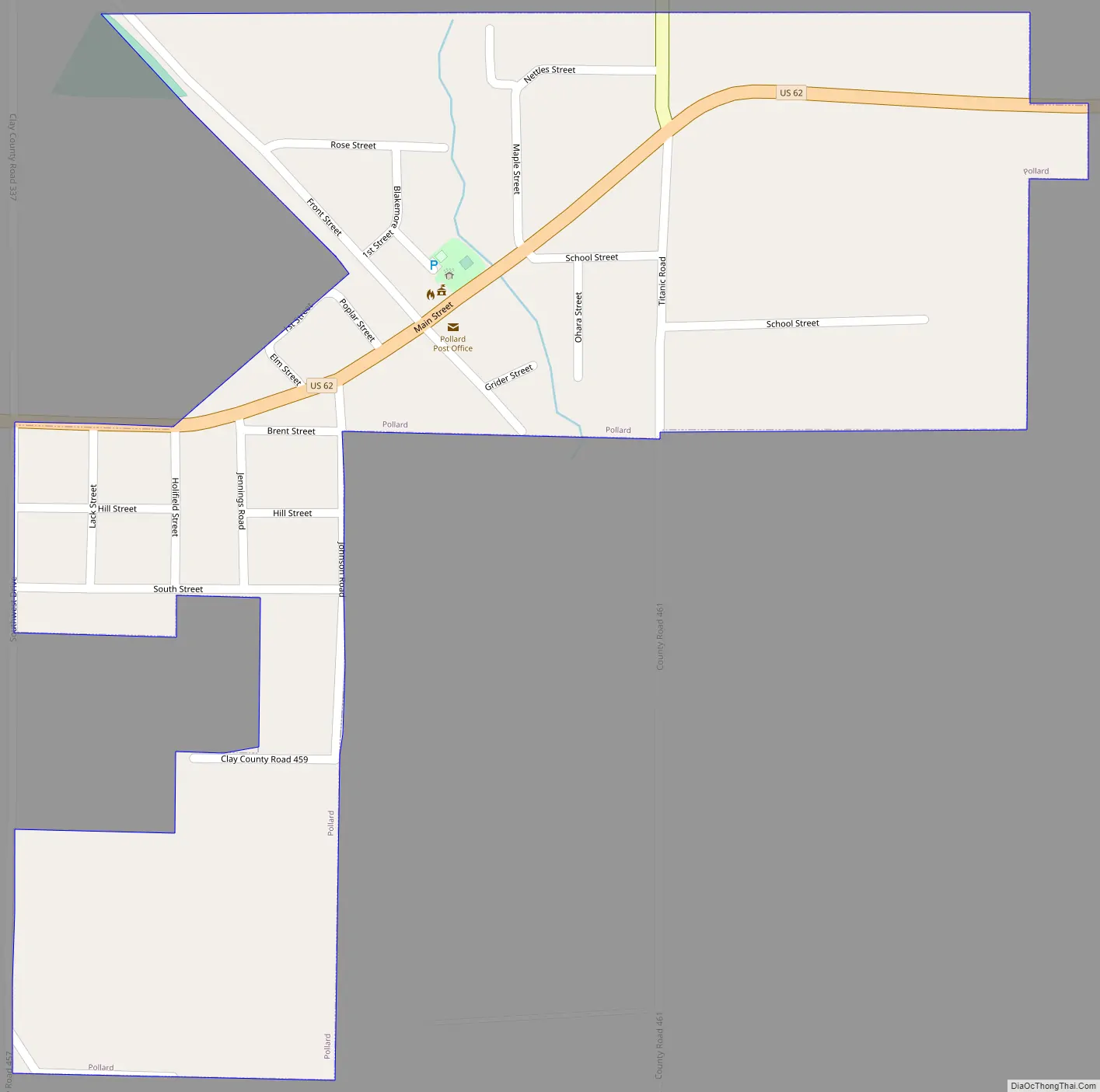
Pollard Road Map
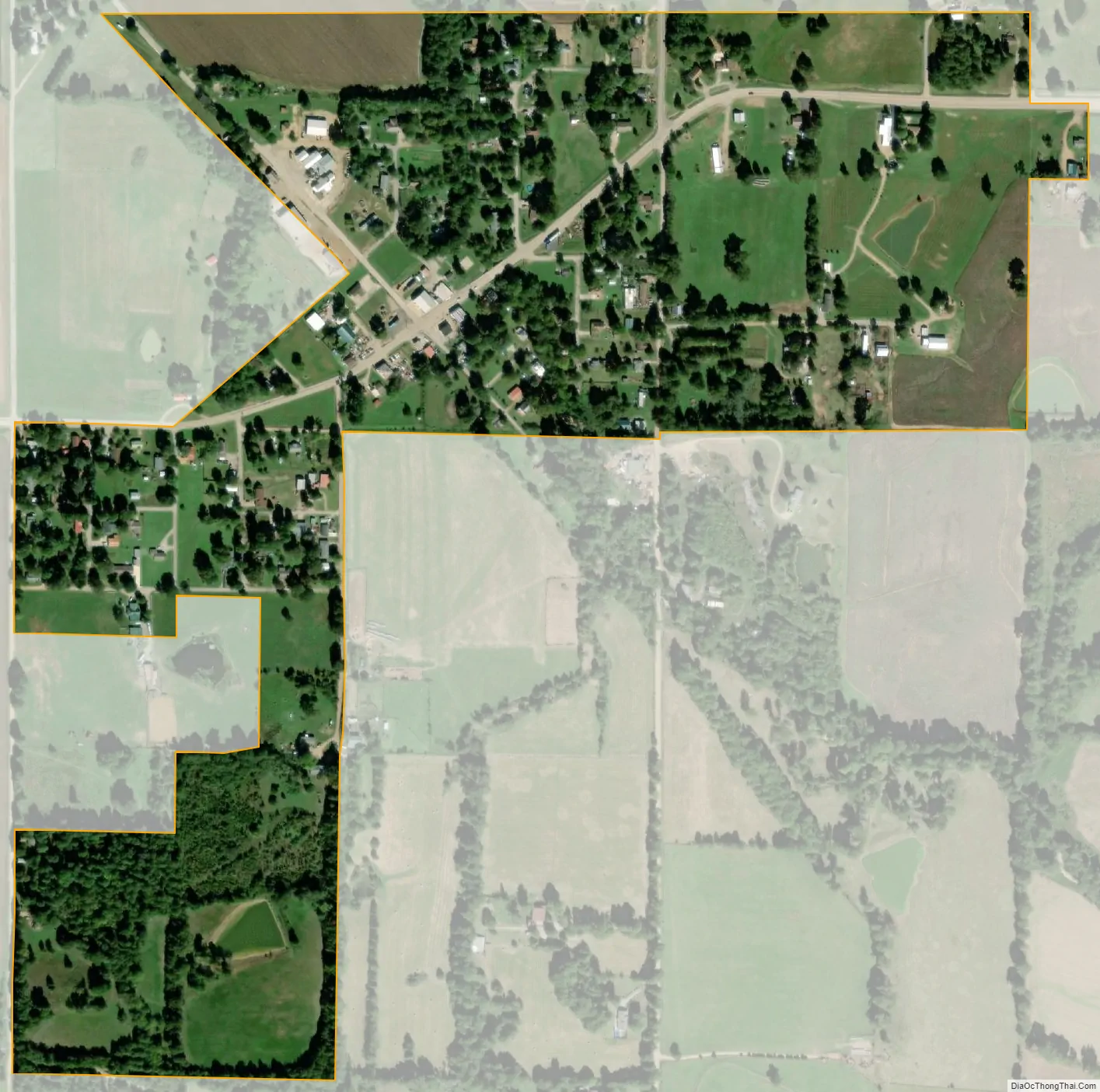
Pollard city Satellite Map
Geography
Pollard is located at 36°25′50″N 90°16′8″W / 36.43056°N 90.26889°W / 36.43056; -90.26889 (36.430686, -90.268820). The town is located at the intersection of U.S. Route 62 and Arkansas Highway 139, northwest of Piggott, and a few miles south of the Arkansas-Missouri state line.
According to the United States Census Bureau, the town has a total area of 0.8 km (0.3 mi), all land.
See also
Map of Arkansas State and its subdivision:- Arkansas
- Ashley
- Baxter
- Benton
- Boone
- Bradley
- Calhoun
- Carroll
- Chicot
- Clark
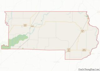
- Clay
- Cleburne
- Cleveland
- Columbia
- Conway
- Craighead
- Crawford
- Crittenden
- Cross
- Dallas
- Desha
- Drew
- Faulkner
- Franklin
- Fulton
- Garland
- Grant
- Greene
- Hempstead
- Hot Spring
- Howard
- Independence
- Izard
- Jackson
- Jefferson
- Johnson
- Lafayette
- Lawrence
- Lee
- Lincoln
- Little River
- Logan
- Lonoke
- Madison
- Marion
- Miller
- Mississippi
- Monroe
- Montgomery
- Nevada
- Newton
- Ouachita
- Perry
- Phillips
- Pike
- Poinsett
- Polk
- Pope
- Prairie
- Pulaski
- Randolph
- Saint Francis
- Saline
- Scott
- Searcy
- Sebastian
- Sevier
- Sharp
- Stone
- Union
- Van Buren
- Washington
- White
- Woodruff
- Yell
- Alabama
- Alaska
- Arizona
- Arkansas
- California
- Colorado
- Connecticut
- Delaware
- District of Columbia
- Florida
- Georgia
- Hawaii
- Idaho
- Illinois
- Indiana
- Iowa
- Kansas
- Kentucky
- Louisiana
- Maine
- Maryland
- Massachusetts
- Michigan
- Minnesota
- Mississippi
- Missouri
- Montana
- Nebraska
- Nevada
- New Hampshire
- New Jersey
- New Mexico
- New York
- North Carolina
- North Dakota
- Ohio
- Oklahoma
- Oregon
- Pennsylvania
- Rhode Island
- South Carolina
- South Dakota
- Tennessee
- Texas
- Utah
- Vermont
- Virginia
- Washington
- West Virginia
- Wisconsin
- Wyoming