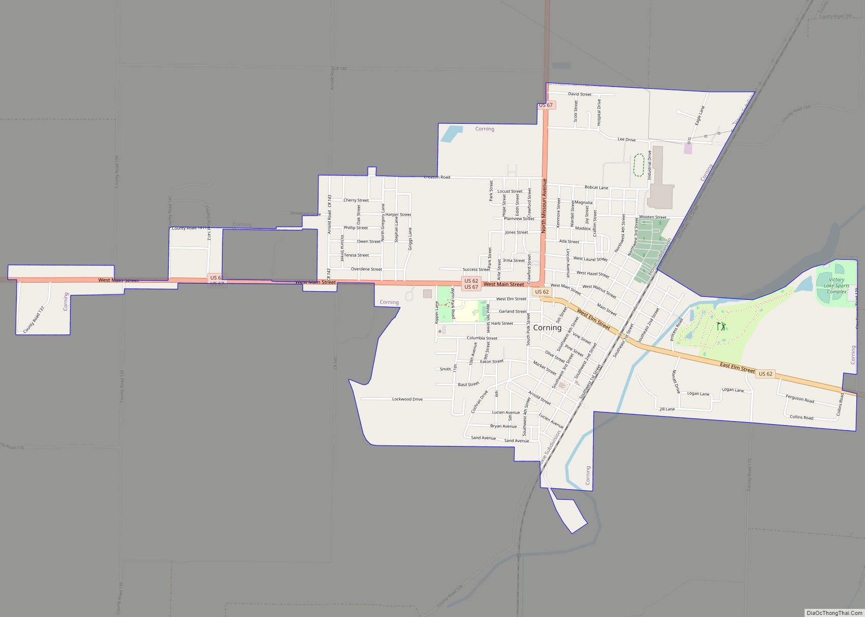
Corning is a city in Clay County, Arkansas, United States. The population was 3,377 at the 2010 census. It is one of the two county seats of Clay County, along with Piggott.
| Name: | Corning city |
|---|---|
| LSAD Code: | 25 |
| LSAD Description: | city (suffix) |
| State: | Arkansas |
| County: | Clay County |
| Elevation: | 292 ft (89 m) |
| Total Area: | 3.70 sq mi (9.58 km²) |
| Land Area: | 3.67 sq mi (9.51 km²) |
| Water Area: | 0.03 sq mi (0.08 km²) |
| Total Population: | 3,227 |
| Population Density: | 879.05/sq mi (339.41/km²) |
| ZIP code: | 72422 |
| Area code: | 870 |
| FIPS code: | 0515460 |
| GNISfeature ID: | 2404134 |
| Website: | www.corningar.gov |
Online Interactive Map
Click on ![]() to view map in "full screen" mode.
to view map in "full screen" mode.
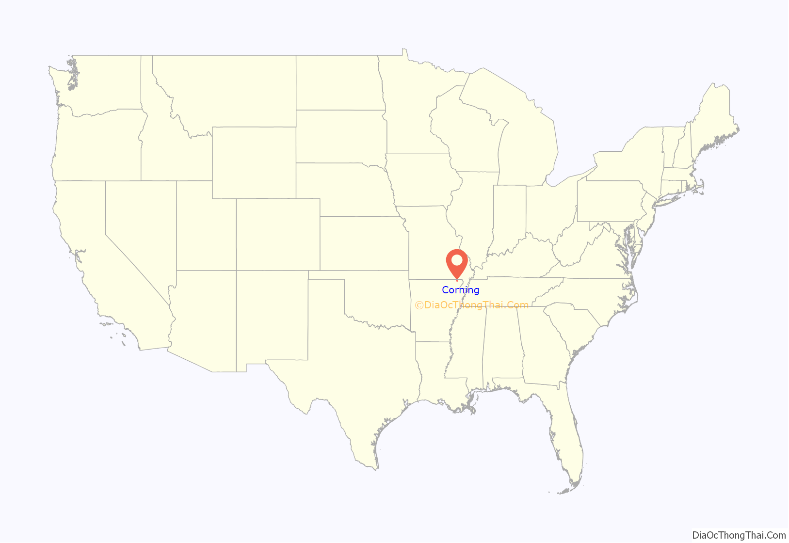
Corning location map. Where is Corning city?

History
The original settlement was approximately one mile east and was called Hecht City, named for brothers Levi and Solomon Hecht, who operated a lumber mill on Black River. Hecht City moved to the present site of Corning in 1871, when the Cairo and Fulton Railroad surveyed the land for the proposed route. The railroad through the settlement was completed by 1872. On February 5, 1873, the name was changed from Hecht City to Corning, in honor of H. D. Corning, an engineer with the railroad.
The city of Corning experienced a massive period of growth in the early part of the 20th century. In the 1960s and 1970s, it was the site of many industrial manufacturing developments.
Corning was the site of a large explosion on March 9, 1966. The pre-dawn explosion originated in a munitions railcar and resulted in only one minor injury in the small town. The explosion was widely reported throughout the surrounding region.
Two properties in Corning are listed on the National Register of Historic Places: Sheeks House and Oliver House.
Corning Road Map
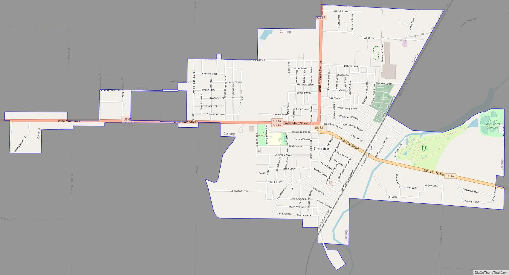
Corning city Satellite Map

Geography
Corning is located in western Clay County 2 miles (3 km) west of the Black River. U.S. Route 62 passes through the city, leading east 25 miles (40 km) to Piggott and southwest 26 miles (42 km) to Pocahontas. U.S. Route 67 leads north from Corning 29 miles (47 km) to Poplar Bluff, Missouri, and joins US 62 heading southwest out of Corning to Pocahontas.
According to the United States Census Bureau, Corning has a total area of 3.14 square miles (8.14 km), of which 3.12 square miles (8.08 km) is land and 0.03 square miles (0.07 km), or 0.81%, is water.
The topography of Corning is flat, having previously been marshland. Area farmers and builders may attest to this due to the proliferation of gumbo soil, a name given to soil high in clay particulate matter and common in the region.
See also
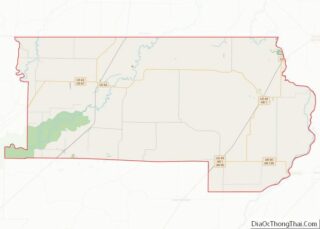
Map of Arkansas State and its subdivision:- Arkansas
- Ashley
- Baxter
- Benton
- Boone
- Bradley
- Calhoun
- Carroll
- Chicot
- Clark
- Clay
- Cleburne
- Cleveland
- Columbia
- Conway
- Craighead
- Crawford
- Crittenden
- Cross
- Dallas
- Desha
- Drew
- Faulkner
- Franklin
- Fulton
- Garland
- Grant
- Greene
- Hempstead
- Hot Spring
- Howard
- Independence
- Izard
- Jackson
- Jefferson
- Johnson
- Lafayette
- Lawrence
- Lee
- Lincoln
- Little River
- Logan
- Lonoke
- Madison
- Marion
- Miller
- Mississippi
- Monroe
- Montgomery
- Nevada
- Newton
- Ouachita
- Perry
- Phillips
- Pike
- Poinsett
- Polk
- Pope
- Prairie
- Pulaski
- Randolph
- Saint Francis
- Saline
- Scott
- Searcy
- Sebastian
- Sevier
- Sharp
- Stone
- Union
- Van Buren
- Washington
- White
- Woodruff
- Yell
- Alabama
- Alaska
- Arizona
- Arkansas
- California
- Colorado
- Connecticut
- Delaware
- District of Columbia
- Florida
- Georgia
- Hawaii
- Idaho
- Illinois
- Indiana
- Iowa
- Kansas
- Kentucky
- Louisiana
- Maine
- Maryland
- Massachusetts
- Michigan
- Minnesota
- Mississippi
- Missouri
- Montana
- Nebraska
- Nevada
- New Hampshire
- New Jersey
- New Mexico
- New York
- North Carolina
- North Dakota
- Ohio
- Oklahoma
- Oregon
- Pennsylvania
- Rhode Island
- South Carolina
- South Dakota
- Tennessee
- Texas
- Utah
- Vermont
- Virginia
- Washington
- West Virginia
- Wisconsin
- Wyoming