St. Francis is a city in northeastern Clay County, Arkansas, United States, along the St. Francis River. The population was 250 at the 2010 census.
| Name: | St. Francis city |
|---|---|
| LSAD Code: | 25 |
| LSAD Description: | city (suffix) |
| State: | Arkansas |
| County: | Clay County |
| Elevation: | 299 ft (91 m) |
| Total Area: | 0.37 sq mi (0.95 km²) |
| Land Area: | 0.35 sq mi (0.92 km²) |
| Water Area: | 0.01 sq mi (0.03 km²) |
| Total Population: | 218 |
| Population Density: | 614.08/sq mi (237.32/km²) |
| ZIP code: | 72464 |
| FIPS code: | 0561970 |
| GNISfeature ID: | 2405393 |
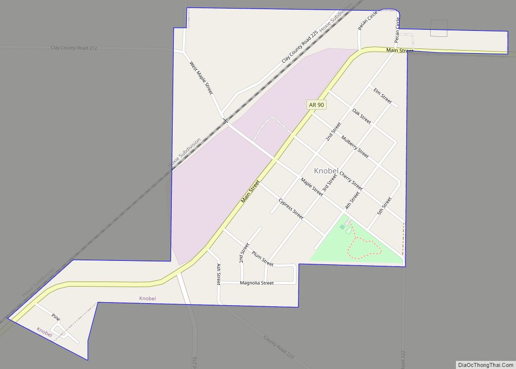
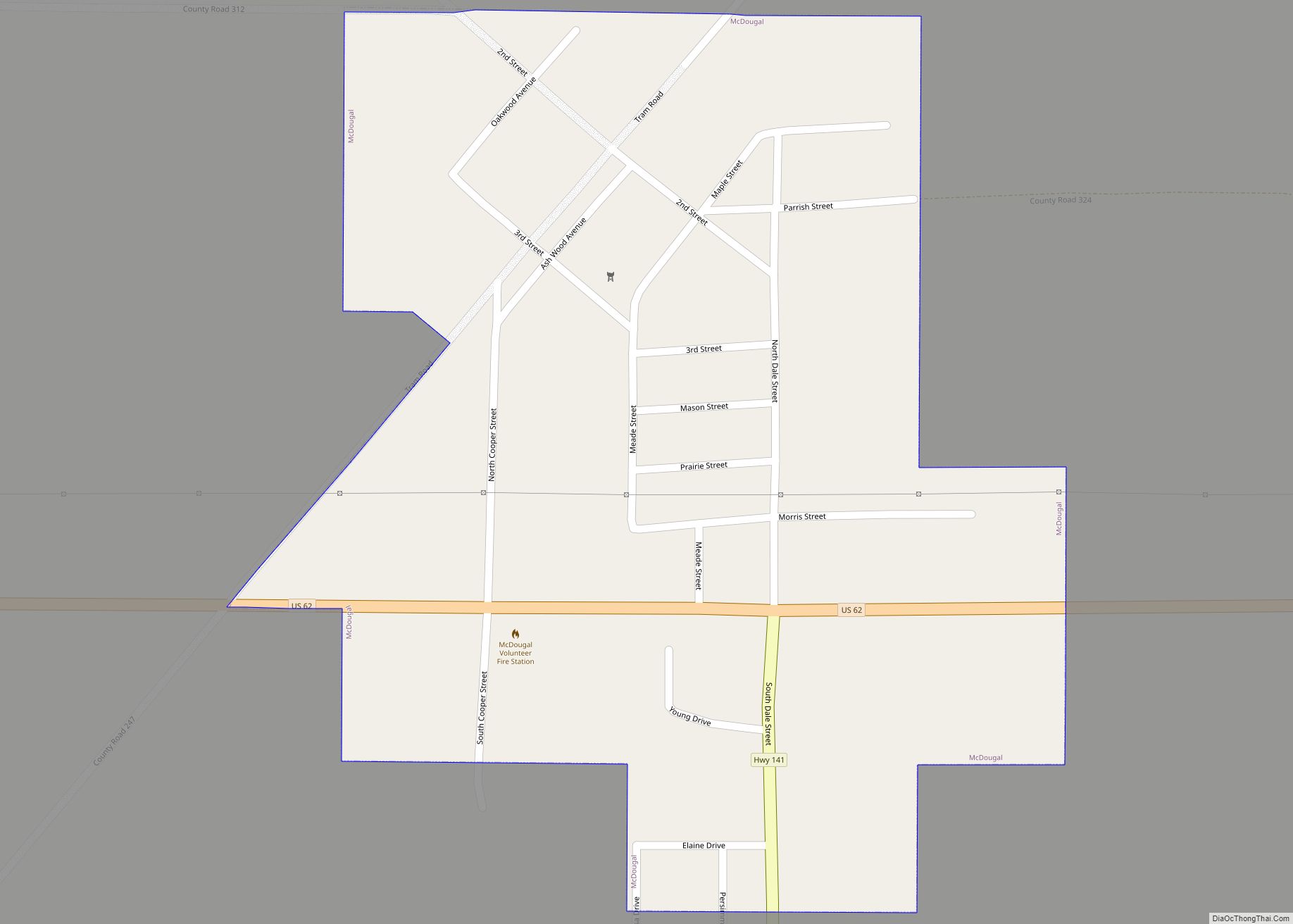
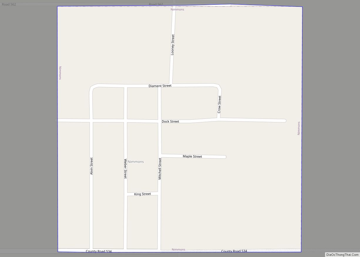
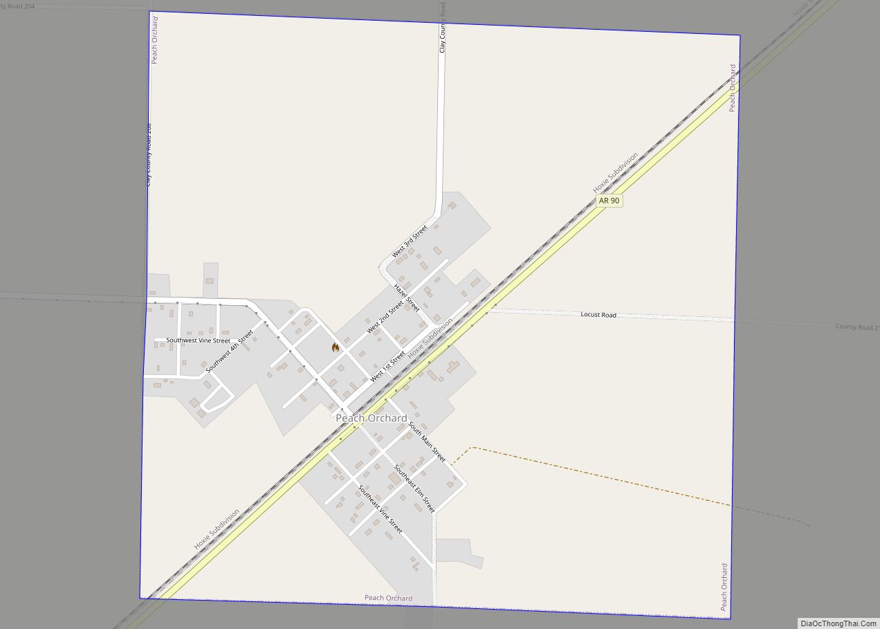
Online Interactive Map
Click on ![]() to view map in "full screen" mode.
to view map in "full screen" mode.
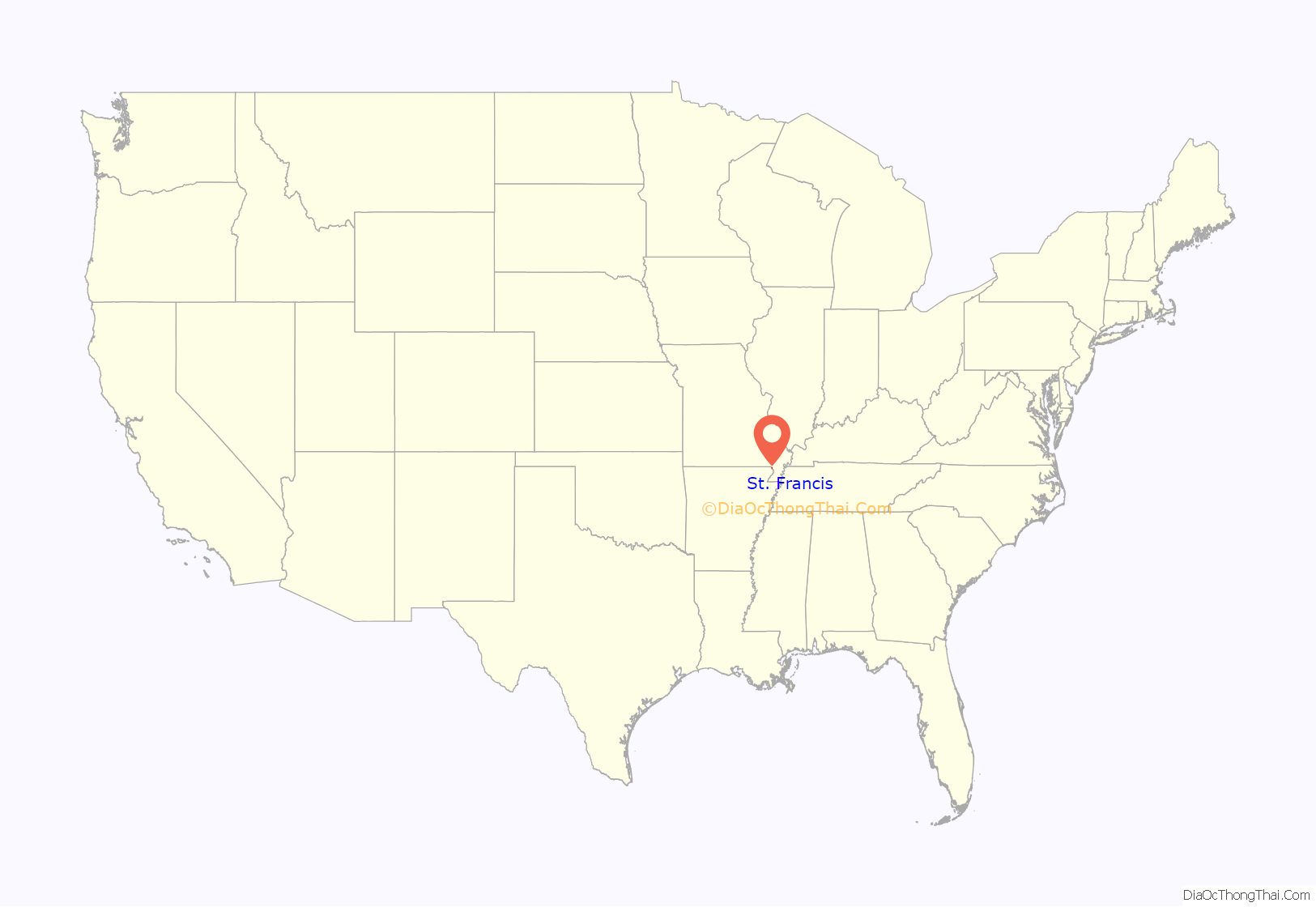
St. Francis location map. Where is St. Francis city?
History
The St. Francis area was settled in the 1840s, with the early residents forming the Chalk Bluff community just northwest of the present city. The Battle of Chalk Bluff was fought here in May 1863, during the Civil War. In 1882, the St. Louis Southwestern Railway (“Cotton Belt”) was constructed through the area, and the Chalk Bluff community gradually shifted southeastward to a location along the railroad tracks. This new community was named “St. Francis” after the adjacent river (the river itself was named after Francis of Assisi).
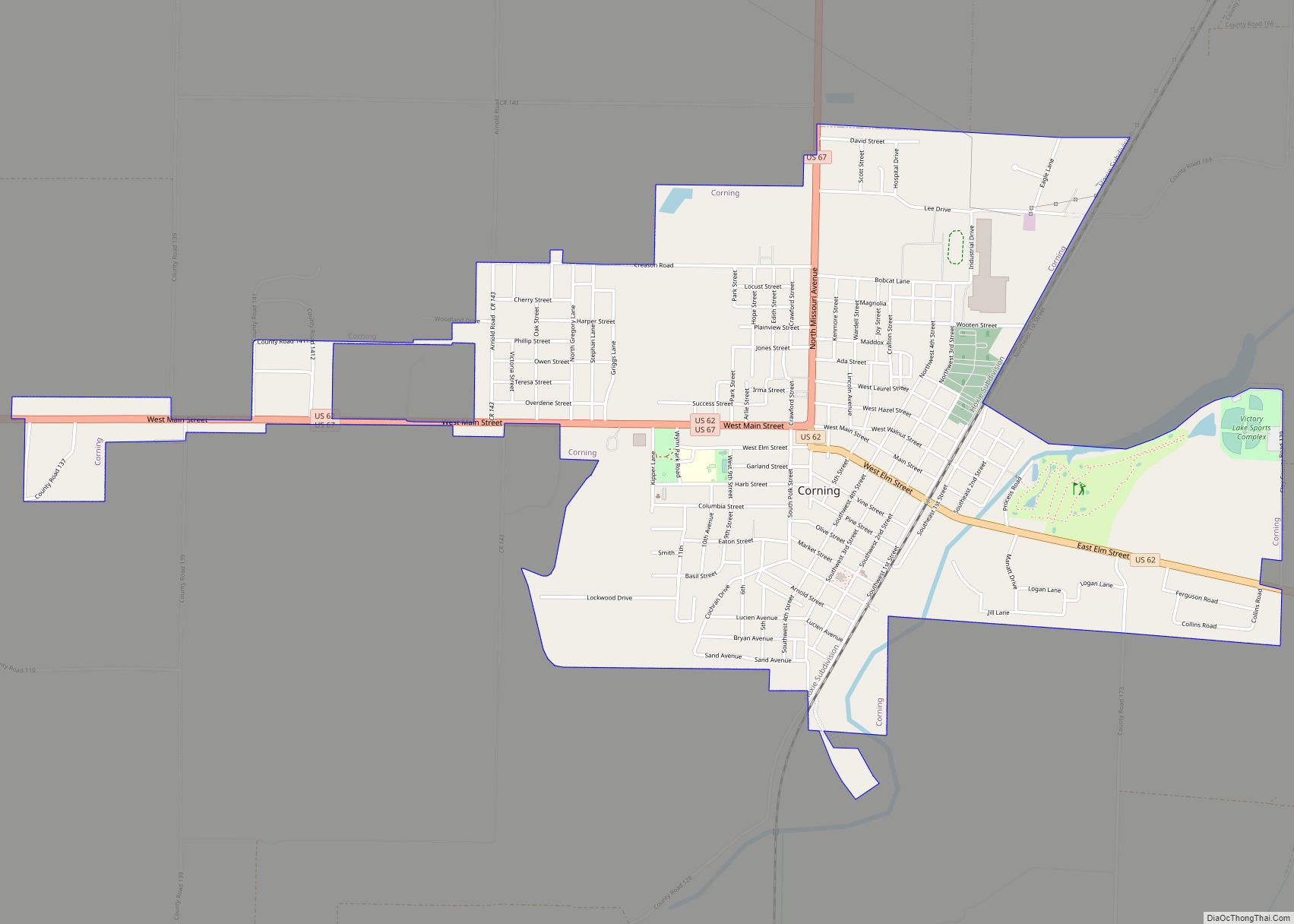
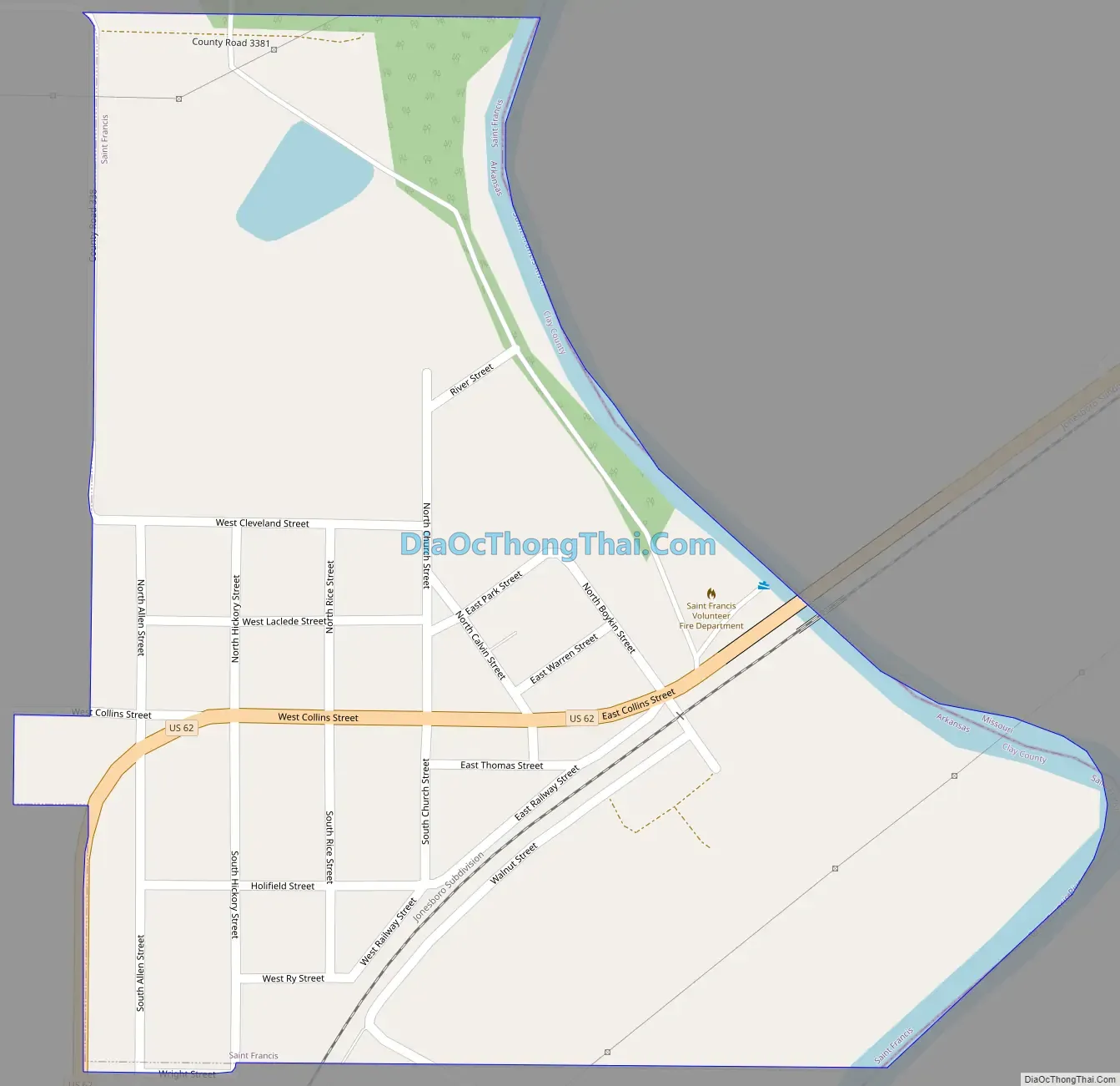
St. Francis Road Map
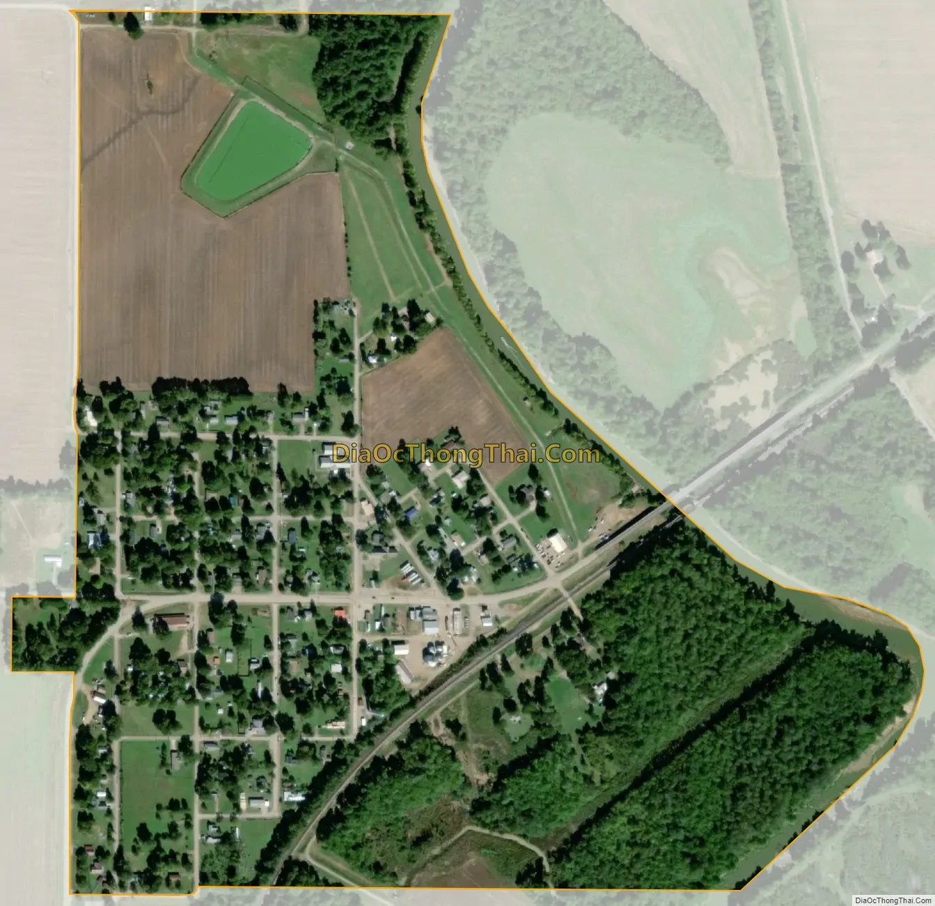
St. Francis city Satellite Map
Geography
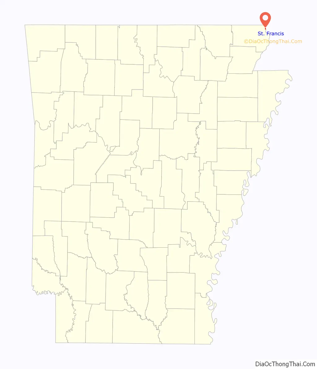
St. Francis is located near the northeastern corner of Clay County. It is bordered on the east by the St. Francis River, which forms the Arkansas–Missouri state line. U.S. Route 62 passes through the community, leading south and west 7 miles (11 km) to Piggott, and northeast 4 miles (6 km) to Campbell, Missouri.
According to the United States Census Bureau, St. Francis has a total area of 0.37 square miles (0.95 km), all land.
See also
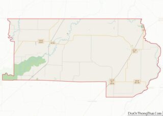
Map of Arkansas State and its subdivision:- Arkansas
- Ashley
- Baxter
- Benton
- Boone
- Bradley
- Calhoun
- Carroll
- Chicot
- Clark
- Clay
- Cleburne
- Cleveland
- Columbia
- Conway
- Craighead
- Crawford
- Crittenden
- Cross
- Dallas
- Desha
- Drew
- Faulkner
- Franklin
- Fulton
- Garland
- Grant
- Greene
- Hempstead
- Hot Spring
- Howard
- Independence
- Izard
- Jackson
- Jefferson
- Johnson
- Lafayette
- Lawrence
- Lee
- Lincoln
- Little River
- Logan
- Lonoke
- Madison
- Marion
- Miller
- Mississippi
- Monroe
- Montgomery
- Nevada
- Newton
- Ouachita
- Perry
- Phillips
- Pike
- Poinsett
- Polk
- Pope
- Prairie
- Pulaski
- Randolph
- Saint Francis
- Saline
- Scott
- Searcy
- Sebastian
- Sevier
- Sharp
- Stone
- Union
- Van Buren
- Washington
- White
- Woodruff
- Yell
- Alabama
- Alaska
- Arizona
- Arkansas
- California
- Colorado
- Connecticut
- Delaware
- District of Columbia
- Florida
- Georgia
- Hawaii
- Idaho
- Illinois
- Indiana
- Iowa
- Kansas
- Kentucky
- Louisiana
- Maine
- Maryland
- Massachusetts
- Michigan
- Minnesota
- Mississippi
- Missouri
- Montana
- Nebraska
- Nevada
- New Hampshire
- New Jersey
- New Mexico
- New York
- North Carolina
- North Dakota
- Ohio
- Oklahoma
- Oregon
- Pennsylvania
- Rhode Island
- South Carolina
- South Dakota
- Tennessee
- Texas
- Utah
- Vermont
- Virginia
- Washington
- West Virginia
- Wisconsin
- Wyoming