Stamps is a city in Lafayette County, Arkansas, United States. The population was 1,693 at the 2010 census, down from 2,131 at the 2000 census.
| Name: | Stamps city |
|---|---|
| LSAD Code: | 25 |
| LSAD Description: | city (suffix) |
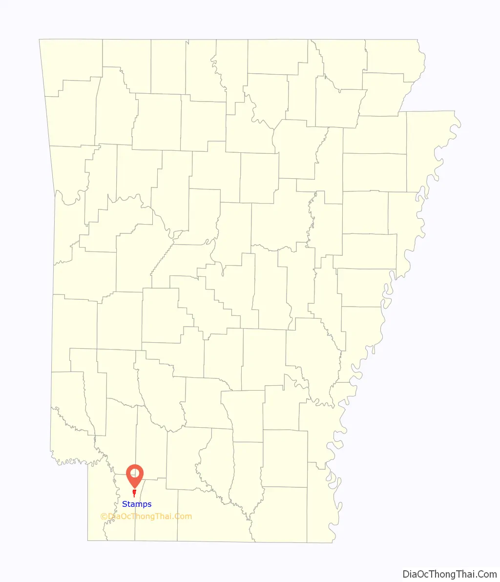
| State: | Arkansas |
| County: | Lafayette County |
| Elevation: | 308 ft (94 m) |
| Total Area: | 3.15 sq mi (8.17 km²) |
| Land Area: | 3.05 sq mi (7.91 km²) |
| Water Area: | 0.10 sq mi (0.26 km²) |
| Total Population: | 1,258 |
| Population Density: | 412.19/sq mi (159.12/km²) |
| ZIP code: | 71860 |
| Area code: | 870 |
| FIPS code: | 0566320 |
| GNISfeature ID: | 0058678 |
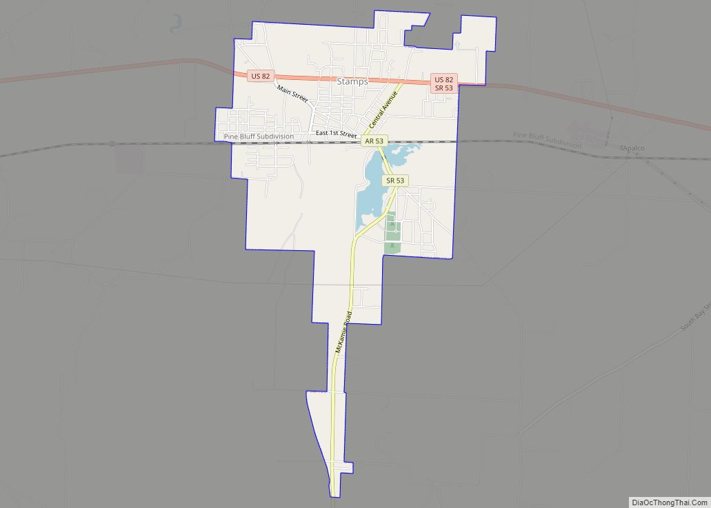
Online Interactive Map
Click on ![]() to view map in "full screen" mode.
to view map in "full screen" mode.
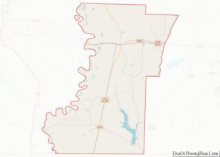
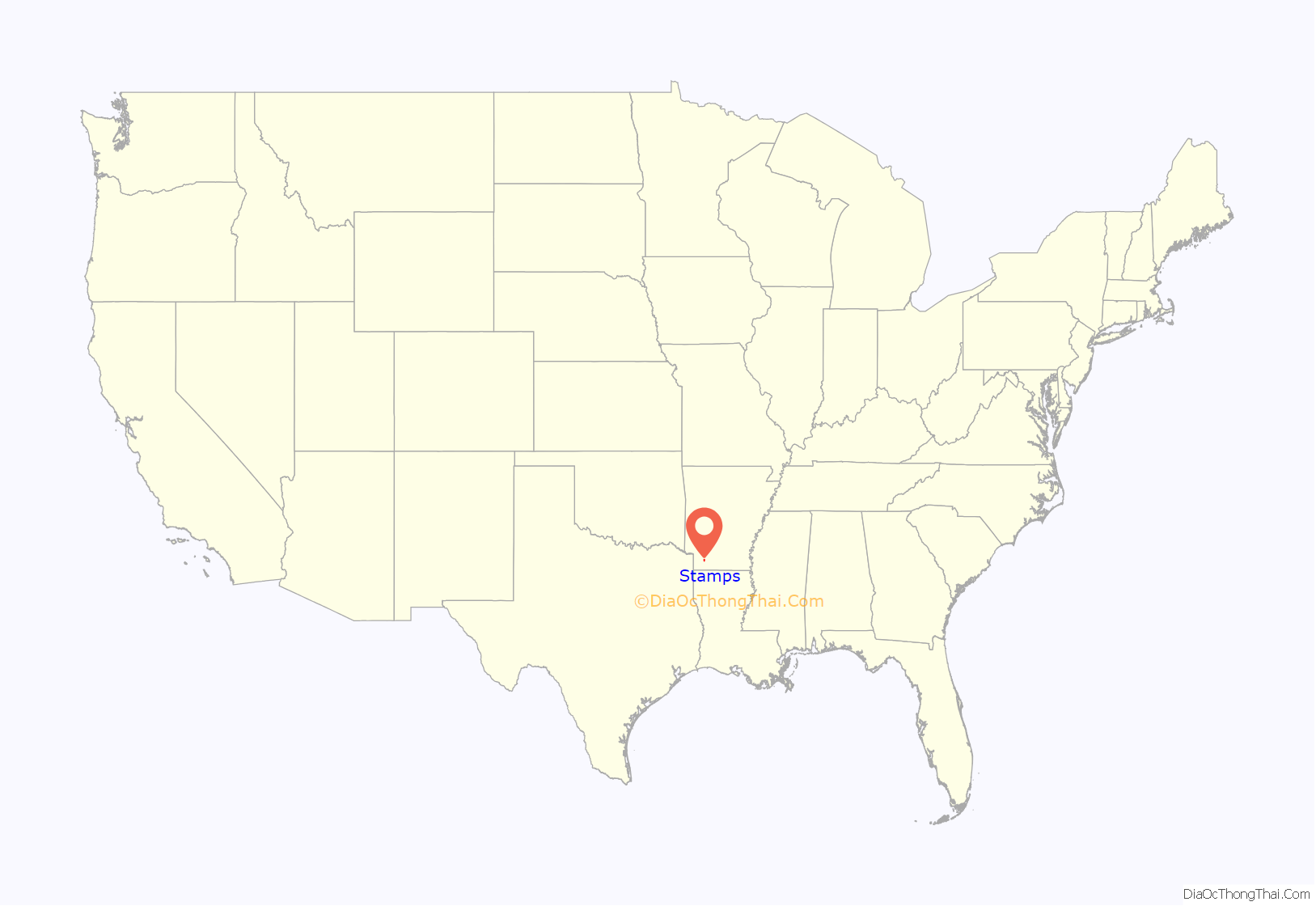
Stamps location map. Where is Stamps city?
History
A post office has been in operation in Stamps since 1887. The community has the name of the local Stamps family. Stamps was the shop headquarters for the former Louisiana and Arkansas Railway until the relocation in the early 1920s to Minden in Webster Parish in northern Louisiana.
Stamps has been noted on lists of unusual place names. An early postmaster quipped that Stamps was “the only town in the U.S. that stamps Stamps on stamps”.
Stamps Ice & Fuel Company and a boxcar of the Louisiana and Arkansas Railway, c. 1904
Stamps Fire Department
Bodcaw Bank in Stamps
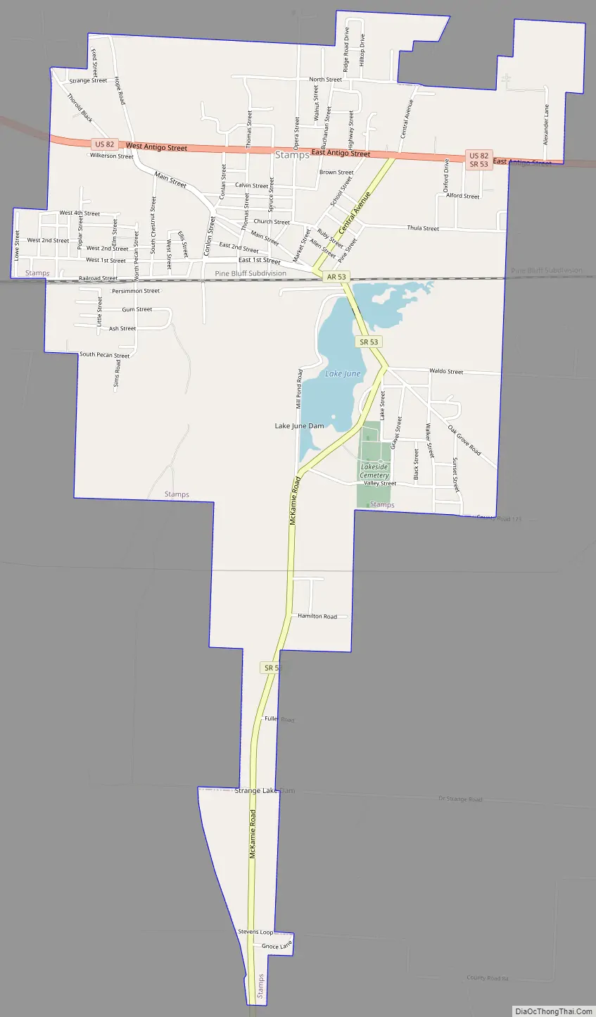
Stamps Road Map
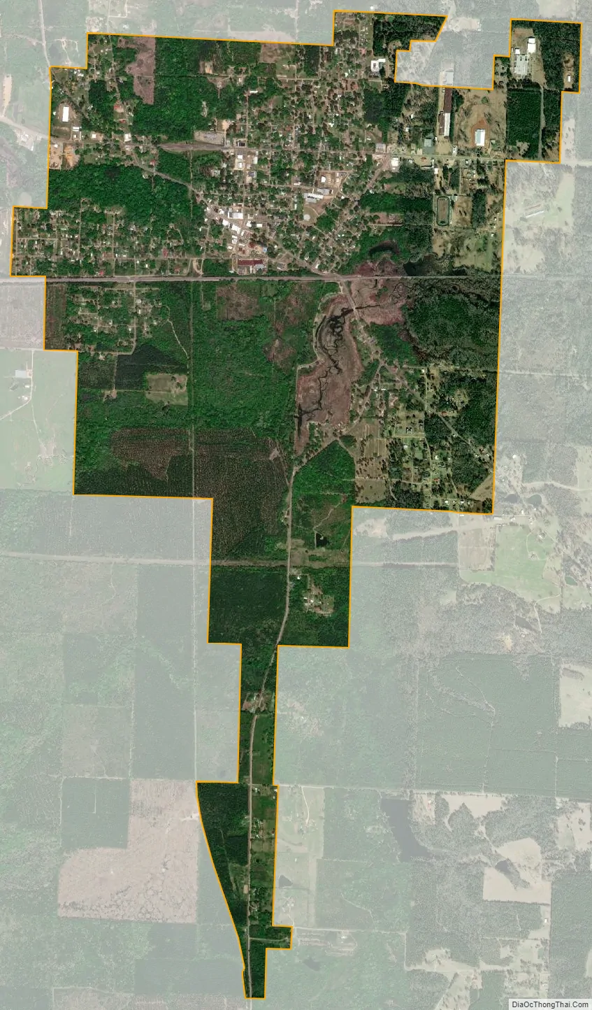
Stamps city Satellite Map
Geography
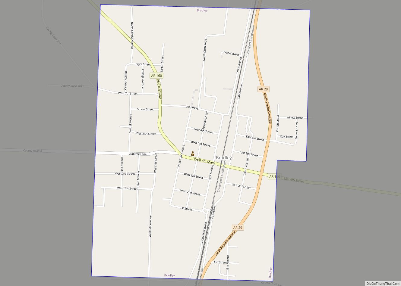
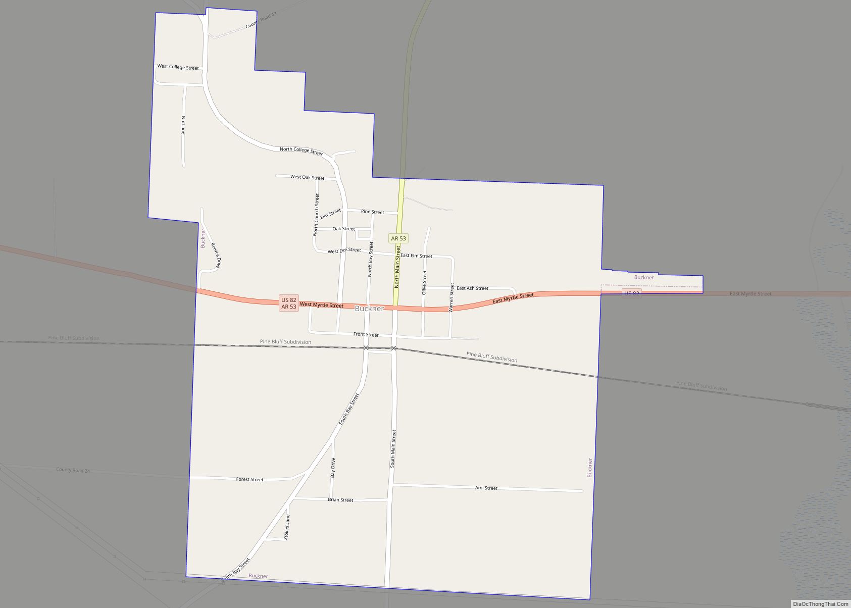
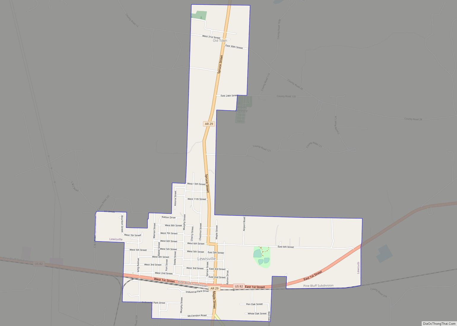
Stamps is in northeastern Lafayette County in southwestern Arkansas. U.S. Route 82 passes through the northern side of the city, leading west 5 miles (8 km) to Lewisville, the county seat, and east 3 miles (5 km) to Buckner. Arkansas Highway 53 has its northern terminus at US 82 and leads south through the center of Stamps 27 miles (43 km) to the state line near Springhill, Louisiana.
According to the United States Census Bureau, the city has a total area of 3.1 square miles (8.1 km), of which 3.1 square miles (7.9 km) are land and 0.1 square miles (0.3 km), or 3.19%, are water. Lake June lies within the southern part of the city limits.
See also
Map of Arkansas State and its subdivision:- Arkansas
- Ashley
- Baxter
- Benton
- Boone
- Bradley
- Calhoun
- Carroll
- Chicot
- Clark
- Clay
- Cleburne
- Cleveland
- Columbia
- Conway
- Craighead
- Crawford
- Crittenden
- Cross
- Dallas
- Desha
- Drew
- Faulkner
- Franklin
- Fulton
- Garland
- Grant
- Greene
- Hempstead
- Hot Spring
- Howard
- Independence
- Izard
- Jackson
- Jefferson
- Johnson
- Lafayette
- Lawrence
- Lee
- Lincoln
- Little River
- Logan
- Lonoke
- Madison
- Marion
- Miller
- Mississippi
- Monroe
- Montgomery
- Nevada
- Newton
- Ouachita
- Perry
- Phillips
- Pike
- Poinsett
- Polk
- Pope
- Prairie
- Pulaski
- Randolph
- Saint Francis
- Saline
- Scott
- Searcy
- Sebastian
- Sevier
- Sharp
- Stone
- Union
- Van Buren
- Washington
- White
- Woodruff
- Yell
- Alabama
- Alaska
- Arizona
- Arkansas
- California
- Colorado
- Connecticut
- Delaware
- District of Columbia
- Florida
- Georgia
- Hawaii
- Idaho
- Illinois
- Indiana
- Iowa
- Kansas
- Kentucky
- Louisiana
- Maine
- Maryland
- Massachusetts
- Michigan
- Minnesota
- Mississippi
- Missouri
- Montana
- Nebraska
- Nevada
- New Hampshire
- New Jersey
- New Mexico
- New York
- North Carolina
- North Dakota
- Ohio
- Oklahoma
- Oregon
- Pennsylvania
- Rhode Island
- South Carolina
- South Dakota
- Tennessee
- Texas
- Utah
- Vermont
- Virginia
- Washington
- West Virginia
- Wisconsin
- Wyoming