Success is a town in Clay County, Arkansas, United States. The population was 149 at the 2010 census.
The origin of the name “Success” is obscure.
| Name: | Success town |
|---|---|
| LSAD Code: | 43 |
| LSAD Description: | town (suffix) |
| State: | Arkansas |
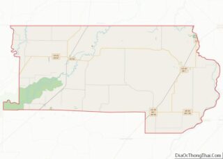
| County: | Clay County |
| Elevation: | 295 ft (90 m) |
| Total Area: | 0.22 sq mi (0.58 km²) |
| Land Area: | 0.22 sq mi (0.58 km²) |
| Water Area: | 0.00 sq mi (0.00 km²) |
| Total Population: | 98 |
| Population Density: | 439.46/sq mi (169.45/km²) |
| ZIP code: | 72470 |
| Area code: | 870 |
| FIPS code: | 0567550 |
| GNISfeature ID: | 2406678 |
Online Interactive Map
Click on ![]() to view map in "full screen" mode.
to view map in "full screen" mode.
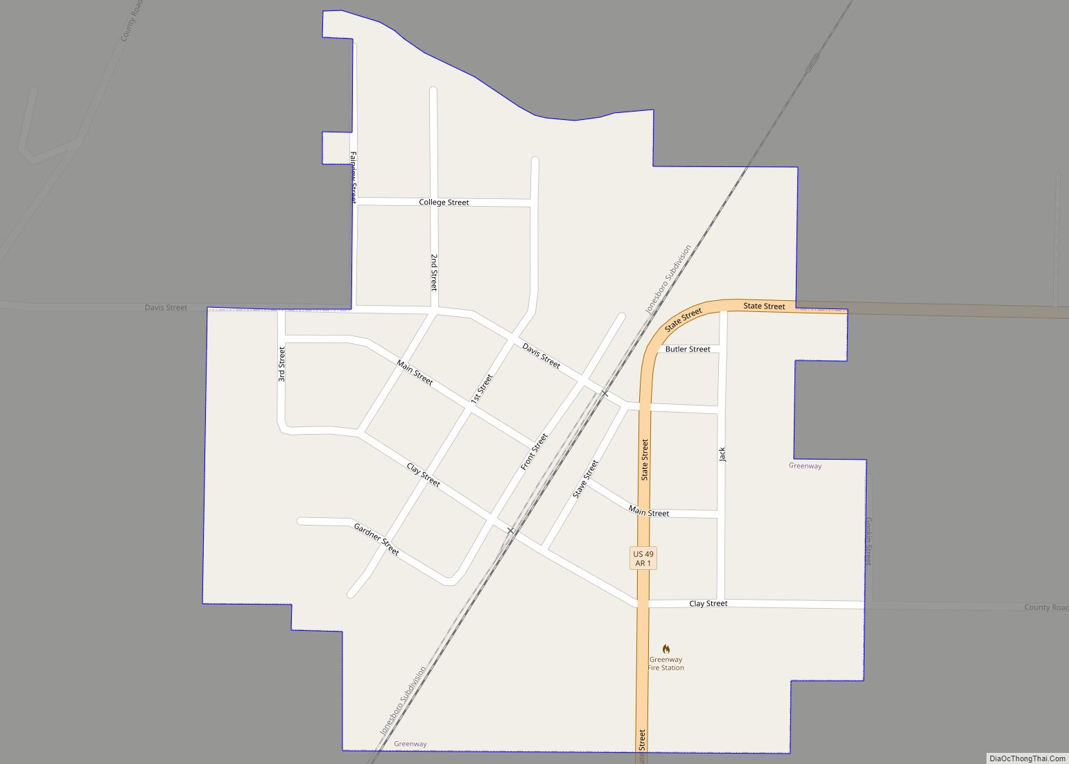
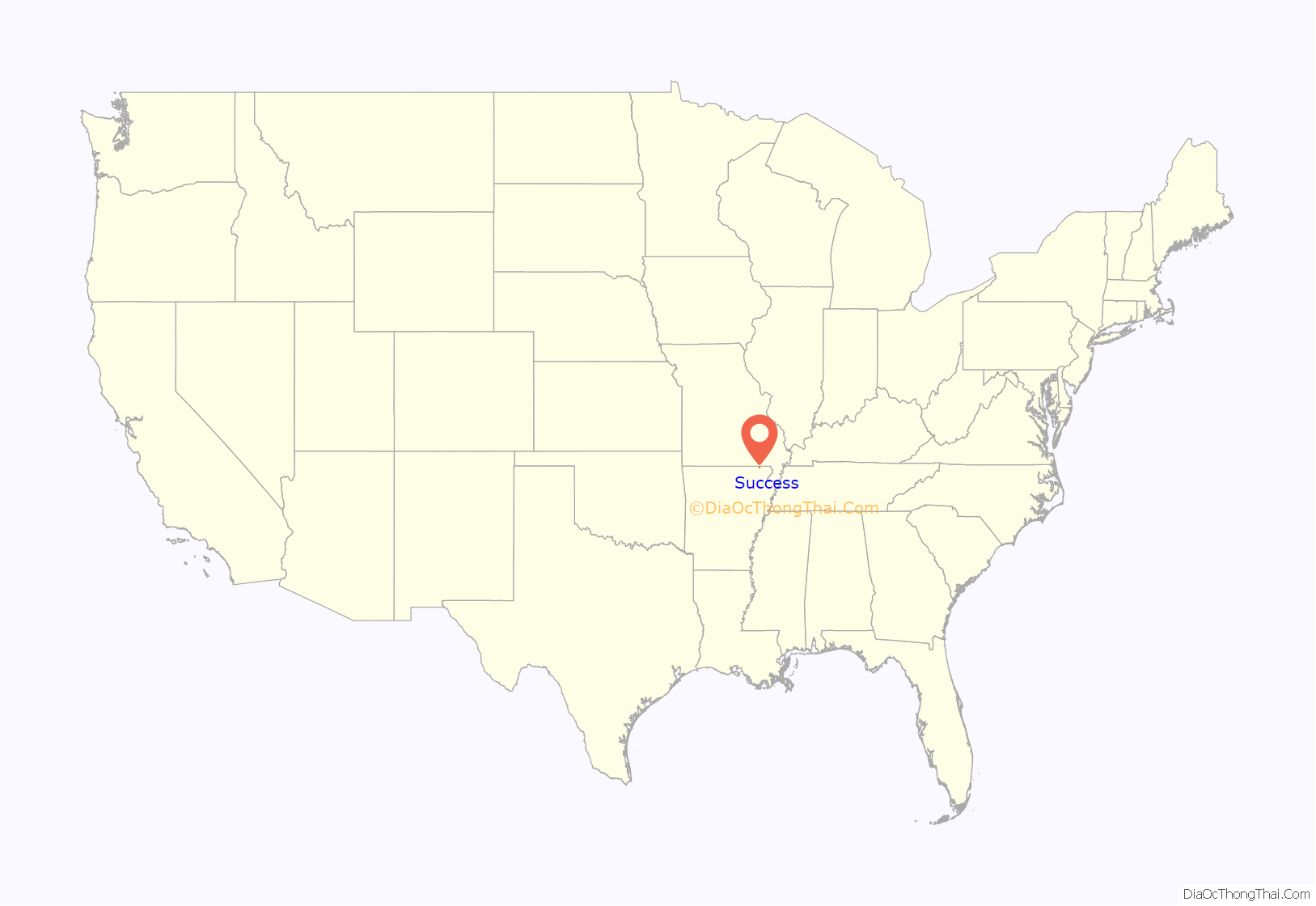
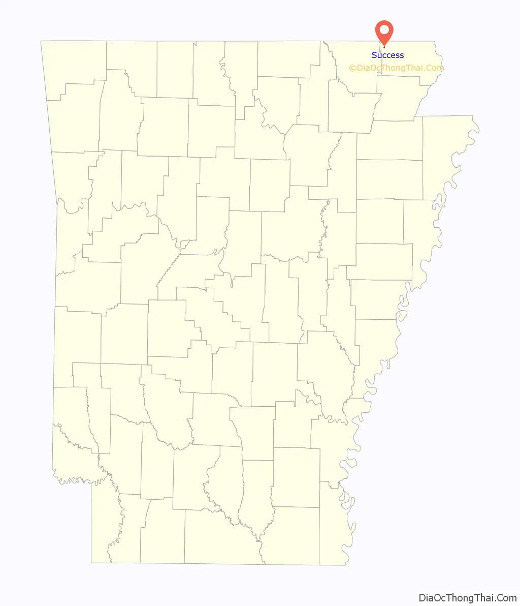
Success location map. Where is Success town?
History
Success was established during the railroad and timber boom that came to northeastern Arkansas during the late 19th century. The community received a post office with the name “Success” in 1895, and incorporated in 1903.
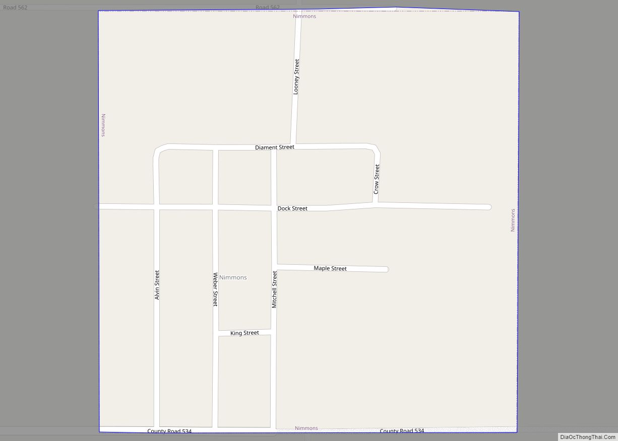
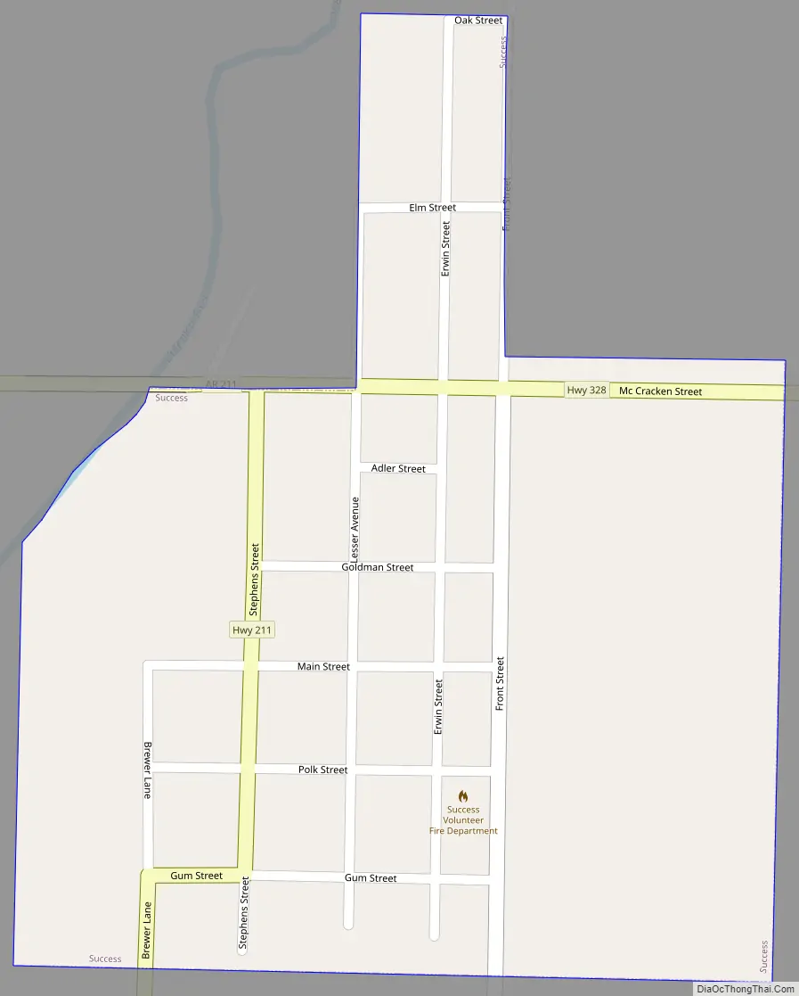
Success Road Map
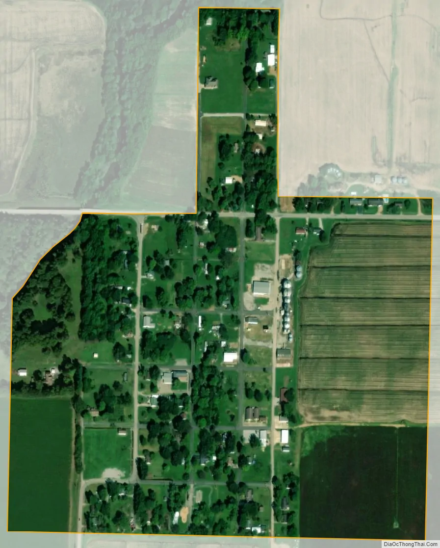
Success city Satellite Map
Geography
Success is located in northwestern Clay County just east of the Little Black River, a tributary of the Current River. The town lies at the intersection of Arkansas Highway 211 and Arkansas Highway 328, northwest of Corning, and 2.7 miles south of the Arkansas-Missouri state line.
According to the United States Census Bureau, the town has a total area of 0.22 square miles (0.56 km), all land.
See also
Map of Arkansas State and its subdivision:- Arkansas
- Ashley
- Baxter
- Benton
- Boone
- Bradley
- Calhoun
- Carroll
- Chicot
- Clark
- Clay
- Cleburne
- Cleveland
- Columbia
- Conway
- Craighead
- Crawford
- Crittenden
- Cross
- Dallas
- Desha
- Drew
- Faulkner
- Franklin
- Fulton
- Garland
- Grant
- Greene
- Hempstead
- Hot Spring
- Howard
- Independence
- Izard
- Jackson
- Jefferson
- Johnson
- Lafayette
- Lawrence
- Lee
- Lincoln
- Little River
- Logan
- Lonoke
- Madison
- Marion
- Miller
- Mississippi
- Monroe
- Montgomery
- Nevada
- Newton
- Ouachita
- Perry
- Phillips
- Pike
- Poinsett
- Polk
- Pope
- Prairie
- Pulaski
- Randolph
- Saint Francis
- Saline
- Scott
- Searcy
- Sebastian
- Sevier
- Sharp
- Stone
- Union
- Van Buren
- Washington
- White
- Woodruff
- Yell
- Alabama
- Alaska
- Arizona
- Arkansas
- California
- Colorado
- Connecticut
- Delaware
- District of Columbia
- Florida
- Georgia
- Hawaii
- Idaho
- Illinois
- Indiana
- Iowa
- Kansas
- Kentucky
- Louisiana
- Maine
- Maryland
- Massachusetts
- Michigan
- Minnesota
- Mississippi
- Missouri
- Montana
- Nebraska
- Nevada
- New Hampshire
- New Jersey
- New Mexico
- New York
- North Carolina
- North Dakota
- Ohio
- Oklahoma
- Oregon
- Pennsylvania
- Rhode Island
- South Carolina
- South Dakota
- Tennessee
- Texas
- Utah
- Vermont
- Virginia
- Washington
- West Virginia
- Wisconsin
- Wyoming