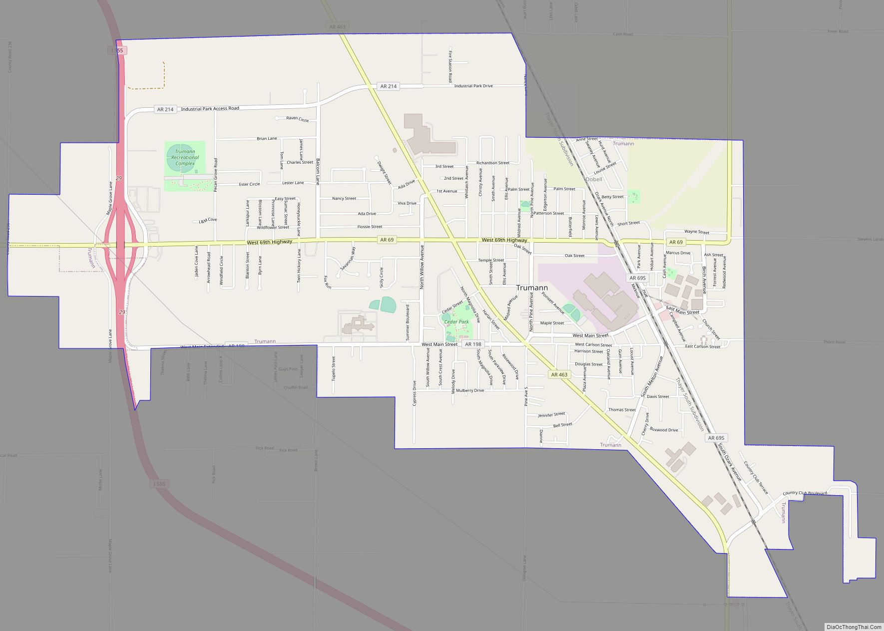
Trumann is a city in Poinsett County, Arkansas, United States. The population was 7,399 at the 2020 census. It is included in the Jonesboro Metropolitan Statistical Area.
| Name: | Trumann city |
|---|---|
| LSAD Code: | 25 |
| LSAD Description: | city (suffix) |
| State: | Arkansas |
| County: | Poinsett County |
| Elevation: | 226 ft (69 m) |
| Total Area: | 5.80 sq mi (15.03 km²) |
| Land Area: | 5.80 sq mi (15.03 km²) |
| Water Area: | 0.00 sq mi (0.00 km²) |
| Total Population: | 7,399 |
| Population Density: | 1,275.25/sq mi (492.41/km²) |
| ZIP code: | 72472 |
| Area code: | 870 |
| FIPS code: | 0570010 |
| GNISfeature ID: | 0078590 |
Online Interactive Map
Click on ![]() to view map in "full screen" mode.
to view map in "full screen" mode.
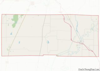
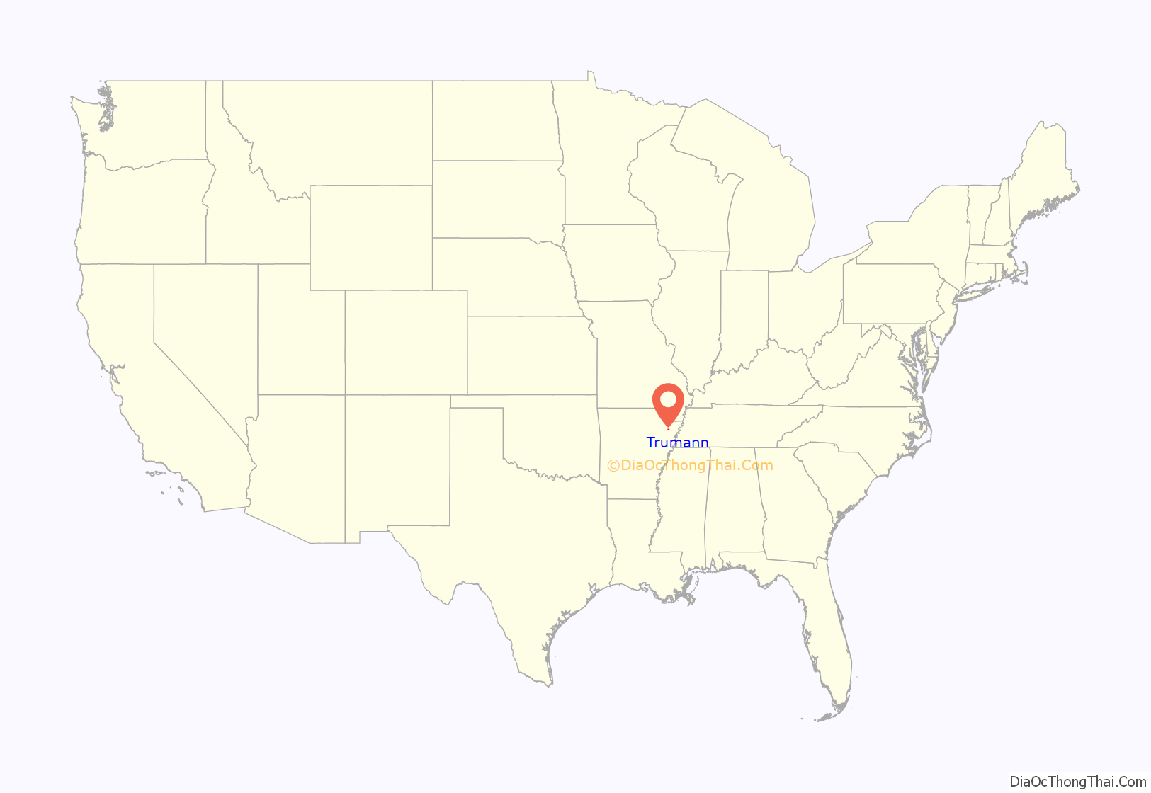
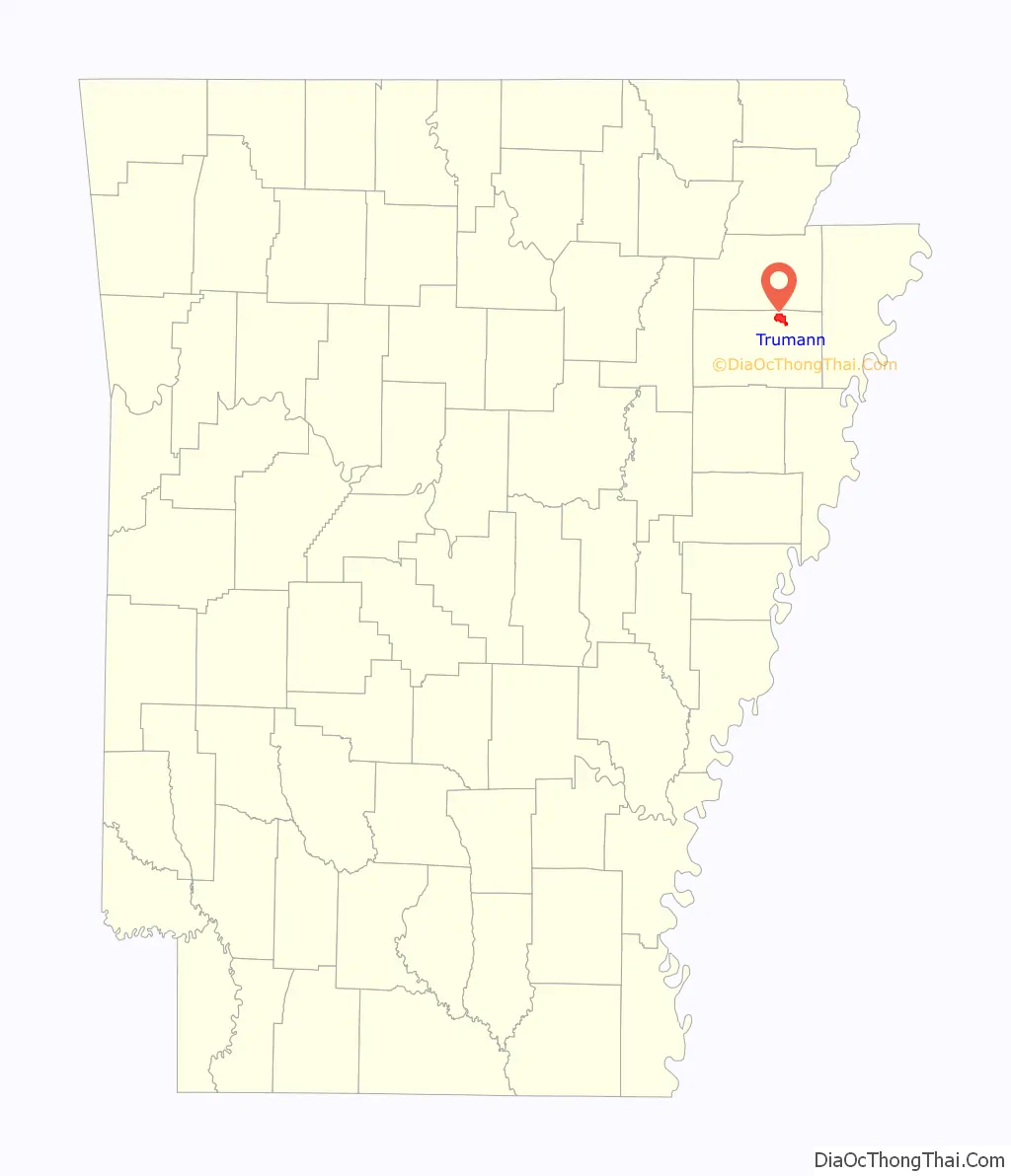
Trumann location map. Where is Trumann city?
History
On June 5, 2014 a derecho passed the through the town, causing extensive damage to trees and power lines. The estimated wind gust at the time of the storm was between 80 and 85 mph, with sustained winds of 75 mph.
On December 10, 2021, a tornado came through the town causing damage. It was part of a tornado outbreak that spawned multiple tornados in Missouri, Kentucky, Tennessee and Illinois that same evening.
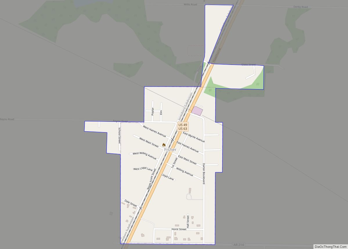
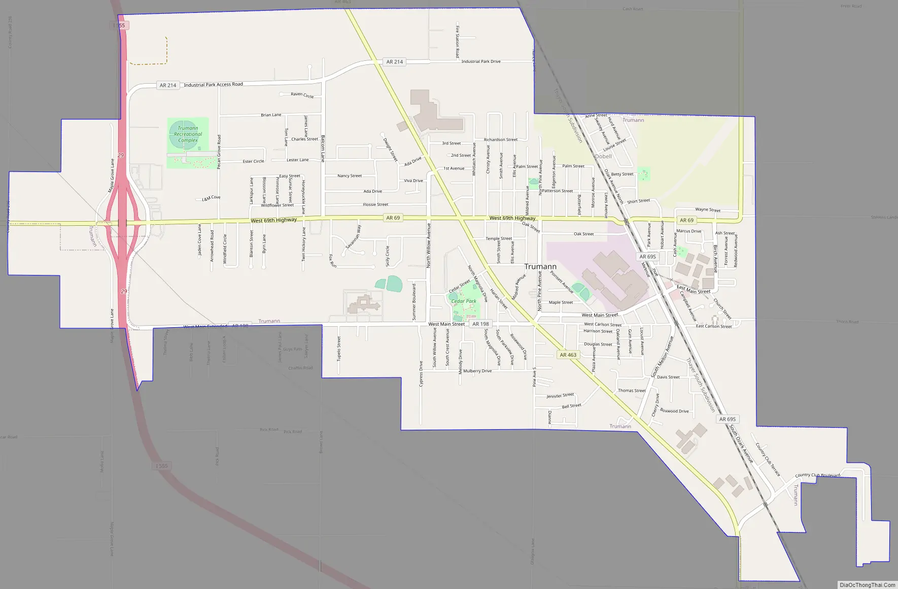
Trumann Road Map
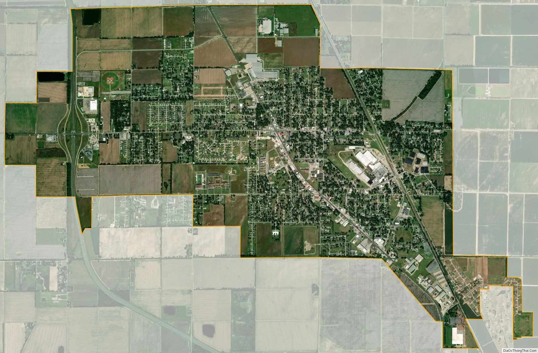
Trumann city Satellite Map
Geography
Trumann is located in the Arkansas Delta at 35°40′35″N 90°31′9″W / 35.67639°N 90.51917°W / 35.67639; -90.51917 (35.676313, -90.519183). According to the United States Census Bureau, the city has a total area of 4.8 square miles (12 km), all land.
Ecologically, Trumann is located within the St. Francis Lowlands ecoregion within the larger Mississippi Alluvial Plain. The St. Francis Lowlands are a flat region with fertile soil mostly covered with row crop agriculture today, though also containing sand blows and sunken lands remaining from the 1811–12 New Madrid earthquakes. Waterways have mostly been channelized, causing loss of aquatic and riparian wildlife habitat. The St. Francis Sunken Lands Wildlife Management Area, which preserves some of the bottomland hardwood forest typical of this ecoregion prior to development for row agriculture lies east of Trumann along the St. Francis River.
Interstate 555 runs through Trumann. U.S. Route 63 ran through Trumann prior to October 2021 before being rerouted.
See also
Map of Arkansas State and its subdivision:- Arkansas
- Ashley
- Baxter
- Benton
- Boone
- Bradley
- Calhoun
- Carroll
- Chicot
- Clark
- Clay
- Cleburne
- Cleveland
- Columbia
- Conway
- Craighead
- Crawford
- Crittenden
- Cross
- Dallas
- Desha
- Drew
- Faulkner
- Franklin
- Fulton
- Garland
- Grant
- Greene
- Hempstead
- Hot Spring
- Howard
- Independence
- Izard
- Jackson
- Jefferson
- Johnson
- Lafayette
- Lawrence
- Lee
- Lincoln
- Little River
- Logan
- Lonoke
- Madison
- Marion
- Miller
- Mississippi
- Monroe
- Montgomery
- Nevada
- Newton
- Ouachita
- Perry
- Phillips
- Pike
- Poinsett
- Polk
- Pope
- Prairie
- Pulaski
- Randolph
- Saint Francis
- Saline
- Scott
- Searcy
- Sebastian
- Sevier
- Sharp
- Stone
- Union
- Van Buren
- Washington
- White
- Woodruff
- Yell
- Alabama
- Alaska
- Arizona
- Arkansas
- California
- Colorado
- Connecticut
- Delaware
- District of Columbia
- Florida
- Georgia
- Hawaii
- Idaho
- Illinois
- Indiana
- Iowa
- Kansas
- Kentucky
- Louisiana
- Maine
- Maryland
- Massachusetts
- Michigan
- Minnesota
- Mississippi
- Missouri
- Montana
- Nebraska
- Nevada
- New Hampshire
- New Jersey
- New Mexico
- New York
- North Carolina
- North Dakota
- Ohio
- Oklahoma
- Oregon
- Pennsylvania
- Rhode Island
- South Carolina
- South Dakota
- Tennessee
- Texas
- Utah
- Vermont
- Virginia
- Washington
- West Virginia
- Wisconsin
- Wyoming