Wilson is a city in Mississippi County, Arkansas, United States. The community is located in the Arkansas Delta and is surrounded by fertile cropland historically used to produce cotton. Wilson started as a company town in 1886 by Robert E. Lee Wilson, who would build a cotton empire and run it from the city. The Wilson Company would become so successful that all of the town’s buildings were rebuilt in the Tudor Revival architectural style following Wilson’s son’s honeymoon to England in 1925. Wilson incorporated in 1959, becoming a town with public roads and municipal government. The extensive property holdings of the Lee Wilson and Company remained in the Wilson family until 2010. The community has seen a rapid decline in economic activity and population since the advent of mechanization on the farm, reducing the need for manual labor to produce cotton. The population was 766 at the 2020 census, down from 903 at the 2010 census.
| Name: | Wilson city |
|---|---|
| LSAD Code: | 25 |
| LSAD Description: | city (suffix) |
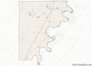
| State: | Arkansas |
| County: | Mississippi County |
| Incorporated: | March 19, 1959 |
| Elevation: | 236 ft (72 m) |
| Total Area: | 1.05 sq mi (2.73 km²) |
| Land Area: | 1.05 sq mi (2.71 km²) |
| Water Area: | 0.01 sq mi (0.02 km²) |
| Total Population: | 766 |
| Population Density: | 731.61/sq mi (282.44/km²) |
| ZIP code: | 72395 |
| Area code: | 870 |
| FIPS code: | 0575920 |
| GNISfeature ID: | 2405757 |
Online Interactive Map
Click on ![]() to view map in "full screen" mode.
to view map in "full screen" mode.
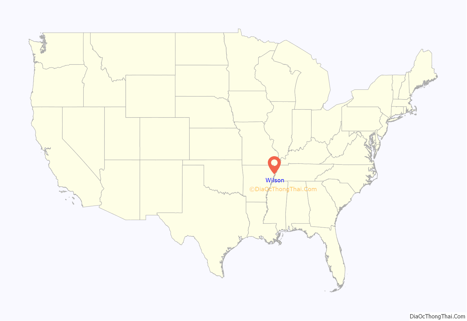
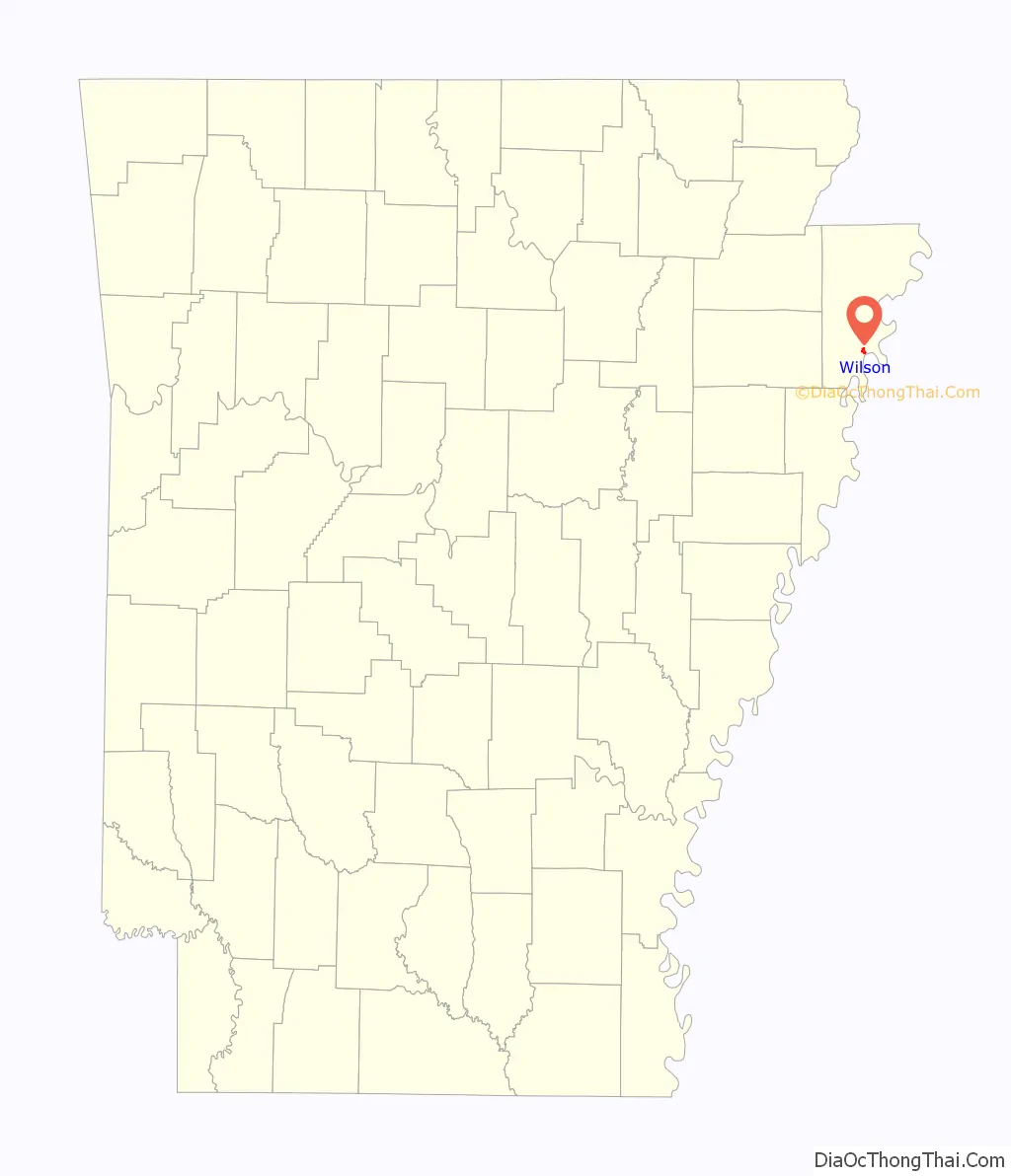
Wilson location map. Where is Wilson city?
History
Wilson started as a company town for Robert E. Lee Wilson’s nearby logging and sawmill operation founded in 1886. The village prospered when Wilson decided to use the cleared land for agriculture instead of selling it after logging. In 1900, a major archaeological find occurred near Wilson when James K. Hampson discovered the Island 35 Mastodon. All residents of Wilson except the postmaster and railroad employees had access to company doctors for $1.25 annually ($20.28 in 2022 dollars), a rarity in the poverty-stricken Arkansas delta. The company also employed people to work in Wilson’s basic service industries, such as drycleaning and automobile repair, keeping the standard of living high.
After Wilson’s son, Wilson Jr., and his wife returned from their England honeymoon enthralled with the Tudor style in 1925, all subsequent public buildings were built with Tudor architecture, including retrofits to all existing public structures. The town incorporated in 1959, selling the houses to the renters living in them and gaining access to tax income it was previously excluded from as a company entity. As technology advanced on the farm, fewer employees were needed and many moved from Wilson to seek other employment.
On January 27, 1921, the lynching of Henry Lowry happened near Wilson; some 500 people participated in the burning of a black sharecropper.
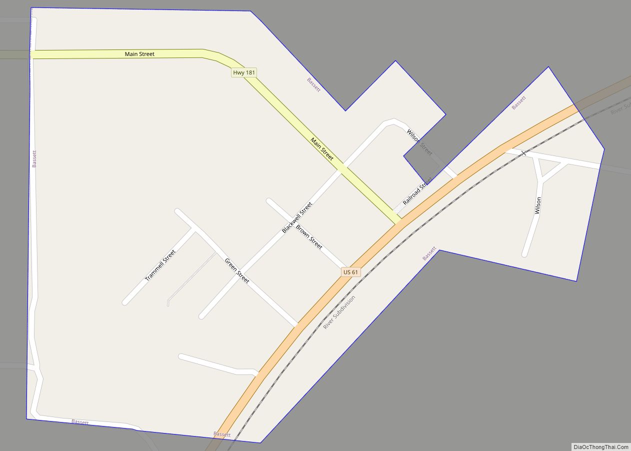
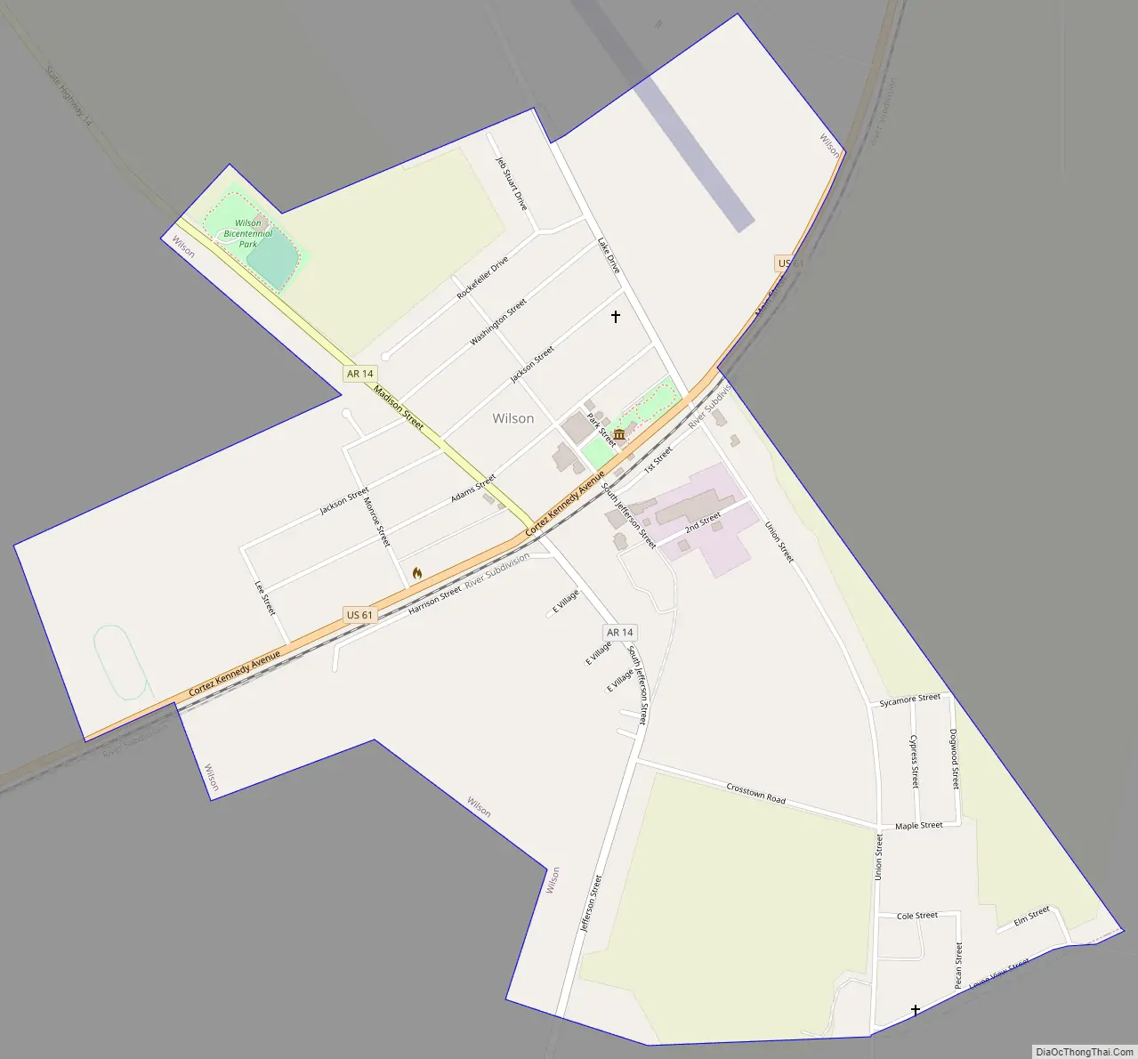
Wilson Road Map
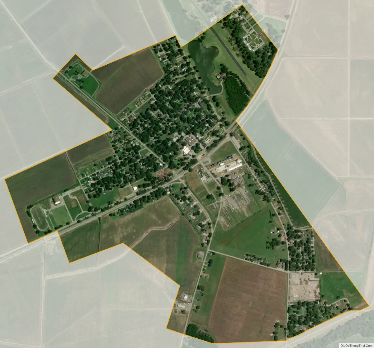
Wilson city Satellite Map
Geography
Wilson is in southern Mississippi County, in the Arkansas Delta region of the state. The area is dominated by the Mississippi River flood plains, trees and fields. Along and parallel to the Tennessee–Arkansas state line, the former course of the Mississippi River as it was before the 1811–12 New Madrid earthquakes is still visible in the landscape more than 200 years after the events. The former riverbed has shrunk to small side arms of the Mississippi which, dependent on the water level and precipitation, are still partly connected to the river. According to the United States Census Bureau, the town has a total area of 1.05 square miles (2.72 km), all land.
The town is located at the intersection of U.S. Route 61 (US 61) and Arkansas Highway 14. The segment of US 61 through Wilson has been designated as part of the Great River Road, a tourist route to display the heritage of communities along the Mississippi River. Highway 61 leads north 11 miles (18 km) to Osceola, the Mississippi county seat, and southwest 19 miles (31 km) to Turrell.
See also
Map of Arkansas State and its subdivision:- Arkansas
- Ashley
- Baxter
- Benton
- Boone
- Bradley
- Calhoun
- Carroll
- Chicot
- Clark
- Clay
- Cleburne
- Cleveland
- Columbia
- Conway
- Craighead
- Crawford
- Crittenden
- Cross
- Dallas
- Desha
- Drew
- Faulkner
- Franklin
- Fulton
- Garland
- Grant
- Greene
- Hempstead
- Hot Spring
- Howard
- Independence
- Izard
- Jackson
- Jefferson
- Johnson
- Lafayette
- Lawrence
- Lee
- Lincoln
- Little River
- Logan
- Lonoke
- Madison
- Marion
- Miller
- Mississippi
- Monroe
- Montgomery
- Nevada
- Newton
- Ouachita
- Perry
- Phillips
- Pike
- Poinsett
- Polk
- Pope
- Prairie
- Pulaski
- Randolph
- Saint Francis
- Saline
- Scott
- Searcy
- Sebastian
- Sevier
- Sharp
- Stone
- Union
- Van Buren
- Washington
- White
- Woodruff
- Yell
- Alabama
- Alaska
- Arizona
- Arkansas
- California
- Colorado
- Connecticut
- Delaware
- District of Columbia
- Florida
- Georgia
- Hawaii
- Idaho
- Illinois
- Indiana
- Iowa
- Kansas
- Kentucky
- Louisiana
- Maine
- Maryland
- Massachusetts
- Michigan
- Minnesota
- Mississippi
- Missouri
- Montana
- Nebraska
- Nevada
- New Hampshire
- New Jersey
- New Mexico
- New York
- North Carolina
- North Dakota
- Ohio
- Oklahoma
- Oregon
- Pennsylvania
- Rhode Island
- South Carolina
- South Dakota
- Tennessee
- Texas
- Utah
- Vermont
- Virginia
- Washington
- West Virginia
- Wisconsin
- Wyoming