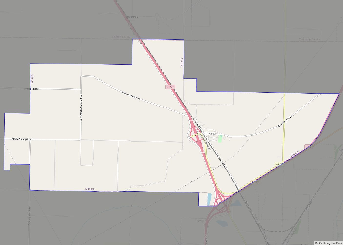
Turrell is a city in Crittenden County, Arkansas, United States. Per the 2020 census, the population was 517.
| Name: | Turrell city |
|---|---|
| LSAD Code: | 25 |
| LSAD Description: | city (suffix) |
| State: | Arkansas |
| County: | Crittenden County |
| Elevation: | 226 ft (69 m) |
| Total Area: | 5.36 sq mi (13.89 km²) |
| Land Area: | 5.35 sq mi (13.85 km²) |
| Water Area: | 0.02 sq mi (0.05 km²) |
| Total Population: | 517 |
| Population Density: | 96.71/sq mi (37.34/km²) |
| ZIP code: | 72384 |
| Area code: | 870 |
| FIPS code: | 0570430 |
| GNISfeature ID: | 0078600 |
Online Interactive Map
Click on ![]() to view map in "full screen" mode.
to view map in "full screen" mode.
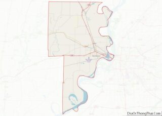
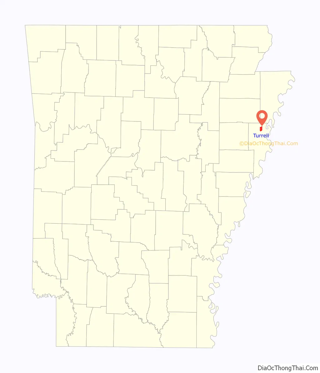
Turrell location map. Where is Turrell city?

Turrell Road Map

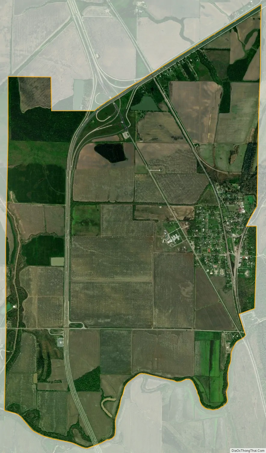
Turrell city Satellite Map
Geography
Turrell is located in northern Crittenden County at 35°22′35″N 90°15′52″W / 35.37639°N 90.26444°W / 35.37639; -90.26444 (35.376351, -90.264583). It is bordered by the town of Gilmore to the north. Turrell is located on Arkansas Highway 77, just southeast of the junction where Interstate 55 and U.S. Routes 61 merge. Prior to 2021, US 63 merged here too. Interstate 55 leads south 24 miles (39 km) to Memphis, Tennessee, and north 42 miles (68 km) to Blytheville, Arkansas, near the Missouri border. US 61/Interstate 555 leads northwest 45 miles (72 km) to Jonesboro.
The Burlington Northern-Santa Fe Railroad runs through Turrell. Two major lines of the Burlington Northern-Santa Fe Springfield Division converge at Turrell (the Thayer South and the River subdivisions), which funnel trains from the Springfield, Missouri, yard and the St. Louis yard, respectively, to Turrell. Once these two lines converge, the trackage then goes to Memphis. The railroad was formerly the St. Louis–San Francisco Railway (better known as the Frisco). The Frisco Railroad was absorbed by the Burlington Northern in 1980.
According to the United States Census Bureau, Turrell has a total area of 5.4 square miles (14.0 km), of which 0.02 square miles (0.05 km), or 0.33%, is water.
See also
Map of Arkansas State and its subdivision:- Arkansas
- Ashley
- Baxter
- Benton
- Boone
- Bradley
- Calhoun
- Carroll
- Chicot
- Clark
- Clay
- Cleburne
- Cleveland
- Columbia
- Conway
- Craighead
- Crawford
- Crittenden
- Cross
- Dallas
- Desha
- Drew
- Faulkner
- Franklin
- Fulton
- Garland
- Grant
- Greene
- Hempstead
- Hot Spring
- Howard
- Independence
- Izard
- Jackson
- Jefferson
- Johnson
- Lafayette
- Lawrence
- Lee
- Lincoln
- Little River
- Logan
- Lonoke
- Madison
- Marion
- Miller
- Mississippi
- Monroe
- Montgomery
- Nevada
- Newton
- Ouachita
- Perry
- Phillips
- Pike
- Poinsett
- Polk
- Pope
- Prairie
- Pulaski
- Randolph
- Saint Francis
- Saline
- Scott
- Searcy
- Sebastian
- Sevier
- Sharp
- Stone
- Union
- Van Buren
- Washington
- White
- Woodruff
- Yell
- Alabama
- Alaska
- Arizona
- Arkansas
- California
- Colorado
- Connecticut
- Delaware
- District of Columbia
- Florida
- Georgia
- Hawaii
- Idaho
- Illinois
- Indiana
- Iowa
- Kansas
- Kentucky
- Louisiana
- Maine
- Maryland
- Massachusetts
- Michigan
- Minnesota
- Mississippi
- Missouri
- Montana
- Nebraska
- Nevada
- New Hampshire
- New Jersey
- New Mexico
- New York
- North Carolina
- North Dakota
- Ohio
- Oklahoma
- Oregon
- Pennsylvania
- Rhode Island
- South Carolina
- South Dakota
- Tennessee
- Texas
- Utah
- Vermont
- Virginia
- Washington
- West Virginia
- Wisconsin
- Wyoming