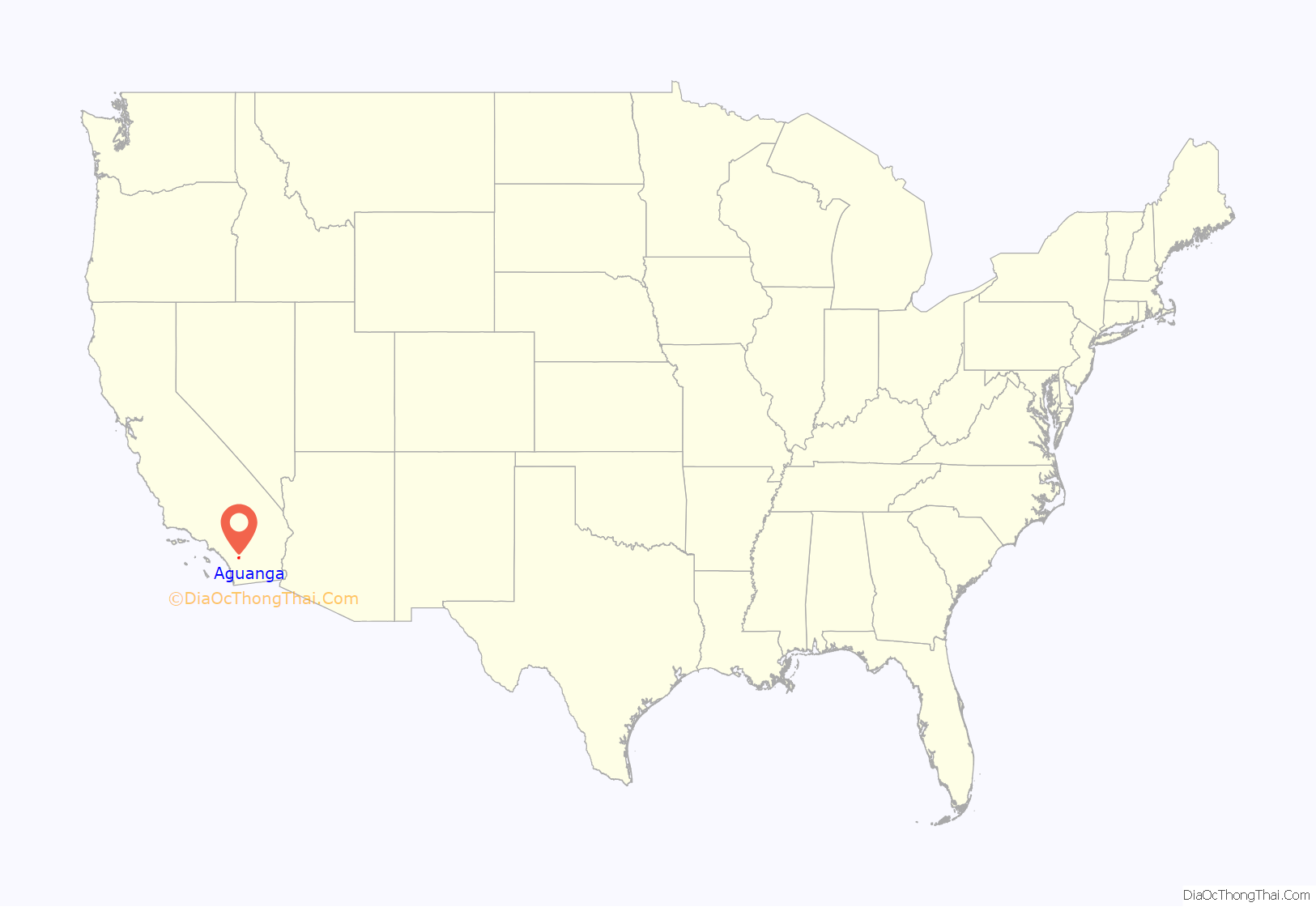
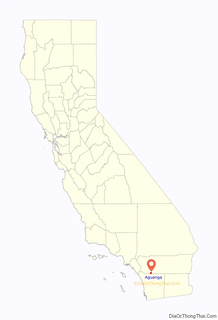
Aguanga (/əˈwɑːŋ.ɡə/; Luiseño: Awáanga, meaning “dog place”) is a census-designated place located within the Inland Empire, Riverside County, California. It is located about 18 miles (29 km) east of Temecula and 22 miles (35 km) south-southeast of Hemet. Aguanga lies at an elevation of 1955 feet (596 m). As of the 2010 census, it had a population of 1,028.
| Name: | Aguanga CDP |
|---|---|
| LSAD Code: | 57 |
| LSAD Description: | CDP (suffix) |
| State: | California |
| County: | Riverside County |
| Elevation: | 1,955 ft (596 m) |
| Total Area: | 13.60 sq mi (35.22 km²) |
| Land Area: | 13.60 sq mi (35.22 km²) |
| Water Area: | 0.00 sq mi (0.00 km²) 0% |
| Total Population: | 989 |
| Population Density: | 72.73/sq mi (28.08/km²) |
| ZIP code: | 92536 |
| Area code: | 951 |
| FIPS code: | 0600464 |
Online Interactive Map
Click on ![]() to view map in "full screen" mode.
to view map in "full screen" mode.
Aguanga location map. Where is Aguanga CDP?
History
The town gets its name from a former village of the Native village called awáanga, meaning ‘dog place’. The Butterfield Overland Mail established a station 1.7 miles to the west of the current Post Office in 1858. It was at first called Tejungo Station and was located 14 miles east of Temecula Station and 12 miles northwest of Oak Grove Stage Station. The wooden building was located in a grove of trees a few hundred feet from the stage road. Soon, however, it became known as Aguanga Station after the name of the nearby Luiseño village.
The November 7, 1861, report of Lieut. Col. Joseph R. West, mentioned the abandoned station location was then called Giftaler’s Ranch, after its German owner Joseph Giftaler, in a journal of his unit’s march to Fort Yuma on the old Butterfield Overland Mail route. In a later Civil War itinerary of the route, it is referred to as the “Dutchman’s”. In 1863, Camp Giftaler Ranch was established at the ranch as a post along the march route of troops to Arizona Territory by the Union Army.
In 1864, Giftaler’s Ranch was purchased by Jacob Bergman, also a German immigrant, stagecoach driver and Union Army veteran, who operated the Bergman Ranch there for many years until his death on September 13, 1894. After the Civil War, he ran Bergman’s Stage Station there for the Banning and Tomlinson Stage lines for many years. During the Julian Gold Rush, he ran the Guahonga post office there from July 27, 1870, to September 13, 1871. The post office for the area was then moved to Oak Grove until the Bergman post office was opened in 1894, but its name was changed to Aguanga in 1901.
Today the station site is on the Twin Creek Stage Stop Ranch, on Allmouth Road, found just east of the Stagecoach Inn at 43851 Highway 79. The ruins of the old wooden station building and ranch house is located among a grove of trees, at the foot of the west end of the hill at the bottom of the meadow, along the right fork of Allmouth Road. The small, fenced-in Bergman Family Cemetery and the Jacob Bergman Marker are found on Caprice Road, 200 feet from the highway, just across the highway from the entrance to the ranch and a short distance to the east.
2020 shooting
On September 7, 2020, deputies with the Riverside County Sheriff’s Department responded to reports of an assault with a deadly weapon at a residence along Route 371. Upon responding, they found a woman suffering gunshot wounds, who eventually died from her injuries after being rushed to a hospital. The deputies then discovered six additional victims inside the home, all of whom were dead from gunshots. Authorities announced the shooting was an isolated incident but no suspects were in custody and remain at large. The residence where the shooting occurred was reportedly being used to grow illegal marijuana. As of October 28, authorities have not found a motive or any viable suspects. The shooting is the deadliest in Riverside County’s history.
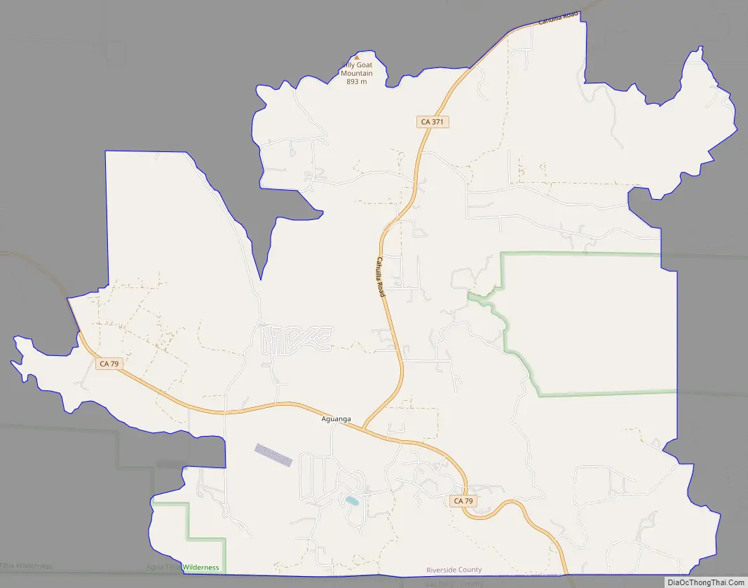
Aguanga Road Map
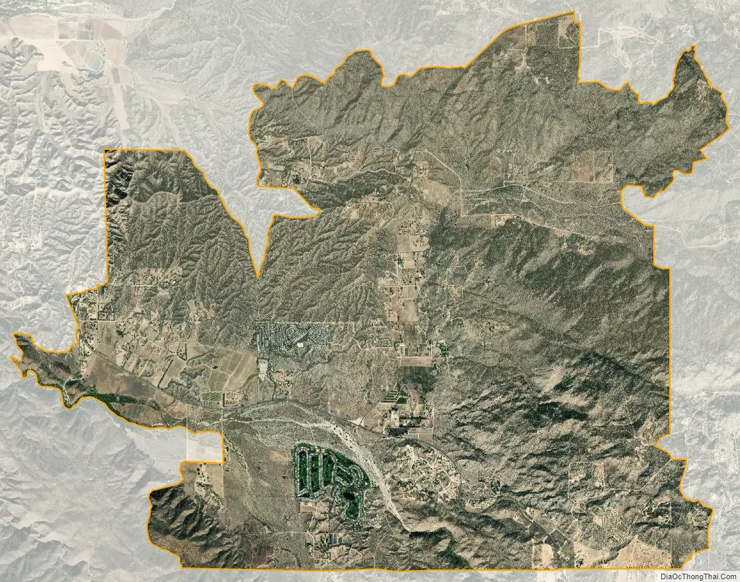
Aguanga city Satellite Map
Geography
According to the United States Census Bureau, the CDP covers an area of 13.6 square miles (35.2 km), all of it land.
The community of Aguanga lies near the intersection of State Route 79 (SR 79) and State Route 371 (Cahuilla Road), along the historic Butterfield Overland Mail stage route. The area lies at about 1,940 feet (590 m) above mean sea level (AMSL) and is north of the Cleveland National Forest. The straight-line distance to Palomar Observatory is 5.9 miles (9.5 km) south, and the observatory site is about 3,500 feet (1,100 m) higher than the community. The town is also home to Cottonwood Elementary School (K–8) operated by the Hemet Valley Unified School District. The largest nearby city is Temecula, along the Interstate 15 corridor, about 17 miles (27 km) west of Aguanga on SR 79.
This area is in a canyon beside Temecula Creek near Pechanga tribal lands and the San Diego County line. Official U.S. Geological Survey NAD27 coordinates for the community are 33°26′34″N 116°51′51″W / 33.44278°N 116.86417°W / 33.44278; -116.86417. It is within area code 951 and shares its ZIP Code, 92536, with the San Diego County community of Holcomb Village.
Climate
According to the Köppen climate classification system, Aguanga has a hot-summer Mediterranean climate, abbreviated “Csa” on climate maps.
See also
Map of California State and its subdivision:- Alameda
- Alpine
- Amador
- Butte
- Calaveras
- Colusa
- Contra Costa
- Del Norte
- El Dorado
- Fresno
- Glenn
- Humboldt
- Imperial
- Inyo
- Kern
- Kings
- Lake
- Lassen
- Los Angeles
- Madera
- Marin
- Mariposa
- Mendocino
- Merced
- Modoc
- Mono
- Monterey
- Napa
- Nevada
- Orange
- Placer
- Plumas
- Riverside
- Sacramento
- San Benito
- San Bernardino
- San Diego
- San Francisco
- San Joaquin
- San Luis Obispo
- San Mateo
- Santa Barbara
- Santa Clara
- Santa Cruz
- Shasta
- Sierra
- Siskiyou
- Solano
- Sonoma
- Stanislaus
- Sutter
- Tehama
- Trinity
- Tulare
- Tuolumne
- Ventura
- Yolo
- Yuba
- Alabama
- Alaska
- Arizona
- Arkansas
- California
- Colorado
- Connecticut
- Delaware
- District of Columbia
- Florida
- Georgia
- Hawaii
- Idaho
- Illinois
- Indiana
- Iowa
- Kansas
- Kentucky
- Louisiana
- Maine
- Maryland
- Massachusetts
- Michigan
- Minnesota
- Mississippi
- Missouri
- Montana
- Nebraska
- Nevada
- New Hampshire
- New Jersey
- New Mexico
- New York
- North Carolina
- North Dakota
- Ohio
- Oklahoma
- Oregon
- Pennsylvania
- Rhode Island
- South Carolina
- South Dakota
- Tennessee
- Texas
- Utah
- Vermont
- Virginia
- Washington
- West Virginia
- Wisconsin
- Wyoming


