Allensworth is an unincorporated community in Tulare County, California. Established by Allen Allensworth in 1908, the town was the first in California to be founded, financed, and governed by African-Americans.
The original townsite is designated as Colonel Allensworth State Historic Park. The 2020 United States census reported Allensworth’s population was 531, up from 471 at the 2010 census. For statistical purposes, the United States Census Bureau has defined Allensworth as a census-designated place (CDP).
Allensworth sits at an elevation of 213 feet (65 m), the same elevation as the huge and historically important Tulare Lake shore when it was full. The community is located in the ZIP Code 93219 and in the area code 661.
| Name: | Allensworth CDP |
|---|---|
| LSAD Code: | 57 |
| LSAD Description: | CDP (suffix) |
| State: | California |
| County: | Tulare County |
| Founded: | 1908 |
| Elevation: | 213 ft (65 m) |
| Total Area: | 3.10 sq mi (8.04 km²) |
| Land Area: | 3.10 sq mi (8.04 km²) |
| Water Area: | 0.00 sq mi (0.00 km²) 0% |
| Total Population: | 531 |
| Population Density: | 171.18/sq mi (66.09/km²) |
| ZIP code: | 93219 |
| Area code: | 661 |
| FIPS code: | 0601010 |
| GNISfeature ID: | 2585402 |
Online Interactive Map
Click on ![]() to view map in "full screen" mode.
to view map in "full screen" mode.
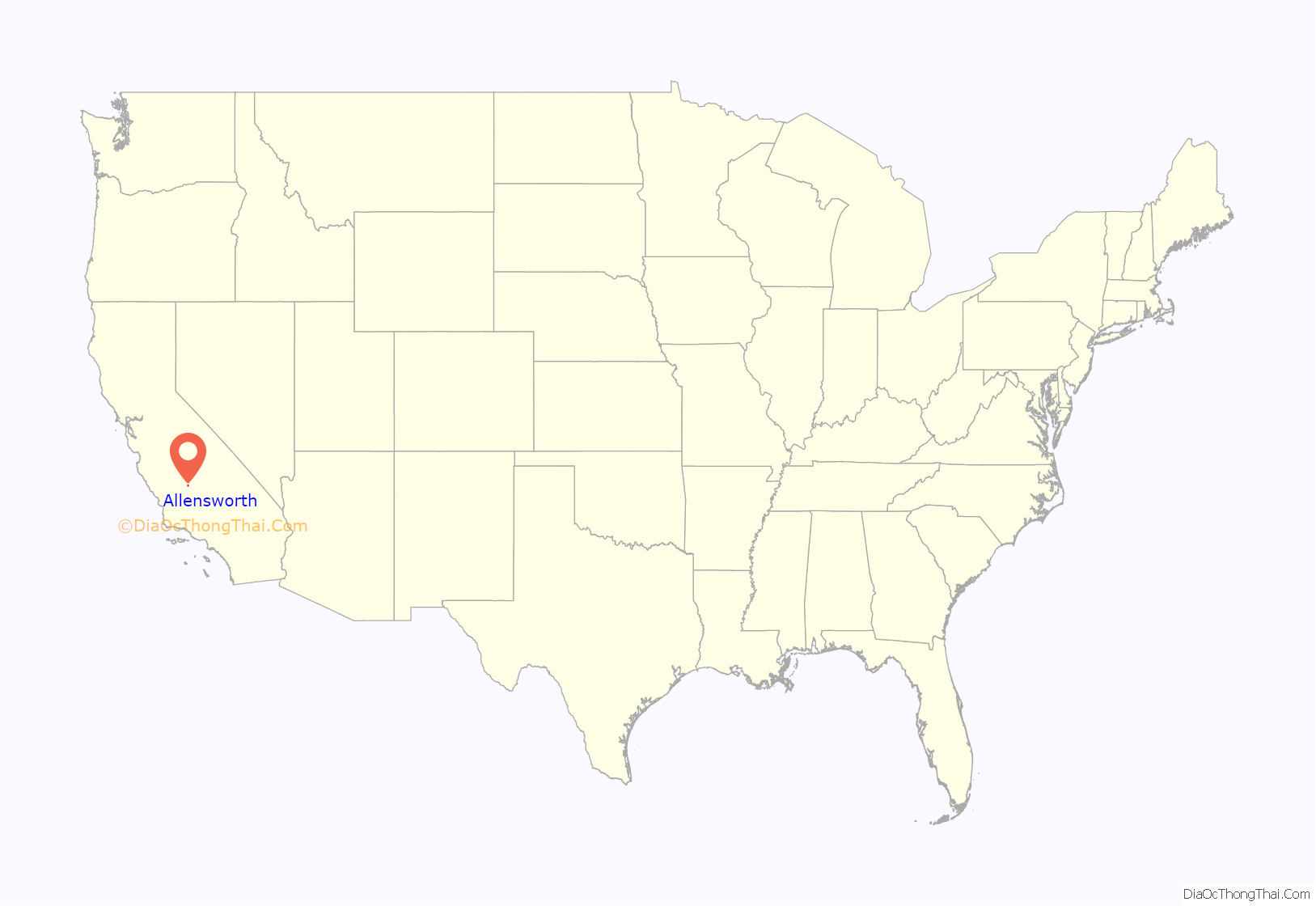
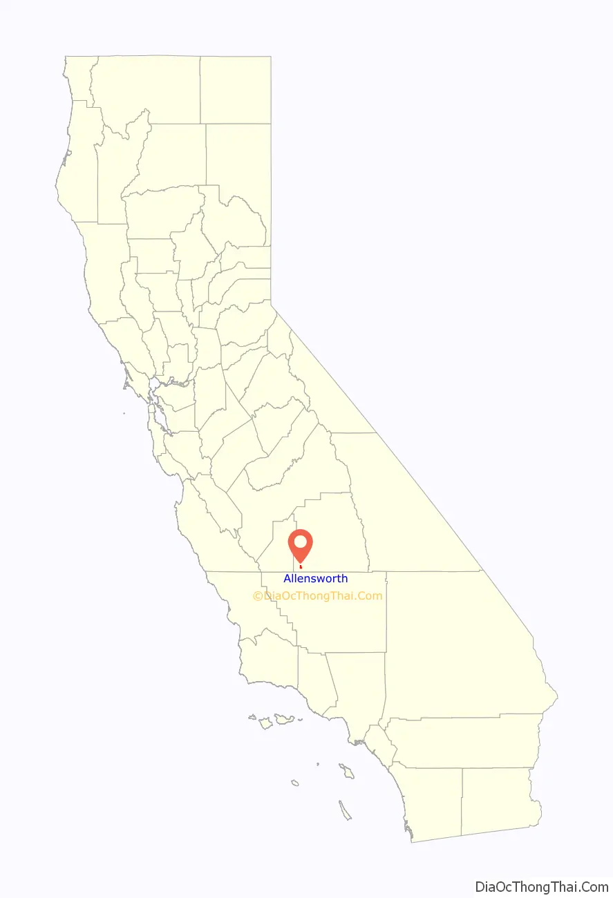
Allensworth location map. Where is Allensworth CDP?
History
On June 30, 1908, clergyman Colonel Allen Allensworth and Denison University graduate Professor William Alexander Payne established the California Colony and Home Promoting Association. Allensworth and Payne were the chief officers, with the other constituents being miner John W. Palmer; minister William H. Peck; and real estate agent Harry A. Mitchell (all of whom were Black men). The Association purchased 20 acres of land from the Pacific Farming Company with the goal of establishing a town for Black soldiers. The land was situated at the then-extant Santa Fe rail line stop, titled “Solita.” The land was divided into individual parcels, forming “a colony of orderly and industrious African Americans who could control their own destiny.”
Allensworth’s reputation drew many from all over the country to the town, causing some to buy property sight-unseen in order to support the efforts. In the early 20th century, the area boasted a great boom and hosted California’s first African American school district by 1910.
The town was especially reported upon in 1912 to 1915, the period considered its apex as a thriving community. Its growth was reported in The New York Age, the California Eagle (which emphasized that “there is not a single white person having anything to do with the affairs of the colony”) and the Los Angeles Times, which labelled Allensworth as the “ideal Negro settlement.”
By 1914, the town had established a schoolhouse, thereby becoming California’s first African American school district. It also had a courthouse, a Baptist church, a hotel, and a Tulare County library.
However, multiple complications occurred in 1914. The Santa Fe rail system moved its railroad stop from Allenstown to Alpaugh. In September 1914, Colonel Allensworth died in Monrovia, California, where he was struck by a motorcycle while crossing the street. The town experienced extreme losses, coupled with severe drought and decreased crop yields. Despite this, the 1915 voting registration showed “farmers, storekeepers, carpenters, nurses and more, all suggesting that the colony’s business and industrial output was prodigious.”
Many residents left the area following World War I.
The California Colony and Home Promoting Association’s 1929 blueprint of Allensworth is available for viewership online via the California State Archives.
The town of Allensworth was scheduled for demolition in 1966 when arsenic was found in the water supply.
Legacy
The town was memorialized as a state park in 1974, and hosts seasonal events to preserve its history, which garner “thousands of visitors” from around the state. The area around the park is inhabited. In 1976, the Colonel Allensworth Historic Park was established, a process which was started by Cornelius Ed Pope. Historic buildings from 1908-1918 have been restored in the town center.
A number of the restored buildings are at the center of the 2022 documentary film Allensworth by James Benning. The film had its U.S. premiere at the 2022 Denver Film Festival and its European premiere at the 2023 Berlinale.
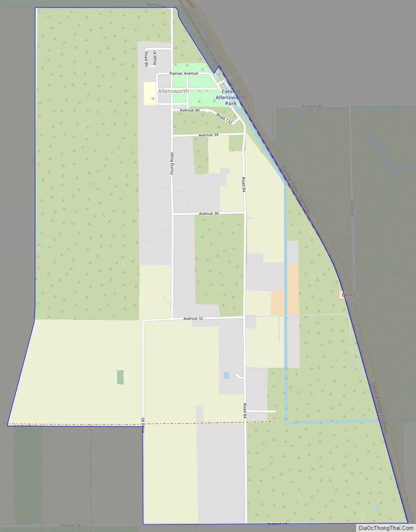
Allensworth Road Map
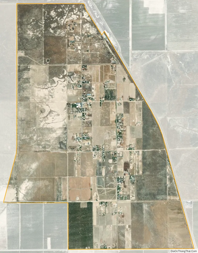
Allensworth city Satellite Map
Geography
Allensworth marks the eastern high-water shoreline of Tulare Lake, (once the largest U.S. lake outside the Great Lakes,) which supported one of the largest Indian populations on the continent, herds of elk, millions of water fowl, as well as a commercial fishery and ferry service. Other townsites located on this historic shoreline include Lemoore on its northern tip, and Kettleman City on the western shore, while nearby Alpaugh is on the eastern end of a long, sandy ridge at elevation 210 ft. that was once called Hog Island. Due to diversions of the natural waterways since the mid to late 19th century, only a tiny remnant of Tulare Lake now remains. The last time Tulare Lake was full and overflowed its spillway (near Lemoore) was 1878.
Just north of Allensworth is the Pixley National Wildlife Refuge, 6,833-acre (27.65 km) grassland and wetland habitats operated by the Department of the Interior, US Fish and Wildlife Service. Of great interest, thousands of sandhill cranes (Grus canadensis), use this refuge each winter from November through March. Red-tailed hawks (Buteo jamaicensis), are among the 141 type of birds that can be seen here. Burrowing owls are sometimes present. Also present are Pacific pond turtles, once an important part of Tulare Lake’s fishery trade with San Francisco.
Adjacent to the town is Allensworth Ecological Reserve. The endangered San Joaquin kit fox (Vulpes macrotis mutica) can be found in this area.
According to the United States Census Bureau, the CDP covers an area of 3.1 square miles (8.0 km), all of it land.
See also
Map of California State and its subdivision:- Alameda
- Alpine
- Amador
- Butte
- Calaveras
- Colusa
- Contra Costa
- Del Norte
- El Dorado
- Fresno
- Glenn
- Humboldt
- Imperial
- Inyo
- Kern
- Kings
- Lake
- Lassen
- Los Angeles
- Madera
- Marin
- Mariposa
- Mendocino
- Merced
- Modoc
- Mono
- Monterey
- Napa
- Nevada
- Orange
- Placer
- Plumas
- Riverside
- Sacramento
- San Benito
- San Bernardino
- San Diego
- San Francisco
- San Joaquin
- San Luis Obispo
- San Mateo
- Santa Barbara
- Santa Clara
- Santa Cruz
- Shasta
- Sierra
- Siskiyou
- Solano
- Sonoma
- Stanislaus
- Sutter
- Tehama
- Trinity
- Tulare
- Tuolumne
- Ventura
- Yolo
- Yuba
- Alabama
- Alaska
- Arizona
- Arkansas
- California
- Colorado
- Connecticut
- Delaware
- District of Columbia
- Florida
- Georgia
- Hawaii
- Idaho
- Illinois
- Indiana
- Iowa
- Kansas
- Kentucky
- Louisiana
- Maine
- Maryland
- Massachusetts
- Michigan
- Minnesota
- Mississippi
- Missouri
- Montana
- Nebraska
- Nevada
- New Hampshire
- New Jersey
- New Mexico
- New York
- North Carolina
- North Dakota
- Ohio
- Oklahoma
- Oregon
- Pennsylvania
- Rhode Island
- South Carolina
- South Dakota
- Tennessee
- Texas
- Utah
- Vermont
- Virginia
- Washington
- West Virginia
- Wisconsin
- Wyoming


