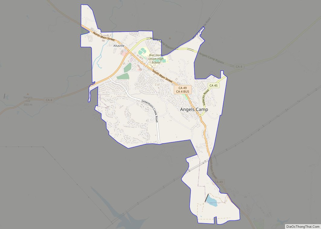
Angels Camp, also known as City of Angels and formerly Angel’s Camp, Angels, Angels City, Carson’s Creek and Clearlake, is the only incorporated city in Calaveras County, California, United States. The population was 3,836 at the 2010 census, up from 3,004 at the 2000 census. It lies at an elevation of 1378 feet (420 m).
Mark Twain based his short story “The Celebrated Jumping Frog of Calaveras County” on a story he claimed to have heard at the Angels Hotel in 1865. The event is commemorated with a Jumping Frog Jubilee each May at the Calaveras County Fairgrounds, just east of the city. Because of this, Angels Camp is sometimes referred to as “Frogtown.”
The city is California Historical Landmark #287.
| Name: | Angels city |
|---|---|
| LSAD Code: | 25 |
| LSAD Description: | city (suffix) |
| State: | California |
| County: | Calaveras County |
| Incorporated: | January 24, 1912 |
| Elevation: | 1,378 ft (420 m) |
| Total Area: | 3.64 sq mi (9.42 km²) |
| Land Area: | 3.63 sq mi (9.41 km²) |
| Water Area: | 0.01 sq mi (0.01 km²) 0.25% |
| Total Population: | 3,667 |
| Population Density: | 1,009.64/sq mi (389.78/km²) |
| ZIP code: | 95222 |
| Area code: | 209 |
| FIPS code: | 0602112 |
| Website: | angelscamp.gov |
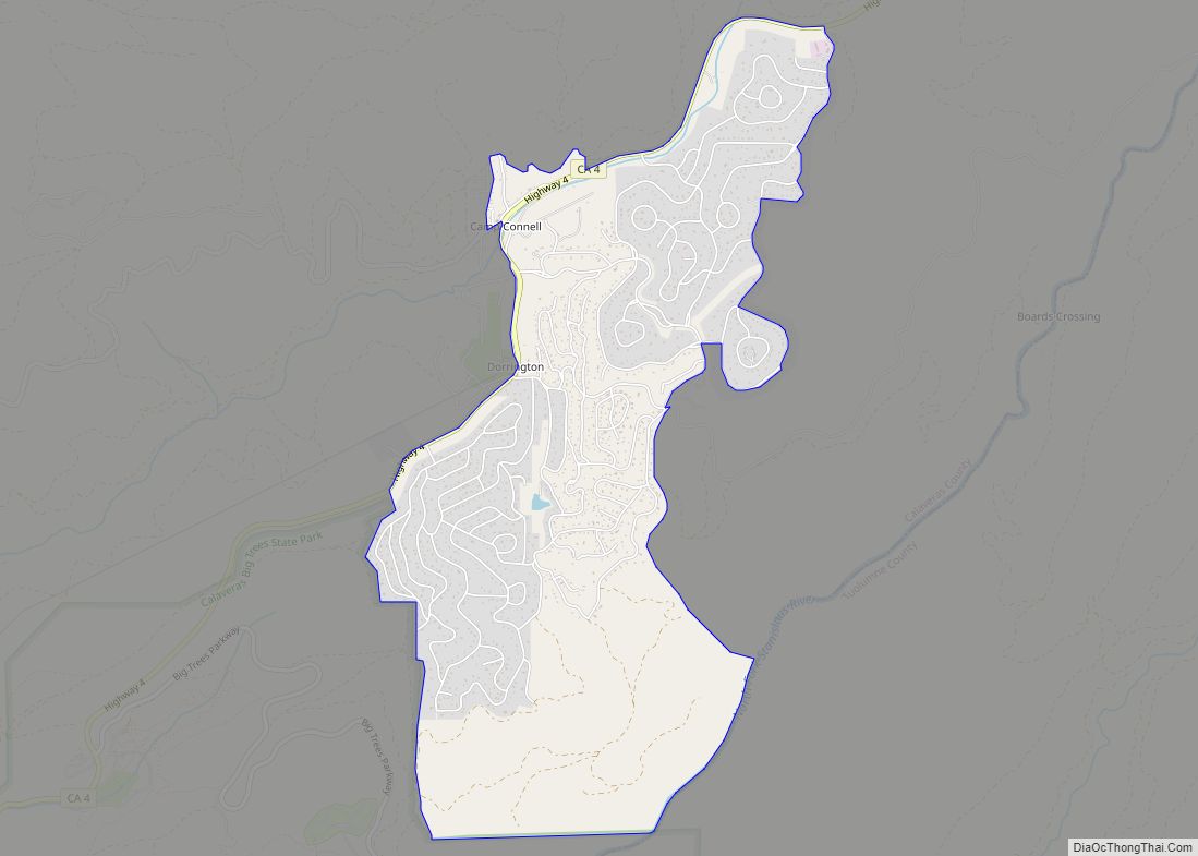
Online Interactive Map
Click on ![]() to view map in "full screen" mode.
to view map in "full screen" mode.
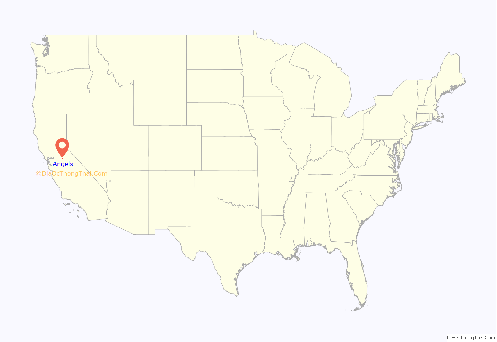
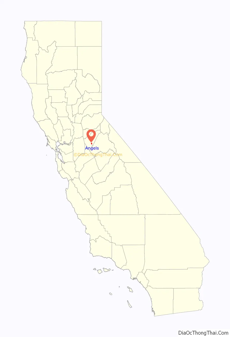
Angels location map. Where is Angels city?
History
Henry Angell, a native of Rhode Island, set up a tent store on the banks of the creek. The placers around his camp were productive but gave out after a few years, and the population began to dwindle until gold-bearing quartz veins were discovered in the town, which brought people back. Those mines operated for the next few decades, producing more than $20 million worth of gold, processed by stamp mills in town. It was said that when the last mill finally ceased operations, the townspeople couldn’t sleep, the silence was so loud.
The first post office was established in 1851 (and called Carson’s Creek). It was renamed along with the town in 1853. The city was incorporated under the name of “Angels” in 1912.
Angels Road Map
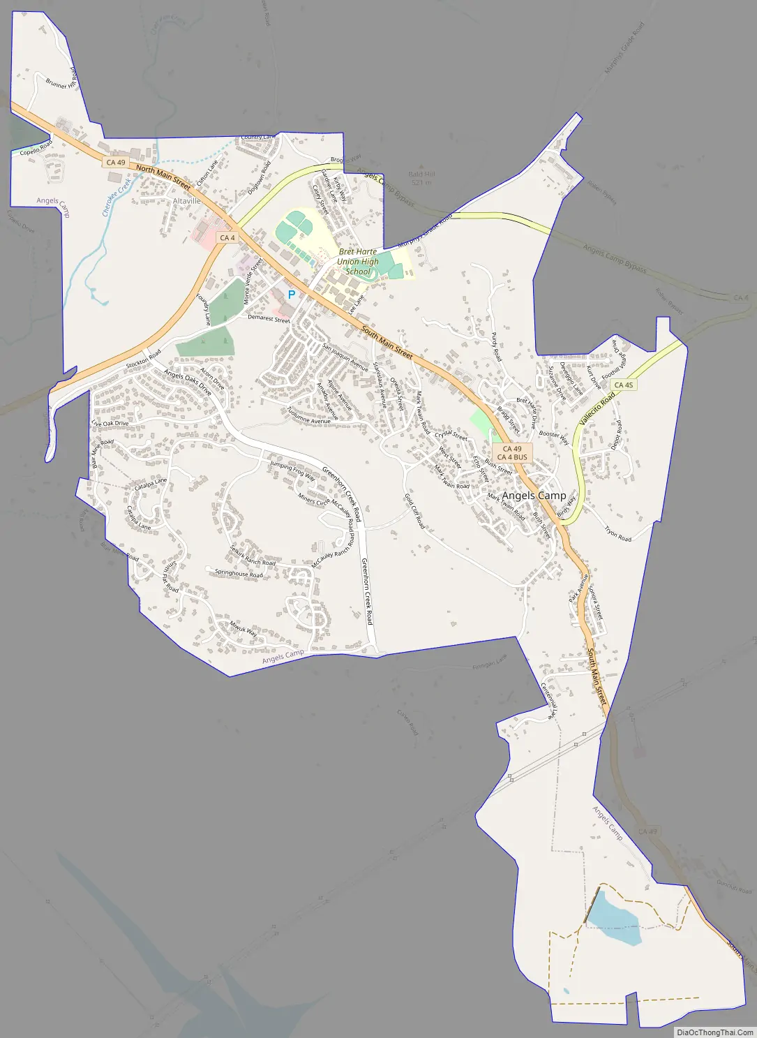
Angels city Satellite Map
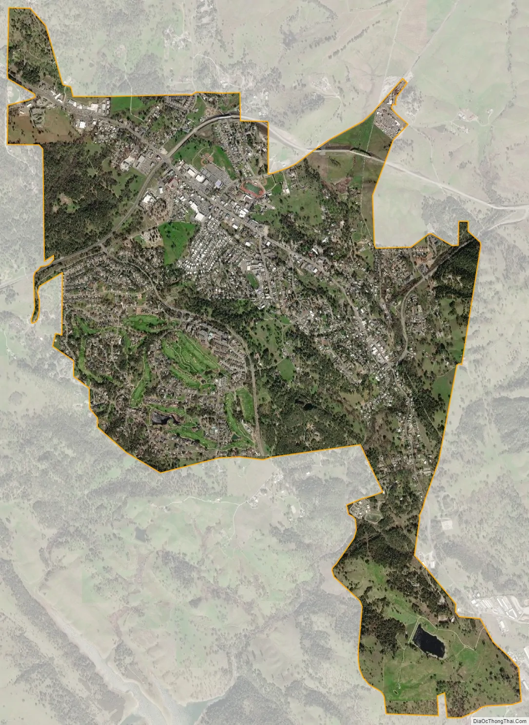
Geography
Angels Camp is located at 38°04′06″N 120°32′23″W / 38.06833°N 120.53972°W / 38.06833; -120.53972.
According to the United States Census Bureau, the city has a total area of 3.6 square miles (9.3 km), all land.
Angels Camp is about 1,400 feet (430 m) above sea level, with Angels Creek flowing through the middle of town.
Climate
According to the Köppen Climate Classification system, Angels Camp has a hot-summer Mediterranean climate, abbreviated “Csa” on climate maps.
See also
Map of California State and its subdivision:- Alameda
- Alpine
- Amador
- Butte
- Calaveras
- Colusa
- Contra Costa
- Del Norte
- El Dorado
- Fresno
- Glenn
- Humboldt
- Imperial
- Inyo
- Kern
- Kings
- Lake
- Lassen
- Los Angeles
- Madera
- Marin
- Mariposa
- Mendocino
- Merced
- Modoc
- Mono
- Monterey
- Napa
- Nevada
- Orange
- Placer
- Plumas
- Riverside
- Sacramento
- San Benito
- San Bernardino
- San Diego
- San Francisco
- San Joaquin
- San Luis Obispo
- San Mateo
- Santa Barbara
- Santa Clara
- Santa Cruz
- Shasta
- Sierra
- Siskiyou
- Solano
- Sonoma
- Stanislaus
- Sutter
- Tehama
- Trinity
- Tulare
- Tuolumne
- Ventura
- Yolo
- Yuba
- Alabama
- Alaska
- Arizona
- Arkansas
- California
- Colorado
- Connecticut
- Delaware
- District of Columbia
- Florida
- Georgia
- Hawaii
- Idaho
- Illinois
- Indiana
- Iowa
- Kansas
- Kentucky
- Louisiana
- Maine
- Maryland
- Massachusetts
- Michigan
- Minnesota
- Mississippi
- Missouri
- Montana
- Nebraska
- Nevada
- New Hampshire
- New Jersey
- New Mexico
- New York
- North Carolina
- North Dakota
- Ohio
- Oklahoma
- Oregon
- Pennsylvania
- Rhode Island
- South Carolina
- South Dakota
- Tennessee
- Texas
- Utah
- Vermont
- Virginia
- Washington
- West Virginia
- Wisconsin
- Wyoming