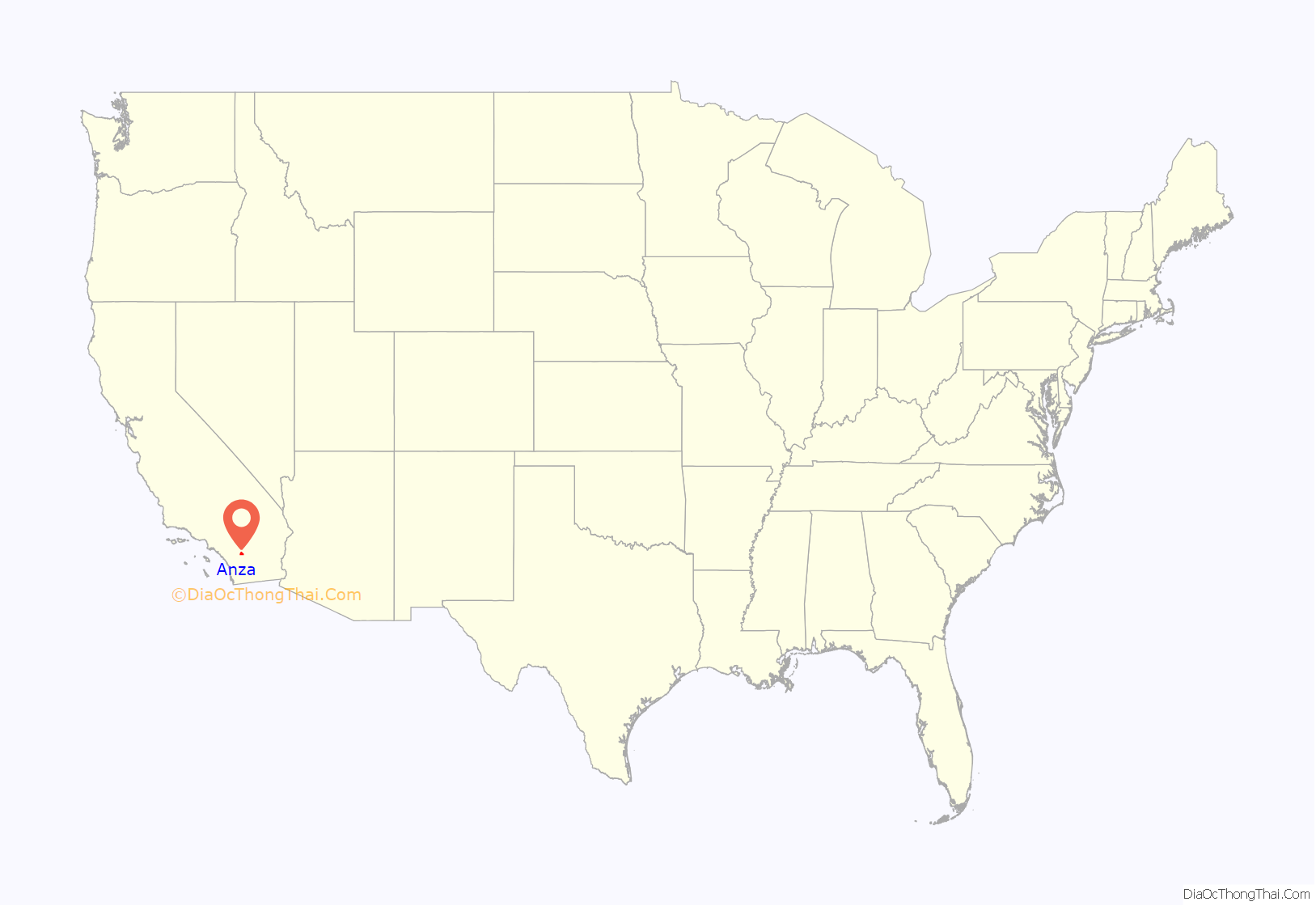
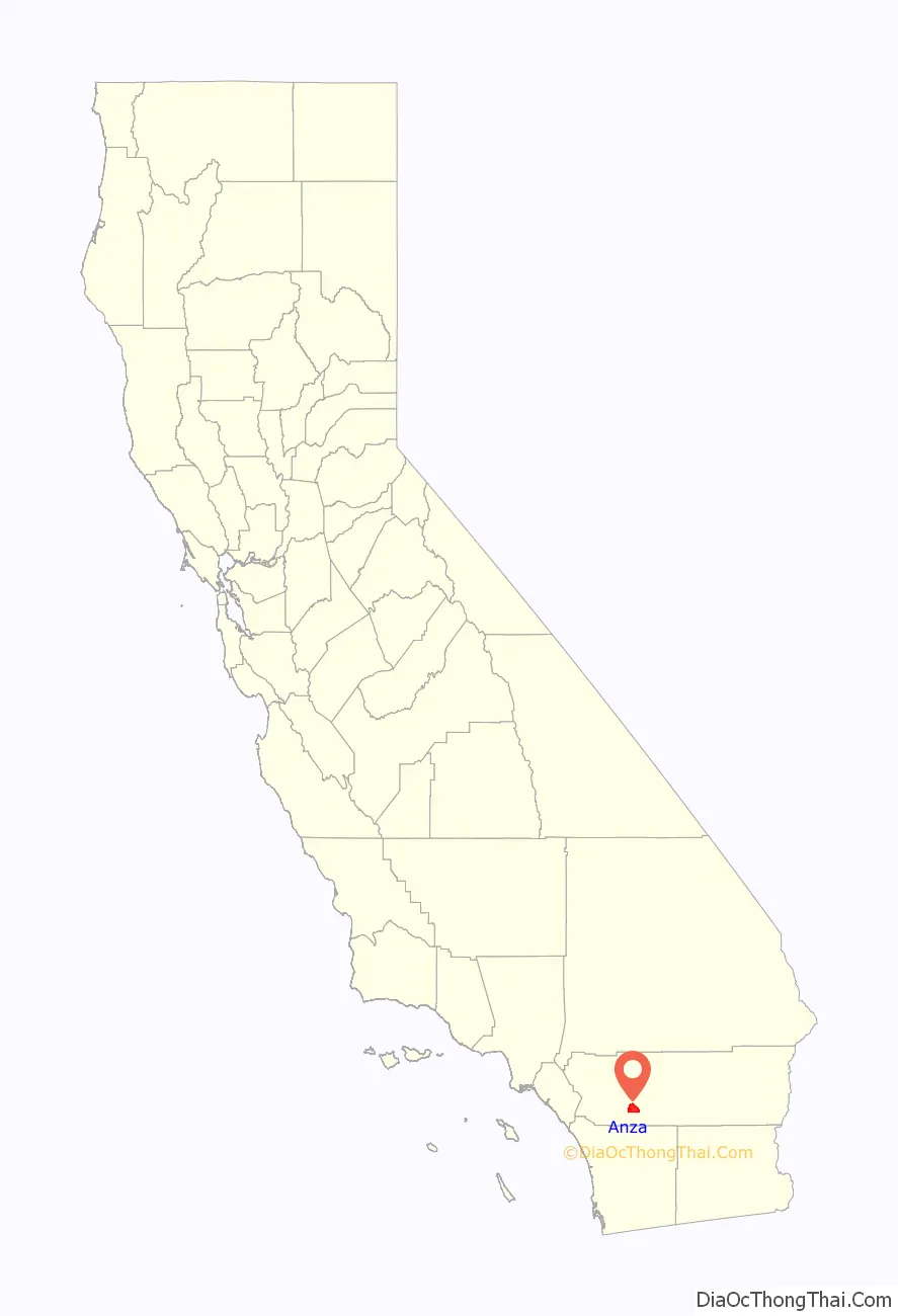
Anza is a census-designated place located in southern Riverside County, California, in the Anza Valley, a semi-arid region at a mean elevation of 3,921 feet (1,195 m) above sea level. It is located 13 miles (21 km) south of Idyllwild, 32 miles (51 km) east-northeast of Temecula, 40 miles (64 km) southwest of Palm Springs, and 90 miles (140 km) northeast of San Diego, being traversed by State Route 371. Anza is on the Pacific Crest Trail. The population was 3,075 at the 2020 census.
Locally, Anza and several other mountain communities (including Garner Valley, Idyllwild, Pinyon Pines and Aguanga) are collectively referred to as “the Hill.”
The ZIP code is 92539, and the community is inside area code 951.
| Name: | Anza CDP |
|---|---|
| LSAD Code: | 57 |
| LSAD Description: | CDP (suffix) |
| State: | California |
| County: | Riverside County |
| Elevation: | 3,921 ft (1,195 m) |
| Total Area: | 27.68 sq mi (71.68 km²) |
| Land Area: | 27.59 sq mi (71.47 km²) |
| Water Area: | 0.08 sq mi (0.21 km²) 0.30% |
| Total Population: | 3,075 |
| Population Density: | 111.43/sq mi (43.02/km²) |
| ZIP code: | 92539 |
| Area code: | 951 |
| FIPS code: | 0602294 |
| GNISfeature ID: | 269555 |
| Website: | anza-valley.com |
Online Interactive Map
Click on ![]() to view map in "full screen" mode.
to view map in "full screen" mode.
Anza location map. Where is Anza CDP?
History
It is estimated that the Cahuilla aboriginal tribes inhabited an area including what is today the Anza Valley more than two thousand years ago and encountered Europeans only as late as 1774, when a Spanish expedition in search of an overland route from Sonora to Alta California made its way from Tubac, Sonora through the valley to Monterey, Alta California. Explorer Juan Bautista de Anza first passed through the valley on March 16, 1774, and again on December 27, 1775. De Anza originally named the valley “San Carlos”; it was renamed in his honor from Cahuilla Valley to Anza Valley on September 16, 1926.
Up until about 1580 the area was in the proximity of a larger body of inland water known as Lake Cahuilla, but that inland lake larger than the current Salton Sea, which occupies a portion of its former location, evaporated, thus increasing the desert character of the Anza Valley. These climatic and cultural factors can be seen as having exercised a unique influence on the early European settlers of the Anza Valley. During the 19th century, settlement included ranchers, a limited number of miners, and honey producers. The mid-to-late 19th century witnessed moderate population and above average economic prosperity for this isolated community.
From the late 1860s on, Anza was largely settled by families seeking to build ranches under the Homestead Act. Of the homesteads in the area, one, the Cary Ranch on Cary Road (south of Anza, east of the Tripp Flats Ranger Station) still exists and is still owned and occupied by family members of the original settlers. The ranch is now occupied by the Hopkins family. The Hopkins are direct descendants of the Cary family. Although the Cary Ranch used to encompass hundreds of acres of land, most has been sold off, and only a 20-acre (81,000 m) parcel and several original buildings exist.
The post office opened in 1926.
Already in the 1970s sales of property parcels and lots in Anza were promoted with particular emphasis on the proximity of the unspoiled countryside to larger coastal cities of southern California. Though perceived by outsiders as friendly and open to newcomers, Anza has been determined to avoid the social and environmental problems of over-urbanization, and since the 1980s the community has sought to preserve its unique artistic and creative culture by closely scrutinizing any development plans that could give rise to dysfunctions experienced in other regions of the state.
Anza has sought incorporation as a town, or to develop a community council. If it incorporates, it would be the smallest municipality in Riverside County. Meanwhile, Cabazon, California has also sought incorporation, and they would be similarly small like Anza, if this occurs. There are over 3,000 permanent residents in Anza, as well as a seasonal summer population to double the community to near 6,000.
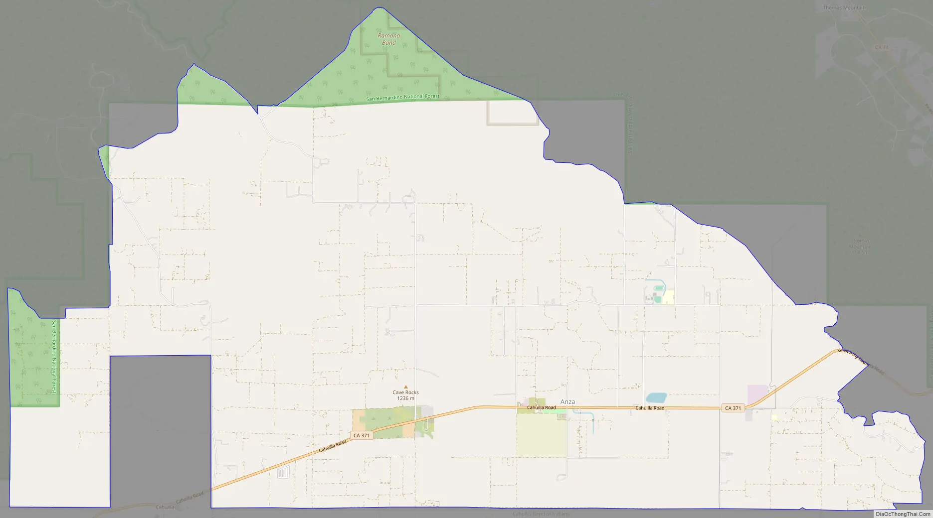
Anza Road Map
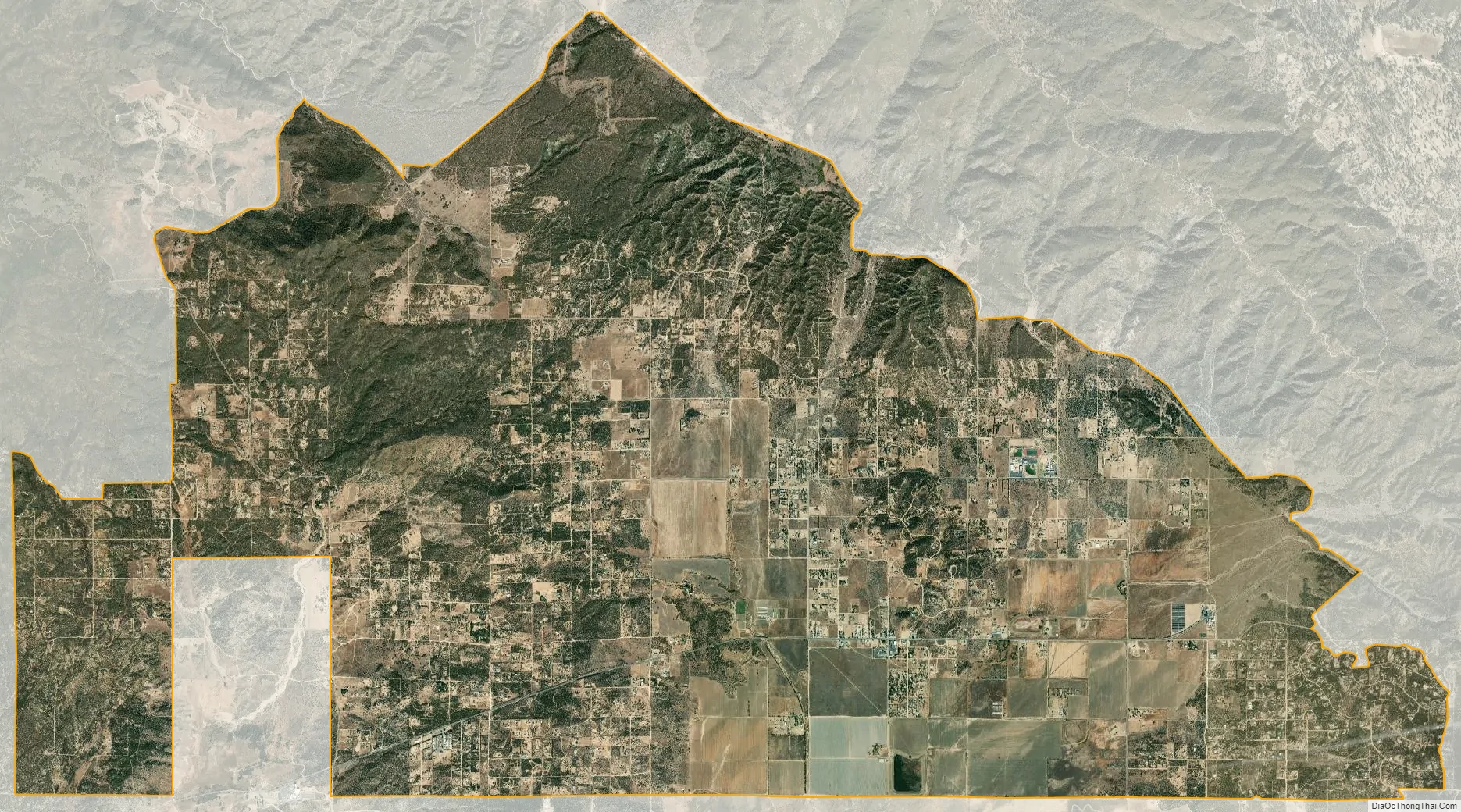
Anza city Satellite Map
Geography
According to the United States Census Bureau, the CDP covers an area of 27.7 square miles (71.7 km), 99.7% of it land and 0.3% of it water.
Regional geographic subdivisions of the unincorporated town include Anza Valley and Cave Rocks (Central); Tripp Flats, Chandler Heights and Cahuilla (West) as well as Oak Spring, Burnt Spring and Heller Spring (East). The Anza Valley in which the unincorporated town is nestled is bordered by three significant mountains: Cahuilla Mountain to the west, Thomas Mountain to the northeast and Beauty Mountain to the southwest.
The area is characterized as high desert, experiencing somewhat stronger temperature variations than those of the coastal cities, including sudden dips of temperature even on summer evenings, due to the high elevation. The Anza Trail—originally travelled on horseback by Juan Bautista de Anza in 1774 through what was then referred to as the Cahuilla Valley—traverses the community from southeast to northwest.
Climate
According to the Köppen Climate Classification system, Anza has a warm-summer Mediterranean climate. Anza weather can range from warm to hot with common afternoon thunderstorms during summer, to chilly with occasional rain and snow during fall and winter. Its higher 4000 ft elevation at the edge of the mountains makes the weather much cooler and far more variable than the lower surrounding cities with often drastic day-to-day changes.
During the summer months, highs range from the lower 80s to mid 90s with low temperatures in the 50s and 60s. Monsoon thunderstorms are common in the afternoon between July and September when typically 3–6″ of rain falls. October high temperatures are in the 60s and 70s with night lows in the 40s and 50s with under .25″ of rain. Between November and early December, high temperatures are typically in the lower 50s and 60s with lows in the upper 20s and 30s. Rain doesn’t fall often and is usually light, occasionally turning to snow with light dustings. Total rainfall is typically 1″ or less.
During winter, typical highs are in the 40s and 50s with overnight lows in the lower 20s and 30s. Precipitation is a varied with rain and snowfall occurring 1–2 days a week. An entire winter typically sees 5–10″ of rain and 8–16″ of snow with a couple snowfalls of several inches to 1 ft common over the higher east side of town. Snowfall melts quickly in the much warmer daytime temperatures with little tree coverage, although deeper more regular snowpack can found over the upper reaches of town near the treeline at 5000 ft at the border of the San Bernardino National Forest. Spring is brief with any snowfall ending by early April and rain becoming a rarity by May and June with 1–2″ of rain falling mostly in March and April.
See also
Map of California State and its subdivision:- Alameda
- Alpine
- Amador
- Butte
- Calaveras
- Colusa
- Contra Costa
- Del Norte
- El Dorado
- Fresno
- Glenn
- Humboldt
- Imperial
- Inyo
- Kern
- Kings
- Lake
- Lassen
- Los Angeles
- Madera
- Marin
- Mariposa
- Mendocino
- Merced
- Modoc
- Mono
- Monterey
- Napa
- Nevada
- Orange
- Placer
- Plumas
- Riverside
- Sacramento
- San Benito
- San Bernardino
- San Diego
- San Francisco
- San Joaquin
- San Luis Obispo
- San Mateo
- Santa Barbara
- Santa Clara
- Santa Cruz
- Shasta
- Sierra
- Siskiyou
- Solano
- Sonoma
- Stanislaus
- Sutter
- Tehama
- Trinity
- Tulare
- Tuolumne
- Ventura
- Yolo
- Yuba
- Alabama
- Alaska
- Arizona
- Arkansas
- California
- Colorado
- Connecticut
- Delaware
- District of Columbia
- Florida
- Georgia
- Hawaii
- Idaho
- Illinois
- Indiana
- Iowa
- Kansas
- Kentucky
- Louisiana
- Maine
- Maryland
- Massachusetts
- Michigan
- Minnesota
- Mississippi
- Missouri
- Montana
- Nebraska
- Nevada
- New Hampshire
- New Jersey
- New Mexico
- New York
- North Carolina
- North Dakota
- Ohio
- Oklahoma
- Oregon
- Pennsylvania
- Rhode Island
- South Carolina
- South Dakota
- Tennessee
- Texas
- Utah
- Vermont
- Virginia
- Washington
- West Virginia
- Wisconsin
- Wyoming


