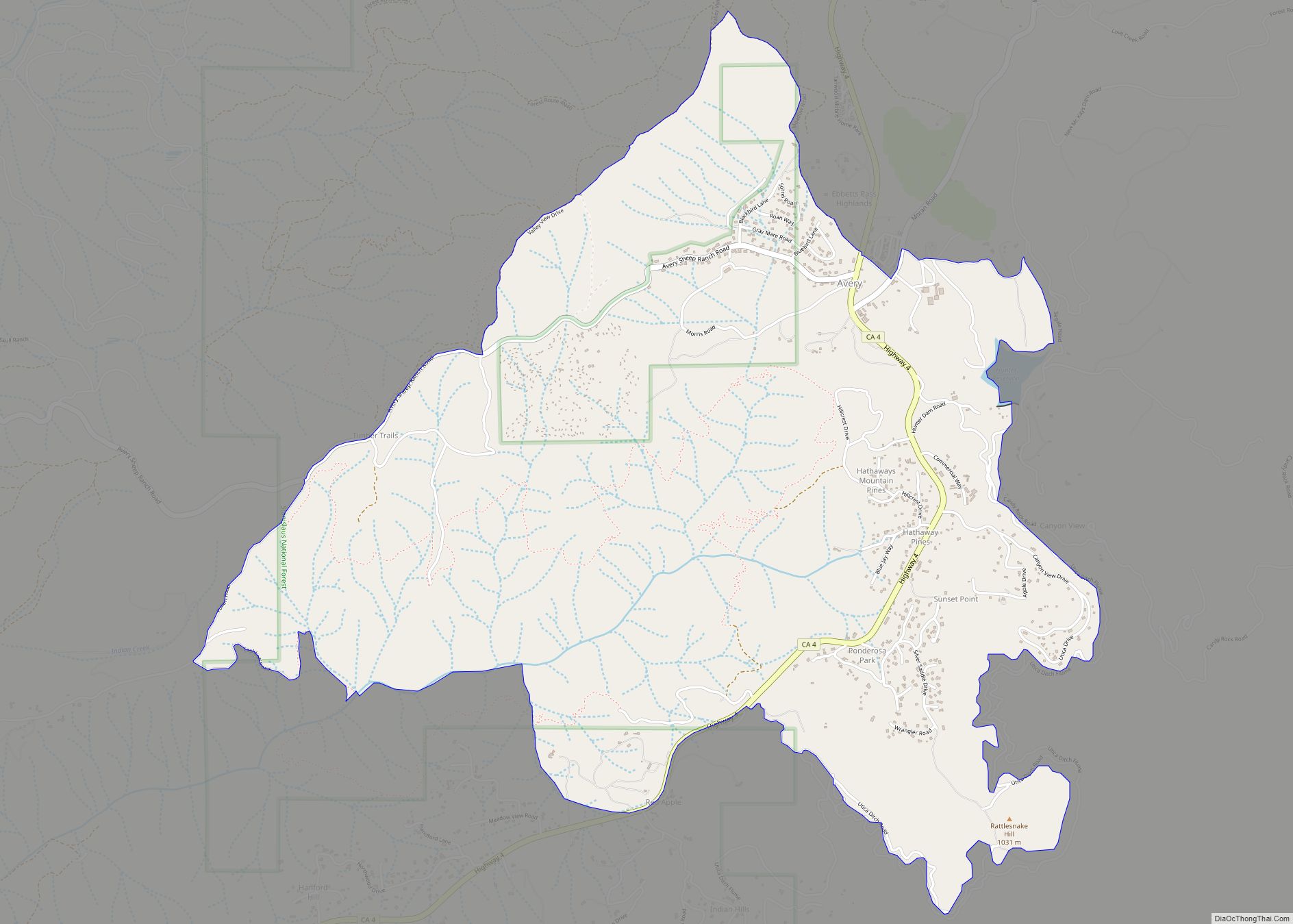
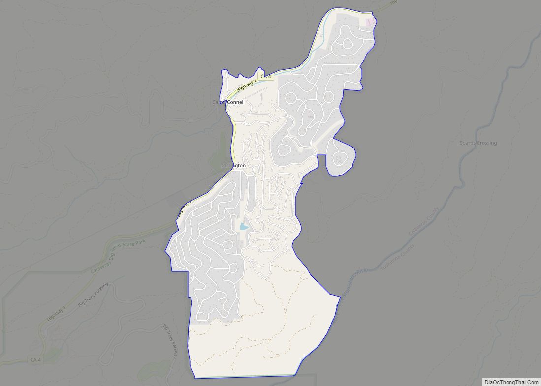
Avery is a census-designated place (CDP) in Calaveras County, California, United States. The population was 646 at the 2010 census, down from 672 at the 2000 census. Avery is located on State Route 4 and is home to the oldest continually operating hotel in the county, the Avery Hotel Restaurant & Saloon. Built in 1853, it was known as the “Half Way House,” being located between Murphys, Arnold, and Calaveras Big Trees State Park.
| Name: | Avery CDP |
|---|---|
| LSAD Code: | 57 |
| LSAD Description: | CDP (suffix) |
| State: | California |
| County: | Calaveras County |
| Elevation: | 3,389 ft (1,033 m) |
| Total Area: | 2.12 sq mi (5.50 km²) |
| Land Area: | 2.10 sq mi (5.45 km²) |
| Water Area: | 0.02 sq mi (0.05 km²) 0% |
| Total Population: | 636 |
| Population Density: | 302.28/sq mi (116.72/km²) |
| ZIP code: | 95224 |
| Area code: | 209 |
| FIPS code: | 0603316 |
Online Interactive Map
Click on ![]() to view map in "full screen" mode.
to view map in "full screen" mode.
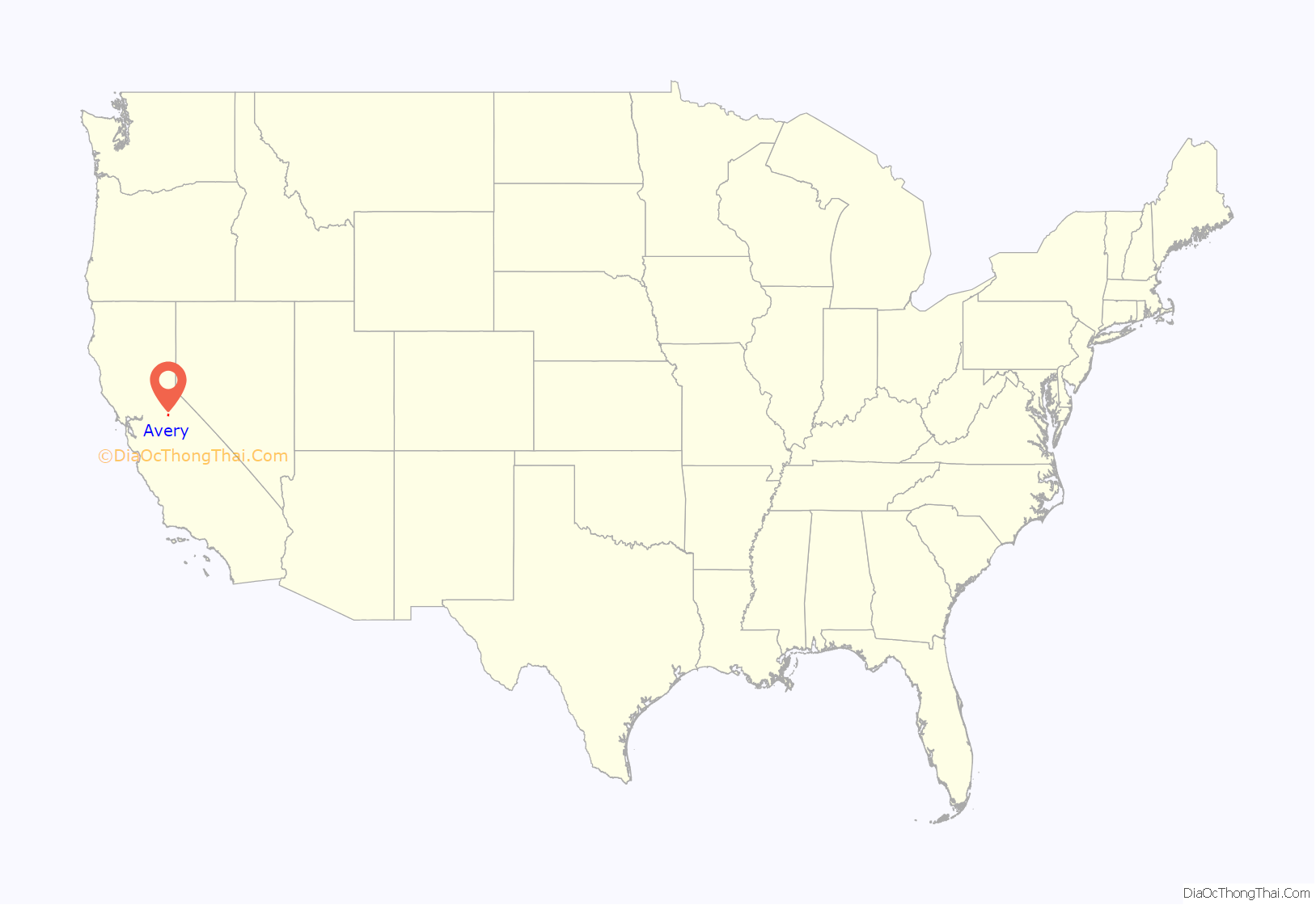
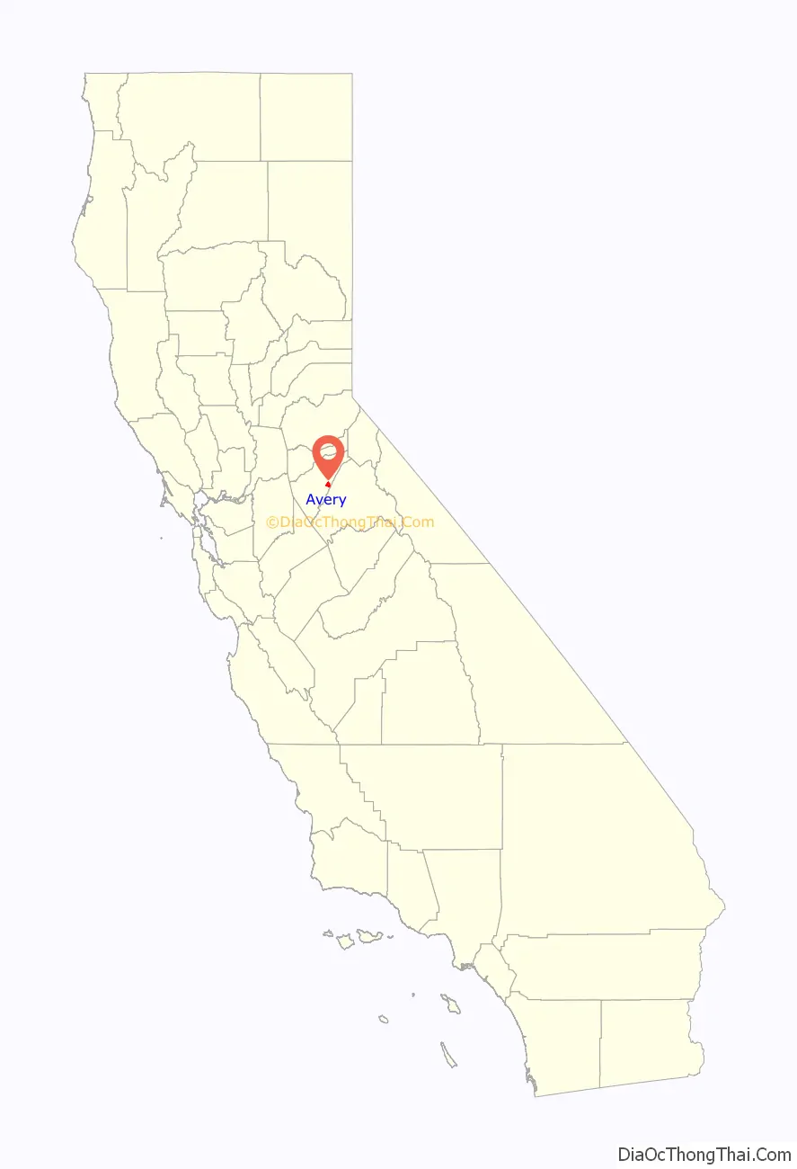
Avery location map. Where is Avery CDP?
History
The place is named after George J. Avery, its first postmaster. The first post office was established in 1885, closed in 1943, and re-established in 1949.
Avery Road Map
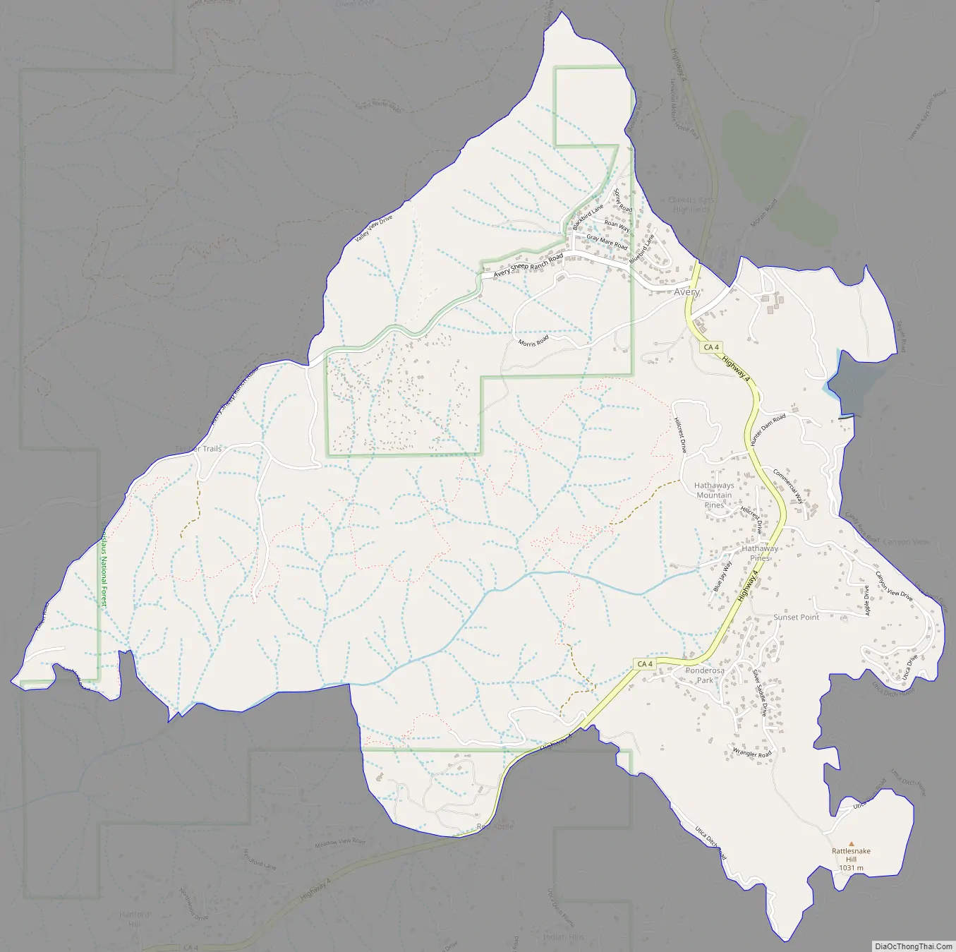
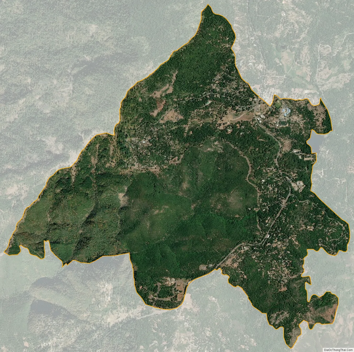
Avery city Satellite Map
Geography
According to the United States Census Bureau, the CDP has a total area of 4.5 square miles (12 km), all of it land.
See also
Map of California State and its subdivision:- Alameda
- Alpine
- Amador
- Butte
- Calaveras
- Colusa
- Contra Costa
- Del Norte
- El Dorado
- Fresno
- Glenn
- Humboldt
- Imperial
- Inyo
- Kern
- Kings
- Lake
- Lassen
- Los Angeles
- Madera
- Marin
- Mariposa
- Mendocino
- Merced
- Modoc
- Mono
- Monterey
- Napa
- Nevada
- Orange
- Placer
- Plumas
- Riverside
- Sacramento
- San Benito
- San Bernardino
- San Diego
- San Francisco
- San Joaquin
- San Luis Obispo
- San Mateo
- Santa Barbara
- Santa Clara
- Santa Cruz
- Shasta
- Sierra
- Siskiyou
- Solano
- Sonoma
- Stanislaus
- Sutter
- Tehama
- Trinity
- Tulare
- Tuolumne
- Ventura
- Yolo
- Yuba
- Alabama
- Alaska
- Arizona
- Arkansas
- California
- Colorado
- Connecticut
- Delaware
- District of Columbia
- Florida
- Georgia
- Hawaii
- Idaho
- Illinois
- Indiana
- Iowa
- Kansas
- Kentucky
- Louisiana
- Maine
- Maryland
- Massachusetts
- Michigan
- Minnesota
- Mississippi
- Missouri
- Montana
- Nebraska
- Nevada
- New Hampshire
- New Jersey
- New Mexico
- New York
- North Carolina
- North Dakota
- Ohio
- Oklahoma
- Oregon
- Pennsylvania
- Rhode Island
- South Carolina
- South Dakota
- Tennessee
- Texas
- Utah
- Vermont
- Virginia
- Washington
- West Virginia
- Wisconsin
- Wyoming