Bonita (Spanish for “Beautiful”) is a census-designated place (CDP) in southern San Diego County, California, nestled between the cities of Chula Vista, National City, and San Diego. The population was 12,538 at the 2010 census.
| Name: | Bonita CDP |
|---|---|
| LSAD Code: | 57 |
| LSAD Description: | CDP (suffix) |
| State: | California |
| County: | San Diego County |
| Elevation: | 118 ft (36 m) |
| Total Area: | 5.16 sq mi (13.35 km²) |
| Land Area: | 5.02 sq mi (12.99 km²) |
| Water Area: | 0.14 sq mi (0.36 km²) 2.71% |
| Total Population: | 12,917 |
| Population Density: | 2,574.65/sq mi (994.10/km²) |
| ZIP code: | 91902, 91908 |
| Area code: | 619 |
| FIPS code: | 0607414 |
| GNISfeature ID: | 1660356 |
Online Interactive Map
Click on ![]() to view map in "full screen" mode.
to view map in "full screen" mode.
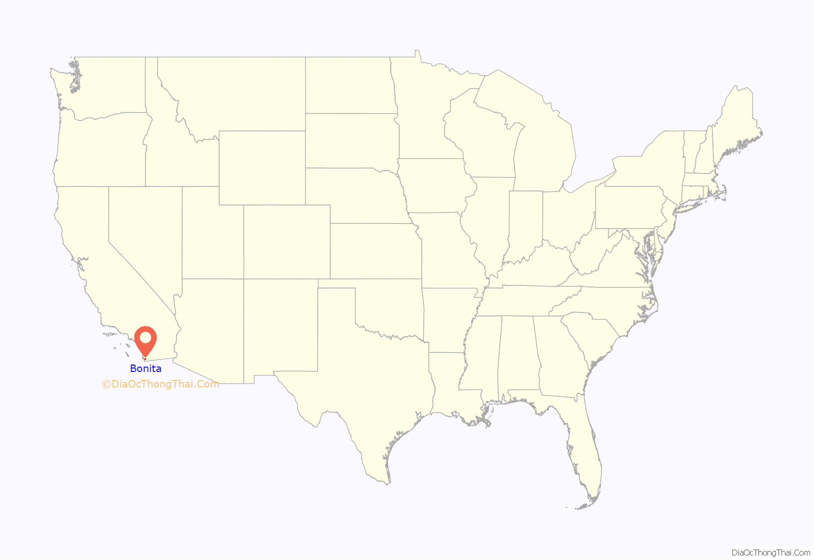
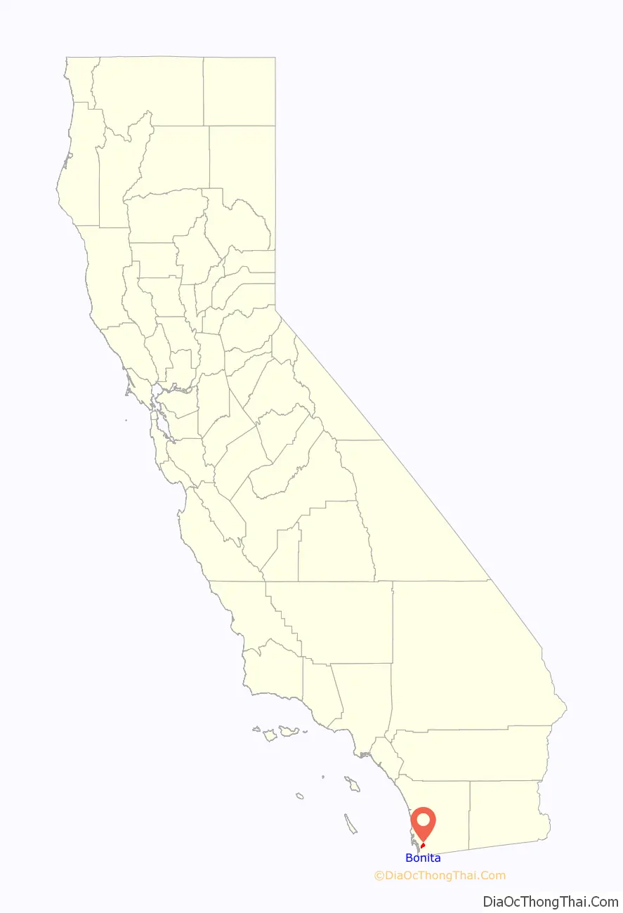
Bonita location map. Where is Bonita CDP?
History
Before the arrival of the Spanish, Kumeyaay lived in the area around Sweetwater Valley, and called it Apusquel. After the establishment of Mission San Diego de Alcalá, the valley was used for cattle raising but was not significantly settled. After gaining independence from the Spanish Empire, the valley became part of a land grant awarded to John (Don Juan) Forster. The word Bonita is a feminine word for “pretty” in the Spanish language. It was the name of a ranch owned by Henry Ernest Cooper, Sr. in 1884, and was used by the nearby post office. The ranch itself was used to cultivate lemons, which were first grown in the area beginning in 1871. During the early years lemon industry was thriving, where it became the originator of the Bonnie Brae Lemon variety, named after the first lemon ranch in the community.
In 1888, the Sweetwater Dam was built, creating the Sweetwater Reservoir and forever changing the geography of the region. Soon after, in 1906, the dam broke as a result of extensive rains which overfilled the reservoir, and the Lower Sweetwater Valley was completely flooded.
Bonita has experienced minor flooding throughout history, generally as a result of high seasonal rains attributed to El Niño. The floods most affect the Central Avenue river crossing, as no bridge has ever been built, unlike the Bonita Road and Willow Road crossings which are bridges, the former of which was rebuilt in the late 1990s.
In the 1990s and 2000s, the development of State Route 125 (The South Bay Expressway) became a major issue to Bonita residents, much as Interstate 805 and State Route 54 did during their development. Opponents argued that Bonita’s rural nature would be compromised without benefit while proponents argued that the highway would reduce the significant increase in surface-street car traffic the community had seen since the 1980s when the eastern Chula Vista communities surrounding Eastlake were developed. The tollway opened in November 2007 and sought Chapter 11 bankruptcy on March 22, 2010, when the cost of litigation over the construction of the road threatened to overwhelm its ability to operate and pay off its loans. On April 14, 2011, South Bay Expressway LP emerged from bankruptcy, and in a closed session on July 29, 2011, the SANDAG board of directors voted to purchase the lease to operate the State Route 125 toll road for approximately $345 million.
In 2007, Glen Abbey Memorial Park was declared a historic district, having been designed by architects who also worked on Balboa Park, and other landscapes and architectures that are significant to the history of San Diego. It is one of only three historic districts in unincorporated San Diego County.
The Bonita Historical Society, which operates the Bonita Museum & Cultural Center, is the principal repository of historical information for the Lower Sweetwater Valley.
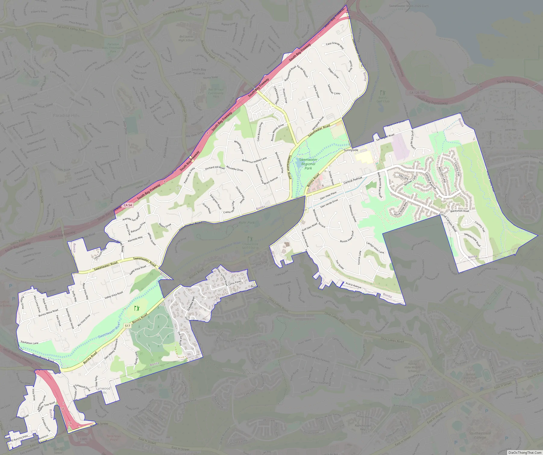
Bonita Road Map
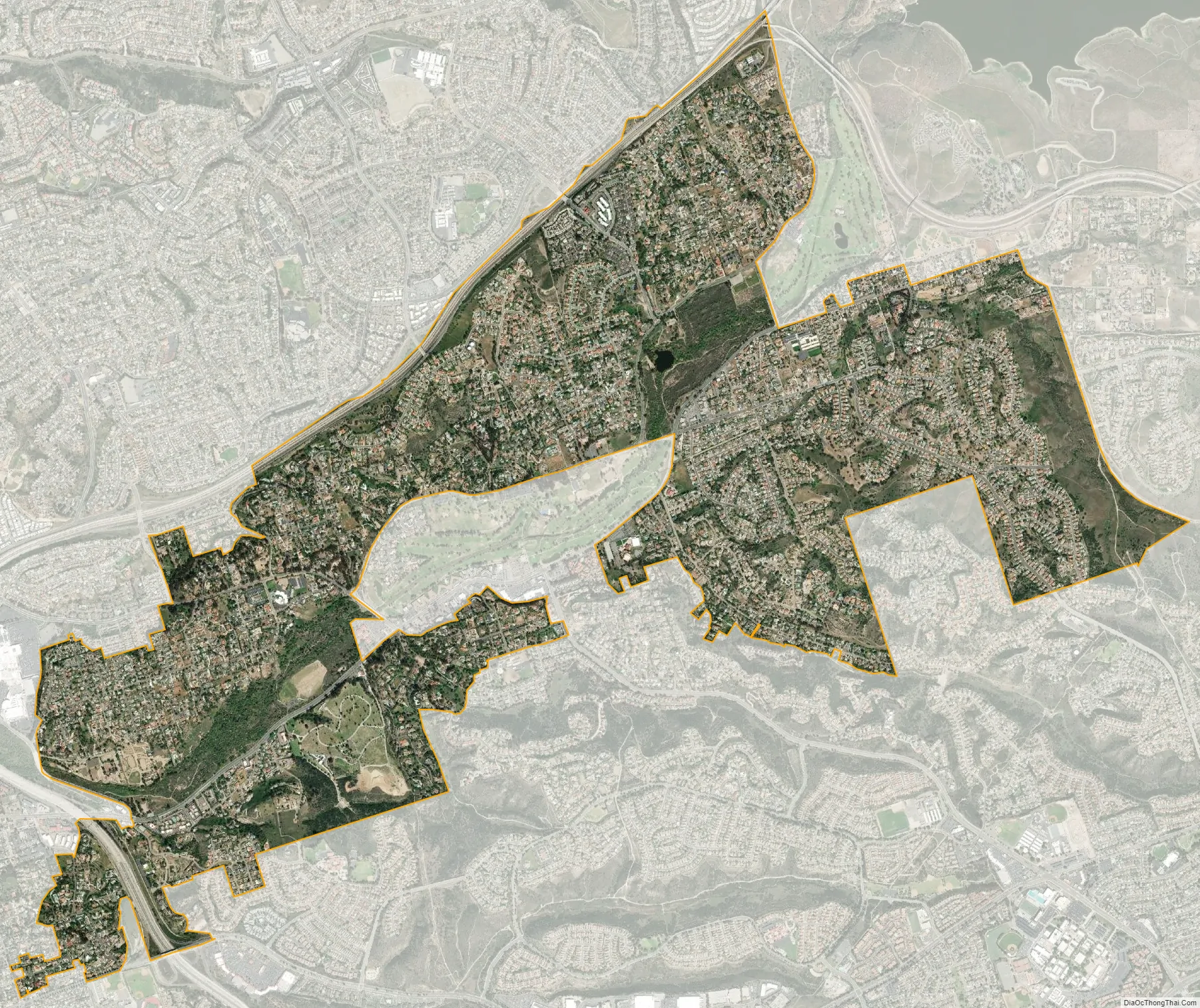
Bonita city Satellite Map
Geography
Bonita is located at 32°39′30″N 117°02′07″W / 32.658420°N 117.035336°W / 32.658420; -117.035336.
According to the United States Census Bureau, Bonita has a total area of 5.1 square miles (13 square kilometers). 5.0 square miles (13 km) of it is land and 0.1 square miles (0.26 km) of it (2.71%) is water.
While Bonita is politically designated as an unincorporated community, bounded by the incorporated cities of Chula Vista, San Diego and National City, it is closely associated with the geography of the Lower Sweetwater Valley. Thus considered, Bonita occupies about a five-mile (8 kilometer) stretch of the Sweetwater River, its valley, and surrounding hills on either side, bounded upstream (east) by the Sweetwater Reservoir, and downstream (west) effectively by Interstate 805. The community crosses west of I-805—an area less than 160 acres (0.65 square kilometers)—reaching as far south and west as East H Street and Hilltop Drive. Its northern boundary is State Route 54 and its southern extent reaches approximately one-mile (1.6 km) south of the river.
Large portions of modern Bonita consist of housing tracts built throughout the 1960s, 1970s, and 1980s, including:
- Bonita Verde Estates
- Bonita Downs
- Bonita Fairways
- Bonita Glen
- Bonita Highlands
- Bonita Long Canyon
- Bonita Woods
- Bonita Woods Park
- Emerald Ranch
- Lynwood Hills
- Ames Ranch
- Villas de Bonita
- Rancho Robinhood
The Bonita area is populated by coyote, racoon, fox, rabbit, squirrel, bobcat, opossum, and skunk, among other wildlife.
See also
Map of California State and its subdivision:- Alameda
- Alpine
- Amador
- Butte
- Calaveras
- Colusa
- Contra Costa
- Del Norte
- El Dorado
- Fresno
- Glenn
- Humboldt
- Imperial
- Inyo
- Kern
- Kings
- Lake
- Lassen
- Los Angeles
- Madera
- Marin
- Mariposa
- Mendocino
- Merced
- Modoc
- Mono
- Monterey
- Napa
- Nevada
- Orange
- Placer
- Plumas
- Riverside
- Sacramento
- San Benito
- San Bernardino
- San Diego
- San Francisco
- San Joaquin
- San Luis Obispo
- San Mateo
- Santa Barbara
- Santa Clara
- Santa Cruz
- Shasta
- Sierra
- Siskiyou
- Solano
- Sonoma
- Stanislaus
- Sutter
- Tehama
- Trinity
- Tulare
- Tuolumne
- Ventura
- Yolo
- Yuba
- Alabama
- Alaska
- Arizona
- Arkansas
- California
- Colorado
- Connecticut
- Delaware
- District of Columbia
- Florida
- Georgia
- Hawaii
- Idaho
- Illinois
- Indiana
- Iowa
- Kansas
- Kentucky
- Louisiana
- Maine
- Maryland
- Massachusetts
- Michigan
- Minnesota
- Mississippi
- Missouri
- Montana
- Nebraska
- Nevada
- New Hampshire
- New Jersey
- New Mexico
- New York
- North Carolina
- North Dakota
- Ohio
- Oklahoma
- Oregon
- Pennsylvania
- Rhode Island
- South Carolina
- South Dakota
- Tennessee
- Texas
- Utah
- Vermont
- Virginia
- Washington
- West Virginia
- Wisconsin
- Wyoming


