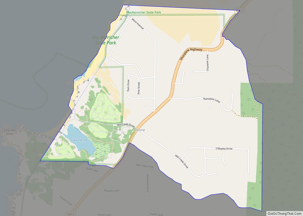
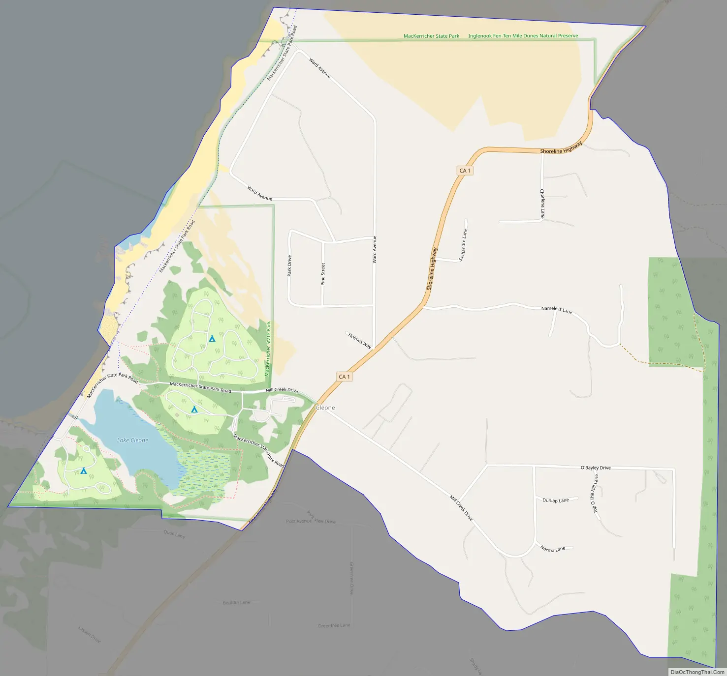
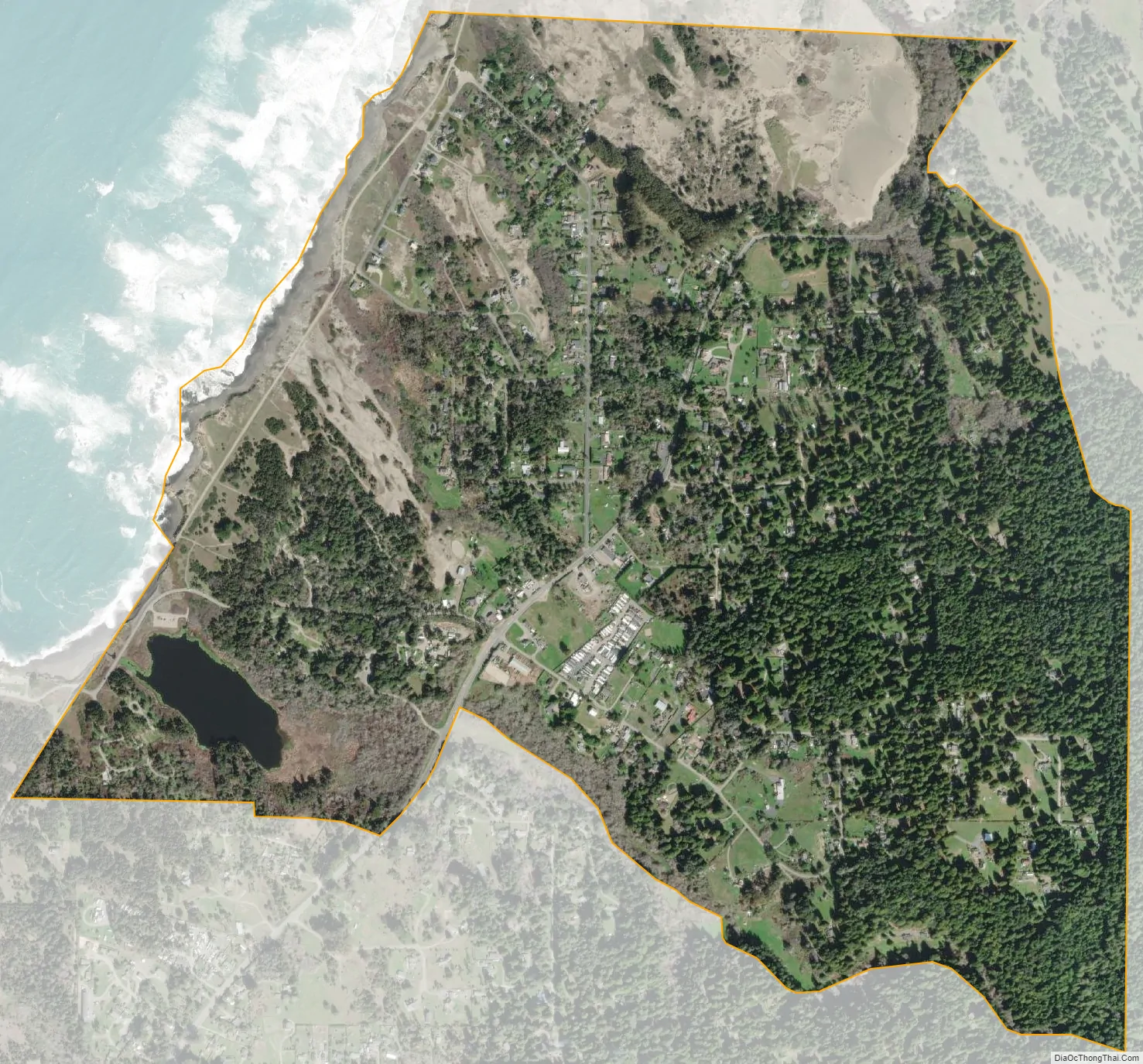
Cleone (formerly Kanuck) is a census-designated place in Mendocino County, California, United States. It is located 3.25 miles (5.2 km) north-northeast of Fort Bragg on California State Highway 1, at an elevation of 79 feet (24 m). It most likely takes its name from Kelio, a division or village of the Pomo people. The population was 622 at the 2020 census.
The Kanuck post office opened in 1883, changed its name to Cleone in 1883, and closed in 1908. In 1883, a sawmill about of a mile and a half east of the village of Cleone was constructed. Wood products were shipped from a wharf at the place. Railroad cars ran down by gravity from the hill to the chute and were returned by horses.
The main entrance to MacKerricher State Park is in Cleone.
| Name: | Cleone CDP |
|---|---|
| LSAD Code: | 57 |
| LSAD Description: | CDP (suffix) |
| State: | California |
| County: | Mendocino County |
| Elevation: | 79 ft (24 m) |
| Total Area: | 1.62 sq mi (4.2 km²) |
| Land Area: | 1.59 sq mi (4.1 km²) |
| Water Area: | 0.02 sq mi (0.05 km²) 1.50% |
| Total Population: | 622 |
| Population Density: | 390.46/sq mi (150.76/km²) |
| ZIP code: | 95437 (Fort Bragg) |
| Area code: | 707 |
| FIPS code: | 0614008 |
Online Interactive Map
Click on ![]() to view map in "full screen" mode.
to view map in "full screen" mode.
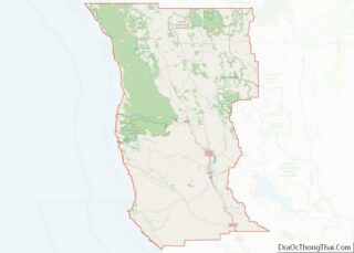
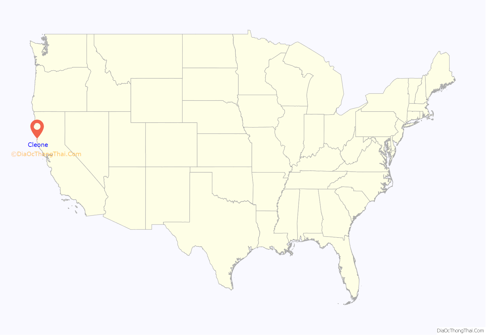
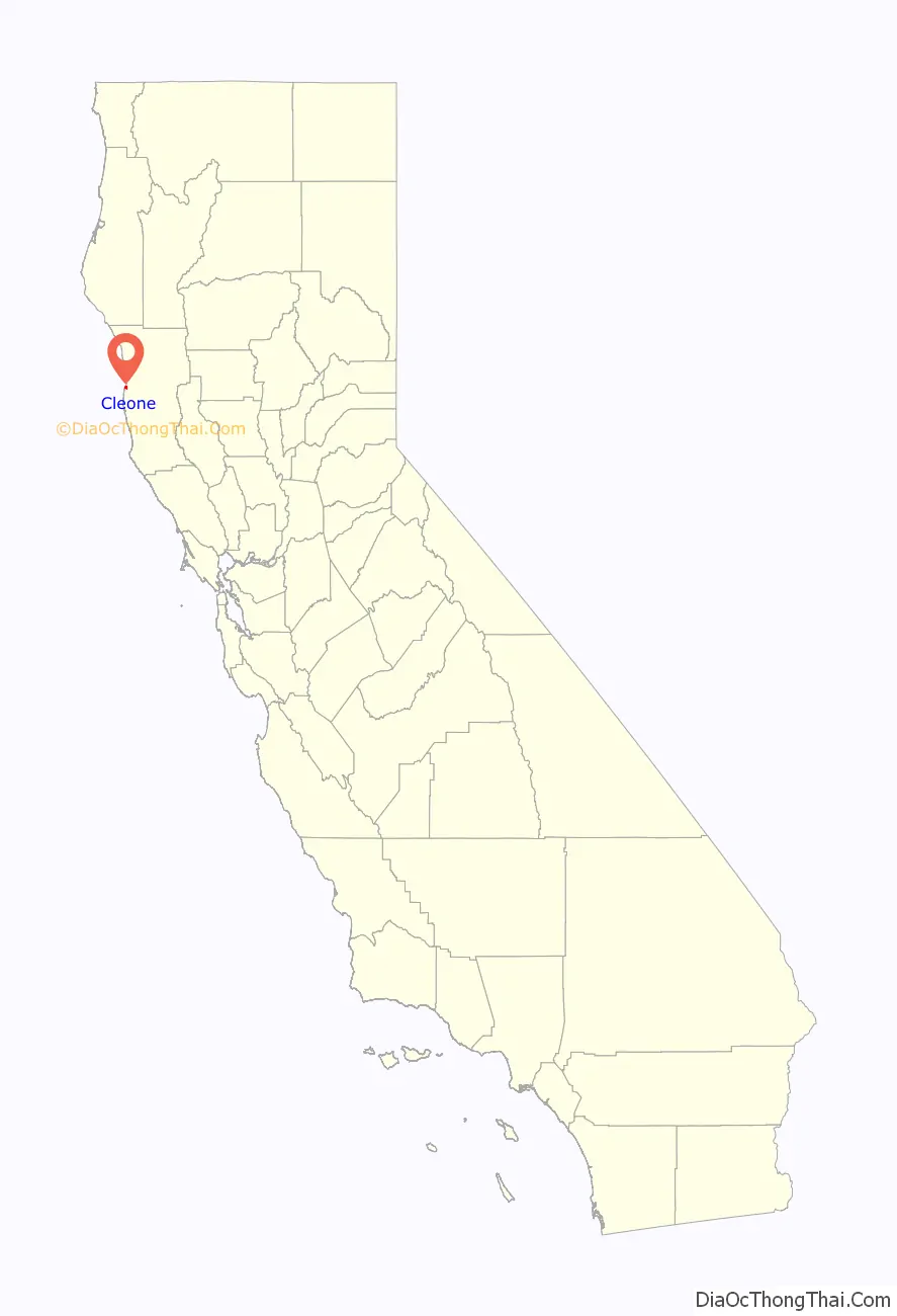
Cleone location map. Where is Cleone CDP?
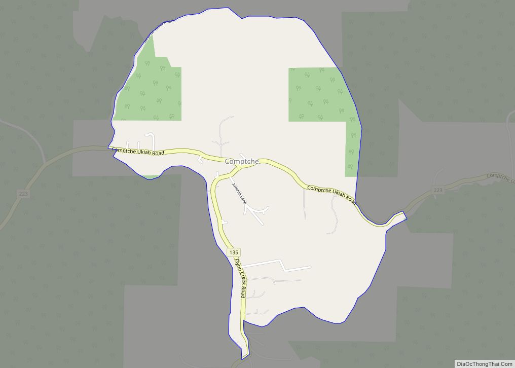
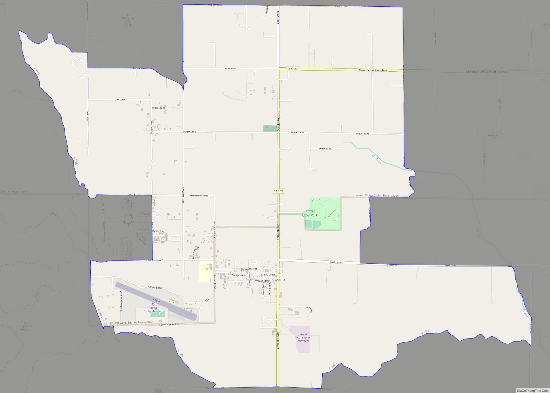
Cleone Road Map
Cleone city Satellite Map
Geography
According to the United States Census Bureau, the CDP covers an area of 1.6 square miles (4.1 km), of which 0.02 square miles (0.05 km), or 1.50%, are water.
See also
Map of California State and its subdivision:- Alameda
- Alpine
- Amador
- Butte
- Calaveras
- Colusa
- Contra Costa
- Del Norte
- El Dorado
- Fresno
- Glenn
- Humboldt
- Imperial
- Inyo
- Kern
- Kings
- Lake
- Lassen
- Los Angeles
- Madera
- Marin
- Mariposa
- Mendocino
- Merced
- Modoc
- Mono
- Monterey
- Napa
- Nevada
- Orange
- Placer
- Plumas
- Riverside
- Sacramento
- San Benito
- San Bernardino
- San Diego
- San Francisco
- San Joaquin
- San Luis Obispo
- San Mateo
- Santa Barbara
- Santa Clara
- Santa Cruz
- Shasta
- Sierra
- Siskiyou
- Solano
- Sonoma
- Stanislaus
- Sutter
- Tehama
- Trinity
- Tulare
- Tuolumne
- Ventura
- Yolo
- Yuba
- Alabama
- Alaska
- Arizona
- Arkansas
- California
- Colorado
- Connecticut
- Delaware
- District of Columbia
- Florida
- Georgia
- Hawaii
- Idaho
- Illinois
- Indiana
- Iowa
- Kansas
- Kentucky
- Louisiana
- Maine
- Maryland
- Massachusetts
- Michigan
- Minnesota
- Mississippi
- Missouri
- Montana
- Nebraska
- Nevada
- New Hampshire
- New Jersey
- New Mexico
- New York
- North Carolina
- North Dakota
- Ohio
- Oklahoma
- Oregon
- Pennsylvania
- Rhode Island
- South Carolina
- South Dakota
- Tennessee
- Texas
- Utah
- Vermont
- Virginia
- Washington
- West Virginia
- Wisconsin
- Wyoming