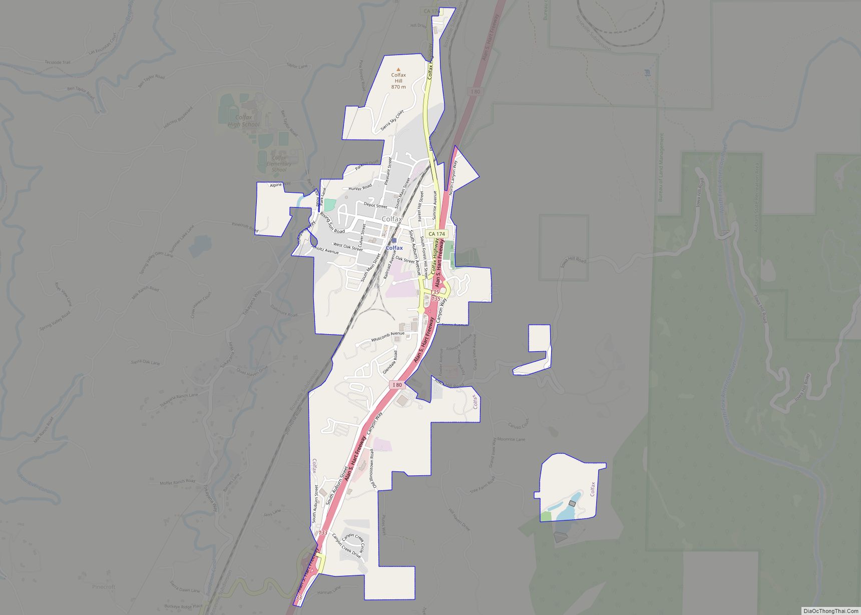
Colfax (formerly Alden Grove, Alder Grove, Illinoistown, and Upper Corral) is a city in Placer County, California, at the crossroads of Interstate 80 and State Route 174. The population was 1,963 at the 2010 census. The town is named in honor of U.S. Vice President Schuyler Colfax (1869–73), a bronze statue of whom stands at Railroad Street and Grass Valley Street. (This is the only known statue of Schuyler Colfax in the United States.)
Some of the town’s notable features include the newly restored Southern Pacific Railroad colonnade-style depot (which houses the Colfax Museum and Chamber of Commerce) built in 1905, the downtown shops on Main Street, and Colfax High School, which serves a large surrounding area.
| Name: | Colfax city |
|---|---|
| LSAD Code: | 25 |
| LSAD Description: | city (suffix) |
| State: | California |
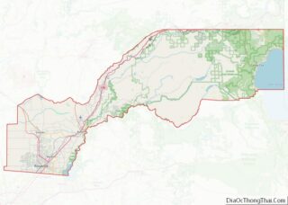
| County: | Placer County |
| Incorporated: | February 23, 1910 |
| Elevation: | 2,425 ft (739 m) |
| Total Area: | 1.41 sq mi (3.64 km²) |
| Land Area: | 1.41 sq mi (3.64 km²) |
| Water Area: | 0.00 sq mi (0.00 km²) 0% |
| Population Density: | 1,418.92/sq mi (547.85/km²) |
| ZIP code: | 95713 |
| Area code: | 530 |
| FIPS code: | 0614498 |
| GNISfeature ID: | 1655912 |
| Website: | www.colfax-ca.gov |
Online Interactive Map
Click on ![]() to view map in "full screen" mode.
to view map in "full screen" mode.
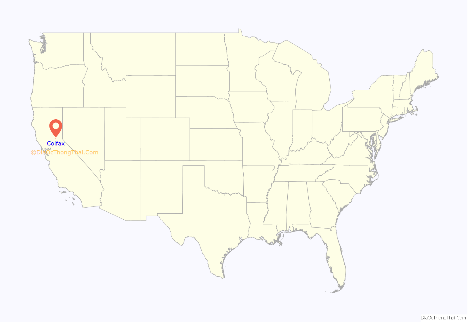
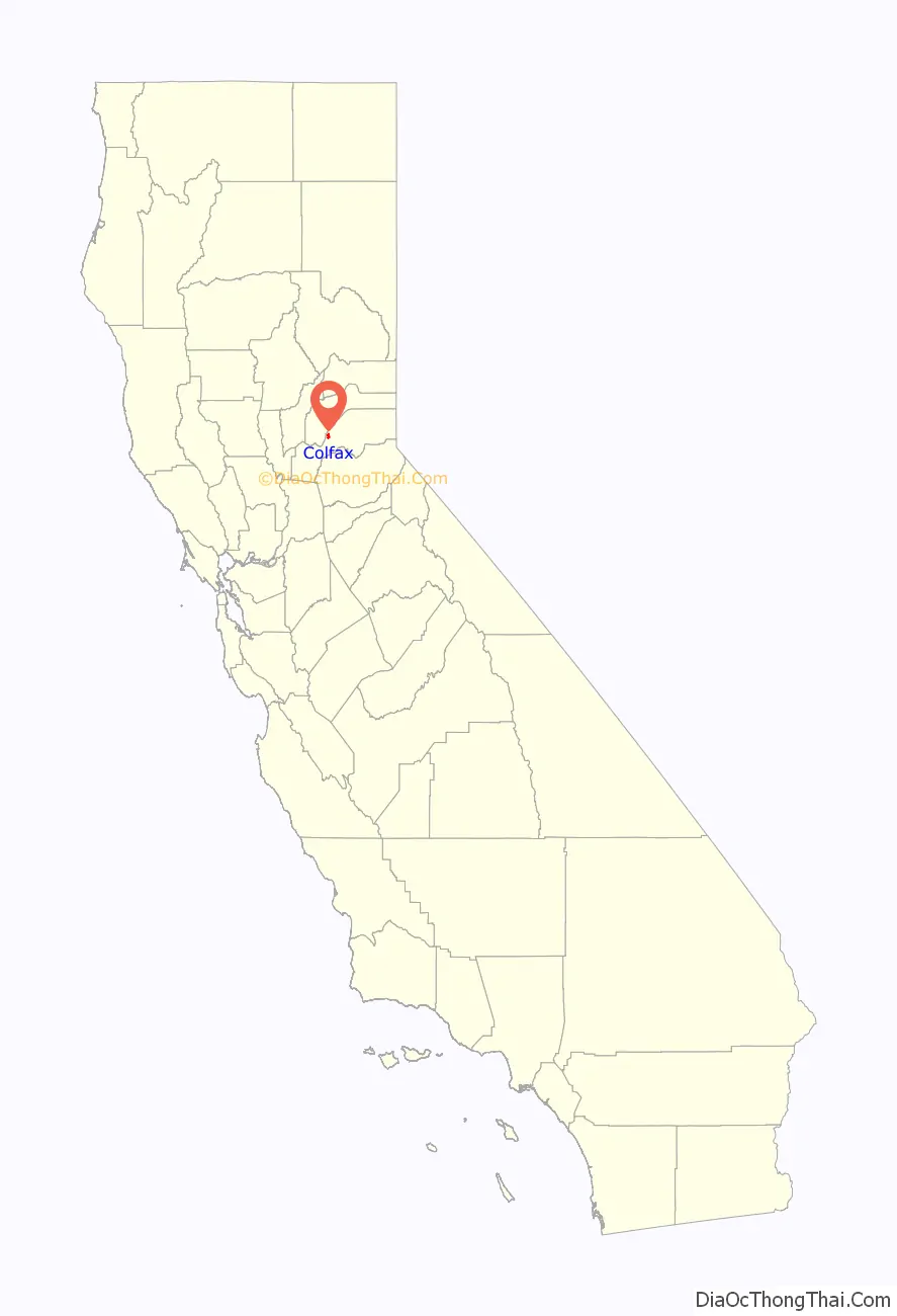
Colfax location map. Where is Colfax city?
History
Originally inhabited by the Maidu and Miwok Native Americans, by the mid-19th century the city site was known as Alder Grove; however, as development increased, the city became known as Illinoistown, a supply hub for gold mining camps. In April 1852, the Reelfoot Williams Gang robbed a Nevada City stagecoach of $7,000 in gold bullion near Illinoistown. This was the first stagecoach robbery in the gold country.
Later it was renamed Colfax after then Speaker of the House (and later Vice President) Schuyler Colfax who visited the town in 1865 while inspecting progress of construction of the Central Pacific Railroad, the western portion of the first transcontinental railroad. The city was the southern terminus of the Nevada County Narrow Gauge Railroad from 1876 until the railroad’s removal in 1942. Historic U.S. Route 40 also runs through the city as well as the more modern Interstate 80. The city is mentioned in Jules Verne’s book, Around the World in Eighty Days.
In July 2015 the Lowell Fire burned thousands of acres nearby, forcing evacuation in Nevada County.
On August 4, 2021 the River Fire started in the Bear River Campground, forcing thousands of residents on both the Placer and Nevada county sides of the river to evacuate. The fire was contained nine days later after burning over 2,600 acres (11 km) and dozens of homes.
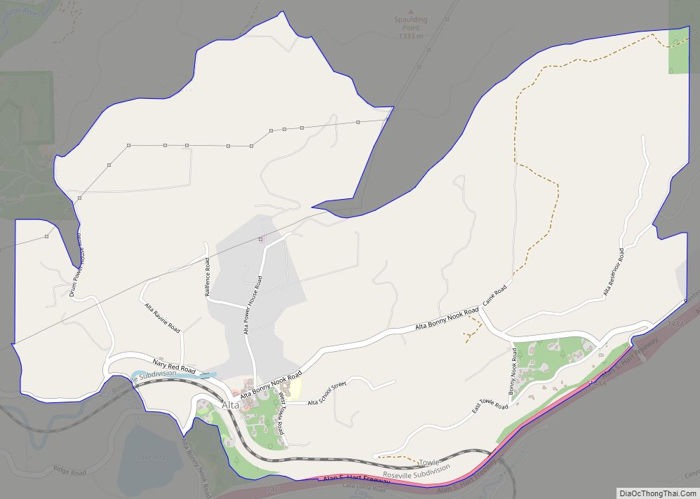
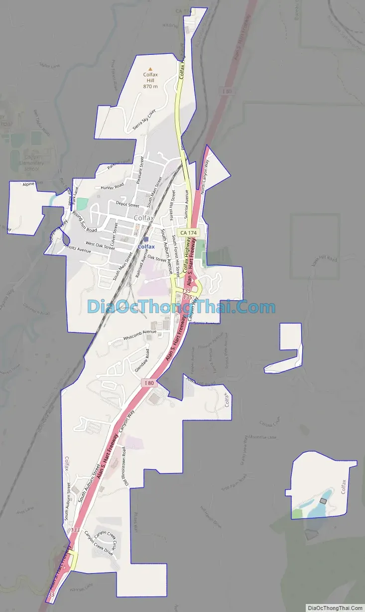
Colfax Road Map
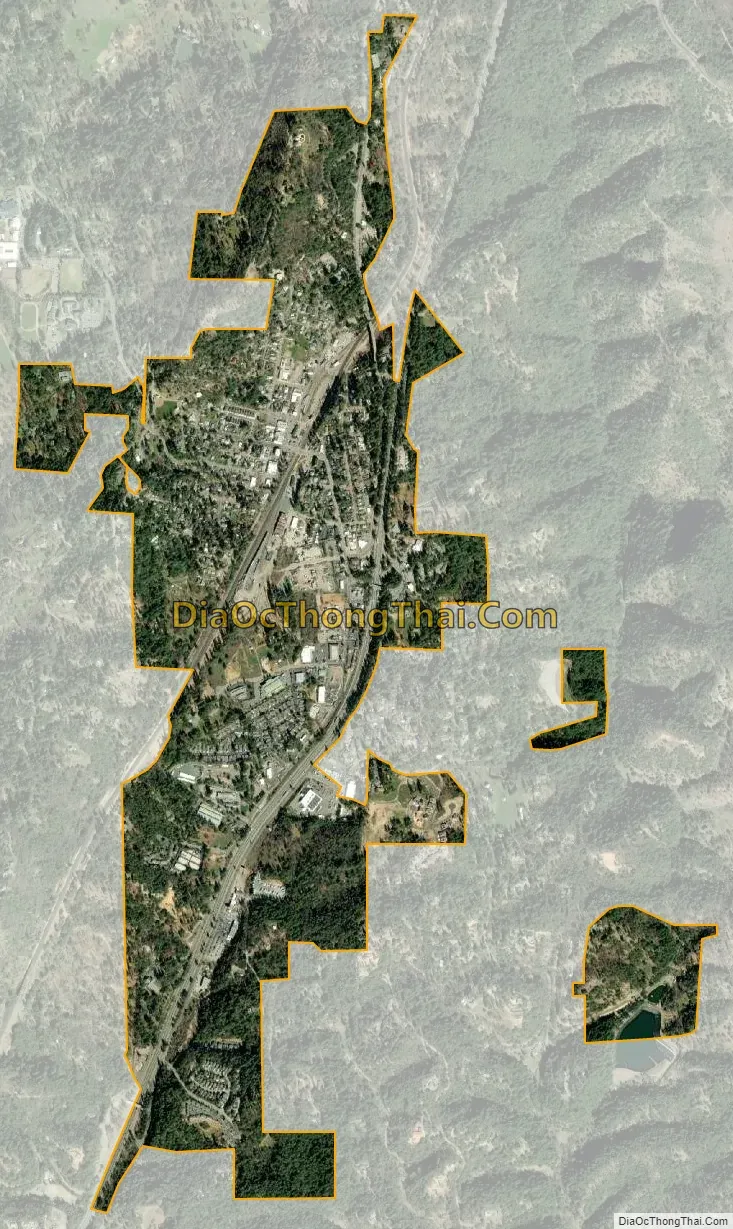
Colfax city Satellite Map
Geography
Colfax is located at 39°5′50″N 120°57′14″W / 39.09722°N 120.95389°W / 39.09722; -120.95389 (39.097260, −120.954017). According to the United States Census Bureau, the city has a total area of 1.4 square miles (3.6 km), all of it land.
The principal geologic structures present are granitic and metamorphic rock formations. Located approximately 1 mile (1.6 km) west of Colfax is a branch of the Melones Fault, running in north to south direction. The fault runs through the old grammar school baseball field so they closed the school. (Earth Metrics, 1989) Another branch of the same fault is located about 1.2 miles (1.9 km) to the east, also aligned in a north–south orientation. No movement has been recorded by the U.S. Geological Survey, and the faults are considered inactive. Bunch Creek is an active water source flowing south to eventually reach a confluence with the North Fork of the American River.
Colfax sits a few miles outside the Tahoe National Forest as I-80 begins its climb into the Sierras. Because of its location it is considered at high risk of wildfire.
Climate
Colfax has a hot-summer Mediterranean climate (Köppen Csa) that is characterized by cool, wet winters and hot, dry summers. Summers can be quite hot, especially in the months of July and August where temperatures easily reach 90 °F (32 °C), with plenty of sunshine. Winters, on the other hand, are quite cool with temperatures in December hovering around 46 °F (8 °C), and owing to its altitude above sea level, Colfax some years sees snow accumulation.
See also
Map of California State and its subdivision:- Alameda
- Alpine
- Amador
- Butte
- Calaveras
- Colusa
- Contra Costa
- Del Norte
- El Dorado
- Fresno
- Glenn
- Humboldt
- Imperial
- Inyo
- Kern
- Kings
- Lake
- Lassen
- Los Angeles
- Madera
- Marin
- Mariposa
- Mendocino
- Merced
- Modoc
- Mono
- Monterey
- Napa
- Nevada
- Orange
- Placer
- Plumas
- Riverside
- Sacramento
- San Benito
- San Bernardino
- San Diego
- San Francisco
- San Joaquin
- San Luis Obispo
- San Mateo
- Santa Barbara
- Santa Clara
- Santa Cruz
- Shasta
- Sierra
- Siskiyou
- Solano
- Sonoma
- Stanislaus
- Sutter
- Tehama
- Trinity
- Tulare
- Tuolumne
- Ventura
- Yolo
- Yuba
- Alabama
- Alaska
- Arizona
- Arkansas
- California
- Colorado
- Connecticut
- Delaware
- District of Columbia
- Florida
- Georgia
- Hawaii
- Idaho
- Illinois
- Indiana
- Iowa
- Kansas
- Kentucky
- Louisiana
- Maine
- Maryland
- Massachusetts
- Michigan
- Minnesota
- Mississippi
- Missouri
- Montana
- Nebraska
- Nevada
- New Hampshire
- New Jersey
- New Mexico
- New York
- North Carolina
- North Dakota
- Ohio
- Oklahoma
- Oregon
- Pennsylvania
- Rhode Island
- South Carolina
- South Dakota
- Tennessee
- Texas
- Utah
- Vermont
- Virginia
- Washington
- West Virginia
- Wisconsin
- Wyoming