El Sobrante (Spanish for “the leftovers”, “surplus”, or “remaining land”) is a census-designated place in Riverside County, California. El Sobrante sits at an elevation of 1,283 feet (391 m). The 2010 United States census reported El Sobrante’s population was 12,723.
| Name: | El Sobrante CDP |
|---|---|
| LSAD Code: | 57 |
| LSAD Description: | CDP (suffix) |
| State: | California |
| County: | Riverside County |
| Elevation: | 1,283 ft (391 m) |
| Total Area: | 7.211 sq mi (18.676 km²) |
| Land Area: | 7.211 sq mi (18.676 km²) |
| Water Area: | 0 sq mi (0 km²) 0% |
| Total Population: | 12,723 |
| Population Density: | 1,800/sq mi (680/km²) |
| FIPS code: | 0622457 |
| GNISfeature ID: | 2583009 |
Online Interactive Map
Click on ![]() to view map in "full screen" mode.
to view map in "full screen" mode.
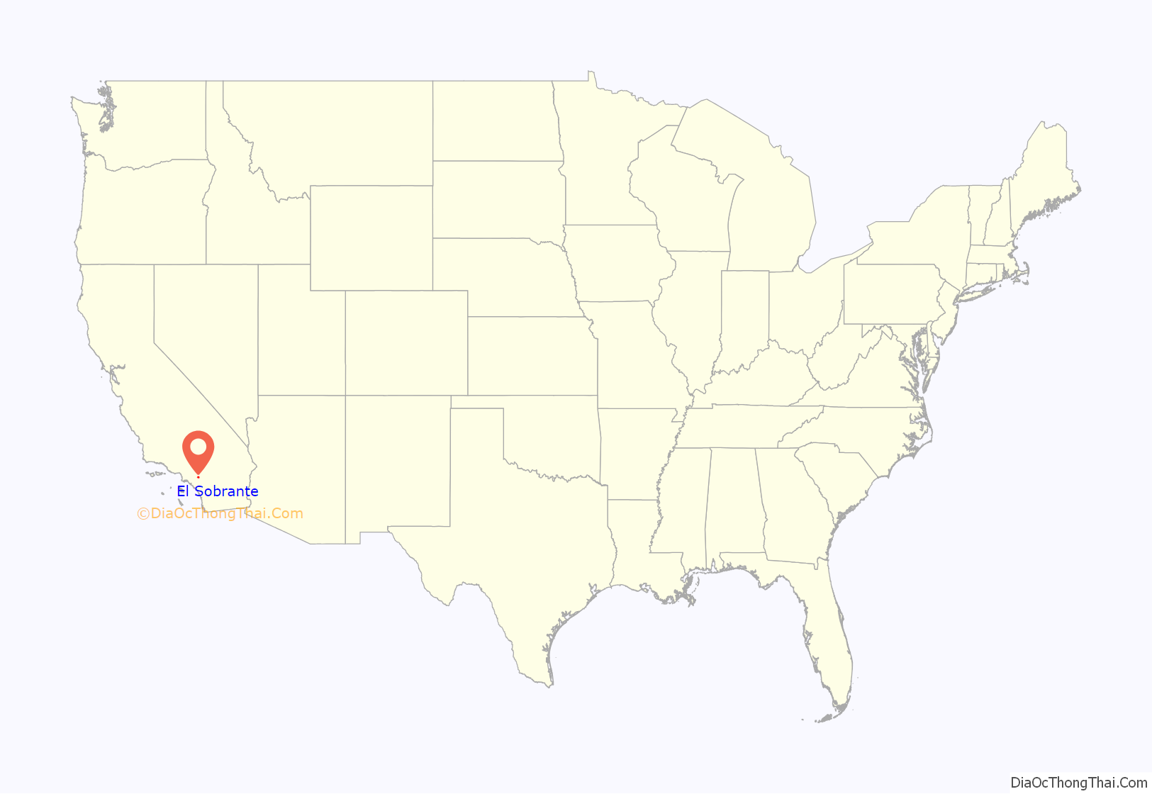
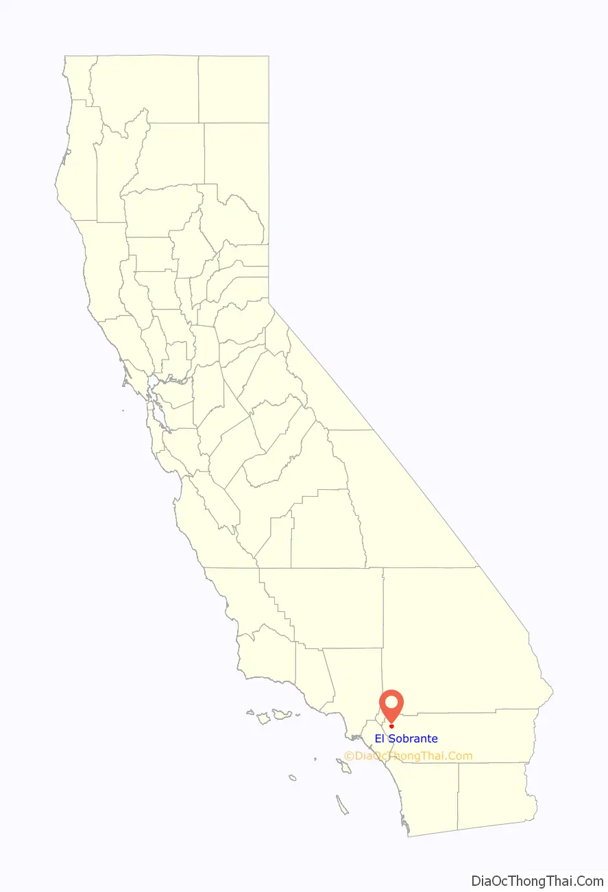
El Sobrante location map. Where is El Sobrante CDP?
History
The area was originally named El Sobrante de San Jacinto, with Maria del Rosario Estudilllo de Aguirre receiving a 5 league land grant in 1846. Her husband, José Antonio Aguirre, patented the grant in 1867.
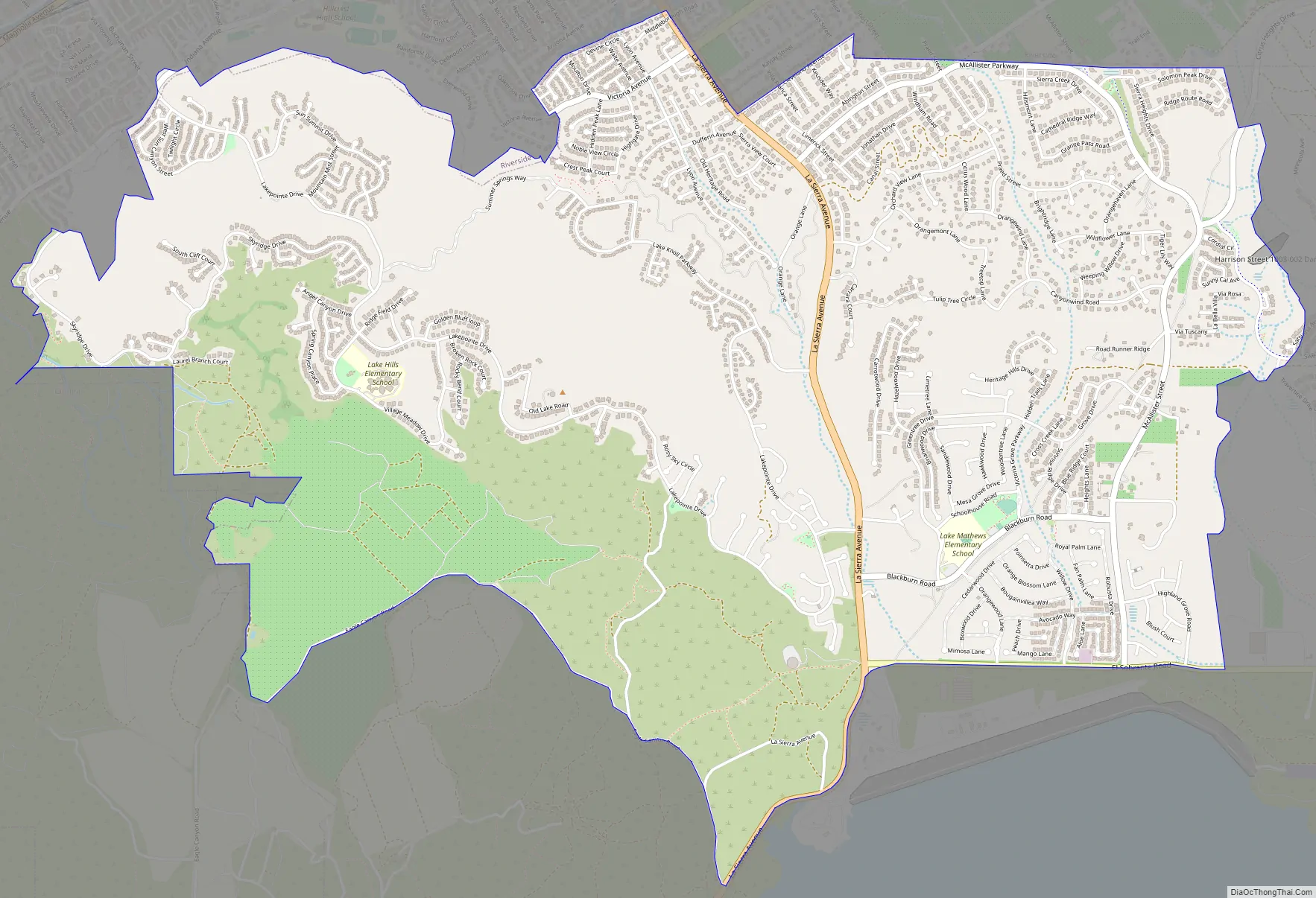
El Sobrante Road Map
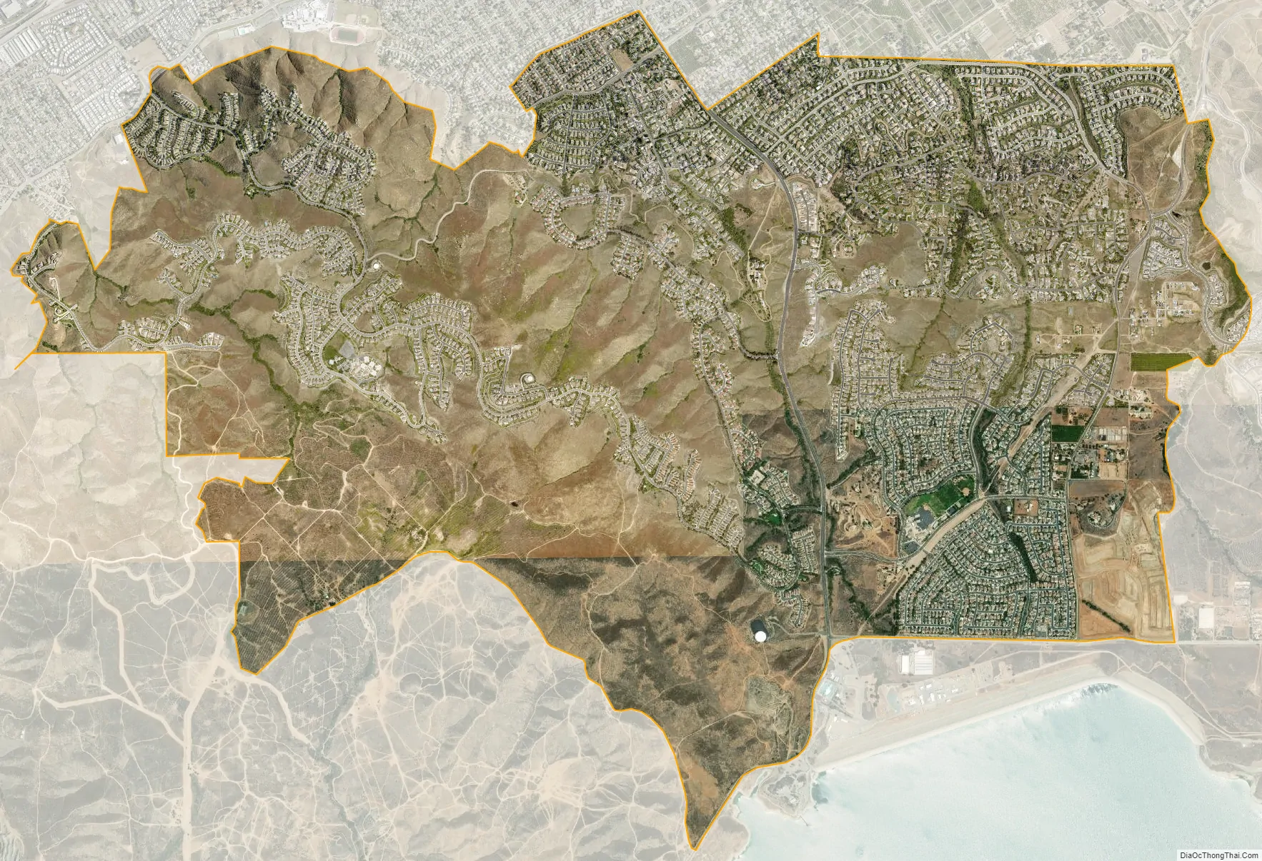
El Sobrante city Satellite Map
Geography
According to the United States Census Bureau, the CDP covers an area of 7.2 square miles (18.7 km), all of it land.
See also
Map of California State and its subdivision:- Alameda
- Alpine
- Amador
- Butte
- Calaveras
- Colusa
- Contra Costa
- Del Norte
- El Dorado
- Fresno
- Glenn
- Humboldt
- Imperial
- Inyo
- Kern
- Kings
- Lake
- Lassen
- Los Angeles
- Madera
- Marin
- Mariposa
- Mendocino
- Merced
- Modoc
- Mono
- Monterey
- Napa
- Nevada
- Orange
- Placer
- Plumas
- Riverside
- Sacramento
- San Benito
- San Bernardino
- San Diego
- San Francisco
- San Joaquin
- San Luis Obispo
- San Mateo
- Santa Barbara
- Santa Clara
- Santa Cruz
- Shasta
- Sierra
- Siskiyou
- Solano
- Sonoma
- Stanislaus
- Sutter
- Tehama
- Trinity
- Tulare
- Tuolumne
- Ventura
- Yolo
- Yuba
- Alabama
- Alaska
- Arizona
- Arkansas
- California
- Colorado
- Connecticut
- Delaware
- District of Columbia
- Florida
- Georgia
- Hawaii
- Idaho
- Illinois
- Indiana
- Iowa
- Kansas
- Kentucky
- Louisiana
- Maine
- Maryland
- Massachusetts
- Michigan
- Minnesota
- Mississippi
- Missouri
- Montana
- Nebraska
- Nevada
- New Hampshire
- New Jersey
- New Mexico
- New York
- North Carolina
- North Dakota
- Ohio
- Oklahoma
- Oregon
- Pennsylvania
- Rhode Island
- South Carolina
- South Dakota
- Tennessee
- Texas
- Utah
- Vermont
- Virginia
- Washington
- West Virginia
- Wisconsin
- Wyoming


