Exeter is a city in Tulare County, California, United States. It is situated in the San Joaquin Valley near the foothills of the Sierra Nevada. The population was 10,321 at the 2020 census, down from 10,334 at the 2010 census.
Exeter is located on State Highway 65, 2 miles (3.2 km) south of Highway 198 and 15 miles (24 km) east of Highway 99.
| Name: | Exeter city |
|---|---|
| LSAD Code: | 25 |
| LSAD Description: | city (suffix) |
| State: | California |
| County: | Tulare County |
| Incorporated: | March 2, 1911 |
| Elevation: | 390 ft (119 m) |
| Land Area: | 2.46 sq mi (6.37 km²) |
| Water Area: | 0.00 sq mi (0.00 km²) 0% |
| Population Density: | 4,200/sq mi (1,600/km²) |
| ZIP code: | 93221 |
| Area code: | 559 |
| FIPS code: | 0623126 |
| GNISfeature ID: | 1652707 |
| Website: | www.cityofexeter.com |
Online Interactive Map
Click on ![]() to view map in "full screen" mode.
to view map in "full screen" mode.
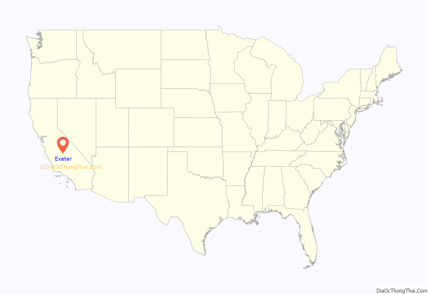
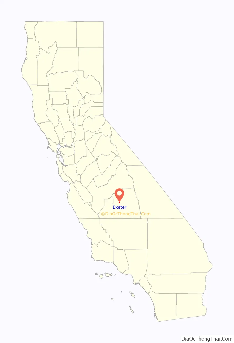
Exeter location map. Where is Exeter city?
History
Before the arrival of European settlers, Yokuts settled around an area in an oak forest two miles north of Exeter. The current town site was a plain that possessed elk, antelope, frogs, and deer. Rocky Hill, to the east of the city, offered shelter to native tribes when the plain flooded. Several caves on the hill contain petroglyphs, though some of the most important of these were destroyed by local vandals/looters and poorly managed and unsupervised steer.
The town site traces its roots to the construction of a railroad line through the San Joaquin Valley, by 1888 a line passed through the area. A representative of the Southern Pacific Railroad, D.W. Parkhurst, purchased the land from an early settler, John Firebaugh, and formed the town which he named after his own hometown of Exeter, England.
The damming of the Kaweah valley during the 1930s provided a reliable source of water for agriculture. Cattle ranching grew at the beginning of the 20th century, led by the Gill Cattle Company, which opened in the late 1800s and was once the largest such business in the United States. The town incorporated in 1911. In October, 1929, Exeter was the site of a large Anti-Filipino race riot. A mob stormed a Filipino work camp, bludgeoning 50 Filipino laborers and burning their camp to the ground. This race-riot sparked a wave of Anti-Filipino hatred. In 2006 the Exeter city of commerce officially apologized for such actions and offered restitution to survivors.
Professional artists depicting the history of the area have painted huge murals on exterior walls throughout the downtown area. There are currently 31 murals in this outdoor art gallery.
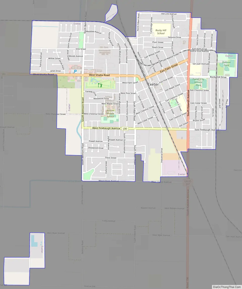
Exeter Road Map
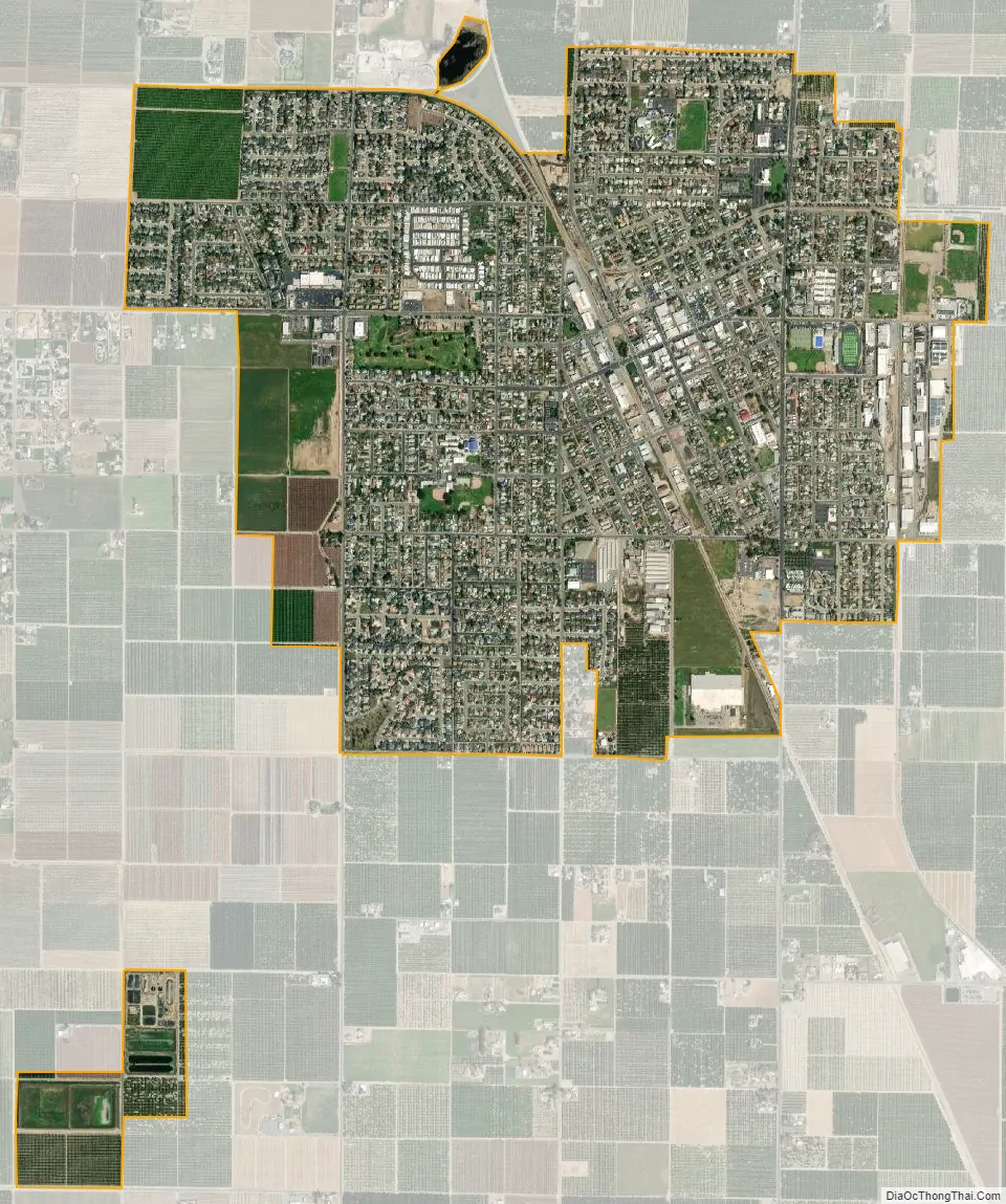
Exeter city Satellite Map
Geography
According to the United States Census Bureau, the city has a total area of 2.5 square miles (6.5 km), all of it land.
Climate
See also
Map of California State and its subdivision:- Alameda
- Alpine
- Amador
- Butte
- Calaveras
- Colusa
- Contra Costa
- Del Norte
- El Dorado
- Fresno
- Glenn
- Humboldt
- Imperial
- Inyo
- Kern
- Kings
- Lake
- Lassen
- Los Angeles
- Madera
- Marin
- Mariposa
- Mendocino
- Merced
- Modoc
- Mono
- Monterey
- Napa
- Nevada
- Orange
- Placer
- Plumas
- Riverside
- Sacramento
- San Benito
- San Bernardino
- San Diego
- San Francisco
- San Joaquin
- San Luis Obispo
- San Mateo
- Santa Barbara
- Santa Clara
- Santa Cruz
- Shasta
- Sierra
- Siskiyou
- Solano
- Sonoma
- Stanislaus
- Sutter
- Tehama
- Trinity
- Tulare
- Tuolumne
- Ventura
- Yolo
- Yuba
- Alabama
- Alaska
- Arizona
- Arkansas
- California
- Colorado
- Connecticut
- Delaware
- District of Columbia
- Florida
- Georgia
- Hawaii
- Idaho
- Illinois
- Indiana
- Iowa
- Kansas
- Kentucky
- Louisiana
- Maine
- Maryland
- Massachusetts
- Michigan
- Minnesota
- Mississippi
- Missouri
- Montana
- Nebraska
- Nevada
- New Hampshire
- New Jersey
- New Mexico
- New York
- North Carolina
- North Dakota
- Ohio
- Oklahoma
- Oregon
- Pennsylvania
- Rhode Island
- South Carolina
- South Dakota
- Tennessee
- Texas
- Utah
- Vermont
- Virginia
- Washington
- West Virginia
- Wisconsin
- Wyoming


