Farmersville is a city in the San Joaquin Valley in Tulare County, California, United States, just to the east of Visalia, California. The population was 10,397 at the 2020 census, down from 10,588 at the 2010 census.
The city helps sponsor many events throughout the year, including a Memorial Day Parade in May, which is well attended and manage to draw around 4,000 visitors from the surrounding areas every Memorial Day. In October a Fall Festival is held on the downtown boulevard. In December a Christmas Tree Lighting event is held at the Old Methodist Church building.
| Name: | Farmersville city |
|---|---|
| LSAD Code: | 25 |
| LSAD Description: | city (suffix) |
| State: | California |
| County: | Tulare County |
| Incorporated: | October 5, 1960 |
| Elevation: | 358 ft (109 m) |
| Land Area: | 2.20 sq mi (5.70 km²) |
| Water Area: | 0.00 sq mi (0.00 km²) 0% |
| Population Density: | 4,700/sq mi (1,800/km²) |
| ZIP code: | 93223 |
| Area code: | 559 |
| FIPS code: | 0623616 |
Online Interactive Map
Click on ![]() to view map in "full screen" mode.
to view map in "full screen" mode.
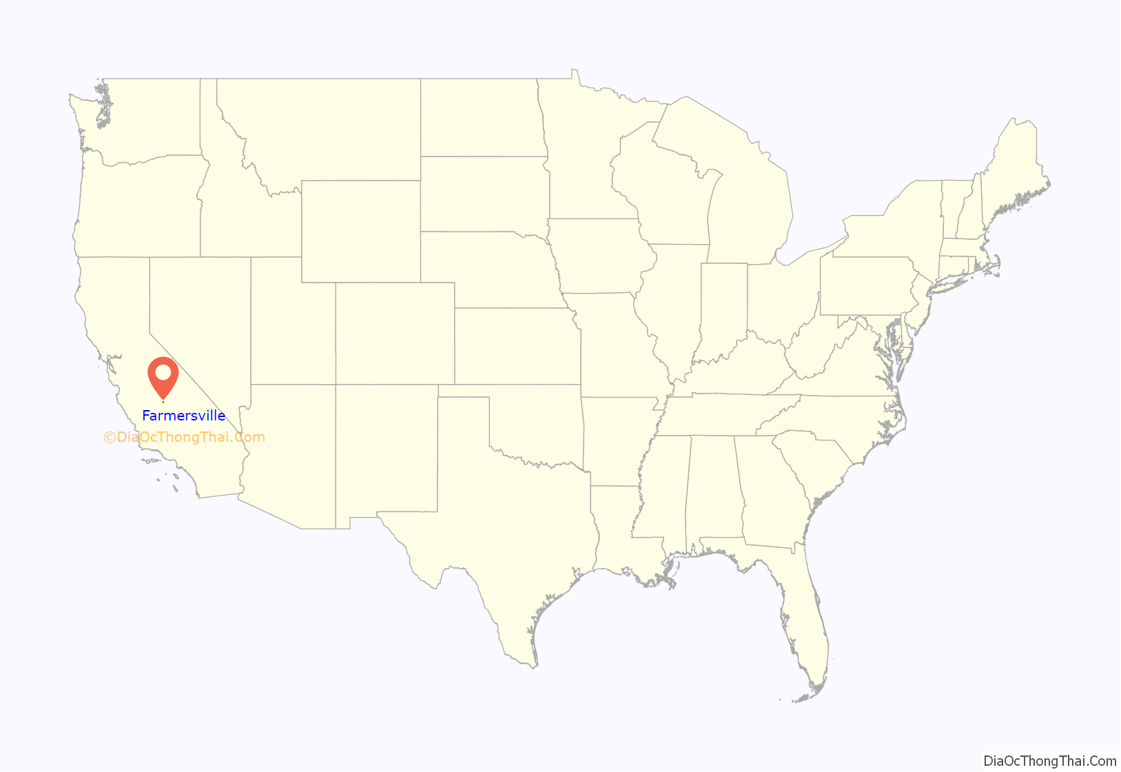
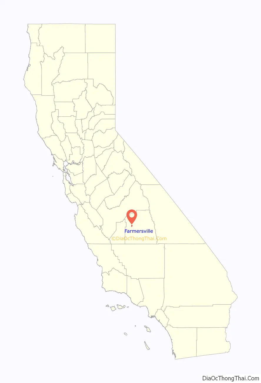
Farmersville location map. Where is Farmersville city?
History
The history of Farmersville began in the 1850s. This early community was called Deep Creek, located near the present Deep Creek Cemetery. There are headstones that date back to the 1850s.
Farmersville’s first school was built there to accommodate the farm children in the area. In the Fly family history, which is preserved in a book written about their travels to California, there is talk about attending the Deep Creek School in the 1860s. It was located East of the Cemetery.
Until 1863, other residents living on the east side of the county traveled through Farmersville on the Visalia Road. They rode their horse-drawn wagons to get their mail, purchase supplies and bring their goods to sell. The trip was long, so many would stop at the Wiley Hinds farm, just south of present-day Farmersville, to ask to sleep in his barn and continue their trip home the next day. Wiley Hinds was a former slave, and came from Arkansas with his brother, Archibald, in 1858. He settled in Farmersville, purchased other parcels for farming, and became very prosperous.
In 1866 two entrepreneurs, John Crowley and his brother in law Merrill Jasper opened a large general store in Farmersville. They wanted to capture the sales of residents on the east side of the county on their way to Visalia to get their mail. Unfortunately, they were not successful. In 1868 their nephew and also store manager Thomas J. Brundage, purchased the business from them. During this time the application for the Post Office and the name of the town were finally approved by the US Government. The store now became much more successful and eastern residents began to stop and pick up their mail. Mr. Brundage also had a lumber yard across the street from the general store. Oxen would pull the lumber shipment from the Sierra hills. Just east of the Brundage General Store was the Brown Hotel. It was constructed in 1870 for Edward Balaam and was later purchased by Charles Brown. The hotel was two stories and served meals to passengers during the horse changeover for the Overland Stage. Brown also owned the livery stable. The location of the Brundage General Merchandise store and the Brown Hotel is near what is now Sam’s Foods Supermarket (old Nickel’s Payless store), commemorated by a historic granite marker in the parking lot.
There was a large fire in 1910 that hit the corner of Visalia Rd and Farmersville Blvd. The Brundage General store received fire damage. The fire also burned a couple of other businesses and buildings and scorched the Methodist Church. This old wooden store was later known as Farmersville Trading Post and being destroyed in a fire in 1951. It was replaced with a Texaco Gas Station, which later became a Beacon Gas station. Today it is an empty lot.
In 1910 Thomas J. Brundage’s son, Oscar G. Brundage, who took over the general store decided to build an additional store, this time made of brick. It was completed in December 1910. He continued working in the stores at least until the late 1920s. Later it became Dixon’s Grocery Store, owned by Floyd Dixon. After that, it became Ryan’s Grocery Store. In the 1940s it became a bar called the Frontier Club. It was finally destroyed in a fire in the 1960s. It sat on the Southeast corner of Visalia Rd and Farmersville Blvd, where Rainbow’s Drive In sits today.
In 1945 the town had voted to pay for its own police department. The town had one Police Officer on duty during this time. Before 1960, the town was under the authority of the County. A small group of residents presented themselves to these officials for any needs of the town.
Discussion to incorporate started as early as 1945. Don Freeman began the petition and application process that lead to the city’s incorporation on October 5, 1960. The first city council was composed of James Tornow, Mayor, Truman Qualls, Don Freeman, Willis Freeman, and Jim Steven. Carl Waddle was the first City Clerk. Early on the City struggled to get proper water delivery and wastewater treatment. In 1968 the Wastewater treatment plant loan was made for $480,000 to build the first plant and transmission infrastructure. The city residents in 1968 seriously discussed dis-incorporation led by store owner Tom Bray.
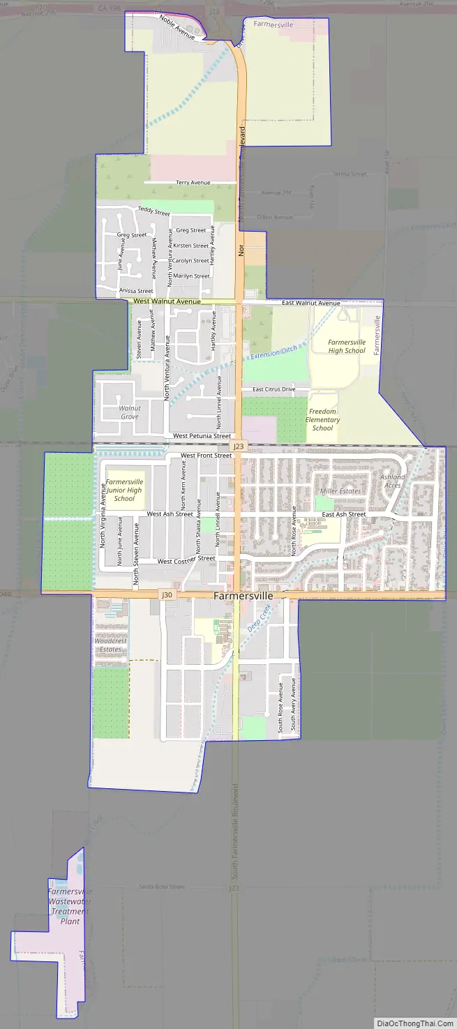
Farmersville Road Map
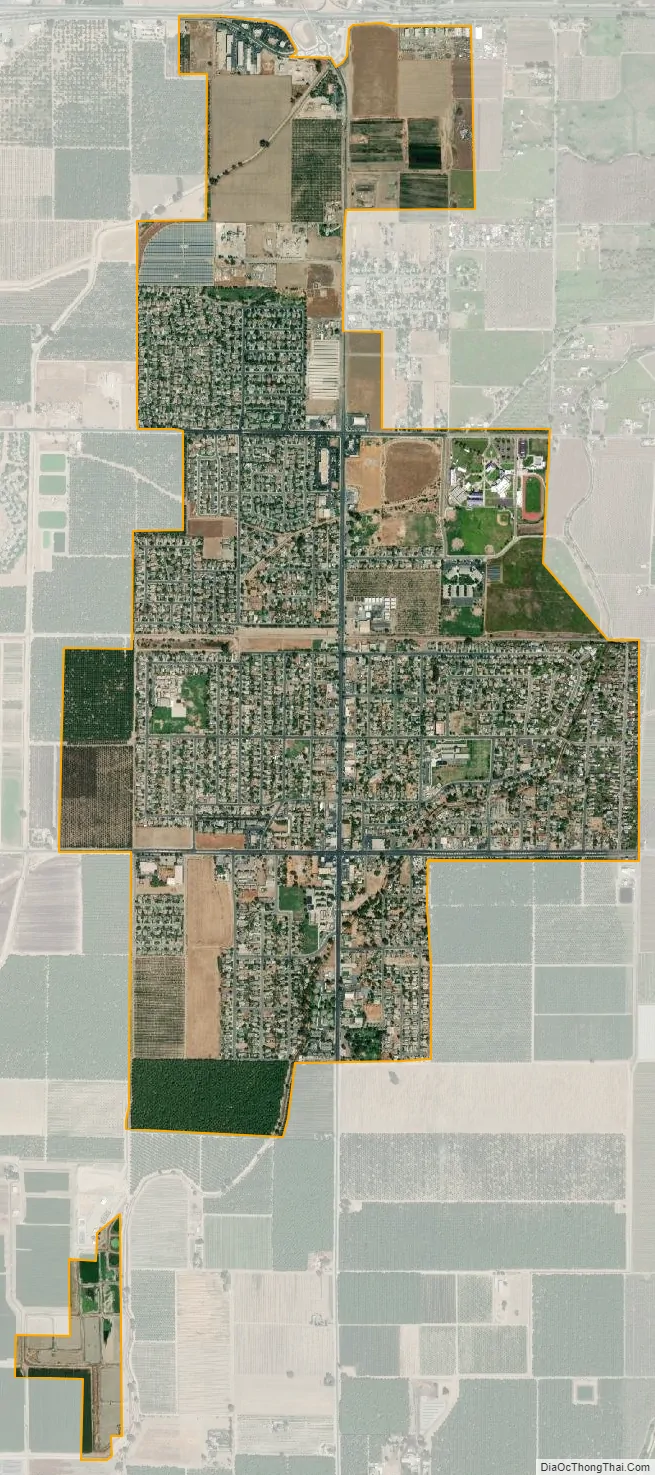
Farmersville city Satellite Map
Geography
Farmersville is located at 36°18′4″N 119°12′27″W / 36.30111°N 119.20750°W / 36.30111; -119.20750 (36.301169, -119.207603).
According to the United States Census Bureau, the city has a total area of 2.3 square miles (6.0 km), all of it land.
See also
Map of California State and its subdivision:- Alameda
- Alpine
- Amador
- Butte
- Calaveras
- Colusa
- Contra Costa
- Del Norte
- El Dorado
- Fresno
- Glenn
- Humboldt
- Imperial
- Inyo
- Kern
- Kings
- Lake
- Lassen
- Los Angeles
- Madera
- Marin
- Mariposa
- Mendocino
- Merced
- Modoc
- Mono
- Monterey
- Napa
- Nevada
- Orange
- Placer
- Plumas
- Riverside
- Sacramento
- San Benito
- San Bernardino
- San Diego
- San Francisco
- San Joaquin
- San Luis Obispo
- San Mateo
- Santa Barbara
- Santa Clara
- Santa Cruz
- Shasta
- Sierra
- Siskiyou
- Solano
- Sonoma
- Stanislaus
- Sutter
- Tehama
- Trinity
- Tulare
- Tuolumne
- Ventura
- Yolo
- Yuba
- Alabama
- Alaska
- Arizona
- Arkansas
- California
- Colorado
- Connecticut
- Delaware
- District of Columbia
- Florida
- Georgia
- Hawaii
- Idaho
- Illinois
- Indiana
- Iowa
- Kansas
- Kentucky
- Louisiana
- Maine
- Maryland
- Massachusetts
- Michigan
- Minnesota
- Mississippi
- Missouri
- Montana
- Nebraska
- Nevada
- New Hampshire
- New Jersey
- New Mexico
- New York
- North Carolina
- North Dakota
- Ohio
- Oklahoma
- Oregon
- Pennsylvania
- Rhode Island
- South Carolina
- South Dakota
- Tennessee
- Texas
- Utah
- Vermont
- Virginia
- Washington
- West Virginia
- Wisconsin
- Wyoming


