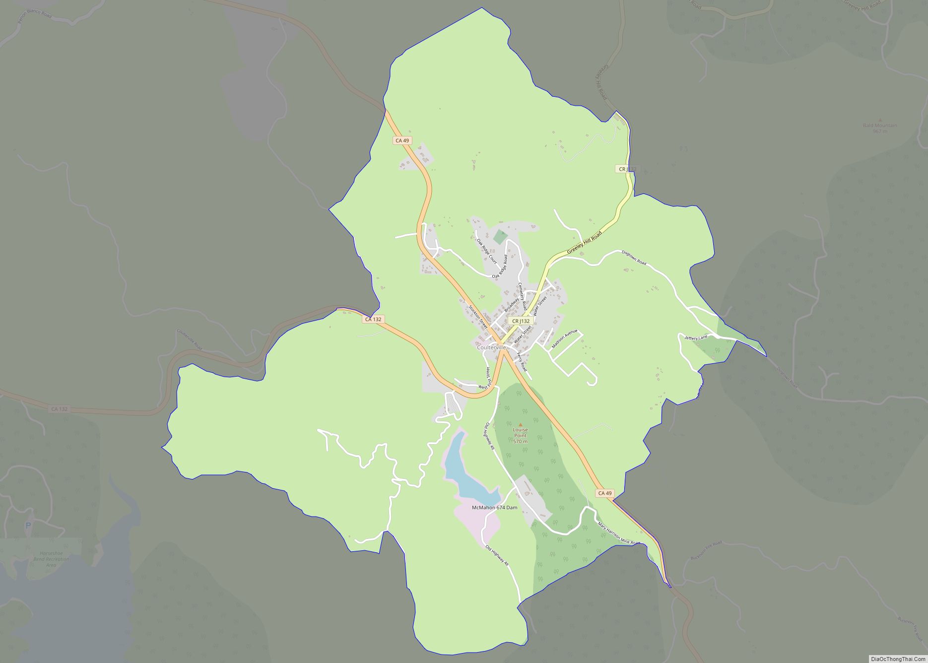
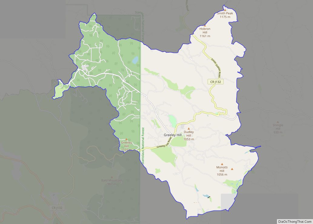
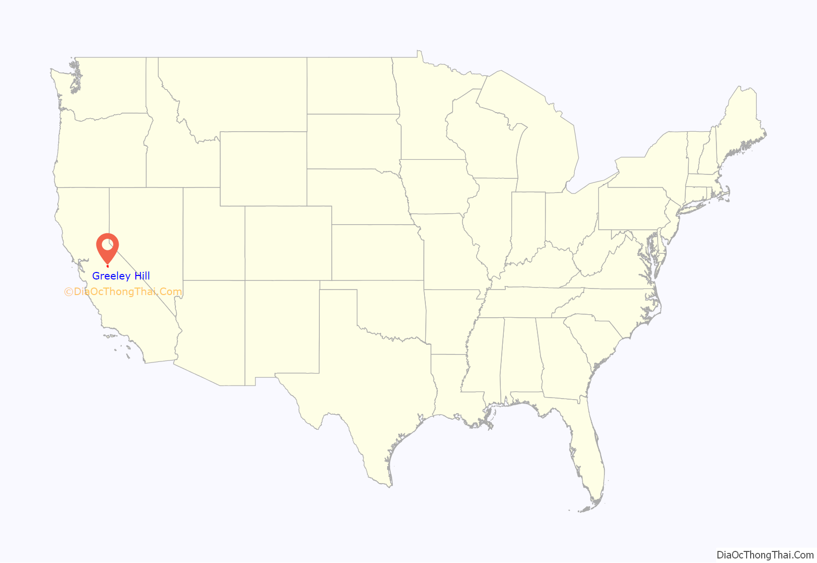
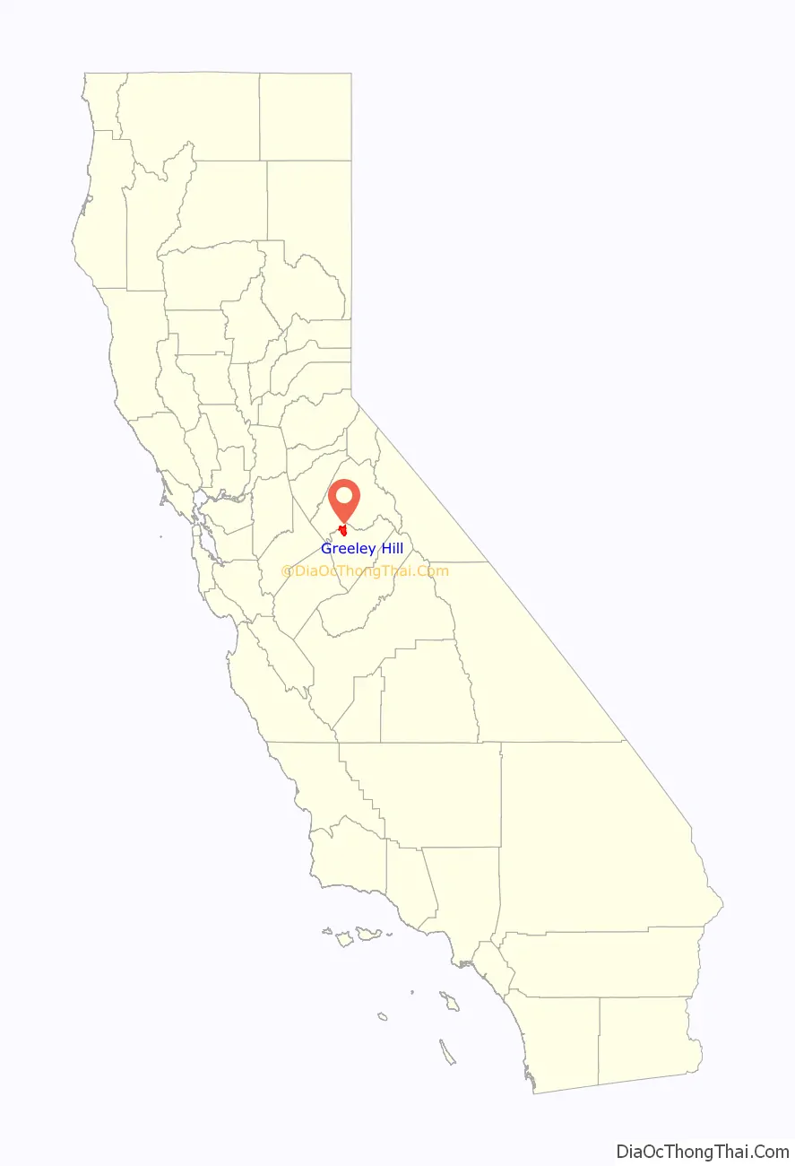
Greeley Hill is a census-designated place in Mariposa County, California, United States. Greeley Hill sits at an elevation of 3,153 feet (961 m) in the foothills of the Sierra Nevada. The 2020 United States census reported Greeley Hill’s population as 927.
| Name: | Greeley Hill CDP |
|---|---|
| LSAD Code: | 57 |
| LSAD Description: | CDP (suffix) |
| State: | California |
| County: | Mariposa County |
| Elevation: | 3,153 ft (961 m) |
| Total Area: | 23.927 sq mi (61.97 km²) |
| Land Area: | 23.881 sq mi (61.85 km²) |
| Water Area: | 0.046 sq mi (0.12 km²) 0.19% |
| Total Population: | 927 |
| Population Density: | 38.8/sq mi (15.0/km²) |
| ZIP code: | 95311 (Coulterville) |
| FIPS code: | 0630900 |
| GNISfeature ID: | 2583028 |
Online Interactive Map
Click on ![]() to view map in "full screen" mode.
to view map in "full screen" mode.
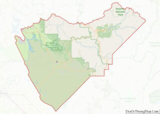
Greeley Hill location map. Where is Greeley Hill CDP?
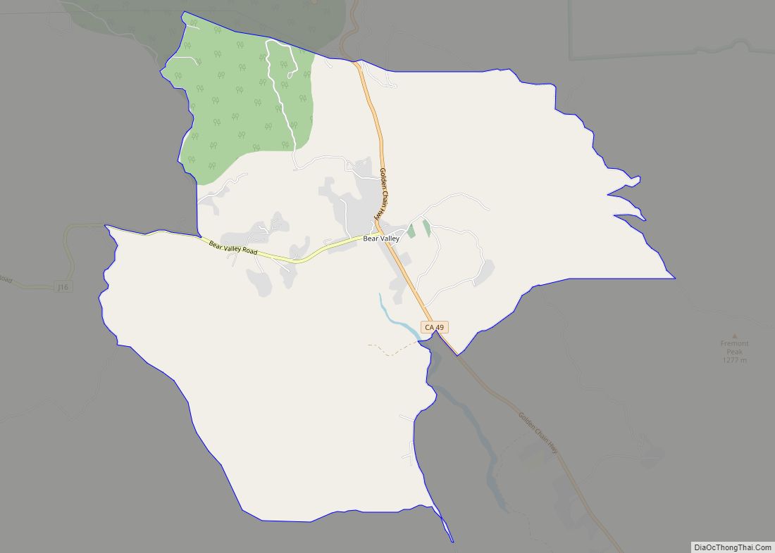
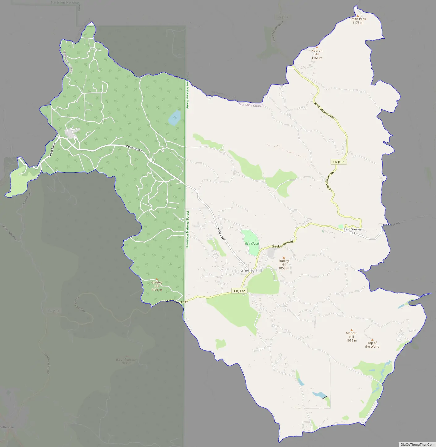
Greeley Hill Road Map
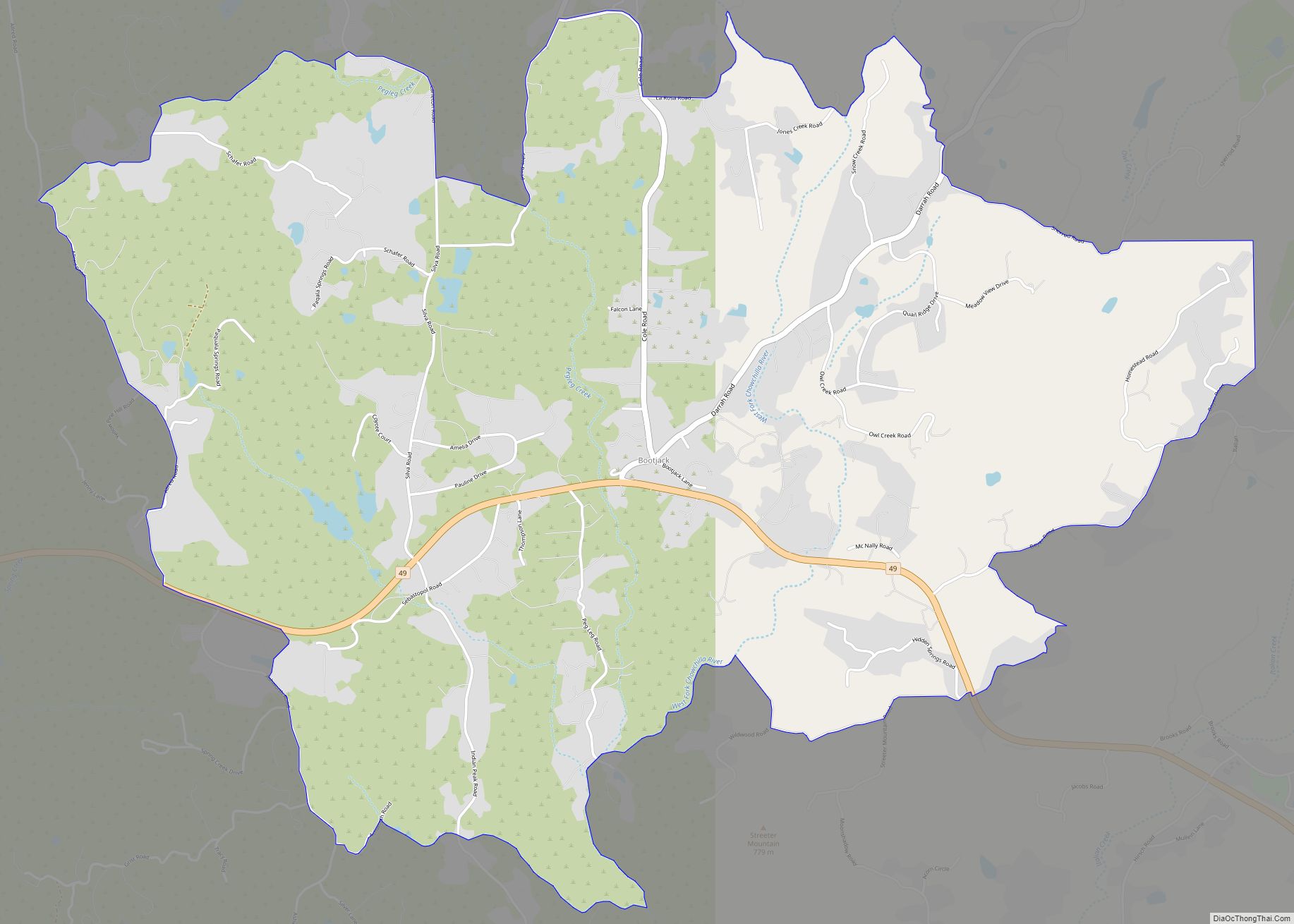
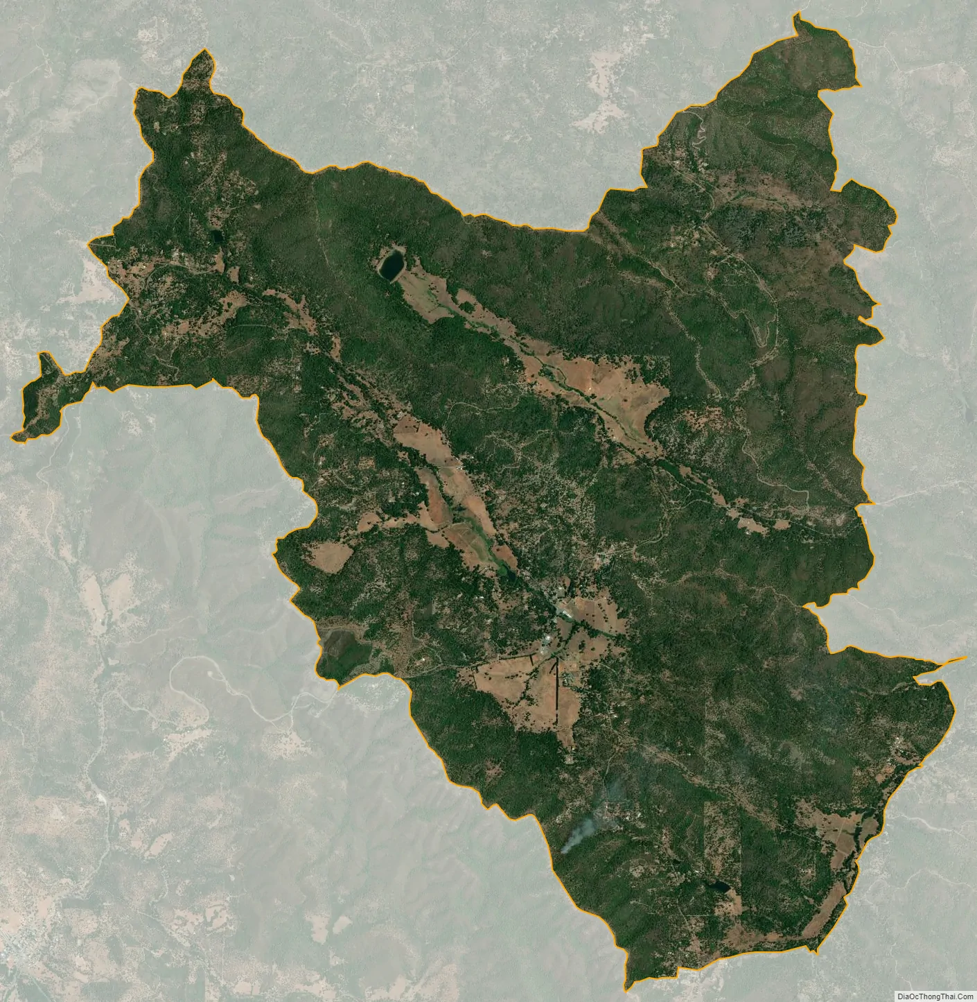
Greeley Hill city Satellite Map
Geography
The community is on the northern border of Mariposa County, with Tuolumne County to the north. It shares a ZIP Code (95311) with the town of Coulterville, which is 6 miles (10 km) to the southwest down Greeley Hill Road.
According to the United States Census Bureau, the CDP has an area of 23.927 square miles (61.97 km), of which 0.05 square miles (0.13 km), or 0.19%, are water. The town center is in a wide upland valley drained by Bean Creek, which flows east to the North Fork of the Merced River within Stanislaus National Forest.
See also
Map of California State and its subdivision:- Alameda
- Alpine
- Amador
- Butte
- Calaveras
- Colusa
- Contra Costa
- Del Norte
- El Dorado
- Fresno
- Glenn
- Humboldt
- Imperial
- Inyo
- Kern
- Kings
- Lake
- Lassen
- Los Angeles
- Madera
- Marin
- Mariposa
- Mendocino
- Merced
- Modoc
- Mono
- Monterey
- Napa
- Nevada
- Orange
- Placer
- Plumas
- Riverside
- Sacramento
- San Benito
- San Bernardino
- San Diego
- San Francisco
- San Joaquin
- San Luis Obispo
- San Mateo
- Santa Barbara
- Santa Clara
- Santa Cruz
- Shasta
- Sierra
- Siskiyou
- Solano
- Sonoma
- Stanislaus
- Sutter
- Tehama
- Trinity
- Tulare
- Tuolumne
- Ventura
- Yolo
- Yuba
- Alabama
- Alaska
- Arizona
- Arkansas
- California
- Colorado
- Connecticut
- Delaware
- District of Columbia
- Florida
- Georgia
- Hawaii
- Idaho
- Illinois
- Indiana
- Iowa
- Kansas
- Kentucky
- Louisiana
- Maine
- Maryland
- Massachusetts
- Michigan
- Minnesota
- Mississippi
- Missouri
- Montana
- Nebraska
- Nevada
- New Hampshire
- New Jersey
- New Mexico
- New York
- North Carolina
- North Dakota
- Ohio
- Oklahoma
- Oregon
- Pennsylvania
- Rhode Island
- South Carolina
- South Dakota
- Tennessee
- Texas
- Utah
- Vermont
- Virginia
- Washington
- West Virginia
- Wisconsin
- Wyoming