Groveland is a census-designated place (CDP) in Tuolumne County, California. Groveland sits at an elevation of 3,136 feet (956 m). The 2020 United States census reported Groveland’s population was 540.
Groveland was created as a CDP prior to the 2010 census; previously it was part of Groveland-Big Oak Flat CDP.
| Name: | Groveland CDP |
|---|---|
| LSAD Code: | 57 |
| LSAD Description: | CDP (suffix) |
| State: | California |
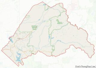
| County: | Tuolumne County |
| Elevation: | 3,136 ft (956 m) |
| Total Area: | 9.567 sq mi (24.779 km²) |
| Land Area: | 9.561 sq mi (24.764 km²) |
| Water Area: | 0.006 sq mi (0.015 km²) 0.06% |
| Total Population: | 540 |
| Population Density: | 56/sq mi (22/km²) |
| ZIP code: | 95321 |
| Area code: | 209 |
| FIPS code: | 0631372 |
| GNISfeature ID: | 2628856 |
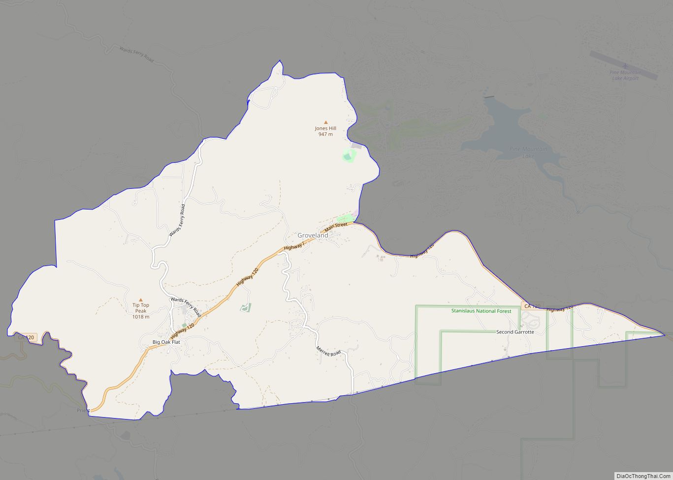
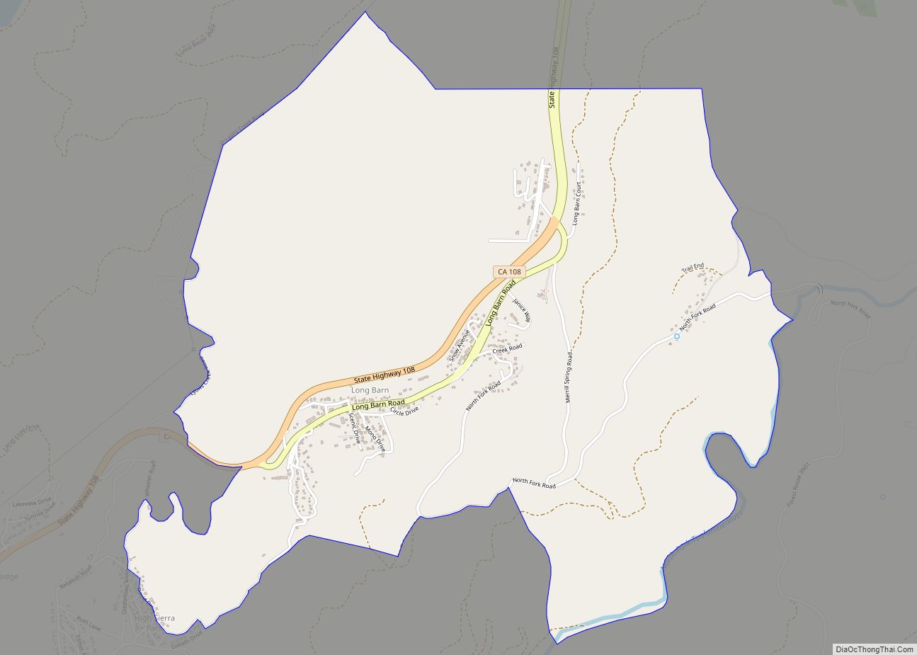
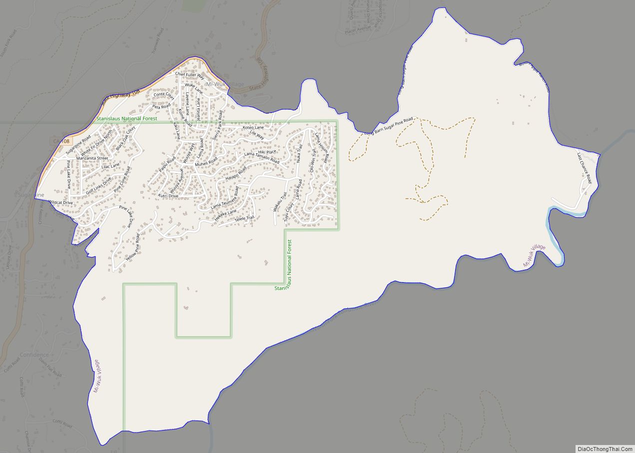
Online Interactive Map
Click on ![]() to view map in "full screen" mode.
to view map in "full screen" mode.
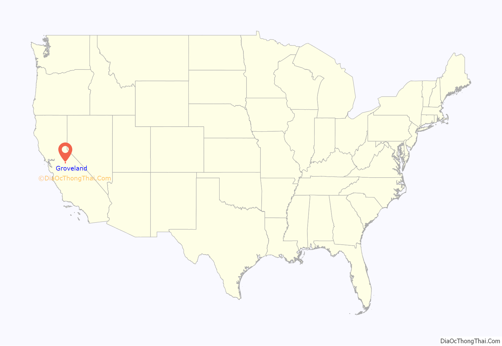
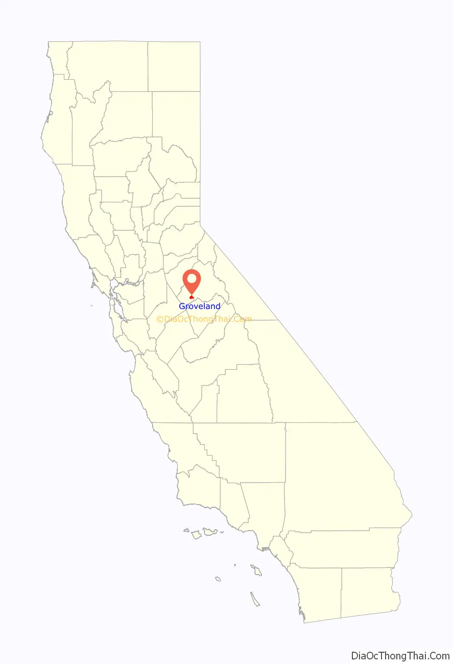
Groveland location map. Where is Groveland CDP?
History
Groveland has always been an important stop on the highway to Yosemite but really grew in the early 1900s with the development of the Tuolumne River Hetch-Hetchy water project for the city of San Francisco. Groveland is adjacent to the Stanislaus National Forest and is known for the historic Iron Door Saloon.
Groveland was originally a gold rush town and then became a sleepy farming community until the San Francisco Hetch Hetchy water project made it their headquarters and built a railroad yard and hospital for the work crews (both now gone). From 1915 till 1935, Groveland was a boom town supporting seven hotels, 10,000 residents and much activity. When the work crews left, the town again became a minor stop on the way to Yosemite until the Boise Cascade company built the Pine Mountain Lake community with a first class golf course, an airport and lake and staked out 5,000 lots. This development has since grown from a summer home area to a retirement community to a thriving neighborhood with year-round families, boosting the once sleepy Groveland to a travel and vacation destination in its own right.
Groveland is the main town on the Highway 120 route to Yosemite National Park, and boasts numerous lodging and restaurant businesses.
Tioga High School and Tenaya Elementary School are located in Groveland.
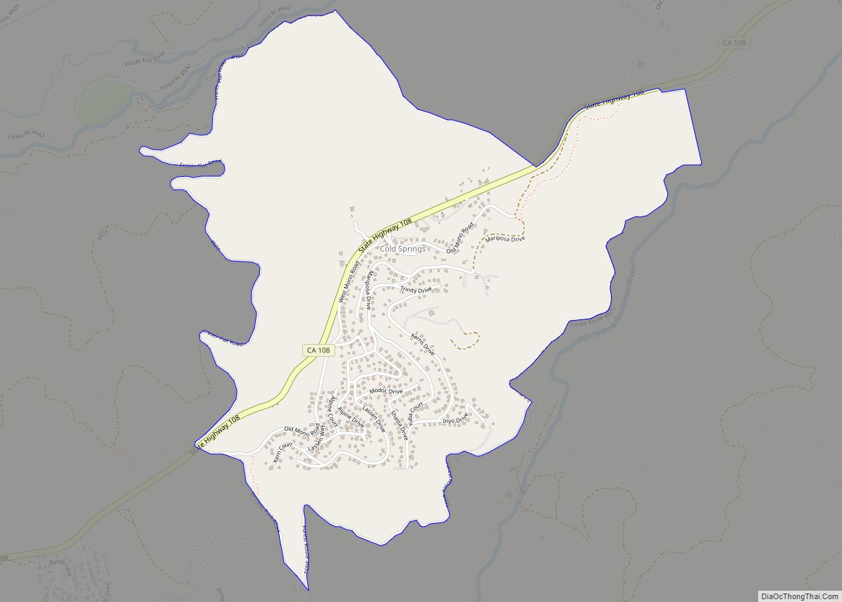
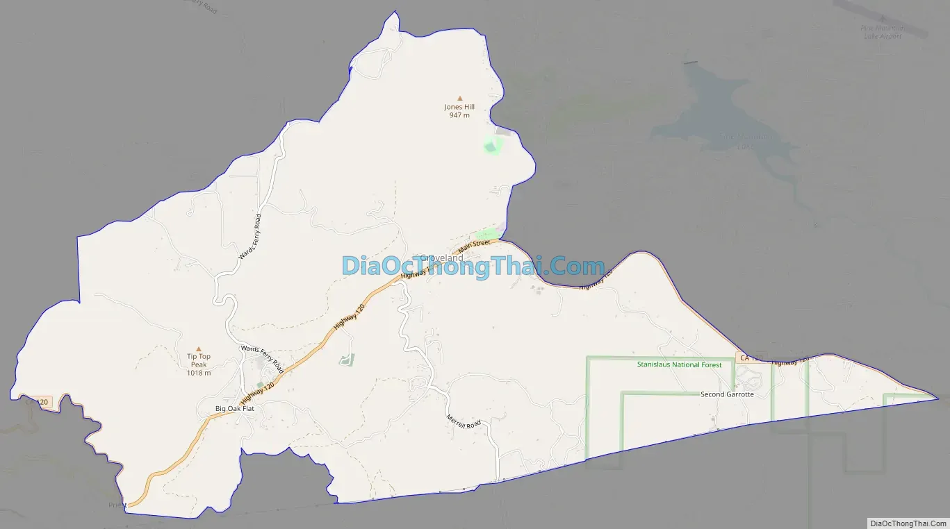
Groveland Road Map
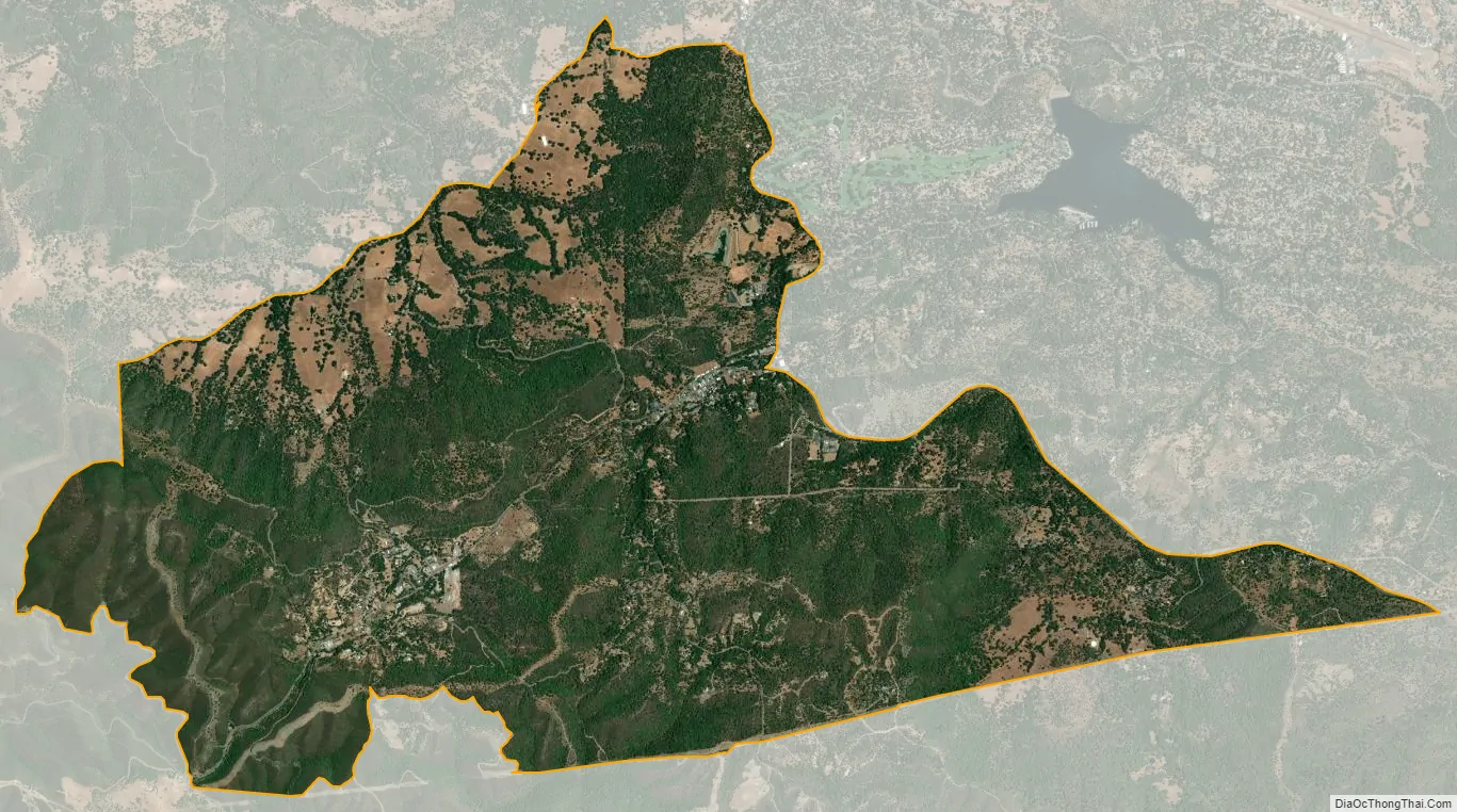
Groveland city Satellite Map
Geography
According to the United States Census Bureau, the CDP covers an area of 9.6 square miles (24.8 km), 99.94% of it land and 0.06% of it water.
Climate
This region experiences warm to very hot and dry summers, with the hottest month having an average temperature of 73.7°F. According to the Köppen Climate Classification system, Groveland has a hot-summer Mediterranean climate, abbreviated “Csa.”
See also
Map of California State and its subdivision:- Alameda
- Alpine
- Amador
- Butte
- Calaveras
- Colusa
- Contra Costa
- Del Norte
- El Dorado
- Fresno
- Glenn
- Humboldt
- Imperial
- Inyo
- Kern
- Kings
- Lake
- Lassen
- Los Angeles
- Madera
- Marin
- Mariposa
- Mendocino
- Merced
- Modoc
- Mono
- Monterey
- Napa
- Nevada
- Orange
- Placer
- Plumas
- Riverside
- Sacramento
- San Benito
- San Bernardino
- San Diego
- San Francisco
- San Joaquin
- San Luis Obispo
- San Mateo
- Santa Barbara
- Santa Clara
- Santa Cruz
- Shasta
- Sierra
- Siskiyou
- Solano
- Sonoma
- Stanislaus
- Sutter
- Tehama
- Trinity
- Tulare
- Tuolumne
- Ventura
- Yolo
- Yuba
- Alabama
- Alaska
- Arizona
- Arkansas
- California
- Colorado
- Connecticut
- Delaware
- District of Columbia
- Florida
- Georgia
- Hawaii
- Idaho
- Illinois
- Indiana
- Iowa
- Kansas
- Kentucky
- Louisiana
- Maine
- Maryland
- Massachusetts
- Michigan
- Minnesota
- Mississippi
- Missouri
- Montana
- Nebraska
- Nevada
- New Hampshire
- New Jersey
- New Mexico
- New York
- North Carolina
- North Dakota
- Ohio
- Oklahoma
- Oregon
- Pennsylvania
- Rhode Island
- South Carolina
- South Dakota
- Tennessee
- Texas
- Utah
- Vermont
- Virginia
- Washington
- West Virginia
- Wisconsin
- Wyoming