Idyllwild, Pine Cove, and Fern Valley are three adjacent unincorporated communities in the San Jacinto Mountains in Riverside County, California, United States. Idyllwild is the largest of the three. For statistical purposes, the United States Census Bureau has defined Idyllwild–Pine Cove as a census-designated place (CDP). The CDP’s population was 3,874 at the 2010 census, up from 3,504 as of the 2000 census.
Idyllwild is on the Pacific Crest Trail.
“Mile-high Idyllwild” is a mountain resort about one mile (1600 m) in altitude. Idyllwild is flanked by two large rock formations, Tahquitz Rock (also known as Lily Rock) and Suicide Rock, which are famous in Southern California rock-climbing circles. It offers no skiing, so “the Hill” has been minimally developed over the years and remains a center for hiking, mountain and rock climbing, mountain biking, and horseback riding.
| Name: | Idyllwild-Pine Cove CDP |
|---|---|
| LSAD Code: | 57 |
| LSAD Description: | CDP (suffix) |
| State: | California |
| County: | Riverside County |
| Elevation: | 5,413 ft (1,650 m) |
| Total Area: | 13.733 sq mi (35.568 km²) |
| Land Area: | 13.723 sq mi (35.542 km²) |
| Water Area: | 0.010 sq mi (0.026 km²) 0.07% |
| ZIP code: | 92549 |
| Area code: | 951 |
| FIPS code: | 0636203 |
| GNISfeature ID: | 2408414 |
Online Interactive Map
Click on ![]() to view map in "full screen" mode.
to view map in "full screen" mode.
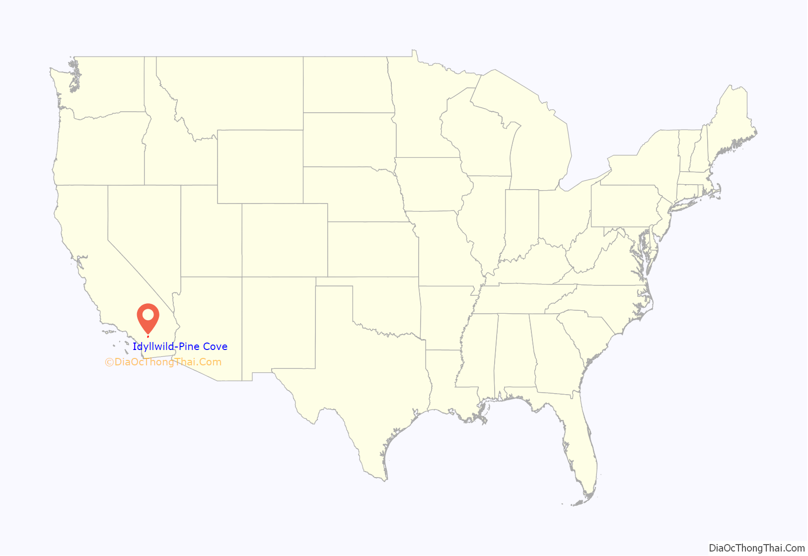
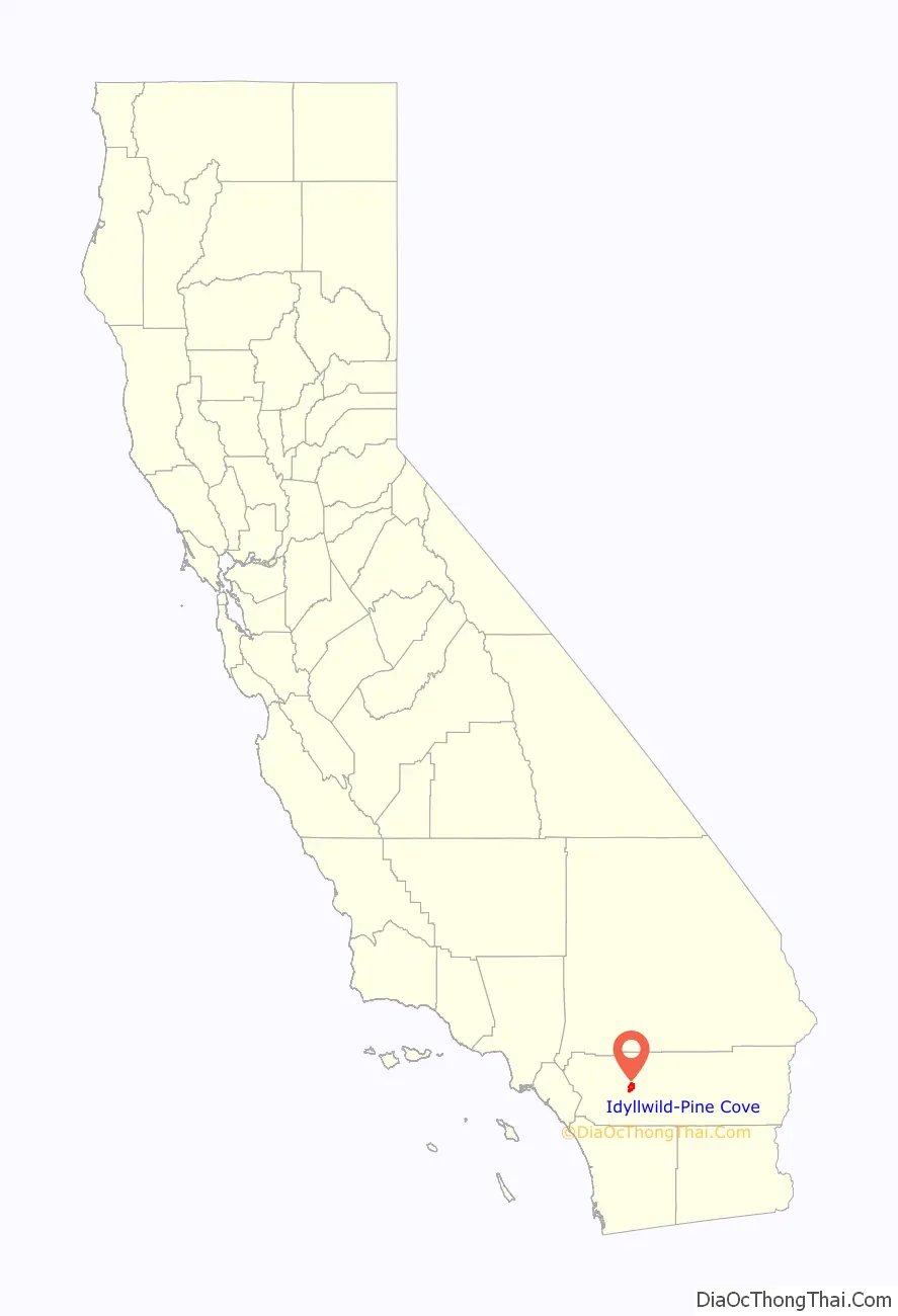
Idyllwild-Pine Cove location map. Where is Idyllwild-Pine Cove CDP?
History
Idyllwild was once the summer home for bands of Cahuilla Indians, who migrated there to escape the heat of lower-elevation deserts. The Cahuilla’s grinding slabs can still be seen in Idyllwild.
A Cahuilla legend recounts how tribesmen chanted over the body of their fallen chieftain Tahquitz, or Takwish, who had been possessed by an evil spirit and killed his sweetheart. Suddenly his body began to glow like fire, and he rose and settled on Idyllwild’s Tahquitz Rock. According to the legend, Tahquitz is trapped beneath the rock with a rattlesnake and a condor for company, and when the mountain shakes and trembles, it is not an earthquake, but Tahquitz up to his evil tricks on Tahquitz Rock.
Idyllwild was originally known as Strawberry Valley because of the wild strawberries that grow there, especially beside the creek that runs through the town, Strawberry Creek. Shepherds regularly brought their flocks to the valley. In the 1880s, the Domenigoni family of San Jacinto homesteaded land near what is now Idyllwild Arts Academy. In 1889, George and Sarah Hannahs built a summer camp next to their sawmill in upper Dutch Flat and named it Camp Idyllwilde. By the 1890s a toll road had been built from Hemet, which opened Idyllwild to settlement, logging, and tourism. A post office was established in 1893; at this time, the town was called Rayneta after the Hannahs’ son Raymond.
In 1901, the Idyllwild Sanatorium was built to treat tuberculosis patients. It was soon remodeled as a resort called Idyllwild Among the Pines, and later Idyllwild. The same year, the town’s name was changed to Idyllwild.
The Tribe of Tahquitz Boy Scout honor society was created in Idyllwild in 1925.
With the advent of the automobile, Idyllwild became a weekend tourist attraction for Southern Californians. For many years, the town presented itself as an alpine village, and hotels and businesses had German or German-sounding names, but this practice ended during World War II.
From the 1930s to the 1950s, Idyllwild was a center for the production of “knotty pine furniture”, the fine log furniture made in the Arts and Crafts style. Under Charles “Selden” Belden’s direction, the furniture was produced by the Idyllwild Pinecraft Furniture Company and, later, C. Selden Belden Idyllwild Pinecraft. The furniture is now “collectible” and can be found in many Idyllwild houses and cabins.
In the 1950s, the Yosemite Decimal System of grading routes was developed at Tahquitz by members of the Rock Climbing Section of the Angeles Chapter of the Sierra Club. In 1957 architect Frank Gehry designed and constructed his first private residence. Built along with USC classmate/architect Greg Walsh, The David Cabin shows early inspirational Asian influences and characteristics of Gehry’s later works, including unfinished ceiling beams and other exposed materials. It is on Middle Ridge Drive.
In the late 1960s and 1970s, there was an influx of hippies to Idyllwild that changed the town and alarmed many longtime residents. Timothy Leary lived on a ranch in nearby Garner Valley, with the ranch serving as the headquarters of The Brotherhood of Eternal Love. In 2019 YouTube celebrity Logan Paul bought the ranch.
From 1974 to 1979, Idyllwild hosted the Idyllwild Bluegrass Invitational, then Southern California’s only bluegrass music festival (it was inspired by the Julian Banjo-Fiddle Contest, which takes place on the third weekend in September). From the 1950s through the 1970s Idyllwild also hosted the Bear Flag Festival, which honored California’s Bear Flag and marked the passing of the grizzly bear from California, the last of which, according to local legend, was killed at Hurkey Creek in Garner Valley.
Most high school-age students in Idyllwild attend school in Hemet, which requires them to travel by school bus some 35 miles (56 km) in distance and 3,000 feet (910 m) in altitude to and from school. Since the 1950s, some Idyllwild parents have agitated for a high school in the town, and there have been many attempts at establishing high schools, but most were short-lived. Startup schools that failed included Hi-Lo, or LIFE (Living in Free Education, a public school where Idyllwild Arts Academy now stands, operated by Mary Glavin in 1973–76), New Schole Ranch (a private school in Mountain Center), and Freedom Schools, Inc. (a private school operated in Mountain Center by Mary Ellen DuBay). Desert Sun School (later called the Elliott-Pope School), a private boarding school that accepted boarders and day students, closed in December 1990, due to financial mischief, after operating for 65 years.
Idyllwild, Garner Valley and Lake Hemet have been used for filming since the silent film era. Although most of Cecil B. DeMille’s The Squaw Man (1914) was filmed in the Los Angeles vicinity, footage of cattle on the open range were shot at the “H.J.” Ranch at Keen Camp, midway between Idyllwild and Garner Valley. A number of Westerns have been filmed at the Garner Ranch in Garner Valley: Guns and Guitars (1936), Heading for the Rio Grande (1936), Springtime in the Rockies (1937), Brothers in the Saddle (1949), Riders of the Range (1949), and Storm over Wyoming (1950). The Garner Ranch also stood in for the Ponderosa in episodes of the TV show Bonanza. In 1961 and 1962, the Elvis Presley musical Kid Galahad was filmed in the Idyllwild vicinity. The 1980s television series Air Wolf and various car commercials were also filmed in the area. The biker funeral procession from the 1966 film The Wild Angels was filmed in Idyllwild and included the Silver Pines Lodge, which was named Hillbilly Lodge at the time of filming. Some of Steven Suptic’s Sugar Pine 7, a YouTube comedy series, takes place in Idyllwild.
Idyllwild was listed in the 1998 book 100 Best Small Art Towns in America, by John Villani.
In 2012, a Golden Retriever named Max was elected as the “Mayor” of Idyllwild (which, as part of an unincorporated community, has no local government) out of a running of fourteen dogs and two cats as part of a fundraising event held by and for the non-profit organization Idyllwild Animal Rescue Friends (ARF). In 2013, Mayor Max died, and Maximus Mighty Dog Mueller II, another Golden Retriever, arrived in Idyllwild to complete the remainder of the term. In March 2014, as the end of Max’s term approached, ARF solicited the town’s interest in holding another election, after which Mayor Max II became Mayor in perpetuity. Mayor Max II died on July 30, 2022, after a brief medical issue.
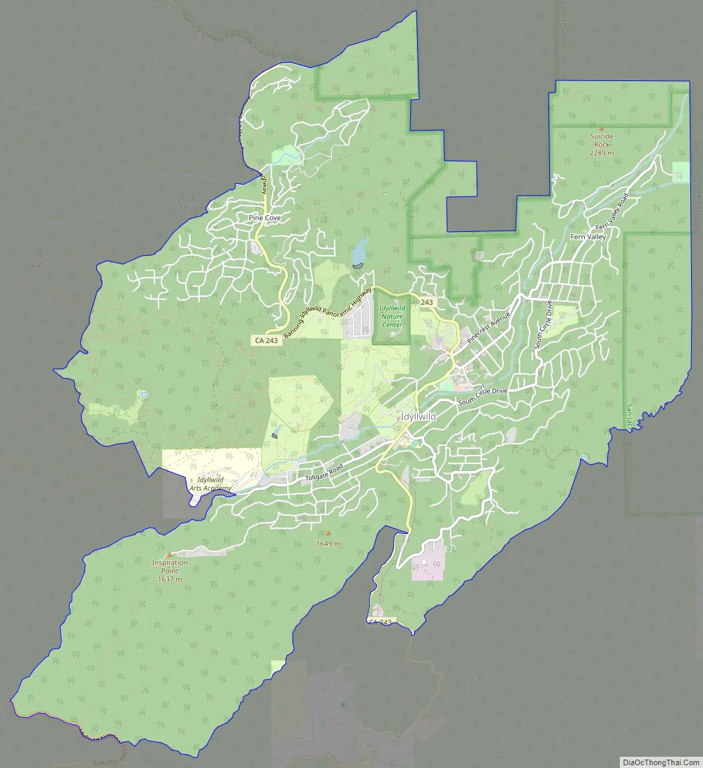
Idyllwild-Pine Cove Road Map
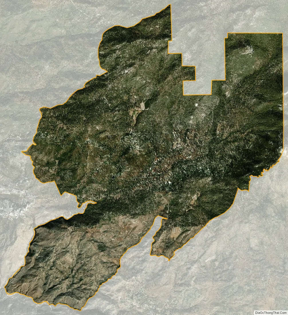
Idyllwild-Pine Cove city Satellite Map
Geography
The Idyllwild–Pine Cove–Fern Valley CDP in Southern California’s San Jacinto Mountains as defined by the United States Census Bureau statistical purposes may not precisely correspond to local understanding of the areas with the same names. The area includes 10,834-foot (3,302 m) high San Jacinto Peak, Southern California’s second highest mountain, after Mount San Gorgonio.
Idyllwild lies mostly within a high mountain valley bisected by a small year-round stream, Strawberry Creek.
Pine Cove occupies a ridgetop location nearly 1,000 feet (300 m) higher than Idyllwild.
Flora and fauna
Ancient ponderosa pine is the major flora of the area. Many other plant species are known to occur in the area too, such as the California incense-cedar, Bigcone Douglas fir, and California black oak. Rainbow trout occur in Lake Fulmor and Strawberry Creek, and Mule deer, Squirrels, and Chipmunks roam the forest.
Climate
Under the Köppen climate classification system, Idyllwild–Pine Cove has a warm-summer Mediterranean climate, abbreviated “Csb” on climate maps. Winter is cool with occasional rain storms and snow showers. January daily high temperatures are usually between 50–60 °F (10–16 °C) with lows just below freezing. On average, the lowest winter temperature is 14 °F (−10 °C), putting the area in hardiness zone 8A. Spring starts slowly but then gets warmer in April and is usually a pleasant time of year.
Summer is hot and dry, but temperatures cool off to below 60 °F (16 °C) at night and days are more similar to the coastal areas than to the deserts. An average of 17.7 days a year exceed 90 °F (32 °C), very low for inland California. Late summer brings occasional thunderstorms from the North American Monsoon. Fall is warm and dry, with the first freezes by October and the first snows by November.
The record high is 104 °F (40 °C) on September 6, 2020 and June 16, 2021, while the record low is 1 °F (−17 °C) on January 5, 1971. The lowest high ever was 23 °F (−5 °C) on January 10, 1949 while the highest low was 77 °F (25 °C) on July 10, 2002.
The wettest year was 1983 with 56.87 inches (144 cm) of precipitation. The wettest month was January 1993 with 23.72 inches (60 cm) of rainfall, and the wettest day had 6.66 inches (17 cm) of rainfall on December 5, 1966. With only 10.84 inches (28 cm) of rain, 1961 was the driest year on record.
Snow falls every winter. The snowiest season by far was 1948–1949 with 108.1 inches (275 cm). The snowiest month ever was January 1949 with 49.0 inches (124 cm), and the snowiest day ever was March 24, 1964, when 22.0 inches (56 cm) of snow fell. There has never been a snowless season on record. The 34.8 inches (88 cm) of snow in 1983–1984 was the least snowy season ever.
See also
Map of California State and its subdivision:- Alameda
- Alpine
- Amador
- Butte
- Calaveras
- Colusa
- Contra Costa
- Del Norte
- El Dorado
- Fresno
- Glenn
- Humboldt
- Imperial
- Inyo
- Kern
- Kings
- Lake
- Lassen
- Los Angeles
- Madera
- Marin
- Mariposa
- Mendocino
- Merced
- Modoc
- Mono
- Monterey
- Napa
- Nevada
- Orange
- Placer
- Plumas
- Riverside
- Sacramento
- San Benito
- San Bernardino
- San Diego
- San Francisco
- San Joaquin
- San Luis Obispo
- San Mateo
- Santa Barbara
- Santa Clara
- Santa Cruz
- Shasta
- Sierra
- Siskiyou
- Solano
- Sonoma
- Stanislaus
- Sutter
- Tehama
- Trinity
- Tulare
- Tuolumne
- Ventura
- Yolo
- Yuba
- Alabama
- Alaska
- Arizona
- Arkansas
- California
- Colorado
- Connecticut
- Delaware
- District of Columbia
- Florida
- Georgia
- Hawaii
- Idaho
- Illinois
- Indiana
- Iowa
- Kansas
- Kentucky
- Louisiana
- Maine
- Maryland
- Massachusetts
- Michigan
- Minnesota
- Mississippi
- Missouri
- Montana
- Nebraska
- Nevada
- New Hampshire
- New Jersey
- New Mexico
- New York
- North Carolina
- North Dakota
- Ohio
- Oklahoma
- Oregon
- Pennsylvania
- Rhode Island
- South Carolina
- South Dakota
- Tennessee
- Texas
- Utah
- Vermont
- Virginia
- Washington
- West Virginia
- Wisconsin
- Wyoming


