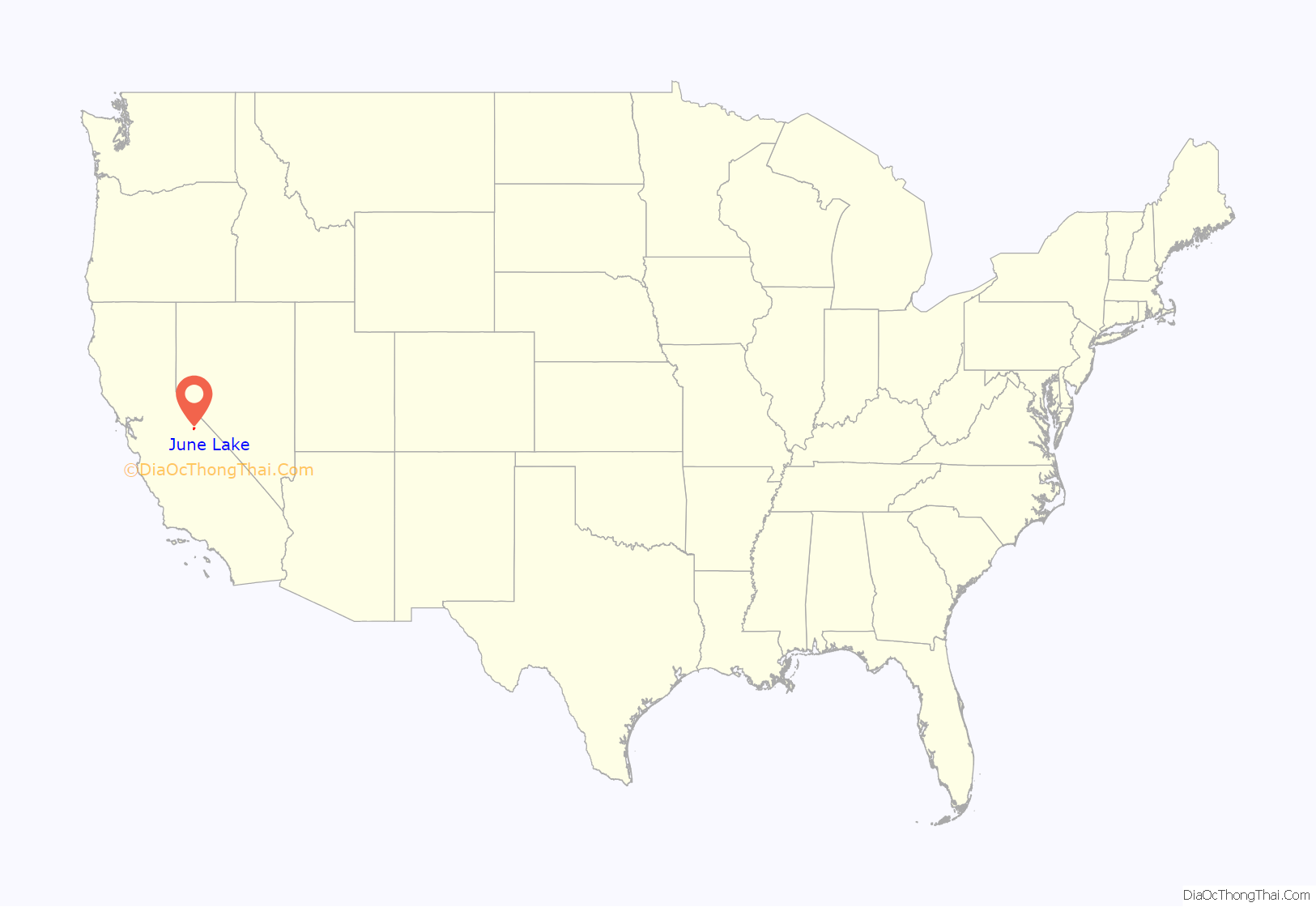
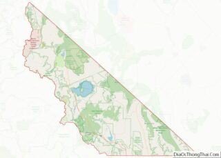
June Lake is an unincorporated community and census-designated place (CDP) in Mono County, California, United States. It is located against the southern rim of the Mono Basin, 12.5 miles (20 km) south of Lee Vining, at an elevation of 7,654 feet (2,333 m).
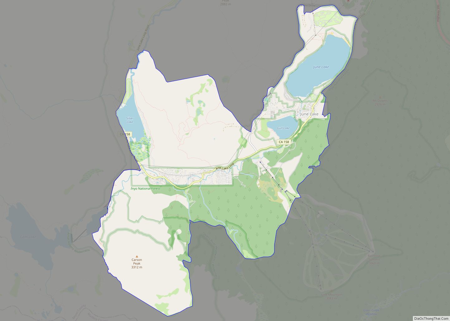
The majority of the developed community is spread narrowly along a five-mile stretch of California State Route 158, known as the June Lake Loop Road, or in the populated areas, Boulder Drive. The Mono County Community Development Department defines June Lake’s planning area to encompass the entire June Lake Loop, including the section of U.S. Route 395 between the north and south junctions of the Loop Road. However, the June Lake census-designated place, for which population figures are published by the U.S. Census Bureau, consists of the area along State Route 158 from its southern intersection with US 395, southwest past June Lake and Gull Lake to Silver Lake.
The population of the CDP was 611 at the 2020 census. In the summer that can grow by an estimated 2,500 visitors: fishermen, campers, tourists, backpackers, and other outdoors enthusiasts. The ZIP Code is 93529.
| Name: | June Lake CDP |
|---|---|
| LSAD Code: | 57 |
| LSAD Description: | CDP (suffix) |
| State: | California |
| County: | Mono County |
| Elevation: | 7,654 ft (2,333 m) |
| Total Area: | 11.10 sq mi (28.74 km²) |
| Land Area: | 10.31 sq mi (26.69 km²) |
| Water Area: | 0.79 sq mi (2.05 km²) 7.12% |
| Total Population: | 611 |
| ZIP code: | 93529 |
| FIPS code: | 0637624 |
Online Interactive Map
Click on ![]() to view map in "full screen" mode.
to view map in "full screen" mode.
June Lake location map. Where is June Lake CDP?
History
The June Lake Loop has attracted fishermen, hunters, and hikers since the late 19th century. Its first inhabitants were the Paiute Indians of the Mono Basin. Although there was abundant mining activity in adjacent areas, the prospectors of the late 19th century found little of interest here. The area remained roadless, and was recognized only for its scenic and recreational value. During the decline of the mining era, interest developed in the new technology of Hydroelectric Energy.
By 1915 a roadway was constructed up Rush Creek to just past Silver Lake, and a rail tramway system was moved from a defunct mine at nearby Bodie into the steep and rugged mountains above for the construction of two dams to provide Hydroelectric Power. The Rush Creek Hydroelectric Project was a significant step in the development of Hydroelectric Power in the State of California, and the Rush Creek Power House began producing electricity for distant cities in 1916.
The initial construction project continued through 1917, and during this time an employee named Roy Carson started the Loop’s first private resort, known as Carson’s Camp. The resort was a tent camp until 1920 when the first cabin was completed. A year later, after the completion of the first cabin another two cabins were erected in 1921. The new, larger cabin contained a dining room and a small area for a post office. This cabin is still in use as a store and restaurant for the historic Silver Lake Resort. Circa 1924 the U.S. Forest Service constructed another unpaved roadway from a point along U.S. Highway 395 to June Lake. Eventually Power Station employees and fishermen continued the road to connect with the road in the Silver Lake area. The road from the June Lake Junction made June Lake automobile accessible and made development in that area possible. Housing tracts were formed in between June and Gull Lakes and also near Fern Creek and Silver Lake. Boulder Lodge, on the shore of June Lake, was the second resort to be built in the June Lake Loop. In 1927 the Ed J. Seymour Company announced the construction of June Lake Lodge, (now a timeshare hotel known as the Heidelberg Inn) on the hillside overlooking June and Gull Lakes. The Lodge was to be operated in conjunction with a fish hatchery and fox farm, and included fifty rooms, a restaurant and bar, and a large four-sided fireplace in the lobby. June Lake Lodge opened in May 1928, and the hatchery produced an average of 1,000,000 small fish every year, distributed to the surrounding area’s lakes and creeks. The fox farm was located near what is now the Pine Cliff area. Other camps and lodges sprung up, including Gull Lake Lodge, Fern Creek Lodge, Camp Culver, and Cherokee Lodge. Due to a larger volume of travel on Highway 395 a land lease permit was issued to the Carrington family so that they could create a service station with a repair shop and lunch room at the June Lake Junction. They called it “Crater Garage and Lunch Room”. With the expansion of the community and its new permanent residents the necessity for a Post Office and school arose. The first United States Post Office in June Lake was established on October 1, 1927, and the first school in 1933. The school was run out of Fern Creek Lodge and the first teacher Mrs. Romana Power earned $1500.00 for a year.
During this period, automobile touring had become quite fashionable, and with the completion of the Tioga Pass Road, June Lake became a popular destination and way point for those traveling between Yosemite and Southern California. Notably, many Los Angeles area dignitaries and Hollywood celebrities made their way here. Film stars Wallace Beery and Raymond Hatton built cabins on Silver Lake. The Beery cabin was on a small island and Beery was known to land his plane on the meadow area adjacent to the lake. Names such as Clark Gable, Charlie Chaplin, Betty Grable, Sally Rand, Marx Brothers and others graced the guest register at the June Lake Lodge. Subsequently, film director Frank Capra and cartoonist Walter Lantz also had cabins at Silver Lake, and their families continue to visit.
The Los Angeles Department of Water and Power since 1923 had been seeking to purchase water rights in the Mono Basin to increase the capabilities of their aqueduct system. And, by 1935, the Mono Basin Project was underway. Water was captured from nearby Parker Creek, Walker Creek and Lee Vining Creek and diverted to Rush Creek at Grant Lake, where a large earthfill dam was constructed. An eleven-mile tunnel was dug under the Mono Craters to deliver this water to another new reservoir at Crowley Lake. This water project was approaching its completion by the time the Second World War began.
The Loop’s population swelled appreciably during those years, as a temporary company-town settlement was developed at the East Portal of the tunnel, about two miles from Grant Lake. Most of the supervisors, private contractors, foremen, and City specialists for the aqueduct project found lodging in June Lake. Restaurants, bars and dance halls proliferated, along with some gambling activity and a bawdy house or two. Glen Colton’s “Tiger” Bar was established in 1932 and still holds one of the State of California’s two longest standing alcoholic beverage licenses.
By the summer of 1940 the June Lake Fire District in conjunction with the United States Forest Service constructed the first municipal water system for the June Lake Village area. Inmate labor was utilized during this construction, and what was known as a “Spike Camp” was established to house those workers.
It was also during this time that the sport of skiing was becoming popular in the United States, and by around 1937 there was an organized race called the “Silver Skis.” Participants started near the Fish Hatchery, hiking to the top of 10,866 foot Carson Peak and skiing back down. By 1940, a group of local businessmen established the June Lake Winter Sports Association, building and operating a 2200-foot rope tow ski area with a vertical rise of 600 feet, including first aid, ski instruction and repair, light lunches, and entertainment.
The ski lift was powered by a small private hydroelectric plant on Fern Creek, as no commercial electricity was yet available. Another private generation facility was established at the Carson’s Camp/Silver Lake Resort. The California Electric Power Company finally constructed local distribution lines and established power service to the Loop area in 1946. Prior to that time oil lanterns were used, and refrigeration was accomplished by sawing blocks of ice from the surface of June Lake during winter, storing them for future use in a large ice house located on shore next to the boat landings.
By the 1950s June Lake had two competing grocery markets: Louie’s Market which had been in business for 20 years and was owned and operated by Louis and Pauline Prole and their daughters Louise and Jocelyn and the newer June Lake General Store owned by Al and Jean Matlaf. Louie’s Market had a wide variety of services including a bakery, ice cream fountain, groceries, necessities, hardware, cold storage for local fisherman and hunters as well as a deli and meat counter. Louis was a trucker and brought in his own supplies to keep the cost down; he also knew produce and only the best would do for his customers and friends. During the long haul, he would often stop along 395 and deliver fresh produce to the locals, many of whom still remember him with a smile. There were also numerous other services including service stations; automotive repair and towing; sport and tackle shops; hardware and dry goods; even an arcade featuring pinball machines and the like. June Lake at the time was one of the more important commercial centers of the Eastern Sierra region. A new, larger school with a teacher’s residence had been constructed near the Rodeo Grounds. In 1955, motel owner Edward Krause and associate Frank Roberts established one of the earliest Community Antenna Cable systems, making June Lake the only town in the area to offer television to its motel guests.
The ski area had been unable to survive during the WWII years, but in late 1958 the Forest Service announced its intention to offer a permit for a new ski area at June Mountain. W.C. “Bud” Hayward obtained the use permit and built a full-service ski area with a double chairlift and T-Bar, which opened in February 1961. During his tenure as owner of the ski resort until 1986, Hayward expanded the terrain and facilities including the addition of a rope tow, poma lift, and three additional double chairs.
The community of June Lake retained its commercial vitality through the 1970s, with the addition of a banking branch, hardware and paint store, welder, auto body repair, art and pottery galleries, and more. Since that time however, there has been a steady economic decline marked by the growth and boom of the nearby Town of Mammoth Lakes, which drew most of the commercial activities away from its outlying communities.
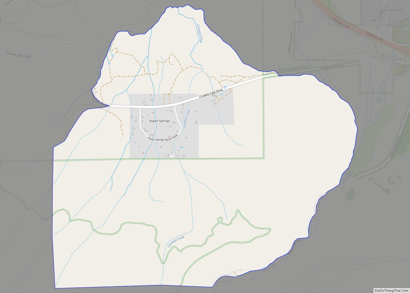
June Lake Road Map
June Lake city Satellite Map
See also
Map of California State and its subdivision:- Alameda
- Alpine
- Amador
- Butte
- Calaveras
- Colusa
- Contra Costa
- Del Norte
- El Dorado
- Fresno
- Glenn
- Humboldt
- Imperial
- Inyo
- Kern
- Kings
- Lake
- Lassen
- Los Angeles
- Madera
- Marin
- Mariposa
- Mendocino
- Merced
- Modoc
- Mono
- Monterey
- Napa
- Nevada
- Orange
- Placer
- Plumas
- Riverside
- Sacramento
- San Benito
- San Bernardino
- San Diego
- San Francisco
- San Joaquin
- San Luis Obispo
- San Mateo
- Santa Barbara
- Santa Clara
- Santa Cruz
- Shasta
- Sierra
- Siskiyou
- Solano
- Sonoma
- Stanislaus
- Sutter
- Tehama
- Trinity
- Tulare
- Tuolumne
- Ventura
- Yolo
- Yuba
- Alabama
- Alaska
- Arizona
- Arkansas
- California
- Colorado
- Connecticut
- Delaware
- District of Columbia
- Florida
- Georgia
- Hawaii
- Idaho
- Illinois
- Indiana
- Iowa
- Kansas
- Kentucky
- Louisiana
- Maine
- Maryland
- Massachusetts
- Michigan
- Minnesota
- Mississippi
- Missouri
- Montana
- Nebraska
- Nevada
- New Hampshire
- New Jersey
- New Mexico
- New York
- North Carolina
- North Dakota
- Ohio
- Oklahoma
- Oregon
- Pennsylvania
- Rhode Island
- South Carolina
- South Dakota
- Tennessee
- Texas
- Utah
- Vermont
- Virginia
- Washington
- West Virginia
- Wisconsin
- Wyoming
