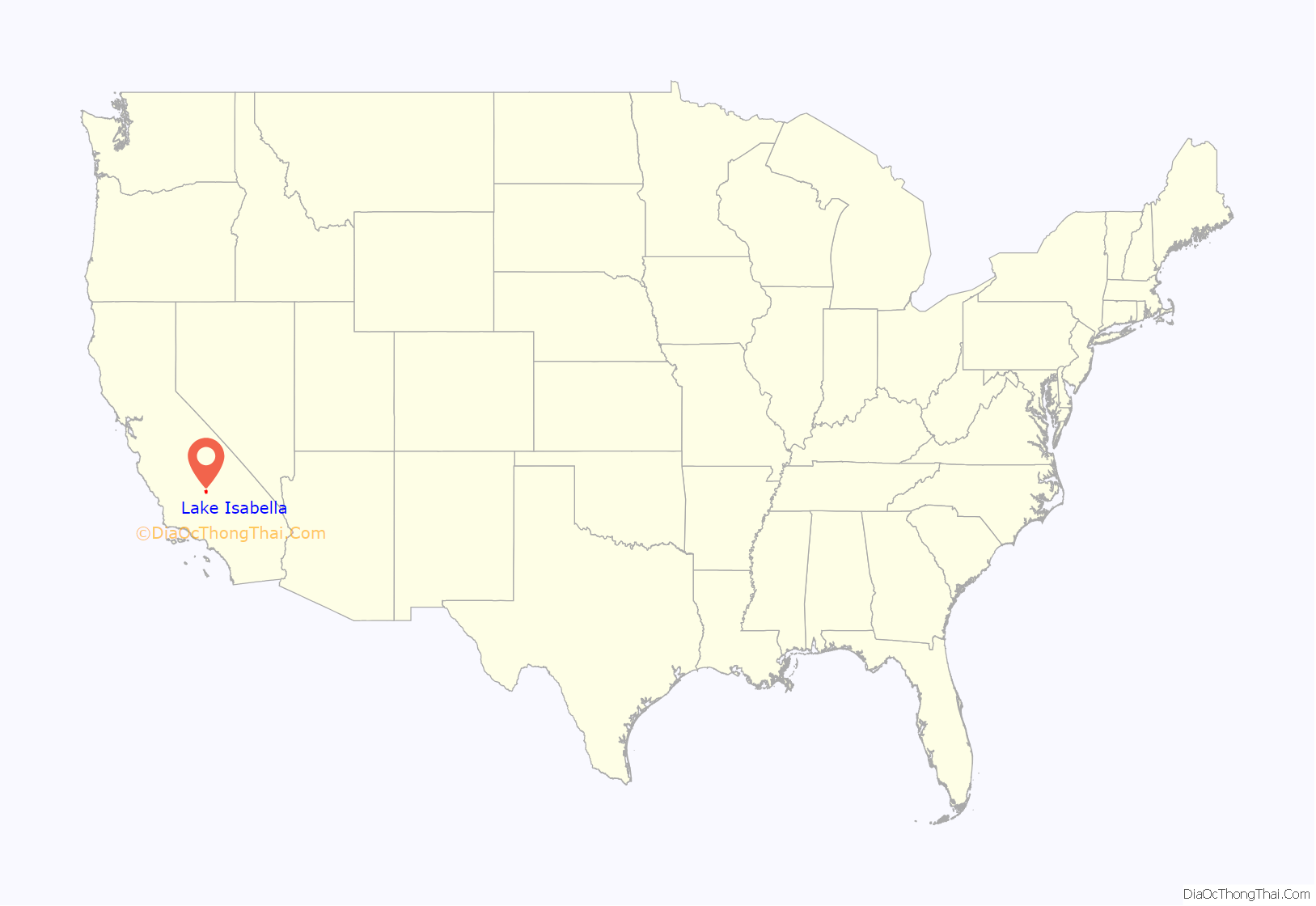
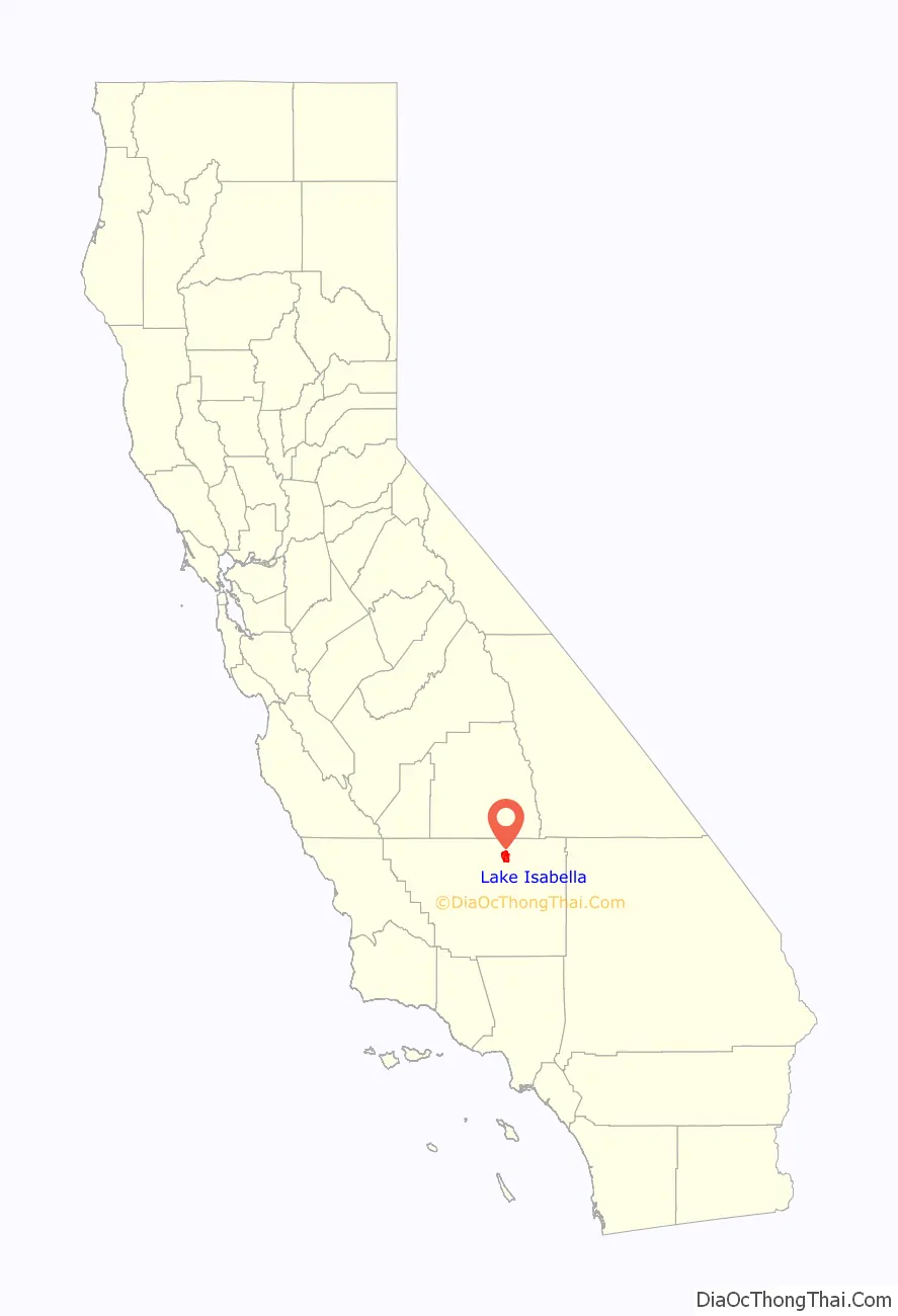
Lake Isabella (formerly, Isabella) is a census-designated place (CDP) in the southern Sierra Nevada, in Kern County, California, United States. It is named after the Lake Isabella reservoir and located at its southwestern edge, 6 miles (9.7 km) south of Wofford Heights in the Kern River Valley.
The town of Lake Isabella is located 35 miles (56 km) east-northeast of Bakersfield, at an elevation of 2,513 feet (766 m). The population was 3,466 at the 2010 census, up from 3,315 at the 2000 census.
| Name: | Lake Isabella CDP |
|---|---|
| LSAD Code: | 57 |
| LSAD Description: | CDP (suffix) |
| State: | California |
| County: | Kern County |
| Elevation: | 2,513 ft (766 m) |
| Total Area: | 22.148 sq mi (57.337 km²) |
| Land Area: | 21.714 sq mi (56.239 km²) |
| Water Area: | 0.424 sq mi (1.098 km²) 1.9% |
| Total Population: | 3,466 |
| Population Density: | 160/sq mi (60/km²) |
| ZIP code: | 93240 |
| FIPS code: | 0639570 |
| GNISfeature ID: | 1652739 |
Online Interactive Map
Click on ![]() to view map in "full screen" mode.
to view map in "full screen" mode.
Lake Isabella location map. Where is Lake Isabella CDP?
History
The area was inhabited for millennia by the indigenous Tübatulabal and Owens Valley Paiute. Gold was discovered nearby in 1853, leading to a gold rush and the founding of Keyesville. The 1863 Keyesville massacre occurred a few miles north.
The town of Isabella was founded by Steven Barton in 1893 and named in honor of Queen Isabella of Spain while her name was popular during the 1893 Columbian Exposition. Lake Isabella was created in 1953 by a dam on the Kern River, forcing the town to move about 1.5 miles (2.4 km) south of the original site. The Isabella post office, which had opened in 1896, operated at the new site; the name was changed to Lake Isabella in 1957.
The dam’s reservoir also inundated the original site of Kernville. Like Isabella, it was relocated, along with several of its historic buildings, to higher ground.
The area is a joy for hikers, boaters, water skiers, fishermen, birders, hunters, wind surfers, kayakers, and other outdoor recreationists. Tourist trade is a major part of the area’s economy.
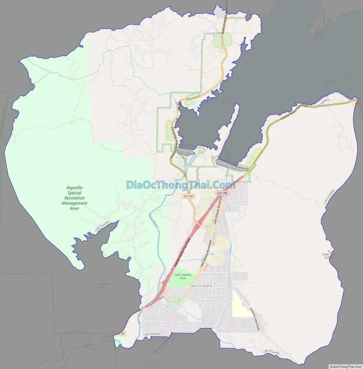
Lake Isabella Road Map
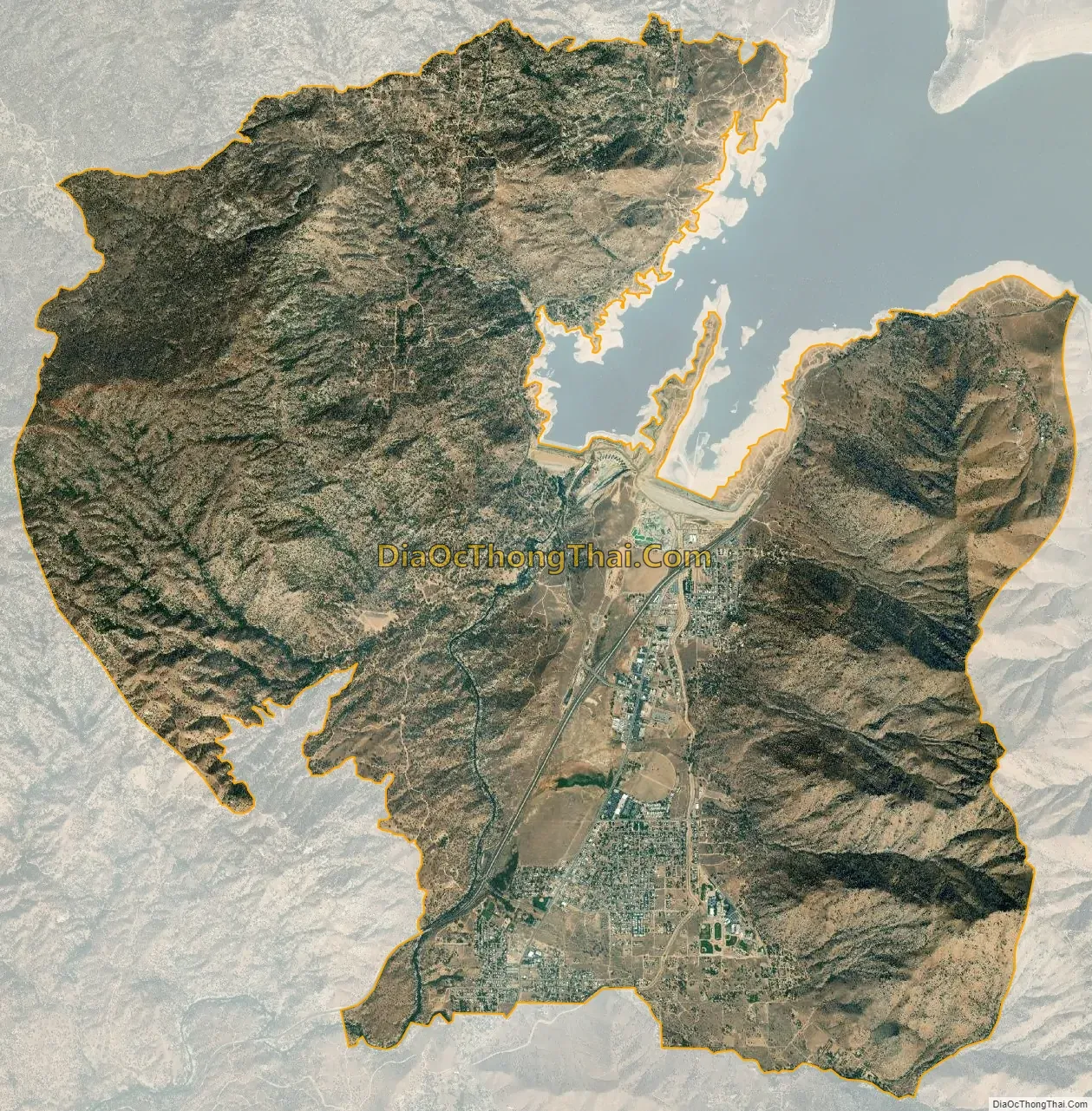
Lake Isabella city Satellite Map
Geography
Lake Isabella is located in Hot Springs Valley, part of the Kern River Valley, at 35°37′05″N 118°28′23″W / 35.61806°N 118.47306°W / 35.61806; -118.47306.
According to the United States Census Bureau, the CDP has a total area of 22.1 square miles (57 km), over 98% of it land.
Lake Isabella is at the confluence of the North and South Forks of the Kern River. These rivers are ‘wild’, in that they are not controlled by any dam upstream. Upstream on the North Fork white water enthusiasts play in the spring and early summer. The famous Golden Trout originate in these rivers in the high country to the north.
See also
Map of California State and its subdivision:- Alameda
- Alpine
- Amador
- Butte
- Calaveras
- Colusa
- Contra Costa
- Del Norte
- El Dorado
- Fresno
- Glenn
- Humboldt
- Imperial
- Inyo
- Kern
- Kings
- Lake
- Lassen
- Los Angeles
- Madera
- Marin
- Mariposa
- Mendocino
- Merced
- Modoc
- Mono
- Monterey
- Napa
- Nevada
- Orange
- Placer
- Plumas
- Riverside
- Sacramento
- San Benito
- San Bernardino
- San Diego
- San Francisco
- San Joaquin
- San Luis Obispo
- San Mateo
- Santa Barbara
- Santa Clara
- Santa Cruz
- Shasta
- Sierra
- Siskiyou
- Solano
- Sonoma
- Stanislaus
- Sutter
- Tehama
- Trinity
- Tulare
- Tuolumne
- Ventura
- Yolo
- Yuba
- Alabama
- Alaska
- Arizona
- Arkansas
- California
- Colorado
- Connecticut
- Delaware
- District of Columbia
- Florida
- Georgia
- Hawaii
- Idaho
- Illinois
- Indiana
- Iowa
- Kansas
- Kentucky
- Louisiana
- Maine
- Maryland
- Massachusetts
- Michigan
- Minnesota
- Mississippi
- Missouri
- Montana
- Nebraska
- Nevada
- New Hampshire
- New Jersey
- New Mexico
- New York
- North Carolina
- North Dakota
- Ohio
- Oklahoma
- Oregon
- Pennsylvania
- Rhode Island
- South Carolina
- South Dakota
- Tennessee
- Texas
- Utah
- Vermont
- Virginia
- Washington
- West Virginia
- Wisconsin
- Wyoming


