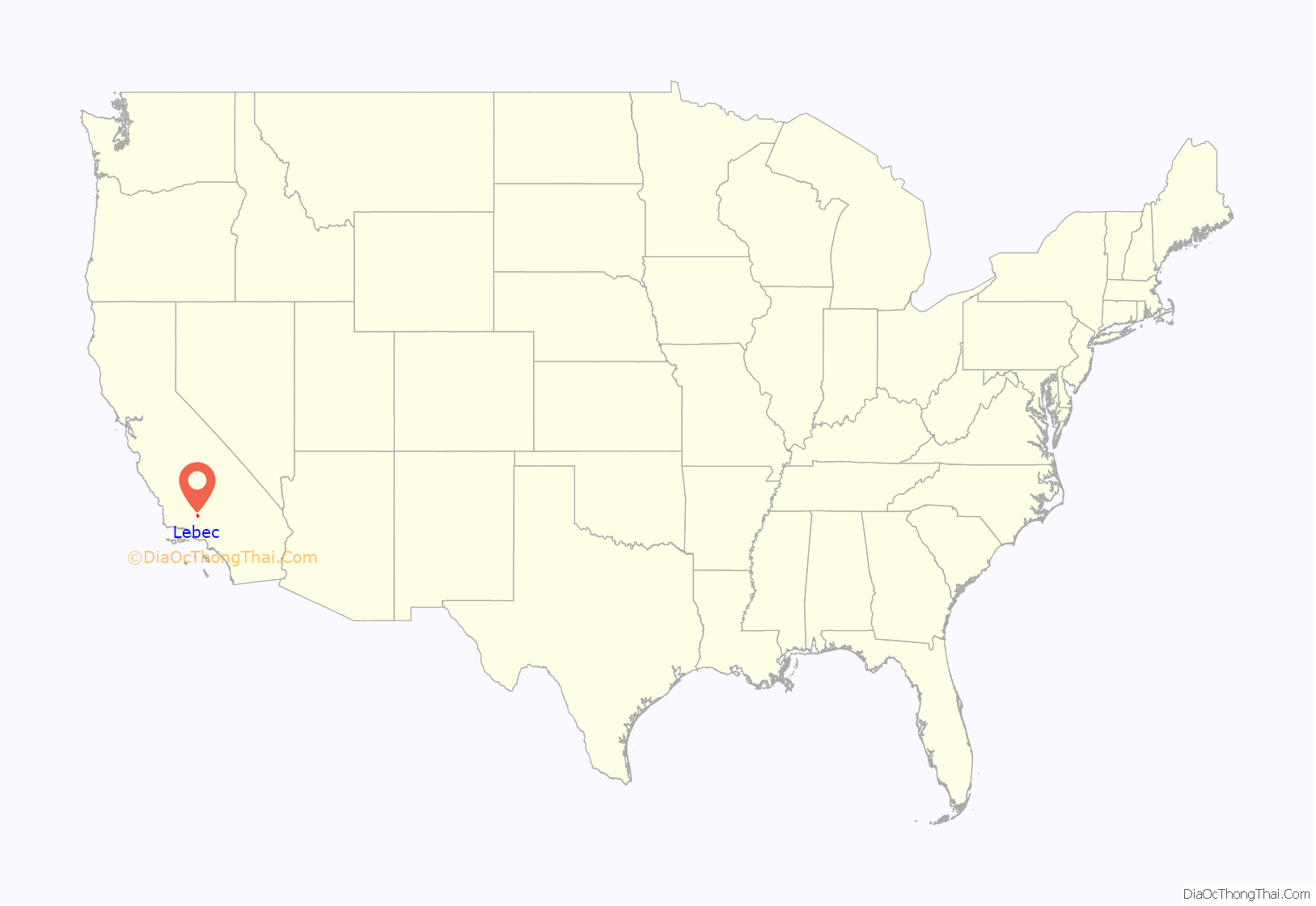
Lebec is an unincorporated community and census-designated place in southwestern Kern County, California. As of the 2010 census, the population was 1,468.
| Name: | Lebec CDP |
|---|---|
| LSAD Code: | 57 |
| LSAD Description: | CDP (suffix) |
| State: | California |
| County: | Kern County |
| Elevation: | 3,481 ft (1,061 m) |
| Total Area: | 15.329 sq mi (39.702 km²) |
| Land Area: | 15.329 sq mi (39.701 km²) |
| Water Area: | 0 sq mi (0.001 km²) 0.002% |
| Total Population: | 1,239 |
| Population Density: | 81/sq mi (31/km²) |
| ZIP code: | 93243 |
| Area code: | 661 |
| FIPS code: | 0640956 |
Online Interactive Map
Click on ![]() to view map in "full screen" mode.
to view map in "full screen" mode.
Lebec location map. Where is Lebec CDP?
History
Lebec is named in honor of Peter Lebeck or Lebecque, a French trapper killed by a grizzly bear in 1837 in the area that later became Fort Tejon. He was memorialized in an epitaph at the site, found carved in a bare spot on an old oak tree. The epitaph read PETER LEBECK / KILLED BY A X BEAR / OCTR 17 / 1837. The bark of the oak tree eventually grew over the carving. A group from Bakersfield, called the Foxtail Rangers, removed the bark in the late 19th century and found the inscription in reverse on its underside. The piece is now displayed in the museum at Fort Tejon State Historic Park.
Lieutenant R.S. Williamson camped at the same oak grove in 1853 while on a mid-1850s mapping mission for a practicable railway route from the Mississippi River to the Pacific Ocean. Geologist William P. Blake accompanied Williamson’s party. The area was garrisoned by the United States Army a year later, on August 10, 1854, as Fort Tejon, the first military fort in the California interior. The fort suffered extensive damage during the 1857 Fort Tejon earthquake.
The first post office opened in 1895, having been transferred there from Tejon.
The Lebec Hotel was a large Spanish Colonial Revival-style hotel located on the Ridge Route in the community. It was built in 1921, and was popular with Hollywood executives and movie stars before World War II. It closed in 1968, and was demolished in 1971.
Lebec Road Map
Lebec city Satellite Map
Geography
Lebec is located in Castac Valley between the San Emigdio and Tehachapi Mountains. The community is one of the Mountain Communities of the Tejon Pass.
Lebec is 40 miles (64 km) south of Bakersfield.
According to the United States Census Bureau, Lebec has an area of 15.3 square miles (40 km). The community, which is near Tejon Pass, lies at an elevation of 3,481 feet (1,061 m).
See also
Map of California State and its subdivision:- Alameda
- Alpine
- Amador
- Butte
- Calaveras
- Colusa
- Contra Costa
- Del Norte
- El Dorado
- Fresno
- Glenn
- Humboldt
- Imperial
- Inyo
- Kern
- Kings
- Lake
- Lassen
- Los Angeles
- Madera
- Marin
- Mariposa
- Mendocino
- Merced
- Modoc
- Mono
- Monterey
- Napa
- Nevada
- Orange
- Placer
- Plumas
- Riverside
- Sacramento
- San Benito
- San Bernardino
- San Diego
- San Francisco
- San Joaquin
- San Luis Obispo
- San Mateo
- Santa Barbara
- Santa Clara
- Santa Cruz
- Shasta
- Sierra
- Siskiyou
- Solano
- Sonoma
- Stanislaus
- Sutter
- Tehama
- Trinity
- Tulare
- Tuolumne
- Ventura
- Yolo
- Yuba
- Alabama
- Alaska
- Arizona
- Arkansas
- California
- Colorado
- Connecticut
- Delaware
- District of Columbia
- Florida
- Georgia
- Hawaii
- Idaho
- Illinois
- Indiana
- Iowa
- Kansas
- Kentucky
- Louisiana
- Maine
- Maryland
- Massachusetts
- Michigan
- Minnesota
- Mississippi
- Missouri
- Montana
- Nebraska
- Nevada
- New Hampshire
- New Jersey
- New Mexico
- New York
- North Carolina
- North Dakota
- Ohio
- Oklahoma
- Oregon
- Pennsylvania
- Rhode Island
- South Carolina
- South Dakota
- Tennessee
- Texas
- Utah
- Vermont
- Virginia
- Washington
- West Virginia
- Wisconsin
- Wyoming
