Manila is a census-designated place located adjacent to Humboldt Bay in Humboldt County, California. It is located 3.25 miles (5.2 km) north of downtown Eureka, at an elevation of 13 feet (4 m). The ZIP Code is 95521. The population was 784 at the 2010 census.
| Name: | Manila CDP |
|---|---|
| LSAD Code: | 57 |
| LSAD Description: | CDP (suffix) |
| State: | California |
| County: | Humboldt County |
| Elevation: | 13 ft (4 m) |
| Total Area: | 0.704 sq mi (1.823 km²) |
| Land Area: | 0.654 sq mi (1.695 km²) |
| Water Area: | 0.050 sq mi (0.128 km²) 7.0% |
| Total Population: | 798 |
| Population Density: | 1,100/sq mi (440/km²) |
| ZIP code: | 95521 |
| Area code: | 707 |
| FIPS code: | 0645414 |
Online Interactive Map
Click on ![]() to view map in "full screen" mode.
to view map in "full screen" mode.
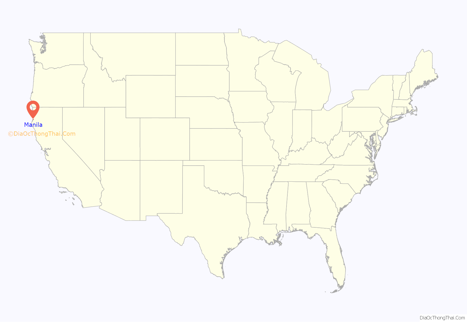
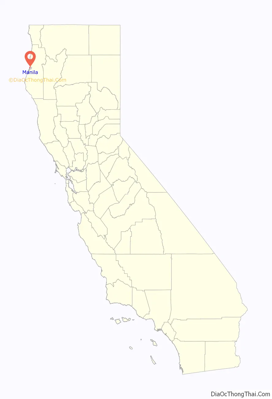
Manila location map. Where is Manila CDP?
History
The town was founded at the end of World War II, and named after Manila in the Philippines. Humboldt Coastal Nature Center of Friends of the Dunes on Stamps Lane includes the Stamps Dune House and surrounding dune landscape. The house was originally built in 1985 as a retirement home of a couple whose heirs sold a large part of their property and the house to Manila-based Friends of the Dunes to use as a nature center on the dunes in 2007.
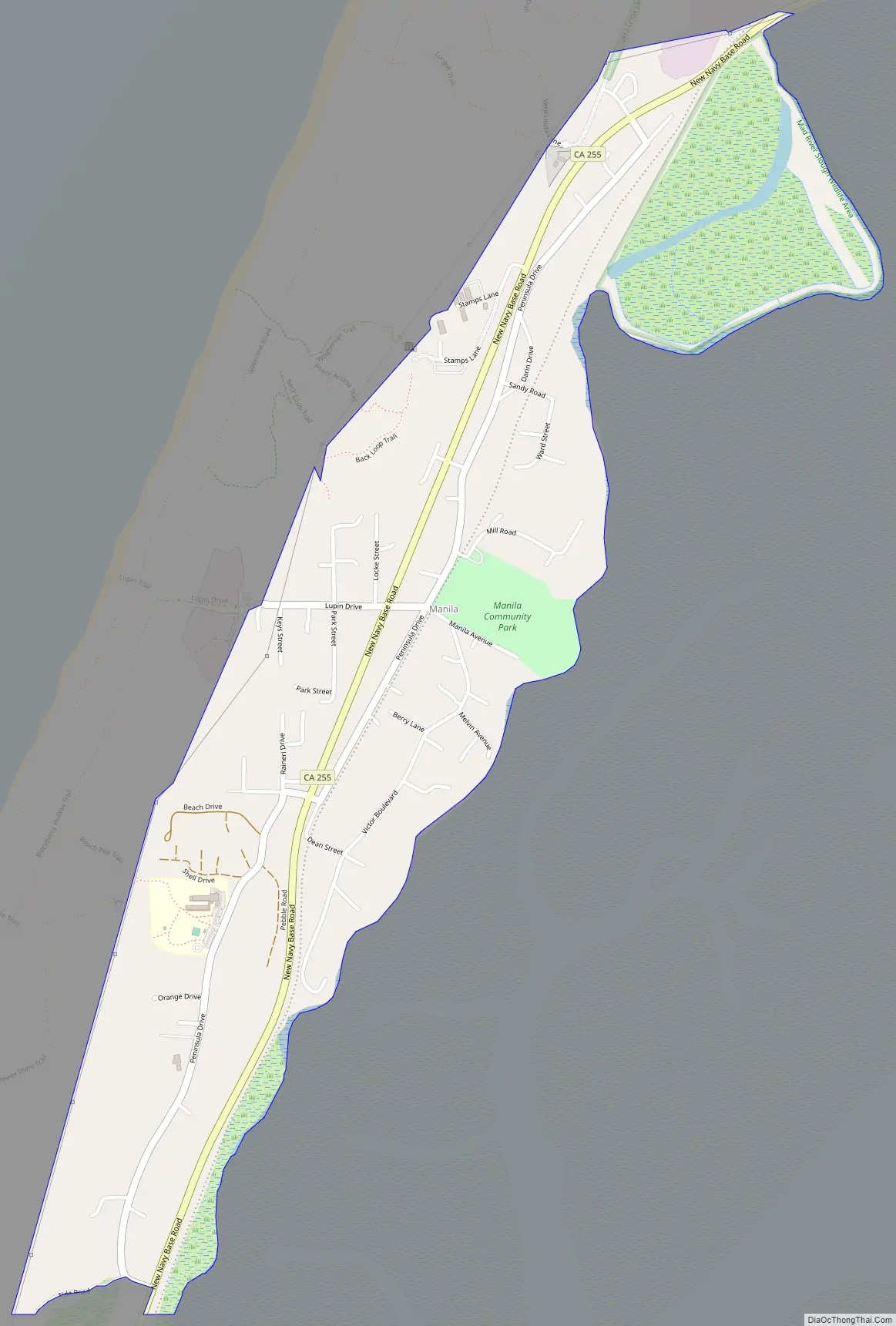
Manila Road Map
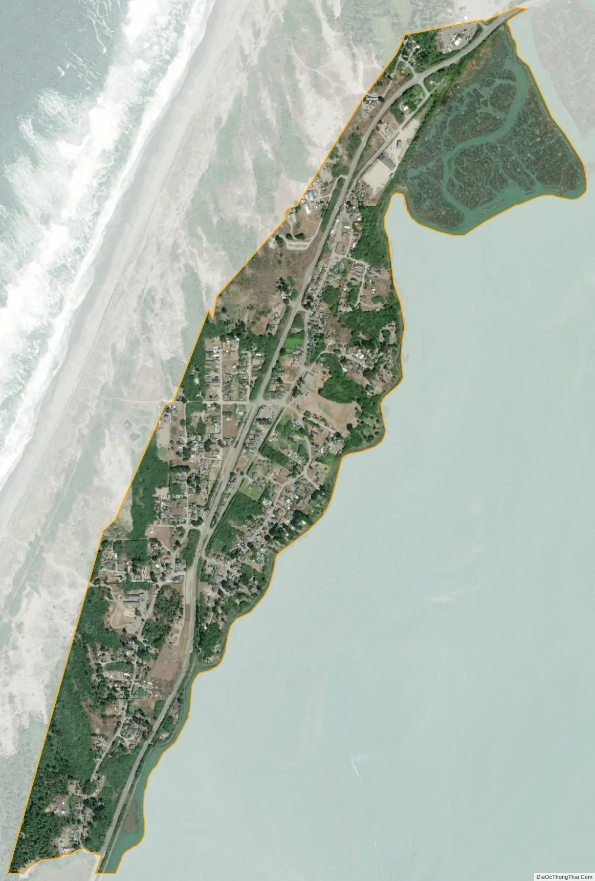
Manila city Satellite Map
See also
Map of California State and its subdivision:- Alameda
- Alpine
- Amador
- Butte
- Calaveras
- Colusa
- Contra Costa
- Del Norte
- El Dorado
- Fresno
- Glenn
- Humboldt
- Imperial
- Inyo
- Kern
- Kings
- Lake
- Lassen
- Los Angeles
- Madera
- Marin
- Mariposa
- Mendocino
- Merced
- Modoc
- Mono
- Monterey
- Napa
- Nevada
- Orange
- Placer
- Plumas
- Riverside
- Sacramento
- San Benito
- San Bernardino
- San Diego
- San Francisco
- San Joaquin
- San Luis Obispo
- San Mateo
- Santa Barbara
- Santa Clara
- Santa Cruz
- Shasta
- Sierra
- Siskiyou
- Solano
- Sonoma
- Stanislaus
- Sutter
- Tehama
- Trinity
- Tulare
- Tuolumne
- Ventura
- Yolo
- Yuba
- Alabama
- Alaska
- Arizona
- Arkansas
- California
- Colorado
- Connecticut
- Delaware
- District of Columbia
- Florida
- Georgia
- Hawaii
- Idaho
- Illinois
- Indiana
- Iowa
- Kansas
- Kentucky
- Louisiana
- Maine
- Maryland
- Massachusetts
- Michigan
- Minnesota
- Mississippi
- Missouri
- Montana
- Nebraska
- Nevada
- New Hampshire
- New Jersey
- New Mexico
- New York
- North Carolina
- North Dakota
- Ohio
- Oklahoma
- Oregon
- Pennsylvania
- Rhode Island
- South Carolina
- South Dakota
- Tennessee
- Texas
- Utah
- Vermont
- Virginia
- Washington
- West Virginia
- Wisconsin
- Wyoming


