McKinleyville (formerly Minorsville) is a census-designated place (CDP) in Humboldt County, California McKinleyville is located 5.25 miles (8.4 km) north of Arcata, at an elevation of 141 feet (43 m). The population was 15,177 at the 2010 census, up from 13,599 at the time of the 2000 census.
This unincorporated community is the third largest community, after Eureka and Arcata, on the far North Coast. It is also the location of the Arcata–Eureka Airport, the largest airport in Humboldt County and the region.
| Name: | McKinleyville CDP |
|---|---|
| LSAD Code: | 57 |
| LSAD Description: | CDP (suffix) |
| State: | California |
| County: | Humboldt County |
| Elevation: | 141 ft (43 m) |
| Total Area: | 21.014 sq mi (54.426 km²) |
| Land Area: | 20.796 sq mi (53.862 km²) |
| Water Area: | 0.218 sq mi (0.564 km²) 1.2% |
| Total Population: | 16,262 |
| Population Density: | 770/sq mi (300/km²) |
| ZIP code: | 95519, 95521 |
| Area code: | 707 |
| FIPS code: | 0644910 |
| GNISfeature ID: | 1659090 |
Online Interactive Map
Click on ![]() to view map in "full screen" mode.
to view map in "full screen" mode.
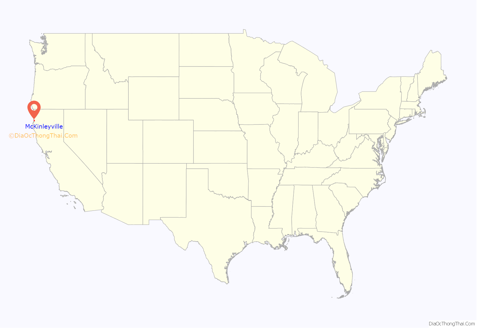
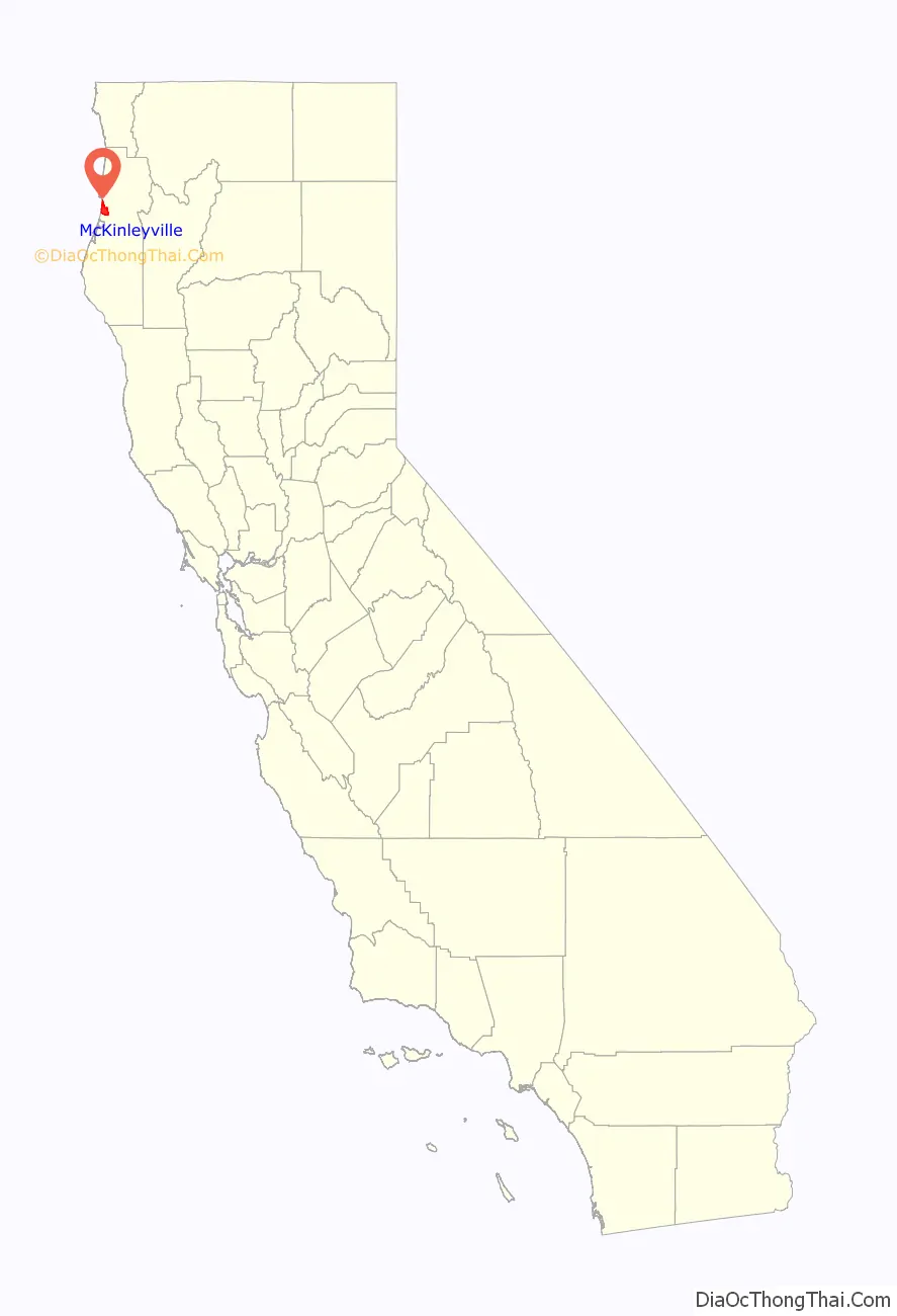
McKinleyville location map. Where is McKinleyville CDP?
History
The Wiyot and Yurok people continue to live here in their traditional territories and both groups are ingrained within the McKinleyville community.
McKinleyville is a community made up of a combination of smaller settlements. Joe Dows settled in the general area in the 1860s and that area was known as Dows Prairie. Slightly south was a small community called Minor (also known as Minorville). Minor was first settled in the late 19th century. Just south of Minor was Calville. Calville was settled by the employees of the California Barrel Company. After President William McKinley was assassinated in 1901, the community of Minor changed its name to McKinleyville in his honor. All three areas are collectively considered to be part of McKinleyville.
The first post office at McKinleyville opened in 1903, closed in 1921, and was reopened in 1955.
McKinleyville is a community with mainly retail and professional businesses to serve its residents but is not an incorporated city or town.
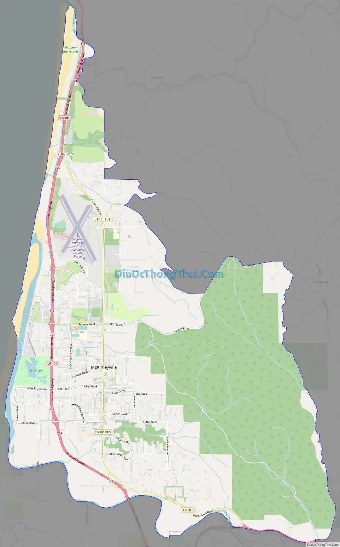
McKinleyville Road Map
McKinleyville city Satellite Map
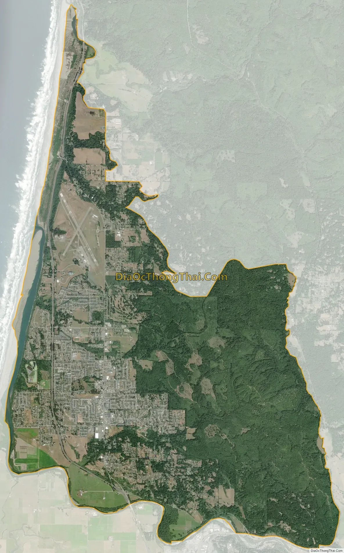
Geography
According to the United States Census Bureau, the CDP has a total area of 21.0 square miles (54 km), of which 20.8 square miles (54 km) is land and 0.2 square miles (0.52 km), or 1.2%, is water.
McKinleyville consists of several watershed areas. The north bank of the Mad River is the farthest watershed to the south. The next watershed to the north is Mill Creek, then Widow White Creek, Norton Creek, Strawberry Creek, Patrick Creek and finally the farthest watershed to the north is the south bank of the Little River. To the west lies the Pacific Ocean.
Climate
The area sees summers that are not as foggy as Eureka and Arcata to the south, and run a few degrees warmer. McKinleyville has a cool-summer Mediterranean climate (Köppen Csc) typical of the North Coast that is characterized by mild, rainy winters and cool, mild summers, with an average temperature of 55°F (13 °C). The area experiences coastal influence fog all year round.
See also
Map of California State and its subdivision:- Alameda
- Alpine
- Amador
- Butte
- Calaveras
- Colusa
- Contra Costa
- Del Norte
- El Dorado
- Fresno
- Glenn
- Humboldt
- Imperial
- Inyo
- Kern
- Kings
- Lake
- Lassen
- Los Angeles
- Madera
- Marin
- Mariposa
- Mendocino
- Merced
- Modoc
- Mono
- Monterey
- Napa
- Nevada
- Orange
- Placer
- Plumas
- Riverside
- Sacramento
- San Benito
- San Bernardino
- San Diego
- San Francisco
- San Joaquin
- San Luis Obispo
- San Mateo
- Santa Barbara
- Santa Clara
- Santa Cruz
- Shasta
- Sierra
- Siskiyou
- Solano
- Sonoma
- Stanislaus
- Sutter
- Tehama
- Trinity
- Tulare
- Tuolumne
- Ventura
- Yolo
- Yuba
- Alabama
- Alaska
- Arizona
- Arkansas
- California
- Colorado
- Connecticut
- Delaware
- District of Columbia
- Florida
- Georgia
- Hawaii
- Idaho
- Illinois
- Indiana
- Iowa
- Kansas
- Kentucky
- Louisiana
- Maine
- Maryland
- Massachusetts
- Michigan
- Minnesota
- Mississippi
- Missouri
- Montana
- Nebraska
- Nevada
- New Hampshire
- New Jersey
- New Mexico
- New York
- North Carolina
- North Dakota
- Ohio
- Oklahoma
- Oregon
- Pennsylvania
- Rhode Island
- South Carolina
- South Dakota
- Tennessee
- Texas
- Utah
- Vermont
- Virginia
- Washington
- West Virginia
- Wisconsin
- Wyoming


