Mecca is an unincorporated community located in Riverside County, California, United States. The desert community lies on the north shore of the Salton Sea in the eastern Coachella Valley and is surrounded by agricultural land.
| Name: | Mecca CDP |
|---|---|
| LSAD Code: | 57 |
| LSAD Description: | CDP (suffix) |
| State: | California |
| County: | Riverside County |
| Elevation: | −187 ft (−57 m) |
| Total Area: | 6.959 sq mi (18.023 km²) |
| Land Area: | 6.959 sq mi (18.023 km²) |
| Water Area: | 0 sq mi (0 km²) 0% |
| Total Population: | 8,219 |
| Population Density: | 1,200/sq mi (460/km²) |
| ZIP code: | 92254 |
| FIPS code: | 0646660 |
Online Interactive Map
Click on ![]() to view map in "full screen" mode.
to view map in "full screen" mode.
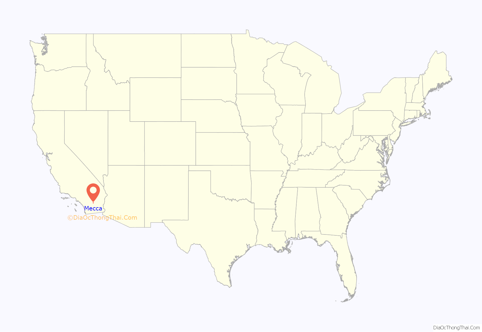
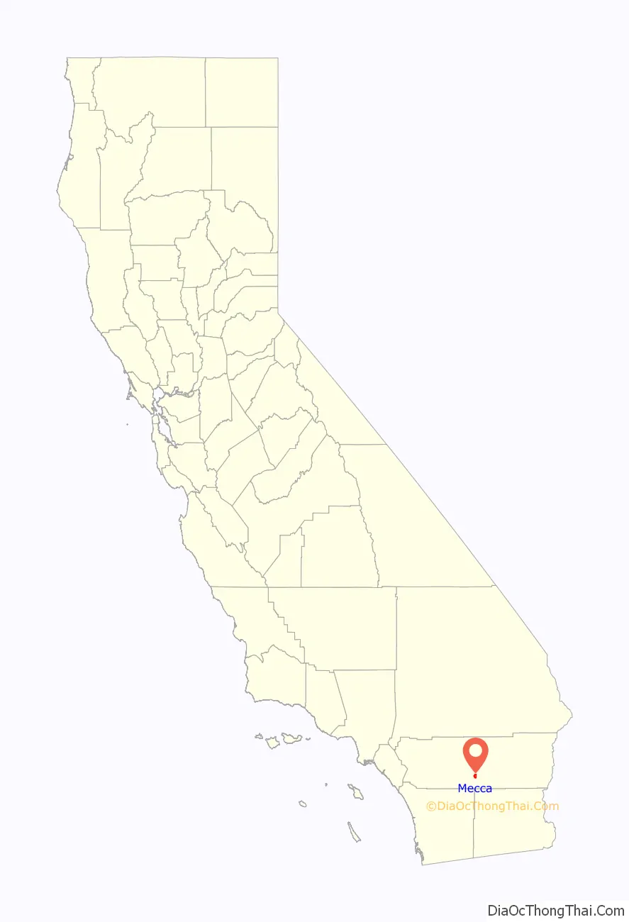
Mecca location map. Where is Mecca CDP?
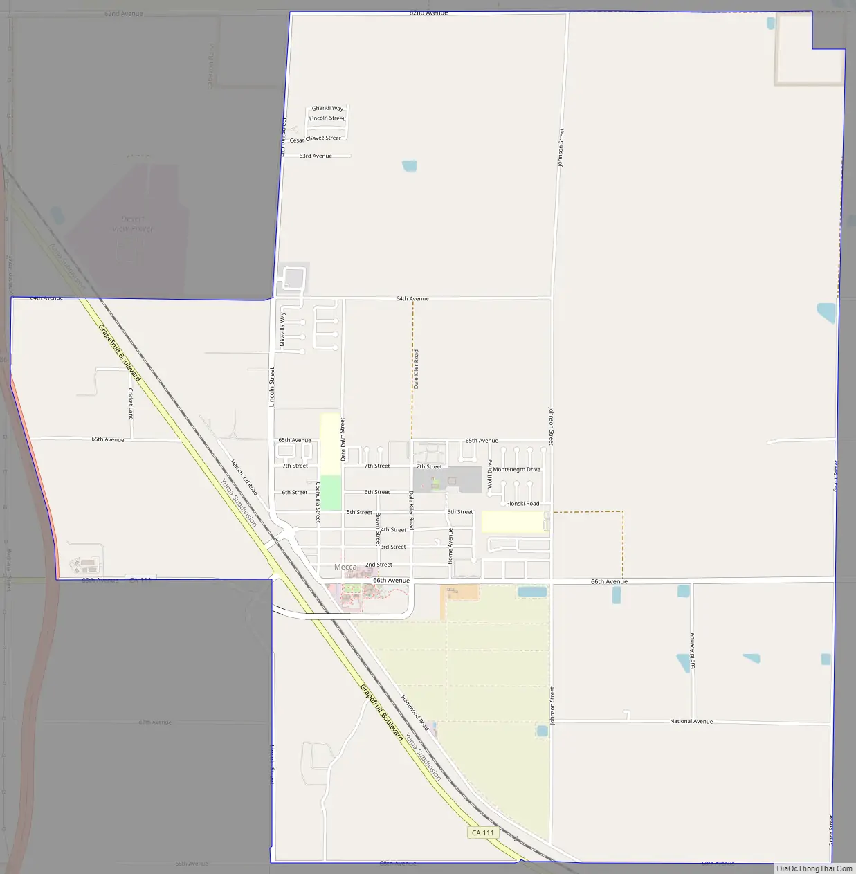
Mecca Road Map
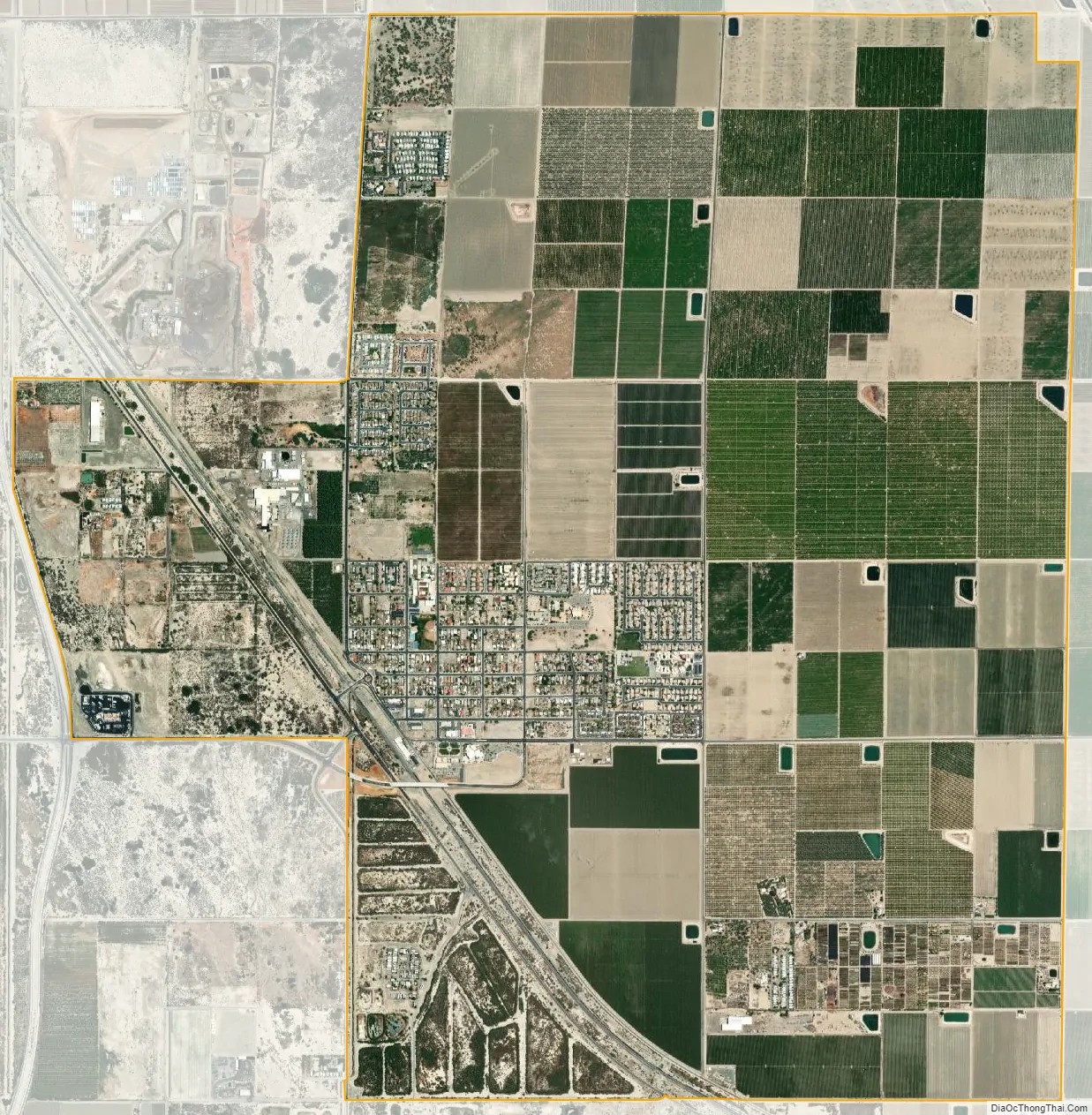
Mecca city Satellite Map
Geography
Situated within the Colorado Desert, Mecca’s climate is that of an arid desert (BWh), which experiences an average 90 °F temperature. Low temperatures can reach into the 20 °F range. The community sits below 150 feet under sea level on the edge of the Salton Sea, formerly the Salton Sink.
Land developers intending to irrigate the desert with water from the Colorado River did not foresee excess snow melt and for two years from 1905–1906 accidentally re-routed the entirety of the river to the Salton Sink, flooding the salt mines that had been a source of salt for perhaps centuries and giving rise to the Salton Sea. Groundwater and water transported via the Coachella Canal have transformed the desert environment into large swaths of agricultural land.
See also
Map of California State and its subdivision:- Alameda
- Alpine
- Amador
- Butte
- Calaveras
- Colusa
- Contra Costa
- Del Norte
- El Dorado
- Fresno
- Glenn
- Humboldt
- Imperial
- Inyo
- Kern
- Kings
- Lake
- Lassen
- Los Angeles
- Madera
- Marin
- Mariposa
- Mendocino
- Merced
- Modoc
- Mono
- Monterey
- Napa
- Nevada
- Orange
- Placer
- Plumas
- Riverside
- Sacramento
- San Benito
- San Bernardino
- San Diego
- San Francisco
- San Joaquin
- San Luis Obispo
- San Mateo
- Santa Barbara
- Santa Clara
- Santa Cruz
- Shasta
- Sierra
- Siskiyou
- Solano
- Sonoma
- Stanislaus
- Sutter
- Tehama
- Trinity
- Tulare
- Tuolumne
- Ventura
- Yolo
- Yuba
- Alabama
- Alaska
- Arizona
- Arkansas
- California
- Colorado
- Connecticut
- Delaware
- District of Columbia
- Florida
- Georgia
- Hawaii
- Idaho
- Illinois
- Indiana
- Iowa
- Kansas
- Kentucky
- Louisiana
- Maine
- Maryland
- Massachusetts
- Michigan
- Minnesota
- Mississippi
- Missouri
- Montana
- Nebraska
- Nevada
- New Hampshire
- New Jersey
- New Mexico
- New York
- North Carolina
- North Dakota
- Ohio
- Oklahoma
- Oregon
- Pennsylvania
- Rhode Island
- South Carolina
- South Dakota
- Tennessee
- Texas
- Utah
- Vermont
- Virginia
- Washington
- West Virginia
- Wisconsin
- Wyoming


