Mendota is a U.S. city in Fresno County, California. The population was 11,014 at the 2010 U.S. Census. CA State Routes 180 and 33 run through the agricultural city. Mendota is located 8.5 miles (14 km) south-southeast of Firebaugh, at an elevation of 174 feet (53 m).
| Name: | Mendota city |
|---|---|
| LSAD Code: | 25 |
| LSAD Description: | city (suffix) |
| State: | California |
| County: | Fresno County |
| Incorporated: | June 17, 1942 |
| Elevation: | 174 ft (53 m) |
| Total Area: | 3.39 sq mi (8.78 km²) |
| Land Area: | 3.38 sq mi (8.77 km²) |
| Water Area: | 0.00 sq mi (0.01 km²) 0.10% |
| Total Population: | 12,595 |
| Population Density: | 3,715.34/sq mi (1,434.50/km²) |
| ZIP code: | 93640 |
| Area code: | 559 |
| FIPS code: | 0646828 |
| Website: | ci.mendota.ca.us |
Online Interactive Map
Click on ![]() to view map in "full screen" mode.
to view map in "full screen" mode.
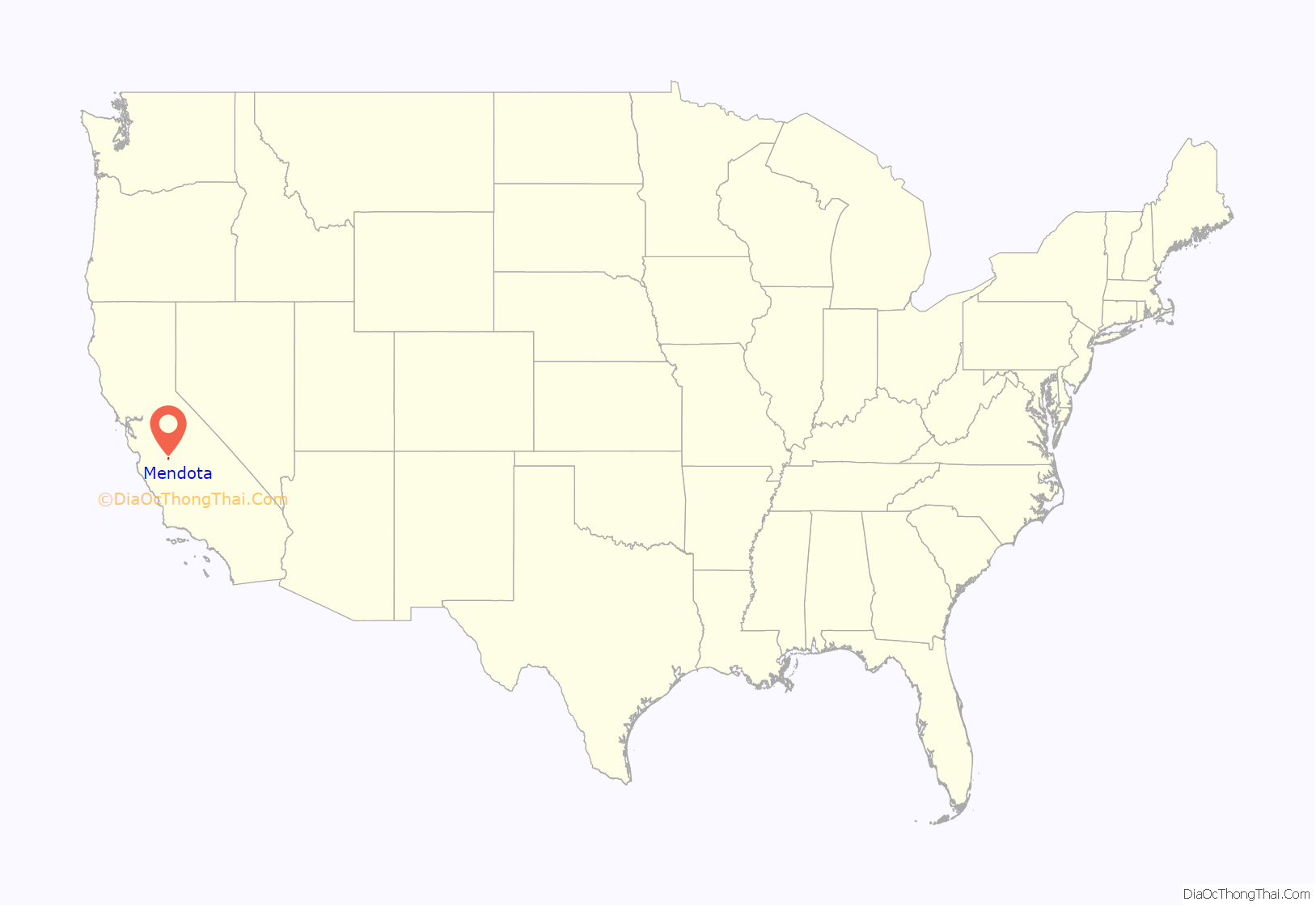
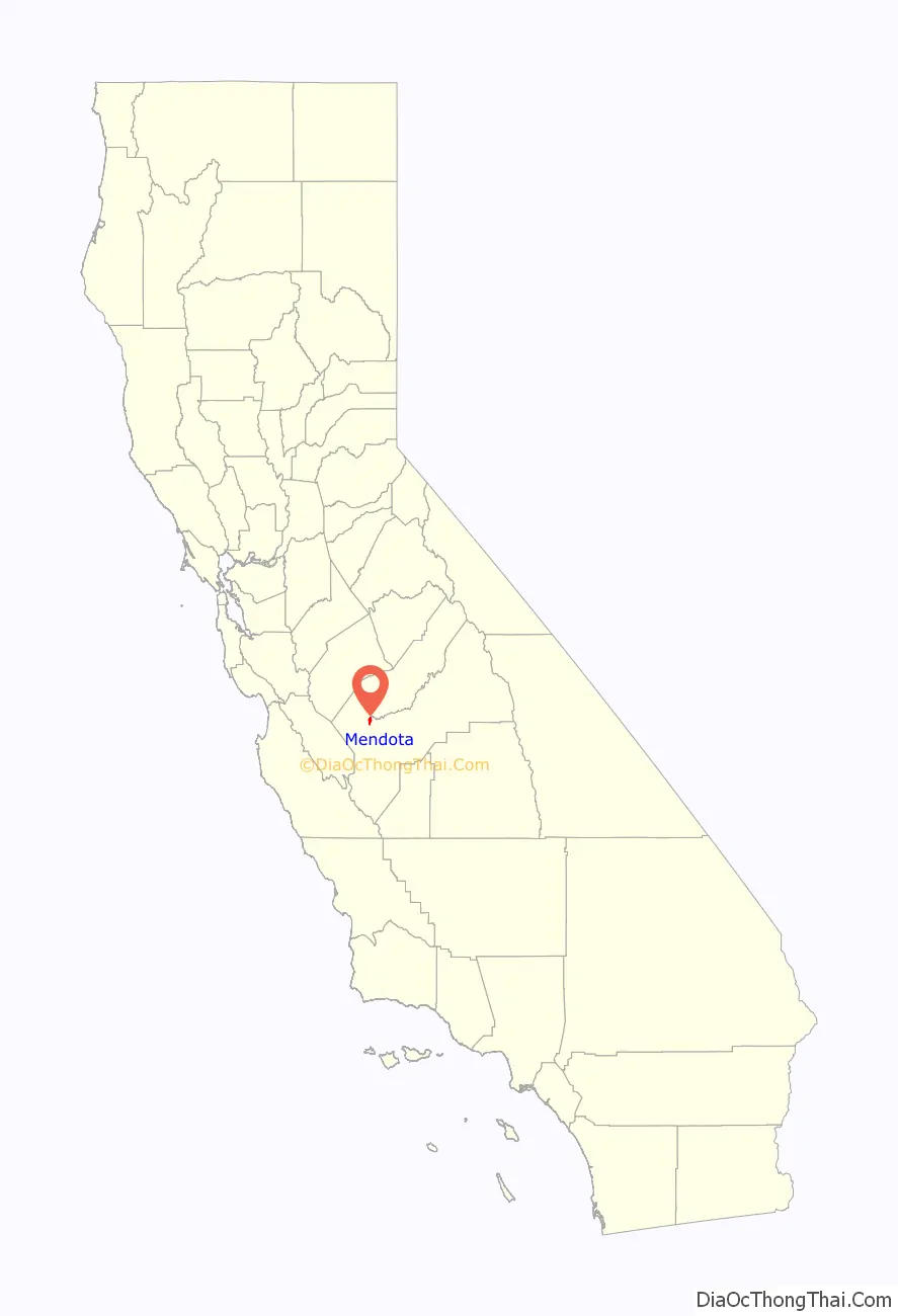
Mendota location map. Where is Mendota city?
History
Beginning in 1891, Mendota thrived as a Southern Pacific Railroad storage and switching facility site. Southern Pacific management borrowed the name from Mendota, Illinois. The first post office opened in 1892. The city incorporated in 1942, and is mostly recognized for its immense production of cantaloupes. Consequently, the city of Mendota is identified as The Cantaloupe Center of the World. State water projects brought irrigation to the region, setting the stage for the tremendous growth of agriculture.
In 2007 a new Mendota Branch Library opened, part of the San Joaquin Valley Library System.
The city suffers from chronic unemployment averaging 20%. In 2009 a drought combined with a recession caused unemployment to surge above 40%. The unemployment was quoted at 45% in May 2011.
In 2019, USA Today named Mendota the “worst city in America” due to poverty, violent crime rate and high unemployment. However, some residents took issue with the ranking.
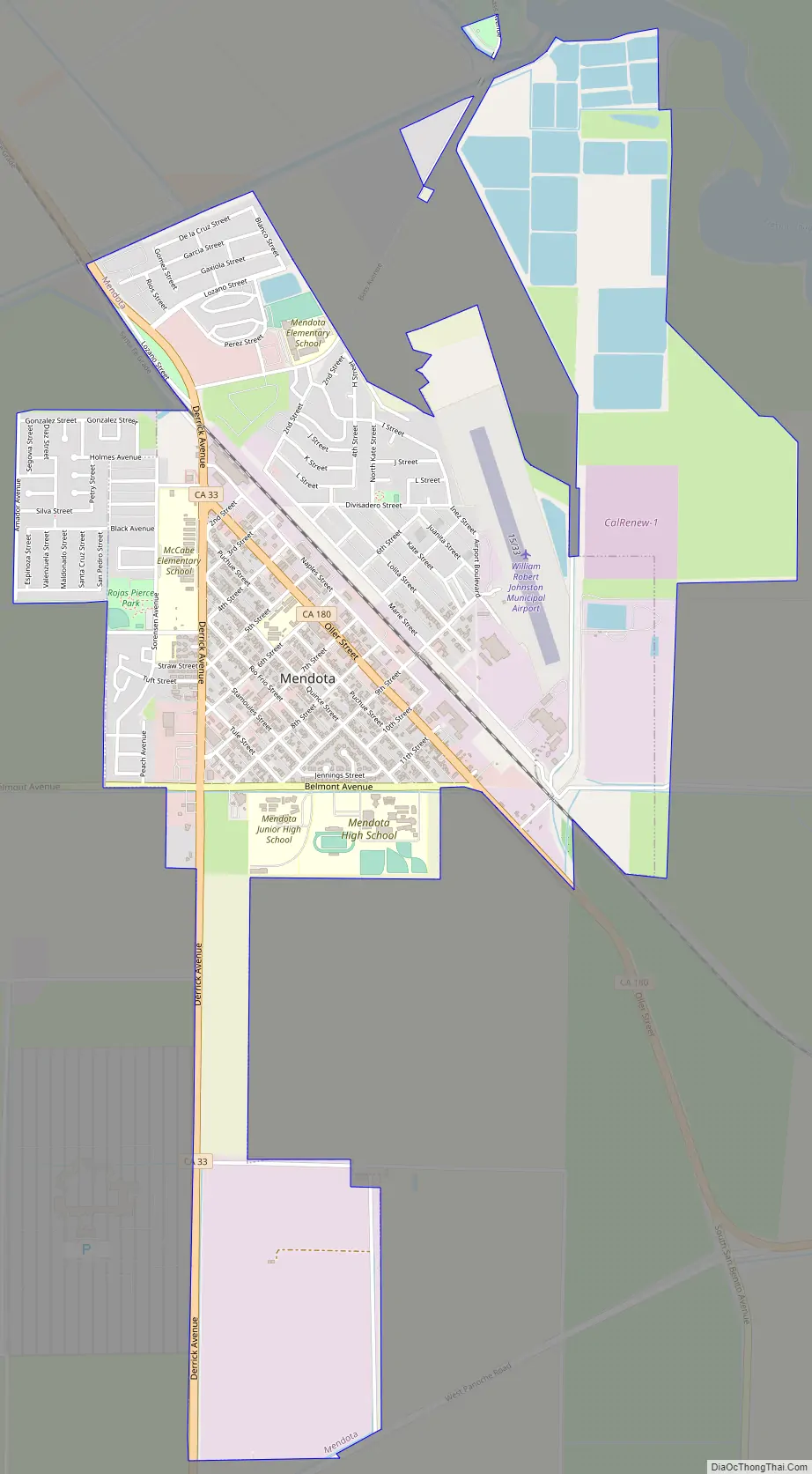
Mendota Road Map
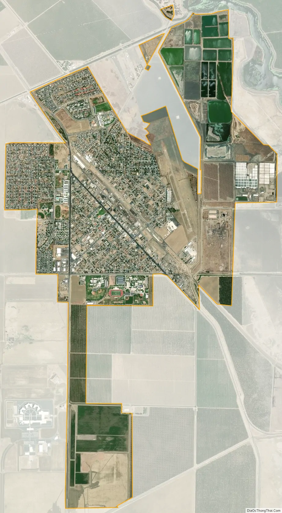
Mendota city Satellite Map
Geography
According to the United States Census Bureau, the city has a total land area of 3.3 square miles (8.5 km), over 99%. At the 2000 census, according to the United States Census Bureau, the city had a total land area of 1.9 square miles (4.9 km). It is located next to the San Joaquin River, near where the Delta-Mendota Canal intercepts it to bring extra water to the dry riverbed.
Climate
According to the Köppen Climate Classification system, Mendota has a semi-arid climate, abbreviated “BSk” on climate maps.
See also
Map of California State and its subdivision:- Alameda
- Alpine
- Amador
- Butte
- Calaveras
- Colusa
- Contra Costa
- Del Norte
- El Dorado
- Fresno
- Glenn
- Humboldt
- Imperial
- Inyo
- Kern
- Kings
- Lake
- Lassen
- Los Angeles
- Madera
- Marin
- Mariposa
- Mendocino
- Merced
- Modoc
- Mono
- Monterey
- Napa
- Nevada
- Orange
- Placer
- Plumas
- Riverside
- Sacramento
- San Benito
- San Bernardino
- San Diego
- San Francisco
- San Joaquin
- San Luis Obispo
- San Mateo
- Santa Barbara
- Santa Clara
- Santa Cruz
- Shasta
- Sierra
- Siskiyou
- Solano
- Sonoma
- Stanislaus
- Sutter
- Tehama
- Trinity
- Tulare
- Tuolumne
- Ventura
- Yolo
- Yuba
- Alabama
- Alaska
- Arizona
- Arkansas
- California
- Colorado
- Connecticut
- Delaware
- District of Columbia
- Florida
- Georgia
- Hawaii
- Idaho
- Illinois
- Indiana
- Iowa
- Kansas
- Kentucky
- Louisiana
- Maine
- Maryland
- Massachusetts
- Michigan
- Minnesota
- Mississippi
- Missouri
- Montana
- Nebraska
- Nevada
- New Hampshire
- New Jersey
- New Mexico
- New York
- North Carolina
- North Dakota
- Ohio
- Oklahoma
- Oregon
- Pennsylvania
- Rhode Island
- South Carolina
- South Dakota
- Tennessee
- Texas
- Utah
- Vermont
- Virginia
- Washington
- West Virginia
- Wisconsin
- Wyoming


