Clovis is a city in Fresno County, California, United States. Clovis was established in 1890 as a freight stop for the San Joaquin Valley Railroad by a group of Fresno businessmen and Michigan railroad speculator Marcus Pollasky. The railroad bought the land from two farmers and named the station after one of them, Clovis Cole. Pollasky then developed a town on the site, also named Clovis.
The completion of the lumber flume in 1894 led to the growth of the area around Clovis Station where a lumberyard and sawmill were built. Clovis was officially incorporated as a city in 1912. Today, Clovis celebrates its heritage as an American frontier town, known for its rodeo, Old Town Clovis historic district, and its motto “Clovis – A Way of Life.”
The 2020 population was 120,124. Clovis is located 6.5 miles (10.5 km) northeast of downtown Fresno, at an elevation of 361 feet (110 m).
| Name: | Clovis city |
|---|---|
| LSAD Code: | 25 |
| LSAD Description: | city (suffix) |
| State: | California |
| County: | Fresno County |
| Incorporated: | February 27, 1912 |
| Elevation: | 361 ft (110 m) |
| Total Area: | 25.91 sq mi (67.10 km²) |
| Land Area: | 25.79 sq mi (66.79 km²) |
| Water Area: | 0.12 sq mi (0.31 km²) 0% |
| Total Population: | 120,124 |
| Population Density: | 4,657.95/sq mi (1,798.44/km²) |
| ZIP code: | 93611–93613, 93619 |
| Area code: | 559 |
| FIPS code: | 0614218 |
| Website: | cityofclovis.com |
Online Interactive Map
Click on ![]() to view map in "full screen" mode.
to view map in "full screen" mode.
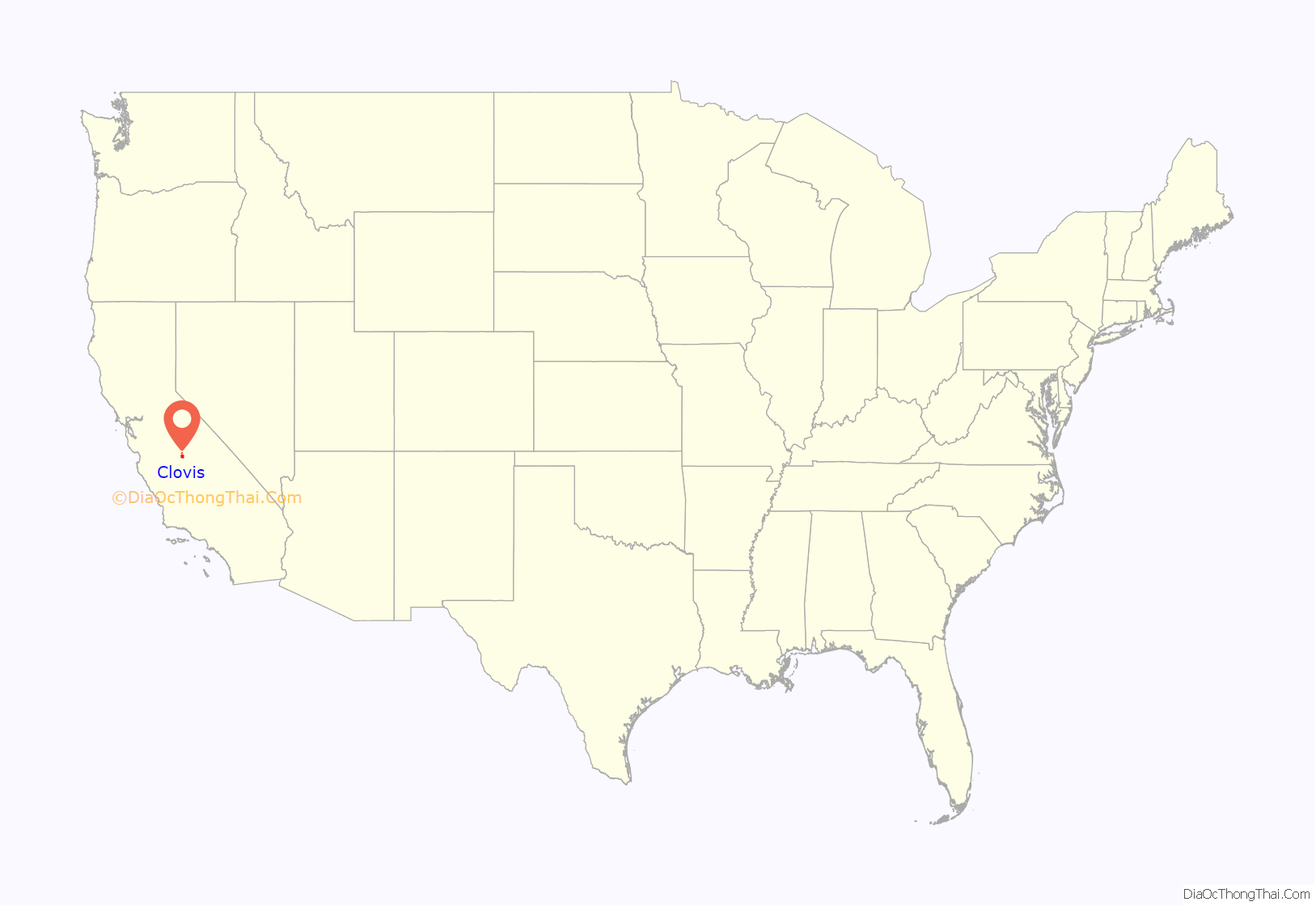
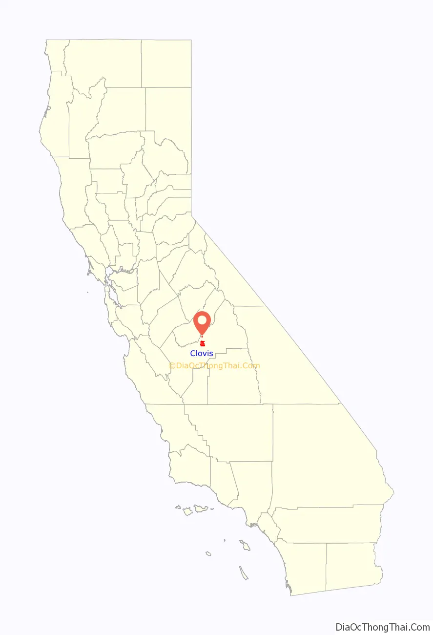
Clovis location map. Where is Clovis city?
History
The city of Clovis began as a freight stop along the San Joaquin Valley Railroad. Organized on January 15, 1890, by Fresno businessmen Thomas E. Hughes, Fulton Berry, Gilbert R. Osmun, H.D. Colson, John D. Gray, and William M. Williams, in partnership with Michigan railroad speculator Marcus Pollasky, the SJVRR began construction in Fresno on July 4, 1891, and reached the farmlands of Clovis M. Cole and George Owen by October of that year. The railroad purchased right-of-way from both farmers, half from each – the east side from Cole and the west side from Owen – and ran tracks up the borderline between the two properties. The railroad agreed to establish a station on the west side of the tracks and to call it “Clovis.” The Clovis station, which was named after Clovis Cole, was positioned on the Owen side of the track.
Cole and Owen later sold land to Marcus Pollasky for the development of a townsite. Fresno civil engineer Ingvart Tielman mapped the townsite on behalf of Pollasky on December 29, 1891. The original townsite featured streets named for the officers and principal investors of the railroad: (Benjamin) Woodworth, (Marcus) Pollasky, Fulton (Berry), (Thomas) Hughes, (Gerald) Osmun, and (O. D.) Baron. The townsite, named “Clovis” after Clovis Station by Pollasky, was laid out on what was originally Owen’s land.
The railroad was completed as far as the town of Hamptonville (now Friant) on the banks of the San Joaquin River, just 26 miles (42 km) from its point of origin in Fresno. Articles of Incorporation for the San Joaquin Valley Railroad indicate that the corporation intended to build 100 miles (160 km) of track, including sidings and spurs, through the agricultural acreage east of Fresno, then north to the timber and mineral resources of the Sierra foothills. At the time, Hamptonville was called “Pollasky”. A celebration of the completion of track-laying was held at the Pollasky terminus on the Wednesday before Thanksgiving of 1891 with a reported 3,000 Fresnans attending. The railroad began official operation in January 1892.
The first year of operation of the railroad coincided with the beginnings of a deep national economic decline. Farmers were unable to get a profitable return on their crops, banks and railroads failed nationwide. The SJVRR was unable to generate sufficient revenues to pay its debt, was leased to the Southern Pacific Railroad and subsequently bought by SPRR in 1893. By reducing the railroad’s schedule of operation and trimming costs, the Southern Pacific was able to turn a small profit in the first years after its acquisition.
At the same time that the railroad was being planned, a group of Michigan lumbermen began acquiring thousands of acres of timber in the Sierra Nevada about 75 miles (121 km) northeast of Fresno and founded the Fresno Flume and Irrigation Company in 1891. A dam was built across Stevenson Creek to create a lake that would enable them to move freshly cut timber to a mill beside the lake. They then constructed a 42-mile (68 km), 25-foot-high (7.6 m), V-shaped flume that started at the foot of the dam. As lumber was rough-cut at the mill, it was loaded into the flume and propelled by water to a planing mill east of the Clovis railroad station, where the Clovis Rodeo and Clark Intermediate School sit today. The lumber mill and yard had its own network of rails to move lumber around the yard and to connect with the SJVRR just south of Clovis station.
The completion in 1894 of the lumber flume and commencement of mill operations provided the impetus for further development of the area around the Clovis Station. The town began to take shape as lumber yard employees built homes close to their employment. Service businesses, churches, and schools became necessary, and the town was begun. Clovis’s first post office opened in 1895. An 1896 newspaper article describes the town as having a population approaching 500 citizens.
Clovis was incorporated as a city in February 1912. Principal streets in the town center were named for the railroad’s officers. Fulton Street was later named Front Street, then Main Street, and is now Clovis Avenue.
The lumber mill burned in 1914 and was not rebuilt. The grounds are now occupied by Clark Intermediate School and the Clovis Rodeo Grounds. Clovis has a long history as a western town known for its slogan, “Clovis – A Way of Life”. Since 1914, the Clovis Rodeo has been held on the last weekend in April, with a parade on Saturday morning, followed by the rodeo that afternoon and all day Sunday. Also contributing to the “Clovis way of life” are a number of street festivals, including Big Hat Days, ClovisFest, and the weekly Friday Night Farmer’s Market held between mid-May and mid-September every year.
The last surviving structure built by the railroad is a depot now located near the site of the original Clovis Station. The earliest photos, from about 1910, show the depot situated in front of the Tarpey winery south of the intersection of Ashlan and Clovis Avenues. In 1999 it was moved to its present location in the town’s center, at the northeast corner of Clovis Avenue and Fourth Street, and was restored by the Clovis Big Dry Creek Historical Society with financing, labor, and materials donated by local businesses and contractors.
Marcus Pollasky was a lawyer, born in Michigan, living in Chicago just before he came to Fresno. Throughout his life he tried to create several projects similar to the SJVRR, including projects in Eureka, California, Virginia, Michigan, and Oklahoma. Few were ever actually built. In 1896, Pollasky sued Collis P. Huntington in Los Angeles courts over the money he lost in Fresno, “while engaged in a joint venture with the defendant, Huntington”. It has long been speculated that Pollasky was an agent of the Southern Pacific, and this “joint venture” suit seems to prove that point.
Many buildings in the town core have been renovated. Older storefronts on Clovis Avenue, the main street running through town, have been restored and new buildings have been designed with facades that resemble those found in the early 20th century. The historic center has been reborn as “Old Town Clovis”.
Clovis Road Map
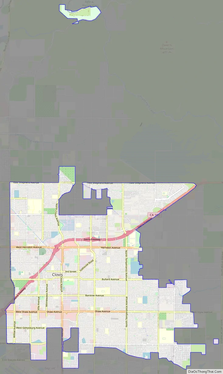
Clovis city Satellite Map

Geography
According to the United States Census Bureau, the city has a total area of 23.28 square miles (60.29 km), all of it land.
Clovis is situated midway between Los Angeles and San Francisco, bordering Fresno, in the agriculturally rich San Joaquin Valley. Lying at the foot of the Sierra Nevada Mountain Range, which includes Yosemite, Kings Canyon, and Sequoia National Parks, Clovis has been known as “Gateway to the Sierras” since its incorporation in 1912.
The formation of alluvial fans in this part of the San Joaquin Valley has led to a rather flat regional geography. The Clovis area has active and potentially active seismic fault zones. The elevation of Clovis is approximately 355 feet (108 m) above mean sea datum According to the Flood Hazard Boundary Map produced by the U.S. Department of Housing and Urban Development, part of Clovis is within the 100-year flood zone, such as some of the area near the Clovis Towne Center. The groundwater flow in Clovis is generally to the southwest.
See also
Map of California State and its subdivision:- Alameda
- Alpine
- Amador
- Butte
- Calaveras
- Colusa
- Contra Costa
- Del Norte
- El Dorado
- Fresno
- Glenn
- Humboldt
- Imperial
- Inyo
- Kern
- Kings
- Lake
- Lassen
- Los Angeles
- Madera
- Marin
- Mariposa
- Mendocino
- Merced
- Modoc
- Mono
- Monterey
- Napa
- Nevada
- Orange
- Placer
- Plumas
- Riverside
- Sacramento
- San Benito
- San Bernardino
- San Diego
- San Francisco
- San Joaquin
- San Luis Obispo
- San Mateo
- Santa Barbara
- Santa Clara
- Santa Cruz
- Shasta
- Sierra
- Siskiyou
- Solano
- Sonoma
- Stanislaus
- Sutter
- Tehama
- Trinity
- Tulare
- Tuolumne
- Ventura
- Yolo
- Yuba
- Alabama
- Alaska
- Arizona
- Arkansas
- California
- Colorado
- Connecticut
- Delaware
- District of Columbia
- Florida
- Georgia
- Hawaii
- Idaho
- Illinois
- Indiana
- Iowa
- Kansas
- Kentucky
- Louisiana
- Maine
- Maryland
- Massachusetts
- Michigan
- Minnesota
- Mississippi
- Missouri
- Montana
- Nebraska
- Nevada
- New Hampshire
- New Jersey
- New Mexico
- New York
- North Carolina
- North Dakota
- Ohio
- Oklahoma
- Oregon
- Pennsylvania
- Rhode Island
- South Carolina
- South Dakota
- Tennessee
- Texas
- Utah
- Vermont
- Virginia
- Washington
- West Virginia
- Wisconsin
- Wyoming


