Monmouth is a census-designated place in Fresno County, California. It is located 7.25 miles (12 km) west of Selma, at an elevation of 276 feet (84 m). At the 2010 census, Monmouth had a population of 152.
Officials of the Atchison, Topeka and Santa Fe Railroad (Monmouth was a stop on the railroad’s Valley Division) named the place after Monmouth, Illinois.
A post office operated at Monmouth from 1908 to 1919.
| Name: | Monmouth CDP |
|---|---|
| LSAD Code: | 57 |
| LSAD Description: | CDP (suffix) |
| State: | California |
| County: | Fresno County |
| Elevation: | 276 ft (84 m) |
| Total Area: | 0.308 sq mi (0.798 km²) |
| Land Area: | 0.308 sq mi (0.798 km²) |
| Water Area: | 0 sq mi (0 km²) 0% |
| Total Population: | 152 |
| Population Density: | 490/sq mi (190/km²) |
| ZIP code: | 93725 |
| Area code: | 559 |
| FIPS code: | 0648592 |
Online Interactive Map
Click on ![]() to view map in "full screen" mode.
to view map in "full screen" mode.
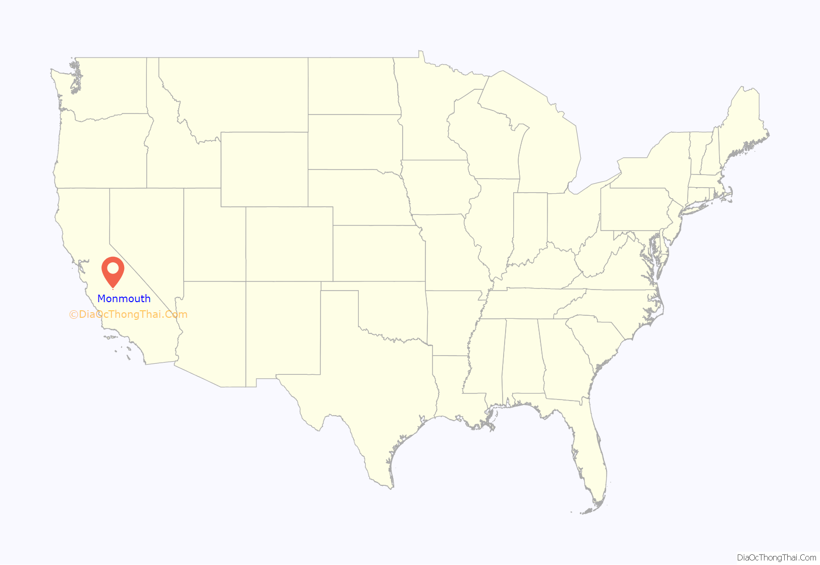
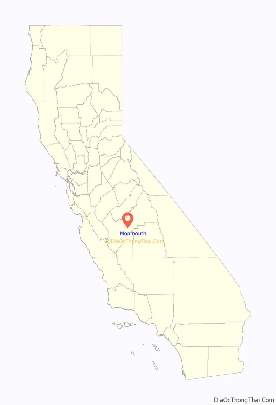
Monmouth location map. Where is Monmouth CDP?
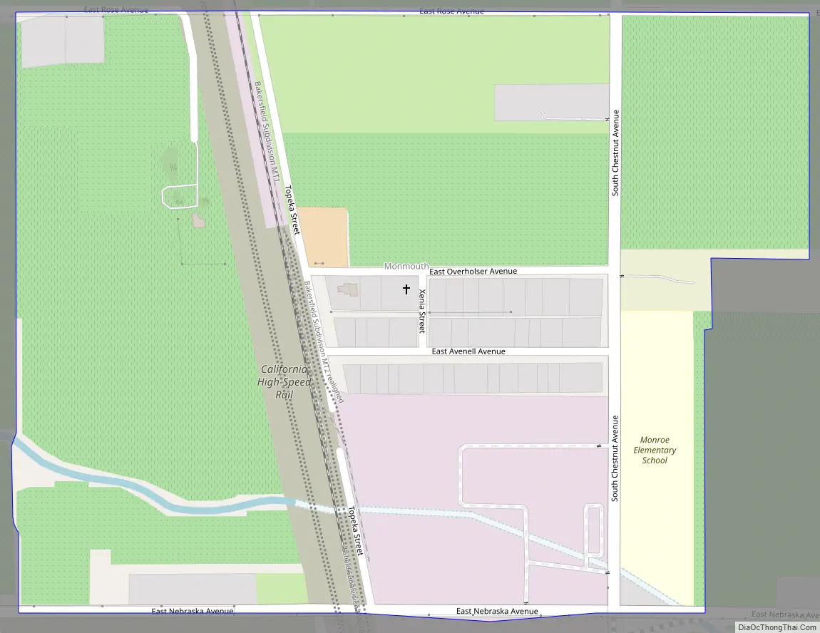
Monmouth Road Map
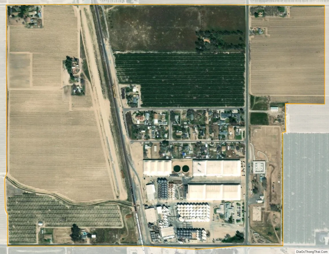
Monmouth city Satellite Map
See also
Map of California State and its subdivision:- Alameda
- Alpine
- Amador
- Butte
- Calaveras
- Colusa
- Contra Costa
- Del Norte
- El Dorado
- Fresno
- Glenn
- Humboldt
- Imperial
- Inyo
- Kern
- Kings
- Lake
- Lassen
- Los Angeles
- Madera
- Marin
- Mariposa
- Mendocino
- Merced
- Modoc
- Mono
- Monterey
- Napa
- Nevada
- Orange
- Placer
- Plumas
- Riverside
- Sacramento
- San Benito
- San Bernardino
- San Diego
- San Francisco
- San Joaquin
- San Luis Obispo
- San Mateo
- Santa Barbara
- Santa Clara
- Santa Cruz
- Shasta
- Sierra
- Siskiyou
- Solano
- Sonoma
- Stanislaus
- Sutter
- Tehama
- Trinity
- Tulare
- Tuolumne
- Ventura
- Yolo
- Yuba
- Alabama
- Alaska
- Arizona
- Arkansas
- California
- Colorado
- Connecticut
- Delaware
- District of Columbia
- Florida
- Georgia
- Hawaii
- Idaho
- Illinois
- Indiana
- Iowa
- Kansas
- Kentucky
- Louisiana
- Maine
- Maryland
- Massachusetts
- Michigan
- Minnesota
- Mississippi
- Missouri
- Montana
- Nebraska
- Nevada
- New Hampshire
- New Jersey
- New Mexico
- New York
- North Carolina
- North Dakota
- Ohio
- Oklahoma
- Oregon
- Pennsylvania
- Rhode Island
- South Carolina
- South Dakota
- Tennessee
- Texas
- Utah
- Vermont
- Virginia
- Washington
- West Virginia
- Wisconsin
- Wyoming


