Olivehurst (formerly, Denniston) is a census-designated place (CDP) in Yuba County, California, United States. The population was 13,656 at the 2010 census, up from 11,061 at the 2000 census. Olivehurst is located 4 miles (6.4 km) south-southeast of Marysville.
| Name: | Olivehurst CDP |
|---|---|
| LSAD Code: | 57 |
| LSAD Description: | CDP (suffix) |
| State: | California |
| County: | Yuba County |
| Elevation: | 66 ft (20 m) |
| Total Area: | 7.473 sq mi (19.354 km²) |
| Land Area: | 7.473 sq mi (19.354 km²) |
| Water Area: | 0 sq mi (0 km²) 0% |
| Total Population: | 13,656 |
| Population Density: | 1,800/sq mi (710/km²) |
| ZIP code: | 95961 |
| Area code: | 530 |
| FIPS code: | 0653714 |
| GNISfeature ID: | 1659301 |
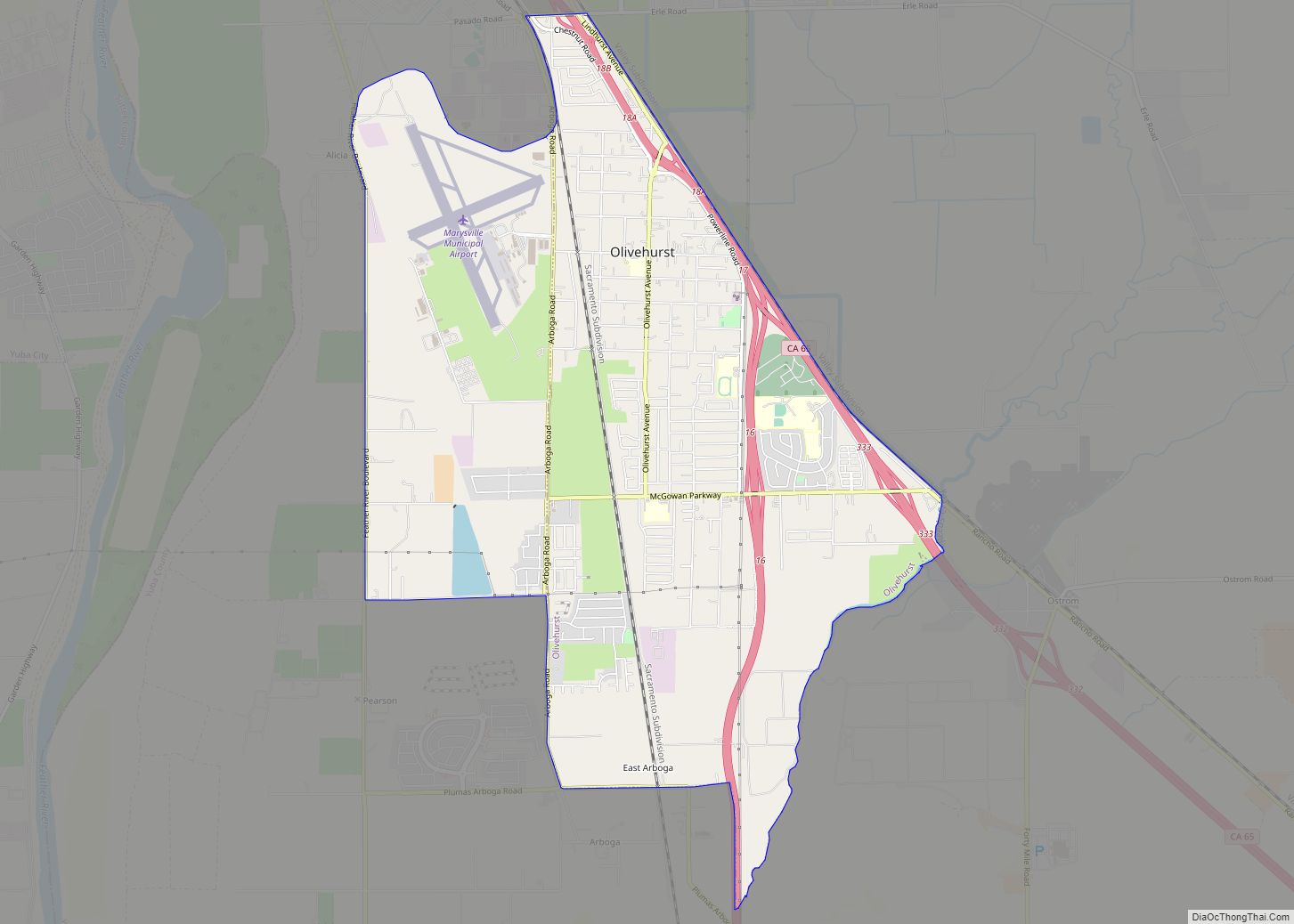
Online Interactive Map
Click on ![]() to view map in "full screen" mode.
to view map in "full screen" mode.
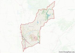
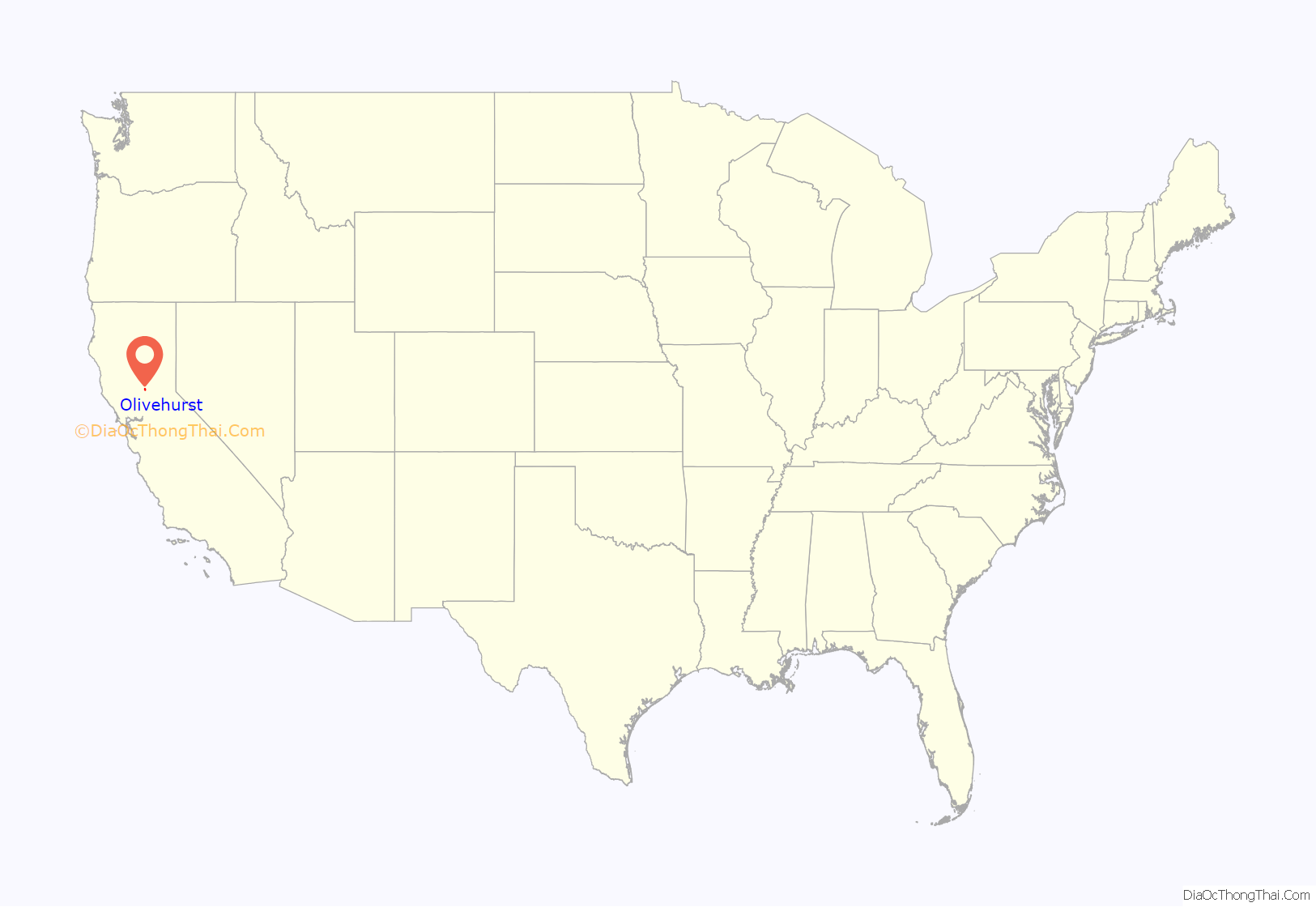
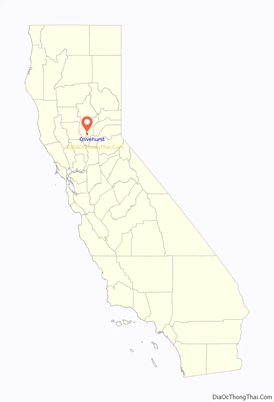
Olivehurst location map. Where is Olivehurst CDP?
History
Olivehurst was first largely settled by people from the Midwest during the Great Depression who were looking for fertile land, availability of jobs and a better future. People from the town have been known to refer to this group of people as “Okies”, a term originally for those from Oklahoma who were escaping the “dust bowl” Oklahoma had become during the Great Depression. This is why some of the streets are named after cities in Oklahoma. These “Okies” were following migrant workers such as those of Chinese, Japanese, Filipino, Mexican and Native American background.
The economy has been largely focused on agriculture, but, since the 1950s, jobs have been increasingly focused on mill and manufacturing work. Today’s economy is centered on a “commuter economy” where many of the residents work outside of the town.
A post office opened at Olivehurst in 1941.
Olivehurst was the site of the Lindhurst High School shooting in 1992, which left four dead.
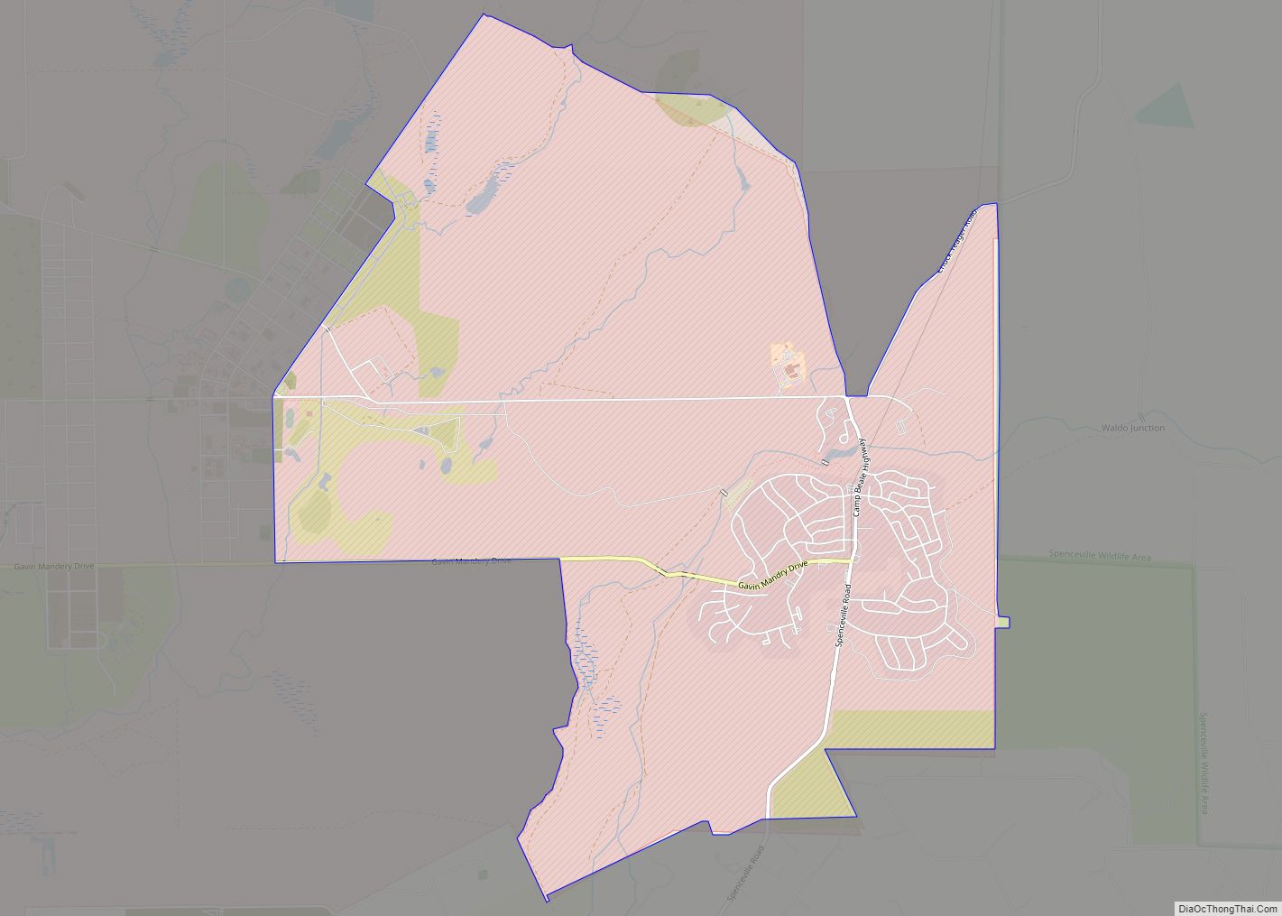
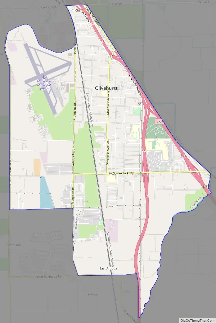
Olivehurst Road Map
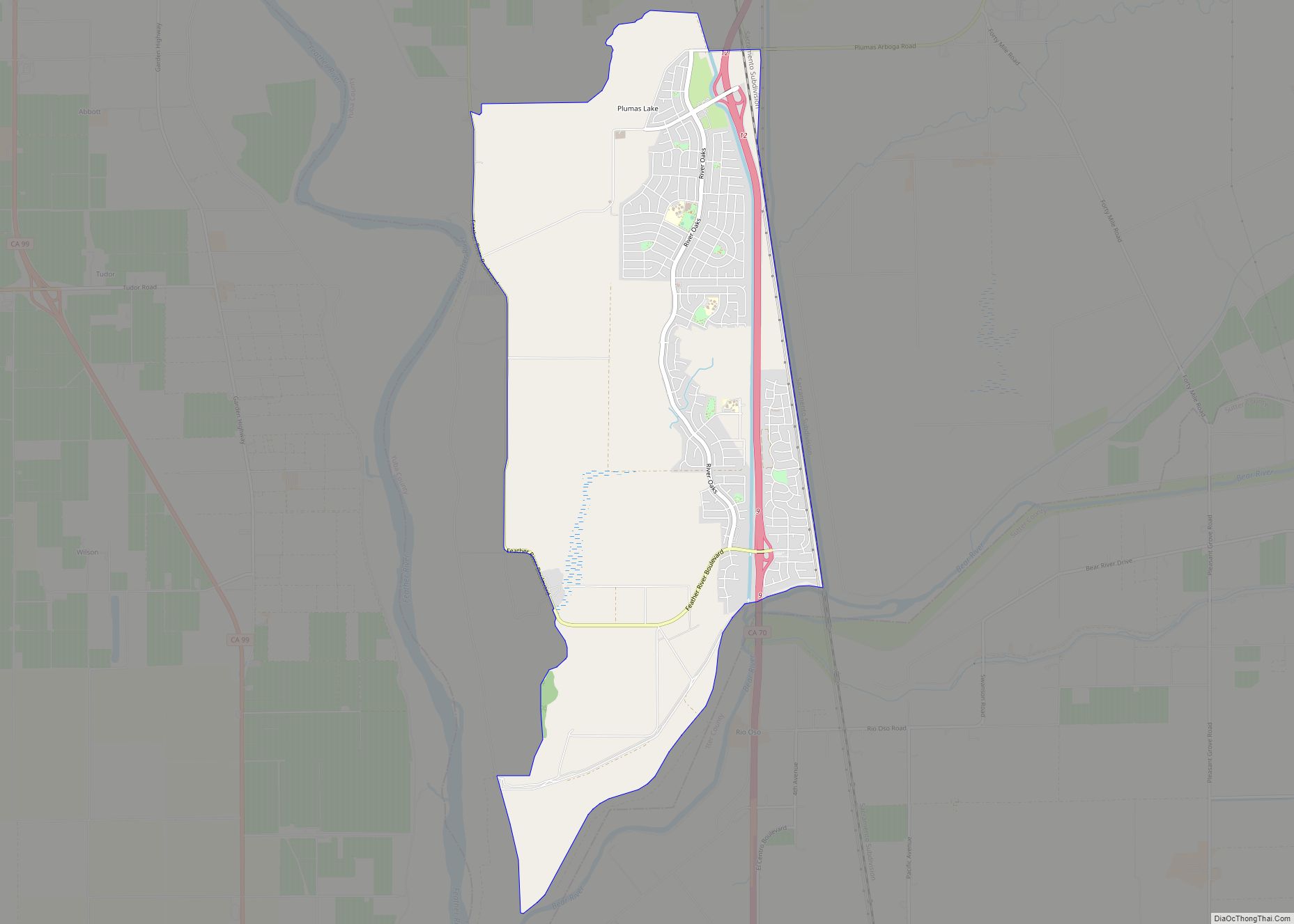
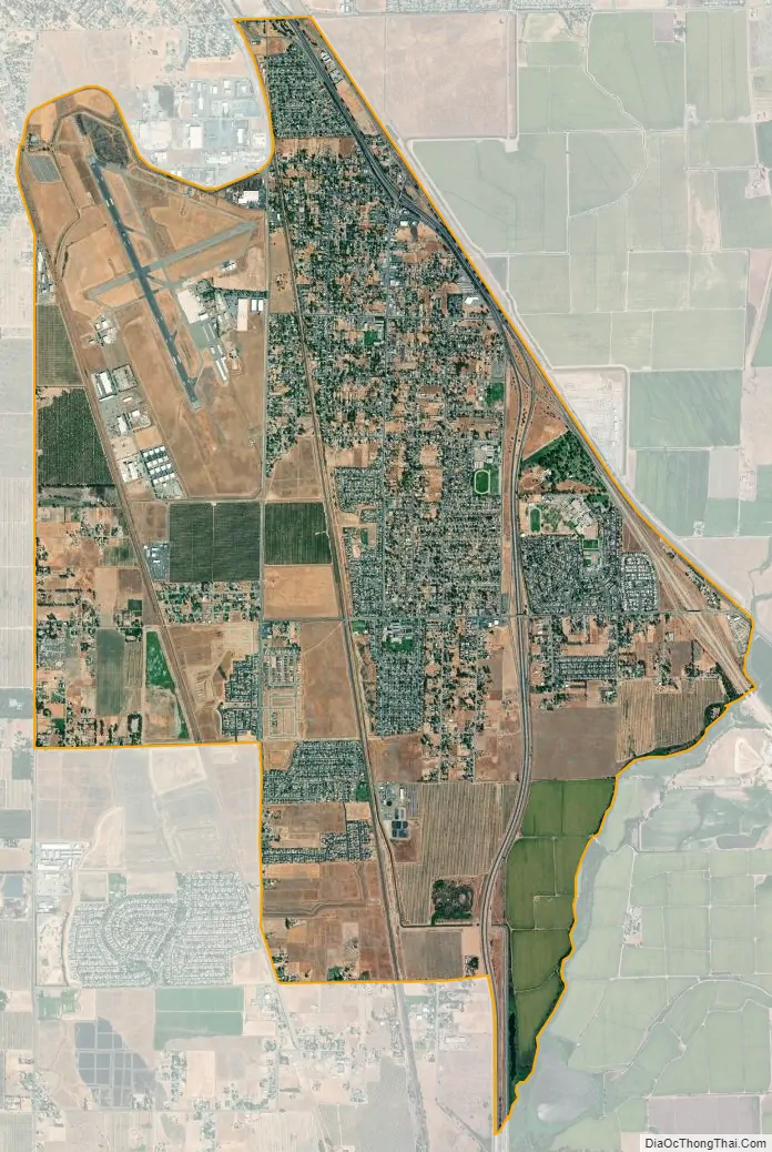
Olivehurst city Satellite Map
Geography
Olivehurst is located at 39°05′44″N 121°33′08″W / 39.09556°N 121.55222°W / 39.09556; -121.55222.
According to the United States Census Bureau, the CDP has a total area of 7.5 square miles (19.4 km), all of it land.
See also
Map of California State and its subdivision:- Alameda
- Alpine
- Amador
- Butte
- Calaveras
- Colusa
- Contra Costa
- Del Norte
- El Dorado
- Fresno
- Glenn
- Humboldt
- Imperial
- Inyo
- Kern
- Kings
- Lake
- Lassen
- Los Angeles
- Madera
- Marin
- Mariposa
- Mendocino
- Merced
- Modoc
- Mono
- Monterey
- Napa
- Nevada
- Orange
- Placer
- Plumas
- Riverside
- Sacramento
- San Benito
- San Bernardino
- San Diego
- San Francisco
- San Joaquin
- San Luis Obispo
- San Mateo
- Santa Barbara
- Santa Clara
- Santa Cruz
- Shasta
- Sierra
- Siskiyou
- Solano
- Sonoma
- Stanislaus
- Sutter
- Tehama
- Trinity
- Tulare
- Tuolumne
- Ventura
- Yolo
- Yuba
- Alabama
- Alaska
- Arizona
- Arkansas
- California
- Colorado
- Connecticut
- Delaware
- District of Columbia
- Florida
- Georgia
- Hawaii
- Idaho
- Illinois
- Indiana
- Iowa
- Kansas
- Kentucky
- Louisiana
- Maine
- Maryland
- Massachusetts
- Michigan
- Minnesota
- Mississippi
- Missouri
- Montana
- Nebraska
- Nevada
- New Hampshire
- New Jersey
- New Mexico
- New York
- North Carolina
- North Dakota
- Ohio
- Oklahoma
- Oregon
- Pennsylvania
- Rhode Island
- South Carolina
- South Dakota
- Tennessee
- Texas
- Utah
- Vermont
- Virginia
- Washington
- West Virginia
- Wisconsin
- Wyoming